3D Topography Models Project Gallery
Browse WhiteClouds custom 3D topographical models, raised relief maps, watershed displays, resort trail maps, visitor center exhibits, and interactive lighted terrain maps.
Browse WhiteClouds custom 3D topographical models, raised relief maps, watershed displays, resort trail maps, visitor center exhibits, and interactive lighted terrain maps.

Embark on an adventure into the heart of Northern British Columbia’s mining landscape with our Canadian Mining Topographical Model. Crafted with precision by WhiteClouds, this immersive replica unveils the intricate network of open-pit mines and underground tunnels. Explore the rugged terrain, spark dialogue, and shape the future of sustainable development in remote communities – adventure awaits!

Step into a world where innovation meets artistry. Explore Michigan’s “Third Coast” like never before with our captivating 3D map, meticulously crafted to bring every contour and curve to life. Join us on a visual odyssey through the heartland’s natural splendor – adventure awaits!
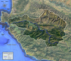
Embark on a thrilling journey through the world of watershed models! These cutting-edge tools not only predict floods and combat pollution but also empower us to protect our planet’s vital waterways. Dive deep into the science that’s shaping our water future and discover how you can play a part in safeguarding water for generations to come.
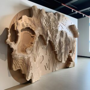
Embark on a visual odyssey with 3D Wall Maps, where geography leaps from the page into stunning three-dimensional reality. Traverse mountains, dive into ocean depths, and roam lush valleys—all within the confines of your home or workspace. Join us in uncovering the craftsmanship, innovation, and transformative power of these maps, as they redefine the way we perceive and interact with our planet.
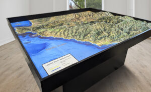
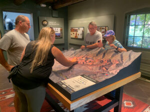
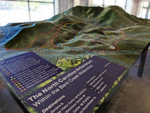
We meld top-of-the-line technologies with professional cartography resources to create stunning raised relief terrain maps and models.
The 3D map took me on a thrilling journey, from the mountaintops to the depths of the ocean. It was like having a bird’s-eye view of the world. Learn more about all the various types and categories of maps and explore the world in new dimensions.
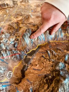
We meld top-of-the-line technologies with professional cartography resources to create stunning raised relief terrain maps and models. Our expertise in 3D printing enables us to allow more markets to benefit from purchasing durable, portable, and affordable models.
See videos of some of the unique custom 3D topographical models WhiteClouds has created.