Wall 3D Relief Topography – Smoky Mountains – Case Study
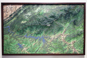
WhiteClouds created two hanging topographical maps of the Great Smoky Mountains approximately 91 by 56 inches with three-dimensional rises of about 2 inches. Accurate to the smallest measurement, each topography delineates the vast array of hiking trails, rivers, lakes, streams, and forests in the national park.