Wall Topography - Smoky Mountains
Case Study: Building a Scale Topography of The Great Smoky Mountains National Park
Table of Contents
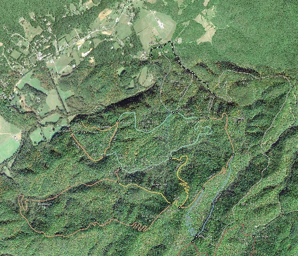
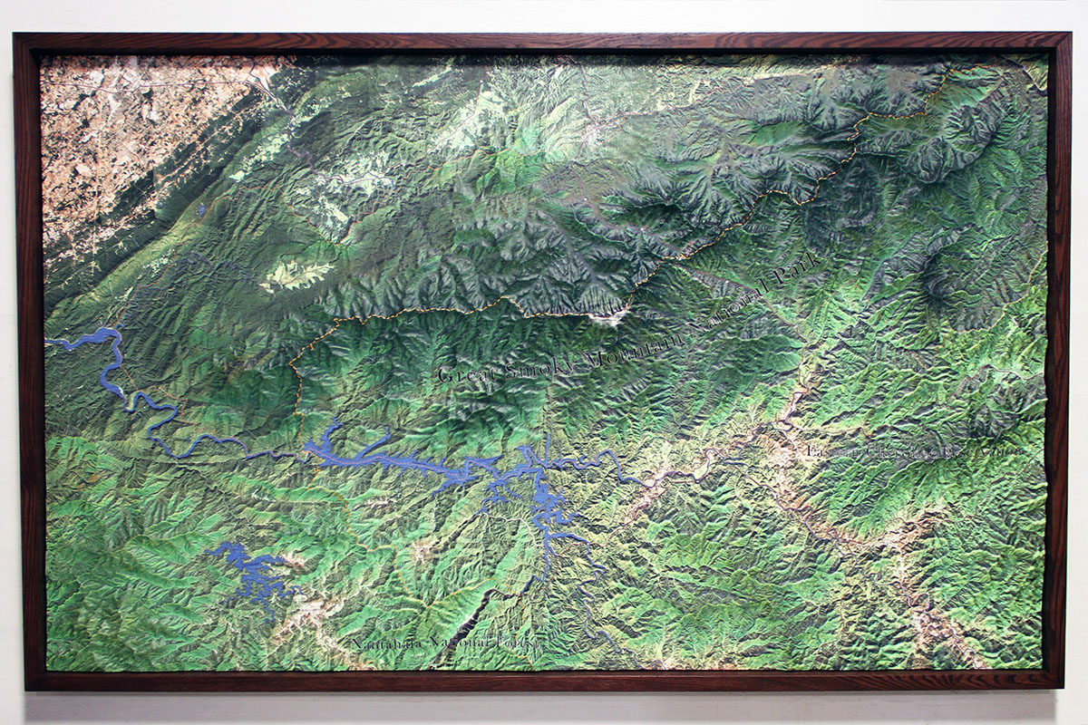
Great Smoky Mountains Topography
The Great Smoky Mountains are a subrange of the Appalachian Mountains in the southeastern United States. Regularly referred to as the “Smokies,” the mountain range gains its name from the natural fog hanging above the range that resembles clouds of smoke seen from a distance. The US National Park Service established the Smoky Mountains as a national park in 1934; President Franklin D. Roosevelt formally dedicated the 522,491-acre park in 1940. The Smokies are the most visited national park in the United States.
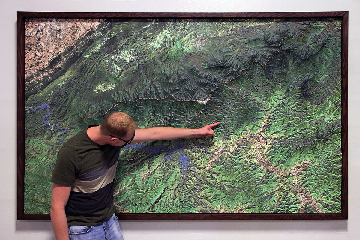
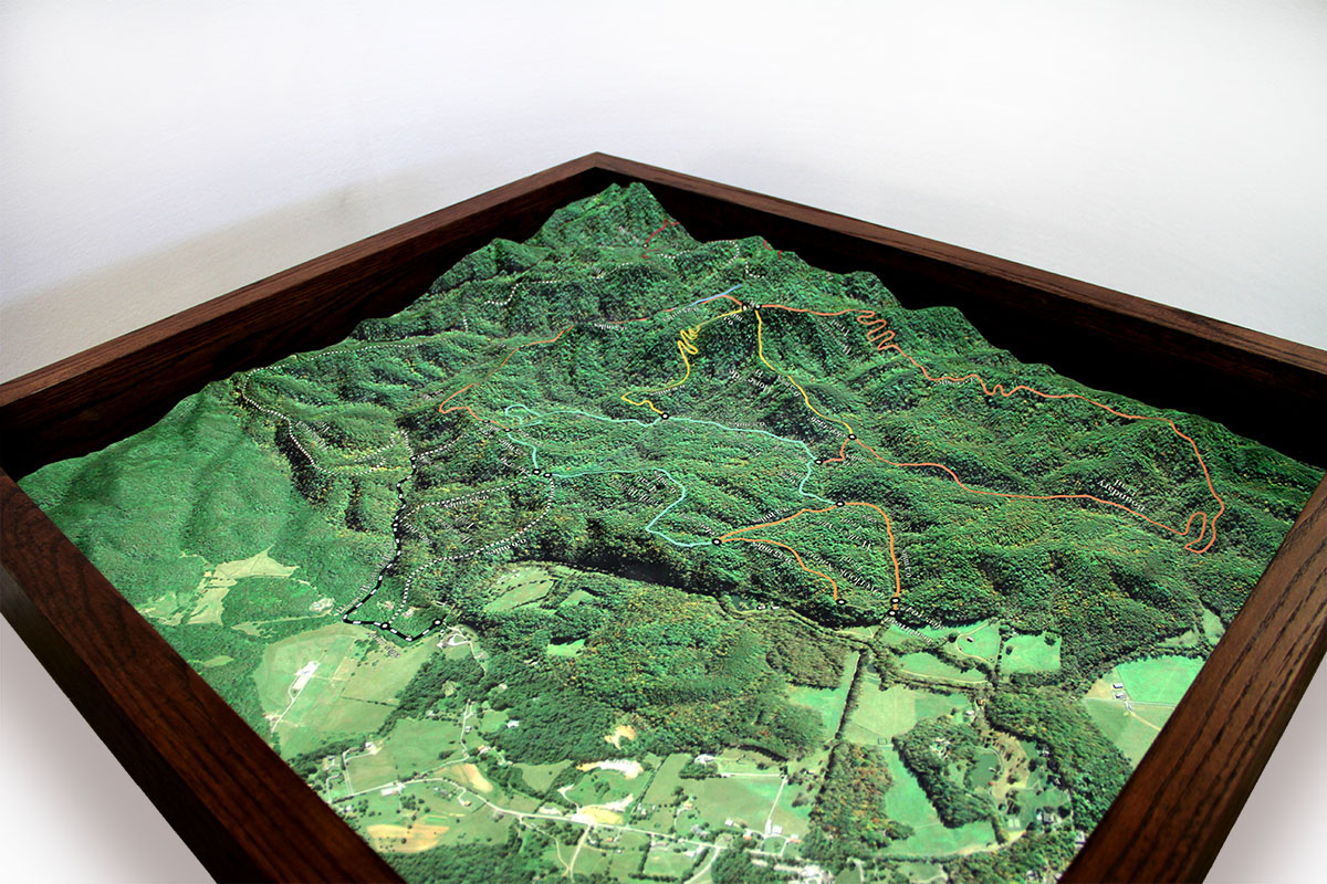
WhiteClouds created two hanging topographical maps of the Great Smoky Mountains for Turpen and Lewis LLC. One of the maps encompasses the entire Great Smoky Mountains National Park, and the other is a closer perspective of a specific property located within the national park. Both topographical models have custom-built frames for long-term display in a private residence. The end-user wanted something that was informational, yet aesthetic, for their living-room wall. The resulting product is nothing short of an artwork that one would see displayed in a museum, a cartographer’s dreamscape.
The project’s design and proof phase took nine iterations to match each topography with the client’s vision, a classic old-world style map that showcases their beautiful forest location.
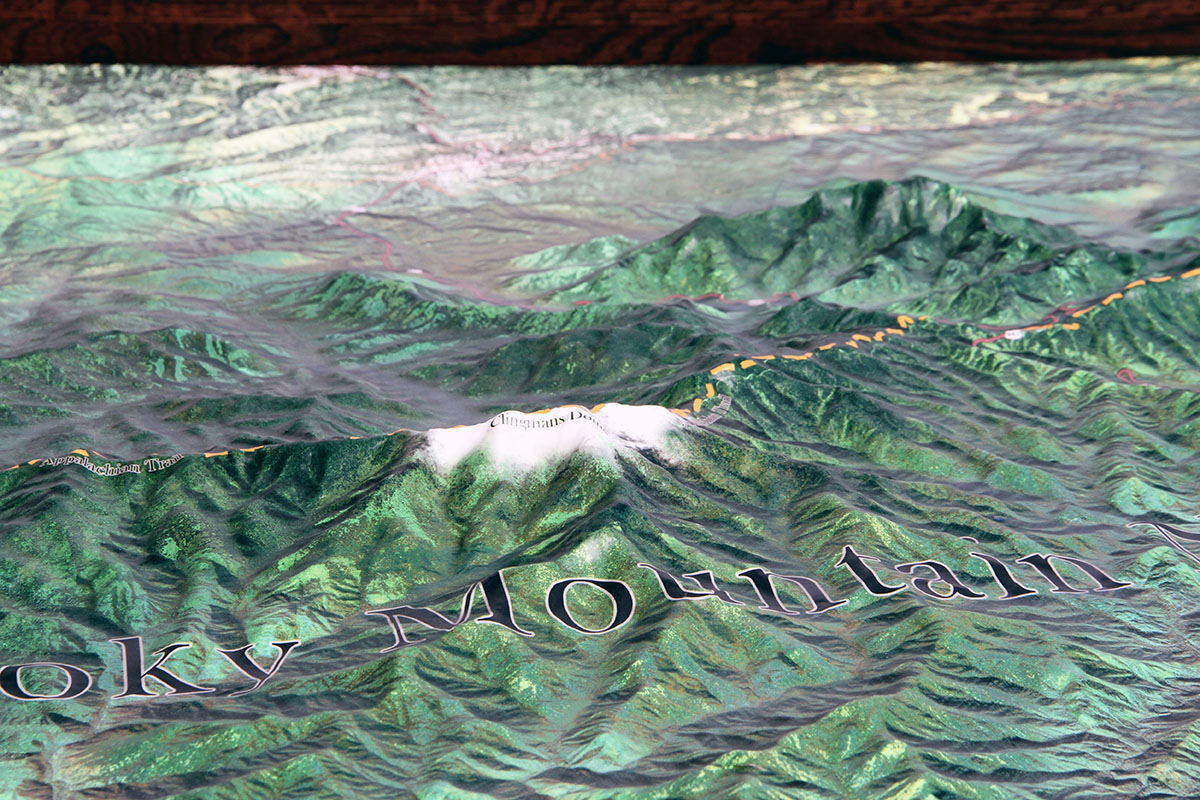
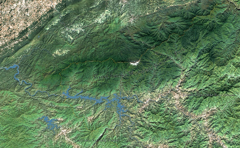
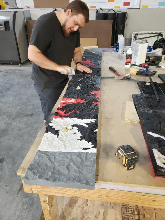
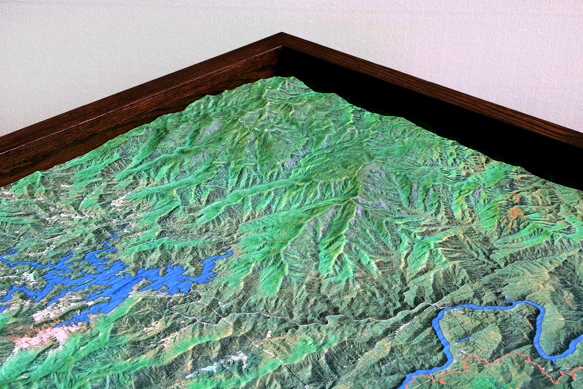
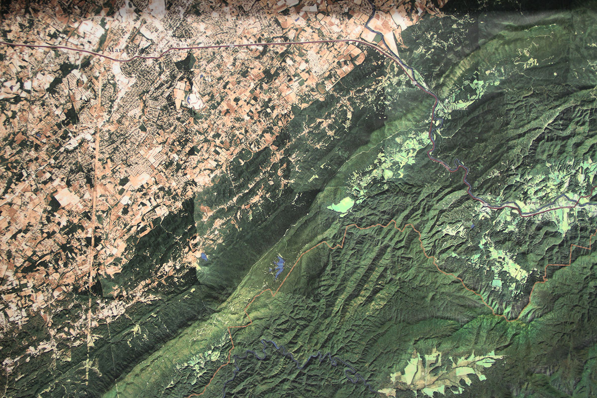
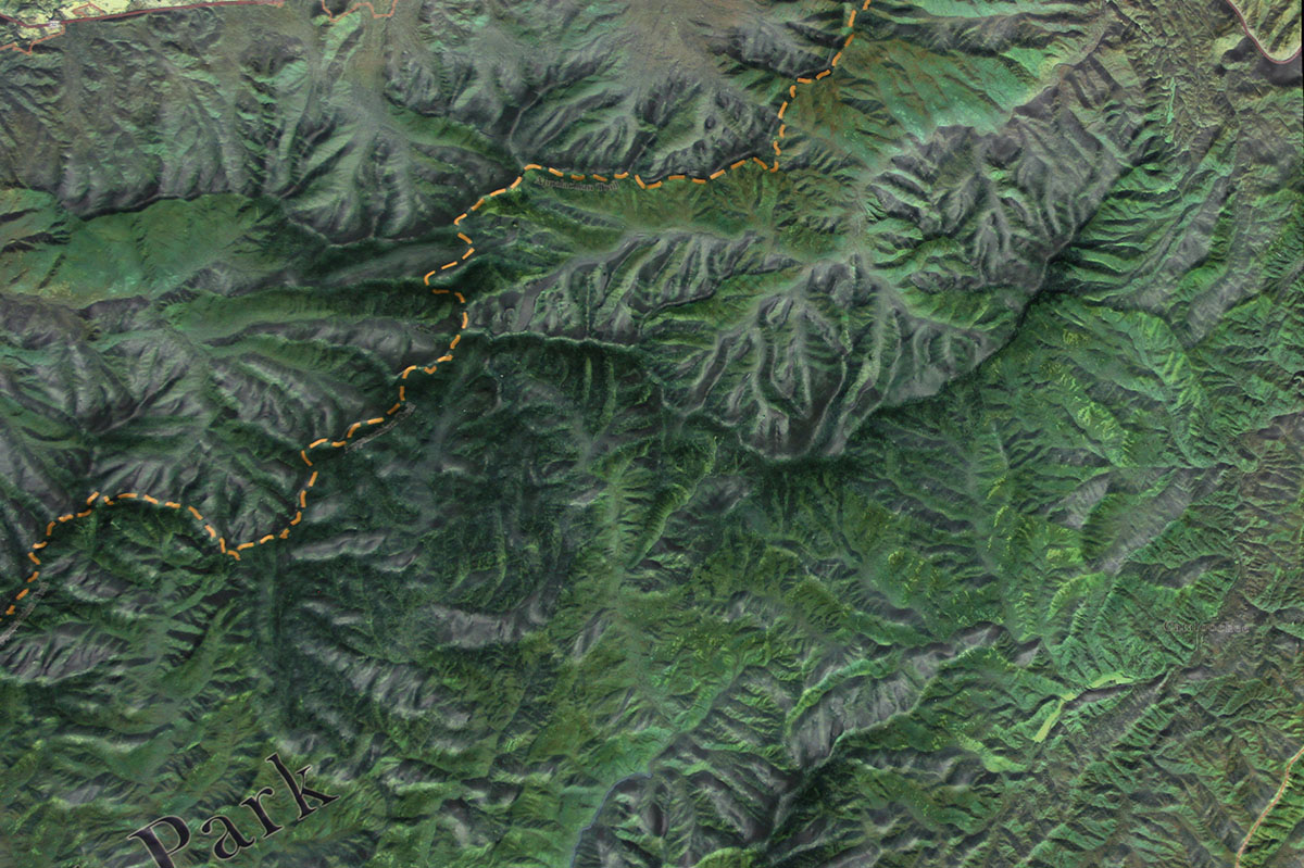
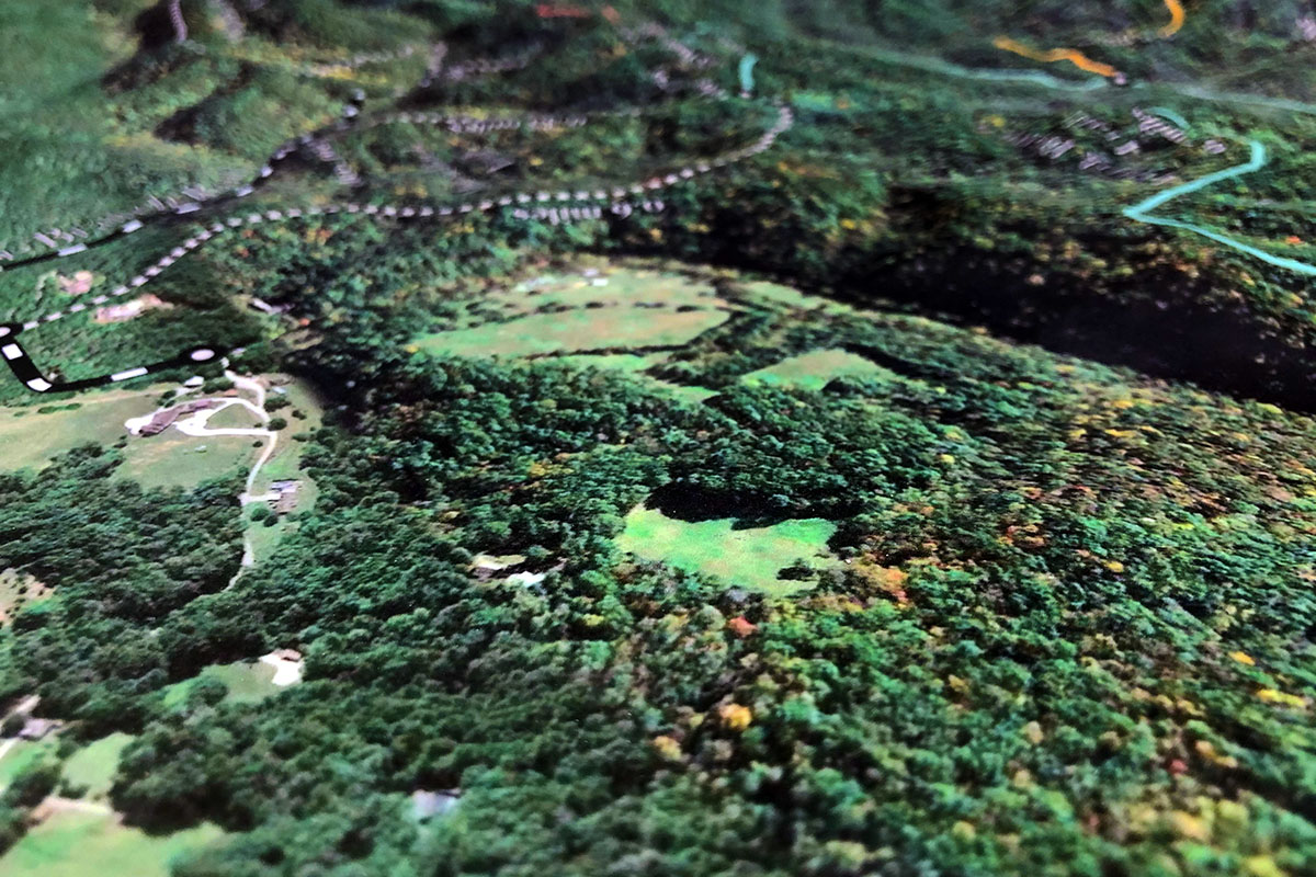
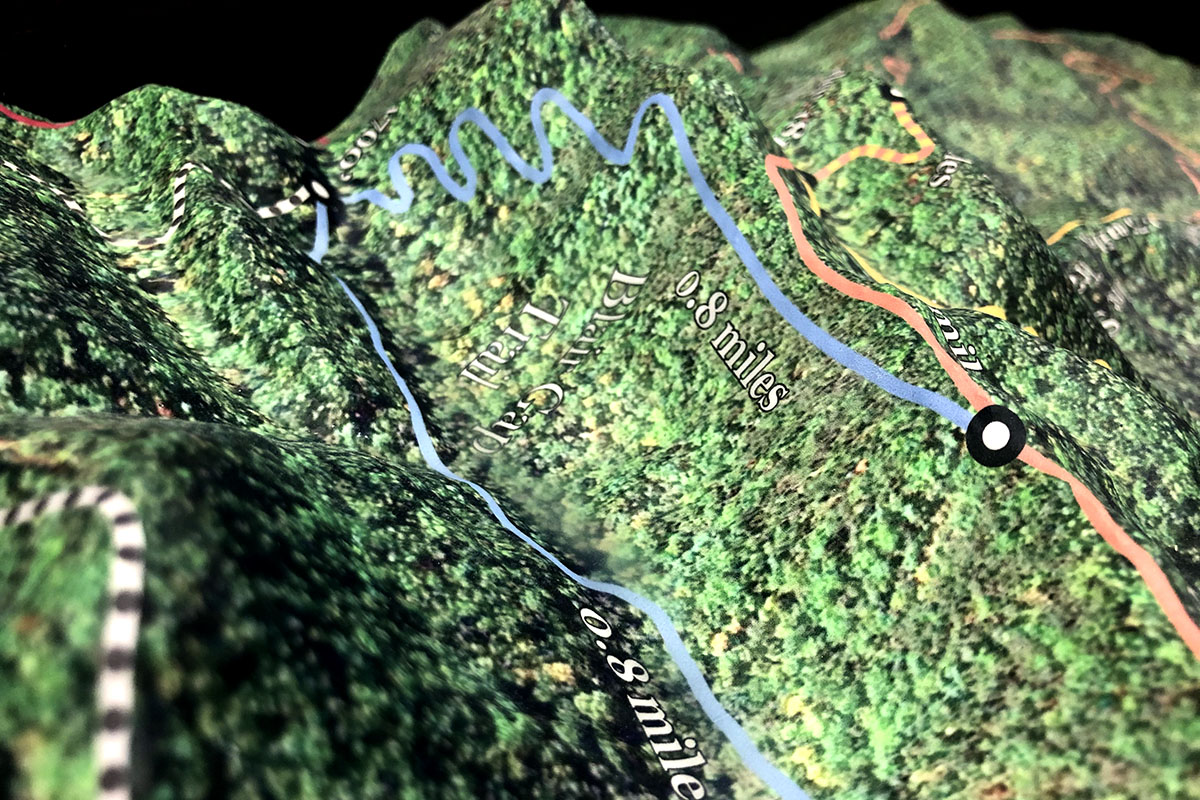
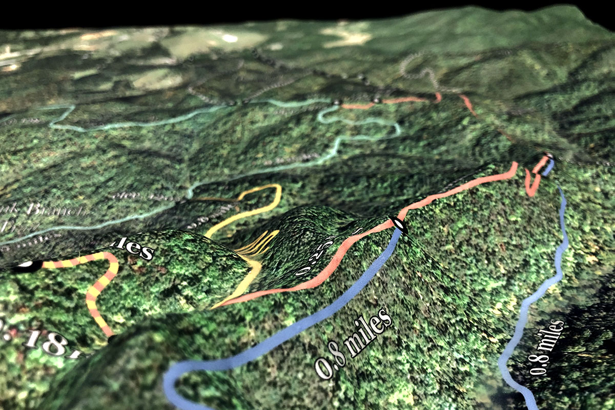
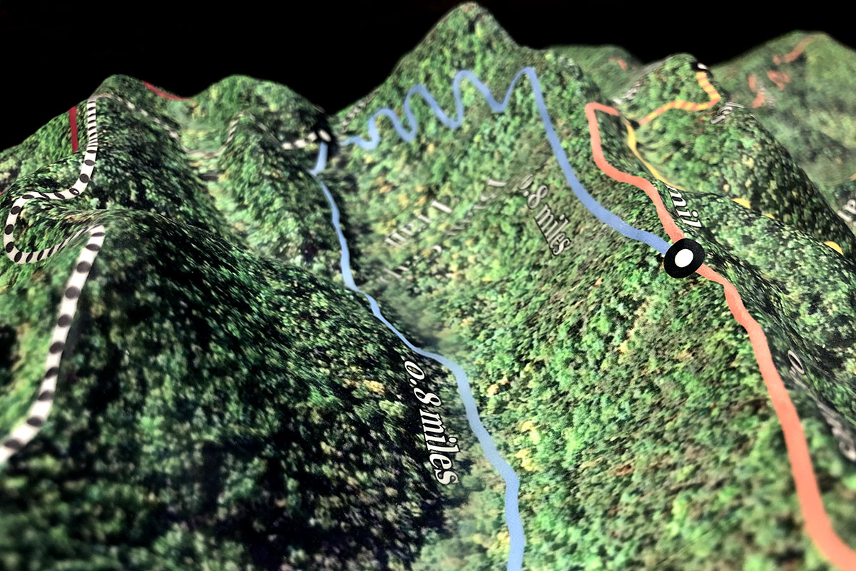
Accurate to the smallest measurement, each topography delineates the vast array of hiking trails, rivers, lakes, streams, and forests in the national park. Cartographic data for the topographies are captured in a height map of the globe that uses geographic information system mapping (GIS), sonar, lidar, and satellite data sets. The heightmap begins as a black and white image that our design team converts into a 3D model. The darkest colors in the data image are the lowest points in the elevation which gradient toward the lighter colors representing the higher elevations. Matching this 3D plain to satellite imagery provides the base image of the topography.
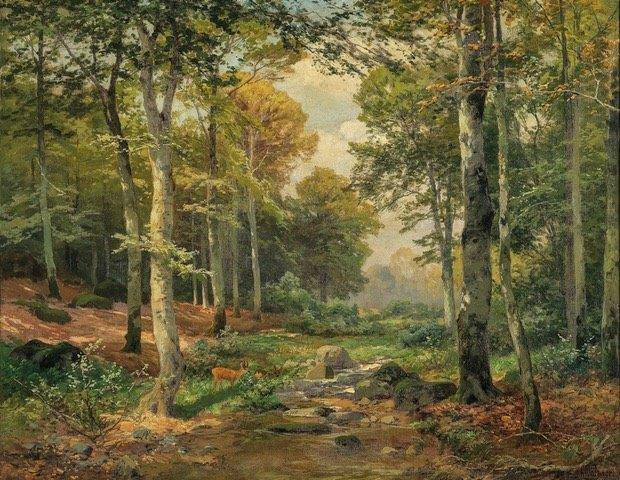
The topographies’ color palette ultimately derives from the oil on canvas, “Lichtdurchfluteter Wald mit Rehwild” (translated; light-flooded forest with roe deer) painted by German artist Heinrich Bohmer. The painting contains the rich greens and ochres that translate so well to the two topographies.
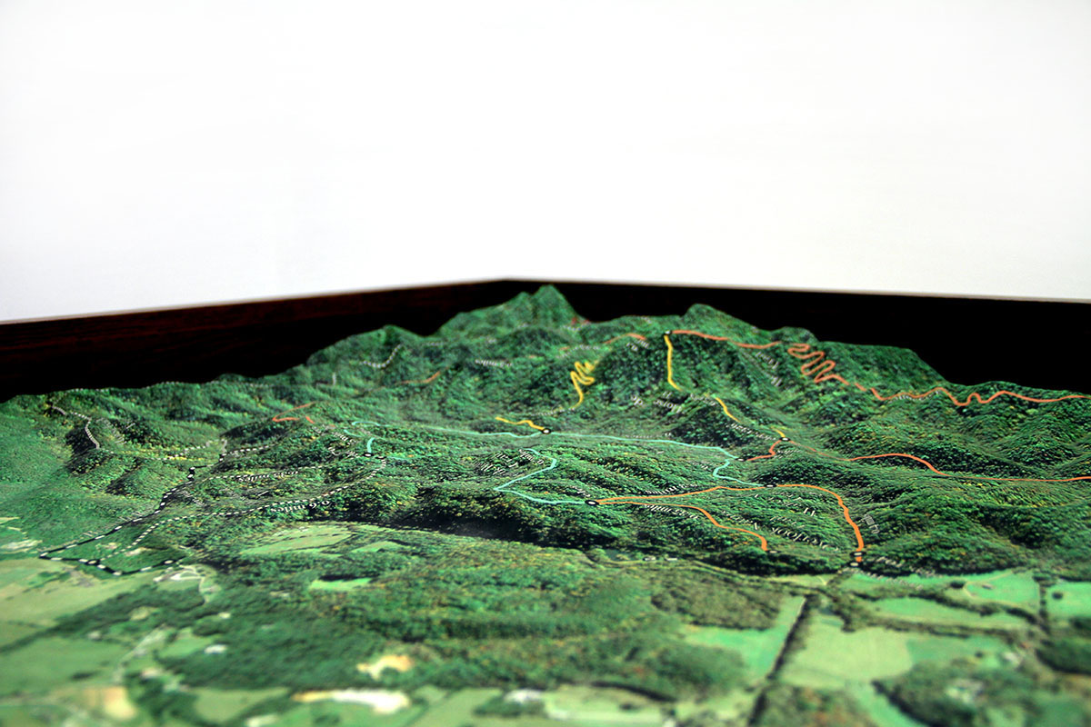
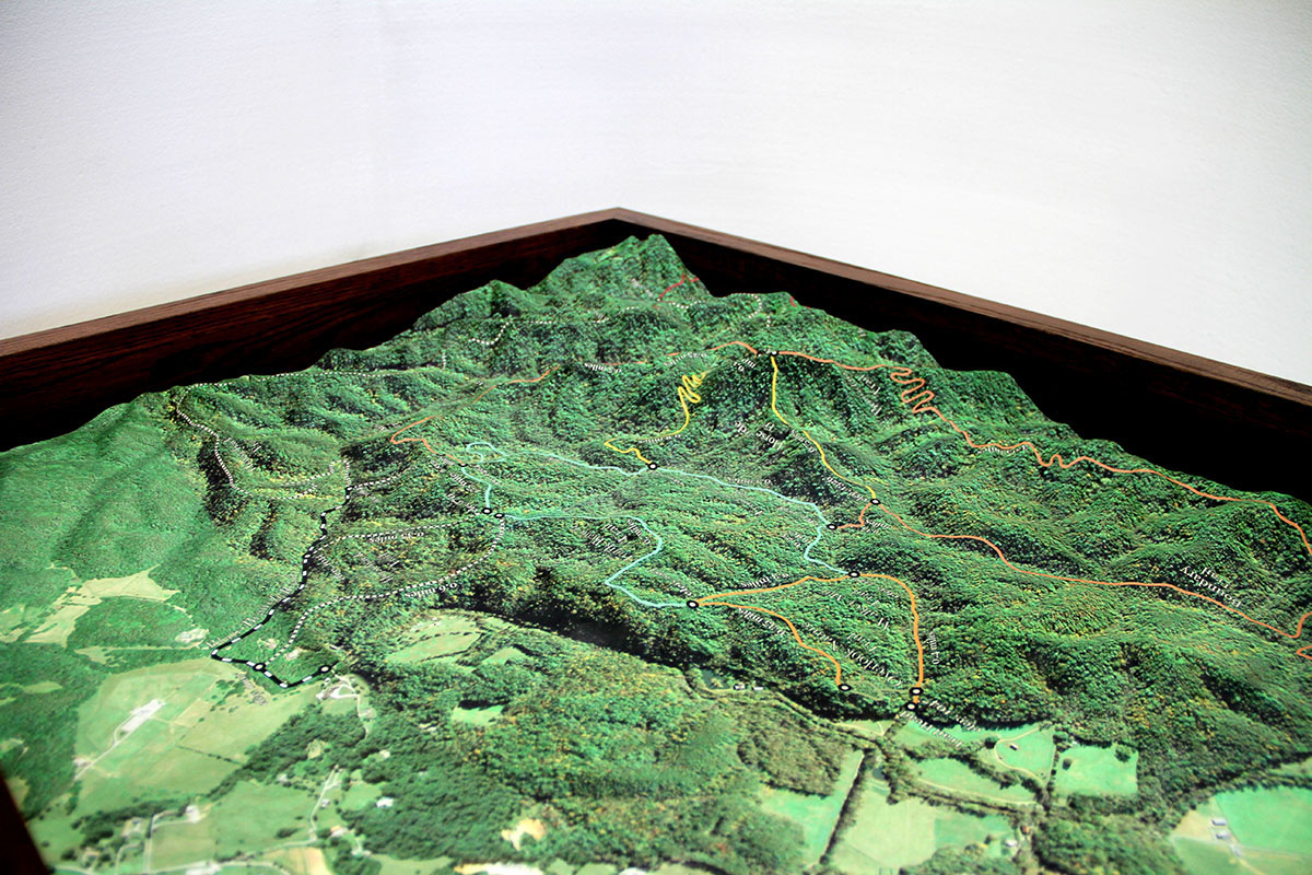
All colors on the topographies match meticulously to the client’s specifications. Texture added to rivers and lakes and snow dusting on top of Clingman’s Dome gives personalized realism to the maps.
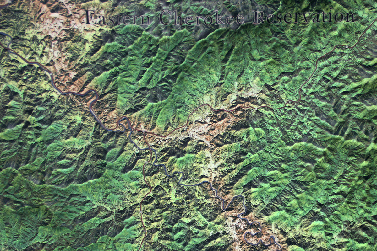
Highlighted on the smaller topography are several hiking and horseback trails. Landmarks identified on the large topography include the Nantahala National Forest, the East Cherokee Indian Reservation, and the Appalachian Trail. It was essential to the client to label relevant municipalities in the area such as Maryville, Walland, Gatlinburg, Pigeon Forge, and several others. Subtle additions of roads and freeways mark their whereabouts throughout the park as well. The chosen font types used in each topography, Baskerville Old Face and New Baskerville, mimic the text seen in old-world sailing maps.
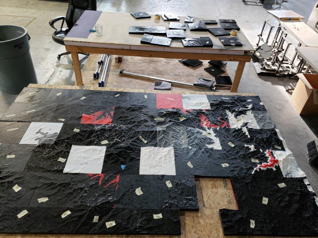
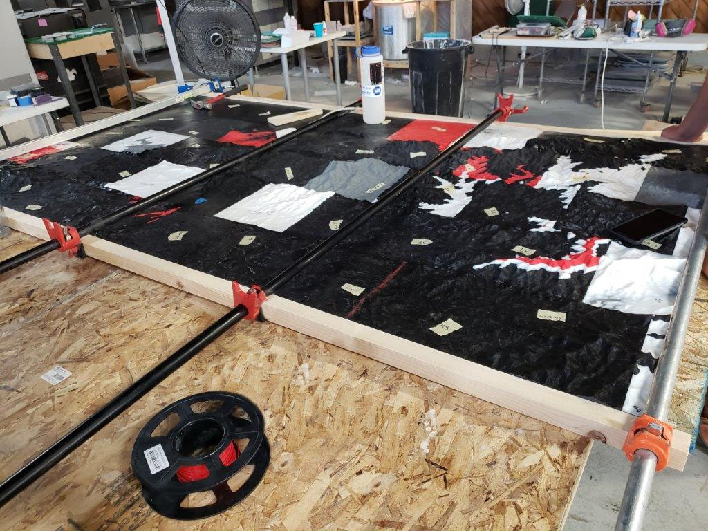
The Smoky Mountains national park topographic model dimensions are approximately 91 by 56 inches with three-dimensional rises of about 2 inches. At a scale of one inch for every 3,250 feet, this model is composed of 60 individual 3D prints with a total print time of about 3,210 hours.
The smaller dioramic model measures approximately 28 by 24 inches with three-dimensional rises of about 2 inches. This model has a lower scale ratio and greater detail than the larger map. Ten separate 3D prints, with approximately 520 hours of print time, form this model at a scale of one inch for every 475 feet.
Each topography’s coloration is treated with our proprietary ink-jet processing to create the details on each map. The maps’ finish is a scratch, spill, and UV-resistant matte coating that also eliminates glare and hotspots that would otherwise cast on to the topographies from the client’s existing overhead lighting.
Each of the topographical models is packed with care into a foam-lined custom crate shipped by freight to their eager owners.
To learn more about topography models go to Topographical Models or Terrain Models.
Finished Topography Gallery
Get a Free Price Estimate for a Custom 3D Topography Model
Custom Fabrication Workflow