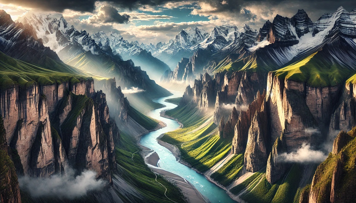
Canyons are awe-inspiring natural wonders, showcasing the immense power of rivers and geological forces over millions of years. These majestic chasms, with their dramatic depths and unique ecosystems, invite exploration and wonder. From the remote landscapes of Tibet to the iconic formations in the United States, each canyon offers a glimpse into Earth’s history and the interplay of natural forces. Let’s explore the world’s ten deepest canyons, uncovering their staggering depths, fascinating facts, and remarkable stories.
#1: Yarlung Tsangpo Grand Canyon – 19,714 feet
The Yarlung Tsangpo Grand Canyon in Tibet is the deepest canyon on Earth, plunging an incredible 19,714 feet. This massive chasm stretches over 300 miles and wraps around the eastern Himalayas, with the Yarlung Tsangpo River carving its way through the rugged terrain. Known as the “Everest of Canyons,” it transitions from snow-covered peaks to dense tropical forests, creating one of the most biodiverse regions on the planet.
The canyon’s inaccessibility has kept much of it pristine, making it a haven for scientists and adventurers alike. In 2002, an expedition of kayakers navigated its treacherous rapids, solidifying the canyon’s reputation as one of the most challenging terrains to conquer.
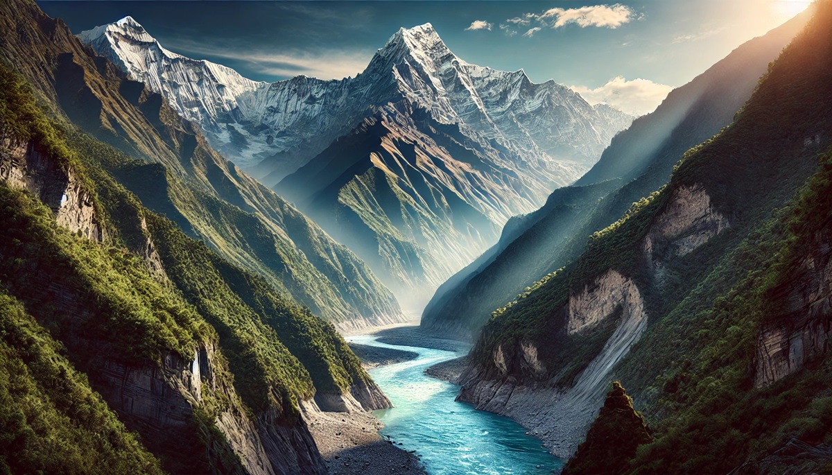
#2: Kali Gandaki Gorge – 18,278 feet
Located in Nepal, the Kali Gandaki Gorge slices through the Himalayas, descending 18,278 feet between the towering Annapurna and Dhaulagiri ranges. The Kali Gandaki River, older than the Himalayas, carves this dramatic valley, making it one of the world’s most geologically significant sites.
The gorge is not just a natural marvel but also a spiritual and cultural hub. The Saligram fossils found in the river are sacred to Hindus, while the Thakali people have cultivated a vibrant culture along its banks. Trekking through this gorge offers breathtaking views and a deep connection to Himalayan history.
#3: Cotahuasi Canyon – 11,595 feet
In the heart of Peru lies Cotahuasi Canyon, plunging 11,595 feet, making it one of the world’s deepest. This Andean marvel is carved by the Cotahuasi River and flanked by the volcanic peaks of Solimana and Coropuna. The region is a tapestry of ancient Incan terraces and picturesque villages, reflecting the harmony between human settlement and rugged nature.
Travelers are drawn to Cotahuasi’s remote beauty and the majestic Sipia Waterfall, which cascades dramatically into the canyon. Its isolation provides an authentic escape for those seeking solitude and natural splendor.
#4: Colca Canyon – 10,730 feet
Also in Peru, Colca Canyon reaches a depth of 10,730 feet and is famed for its Andean condors, which can be observed gliding above its vast expanse. Twice as deep as the Grand Canyon, its steep walls are adorned with ancient terraces still used for farming.
The canyon’s cultural richness is equally compelling. Indigenous communities like the Collagua and Cabana people inhabit the area, preserving traditional practices and attire. Visitors often describe the awe-inspiring sight of condors soaring gracefully over the canyon as unforgettable.
#5: Tiger Leaping Gorge – 9,842 feet
Tiger Leaping Gorge in Yunnan Province, China, is a geological wonder that plunges 9,842 feet between two towering mountain ranges. The Jinsha River, a tributary of the Yangtze, roars through the gorge, creating a dramatic and dynamic landscape.
Legend has it that a tiger once leaped across the gorge at its narrowest point, giving the canyon its name. The area is a hiker’s paradise, with trails offering stunning views of the river below and the snow-capped peaks above.
#6: Grand Canyon – 6,093 feet
The Grand Canyon in Arizona is one of the most iconic natural wonders in the world, with a depth of 6,093 feet. Carved by the Colorado River, its vast expanse stretches 277 miles and reveals nearly two billion years of geological history in its stratified layers.
For thousands of years, Native American tribes have lived within and around the canyon, considering it sacred. Millions of visitors each year are captivated by its grandeur, making it a symbol of the American West.
#7: Fish River Canyon – 5,904 feet
Namibia’s Fish River Canyon, Africa’s largest, plunges 5,904 feet into the arid landscape of the Namib Desert. Formed by the Fish River over millions of years, it offers a rugged, stark beauty that contrasts sharply with its surroundings.
The Fish River Hiking Trail is one of the most popular activities in the canyon, drawing adventurers from around the world to explore its rocky terrain and unique ecosystems.
#8: Tara River Canyon – 4,300 feet
Located in Montenegro, the Tara River Canyon plunges 4,300 feet, making it the deepest canyon in Europe. The turquoise Tara River flows through the gorge, creating a pristine habitat for numerous species and a haven for white-water rafting enthusiasts.
The canyon is part of Durmitor National Park, a UNESCO World Heritage Site, celebrated for its stunning biodiversity and dramatic landscapes.
#9: Blyde River Canyon – 2,625 feet
South Africa’s Blyde River Canyon is one of the most beautiful canyons in the world, descending 2,625 feet into lush greenery. It is part of the Drakensberg escarpment, known for its striking rock formations and diverse wildlife.
The canyon’s scenic viewpoints, like God’s Window, offer breathtaking vistas that attract nature lovers and photographers alike.
#10: Verdon Gorge – 2,300 feet
France’s Verdon Gorge, at 2,300 feet, is often called the “Grand Canyon of Europe.” The Verdon River, with its striking turquoise waters, cuts through the limestone cliffs, creating a picturesque landscape that draws climbers, kayakers, and hikers.
The gorge is a confirmation to the natural beauty of southern France, offering a blend of adventure and serenity for all who visit.
These deepest canyons on Earth are more than geological formations; they are awe-inspiring reminders of nature’s power and artistry. From the staggering depths of the Yarlung Tsangpo to the cultural significance of the Kali Gandaki, each canyon tells a unique story of erosion, biodiversity, and human connection. Exploring these natural wonders provides a profound appreciation for the forces that have shaped our planet over millions of years.