A New Dimension of Adventure:
Exploring National Parks with 3D Maps

We Build Custom 2D and 3D National Park Maps

Did you know we make

3D raised-relief maps

park city utah ski custom 3d map

and

3D raised-relief maps

ready-made 3D map

National Parks are some of the most beautiful and awe-inspiring locations in the world.  They offer a breathtaking glimpse of nature’s raw beauty, and provide an opportunity to reconnect with the great outdoors.  And now, with our new National Parks 3D Maps series, you can explore these magnificent natural wonders like never before.

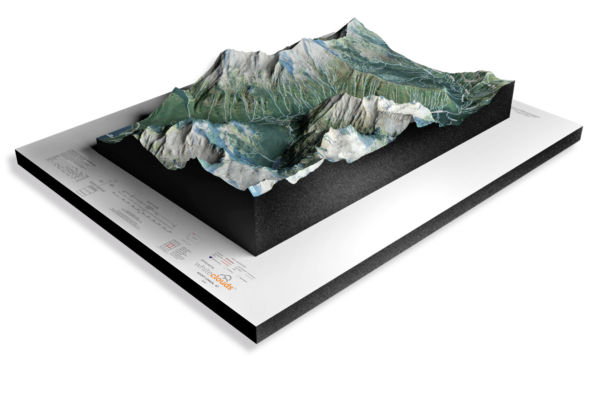
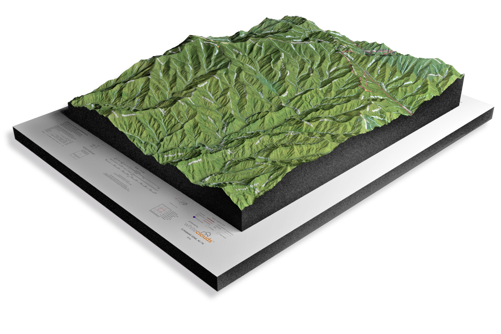
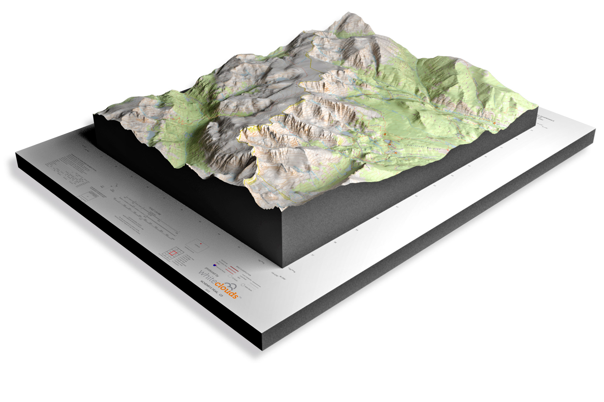
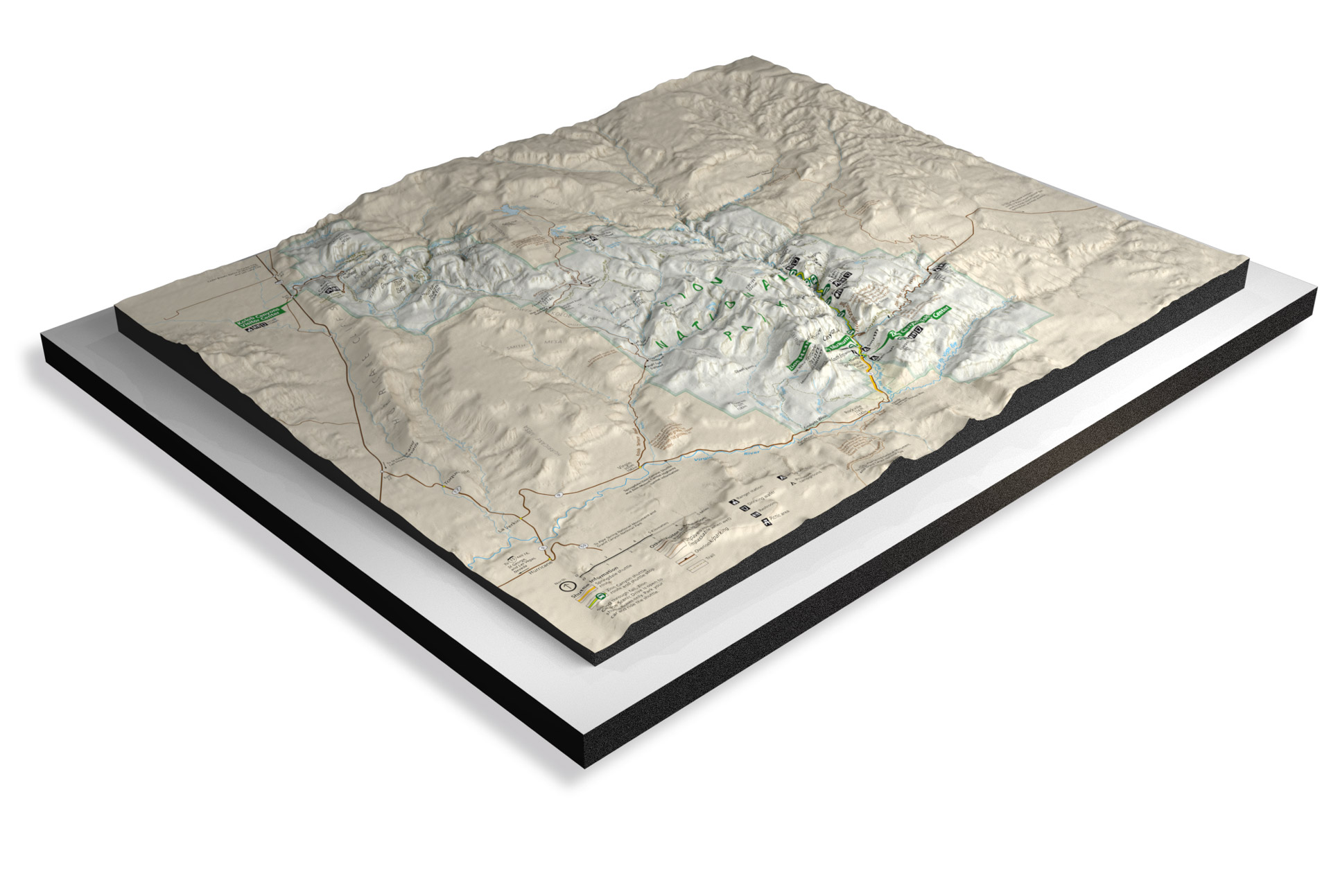
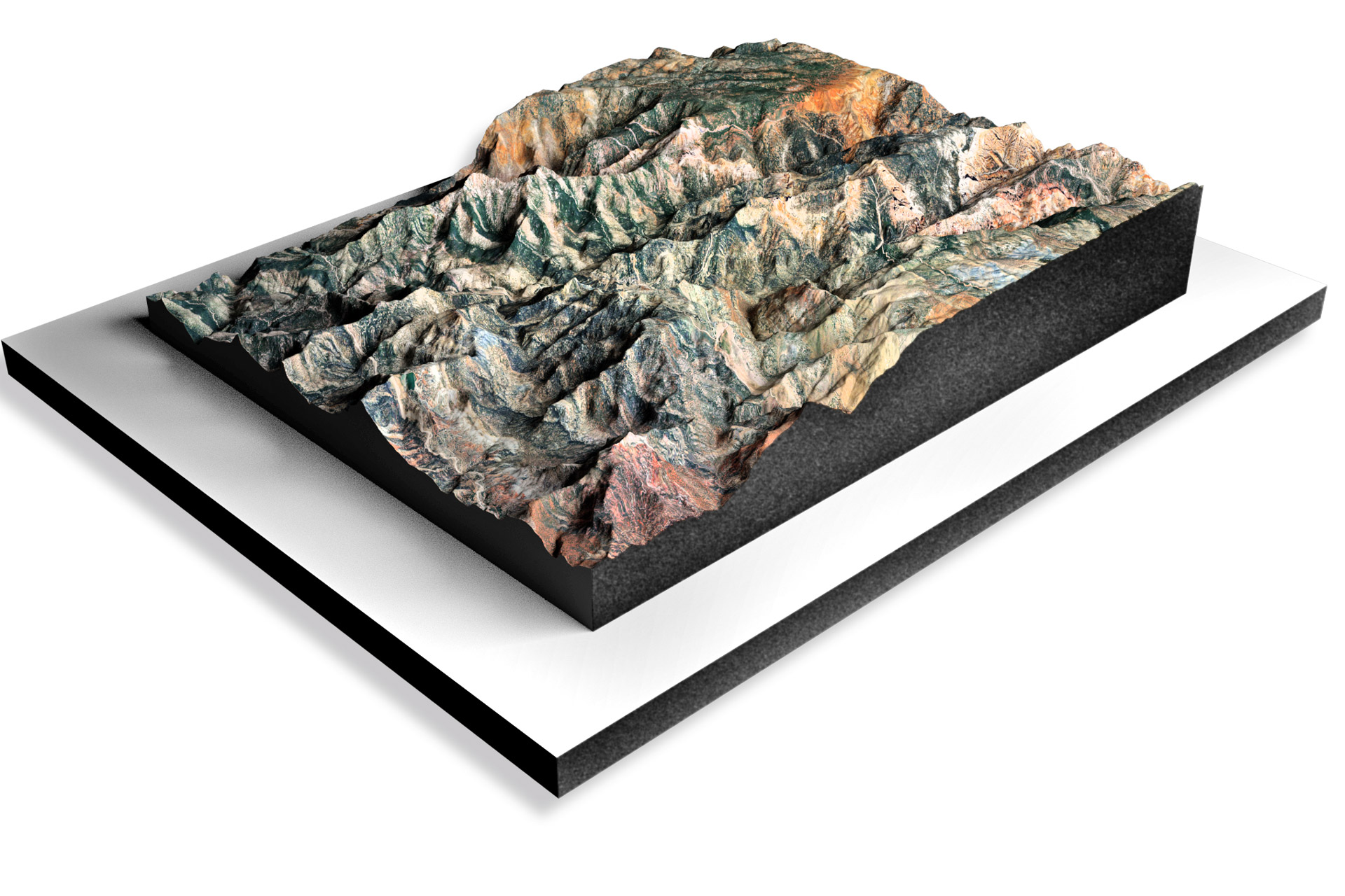
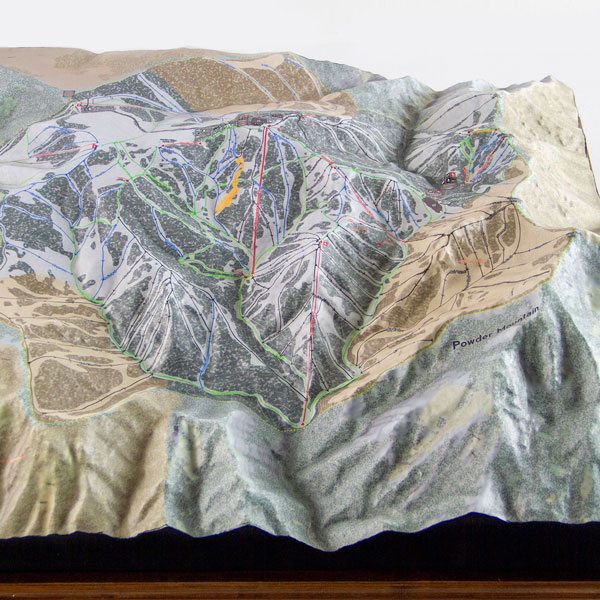
Our National Parks 3D Maps series uses cutting-edge technology to create highly detailed, accurate 3D maps of some of the most popular national parks in the United States.  These maps offer a new dimension of adventure, allowing you to see these natural wonders from a perspective that was previously only available to the most intrepid explorers.

National Parks-Header

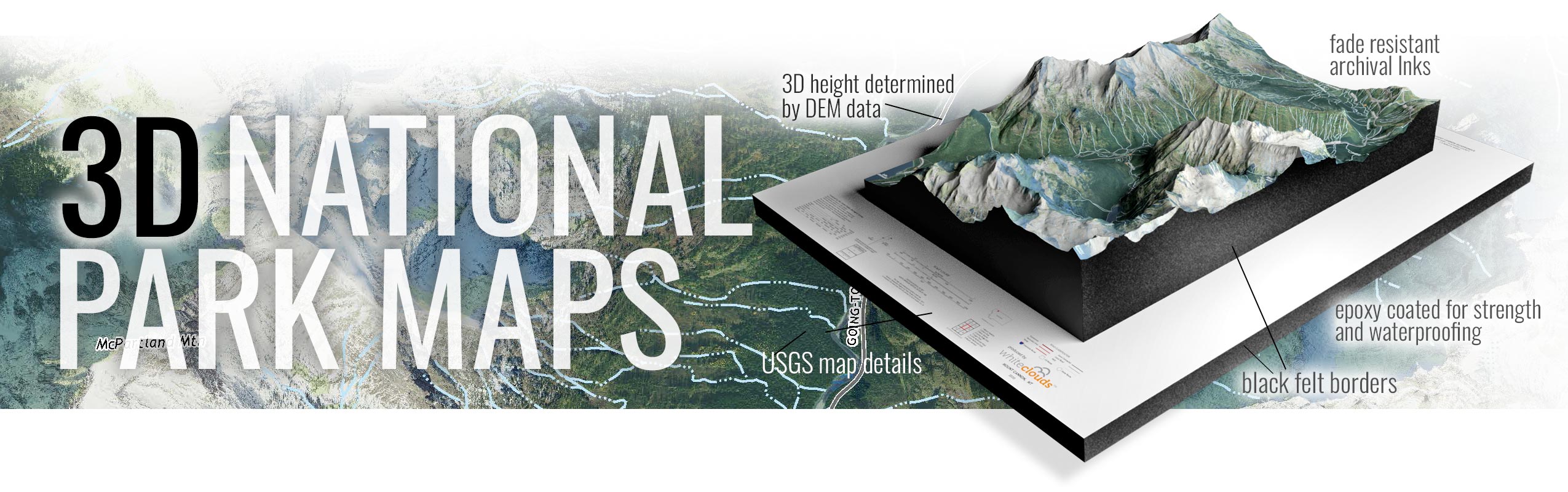
With our National Parks 3D Maps, you can explore the towering mountains, deep valleys, and winding rivers of America’s most beloved national parks.  You can see the stunning vistas from the top of Half Dome in Yosemite National Park, or explore the winding canyons of Zion National Park. Our maps are highly detailed and accurate, so you can plan your hikes and adventures with confidence.

To learn more in-depth about 3D National Parks Raised Relief Maps, view National Parks 3D Maps.

National Park 3D raised relief map models for the Parks Project.

But that’s not all – we also offer an article on the “Top 10 National Parks in The United States” to help you plan your next outdoor adventure.  From the iconic peaks of Grand Teton National Park to the beautiful valleys in the Smoky Mountains National Park, we’ve got you covered.

And once you’ve chosen your next destination, why not bring the beauty of the national parks into your home or office with our National Parks Canvas Wraps?  Our canvas wraps feature stunning photographs of some of the most beautiful locations in the national parks, printed on high-quality canvas and stretched over a sturdy frame. They’re the perfect way to bring a little bit of the great outdoors into your home.

So why wait? Whether you’re an experienced hiker or a casual nature lover, our National Parks 3D Maps series, Top 10 National Parks article, and National Parks Canvas Wraps are the perfect way to explore, plan, and decorate.  So start your next adventure today – the beauty of America’s national parks is waiting for you.

Learn more about Maps

  • Topographical Maps:  Representation of the physical features of a region or area.
  • Contour Maps:  Representation of the contours of the land surface or ocean floor.
  • Raised Relief Maps:  Representation of land elevations with raised features indicating landforms.
  • Terrain Maps:  Representation of the physical features of a terrain or landmass.
  • USGS Topographic Maps:  Representation of topographic features and land elevations based on USGS data.
  • USGS Historical Topographic Maps:  Representation of historical topographic maps created by the USGS.
  • Watershed Maps:  Representation of the areas where water flows into a particular river or lake.
  • Elevation Maps:  Representation of land and water elevations with high precision.
  • Physical Maps:  Representation of physical features of the Earth’s surface such as landforms, oceans, and plateaus.
  • Bathymetric Maps:  Representation of the topography and features of the ocean floor.
  • NOAA Maps:  Representation of atmospheric, oceanographic, and environmental data by NOAA.
  • Nautical Maps:  Representation of the underwater features and depth of an area for navigation purposes.
  • Geologic Maps:  Representation of the geologic features of an area such as rock types, faults, and folds. 
  • Satellite Maps:  Representation of earth from high-definition satellite imagery.

 Contact us today to learn more about our services and how we can help you achieve your goals. 

Get a Free Quote

Get a Free Quote