How Big Is Greenland? A Jaw-Dropping Look at the World’s Largest Island
When people first glance at a world map, especially one based on the familiar Mercator projection, Greenland looks almost impossibly large—sometimes appearing comparable to Africa. That visual shock often sparks the question: how big is Greenland, really? The answer is both simple and astonishing. Greenland covers approximately 836,330 square miles, or about 2.166 million square kilometers. That makes it the largest island on Earth that is not a continent. It is bigger than Mexico, bigger than Saudi Arabia, and roughly three times the size of Texas. Yet despite its immense footprint, fewer than 60,000 people call it home. Understanding Greenland’s size is not just about numbers. It’s about geography, climate, ice, and perception. It’s about how maps can deceive us, how ice can shape landscapes on a planetary scale, and how a land so vast can remain so sparsely inhabited. Let’s take a closer look at the true scale of this Arctic giant.
Greenland by the Numbers: The Raw Scale
Greenland spans roughly 1,660 miles from north to south and about 650 miles at its widest point from east to west. Its coastline stretches for an estimated 27,000 miles when you include the deep fjords and jagged inlets carved by ancient glaciers.
To put that in perspective, Greenland is:
- About one-quarter the size of the contiguous United States
- Larger than Alaska
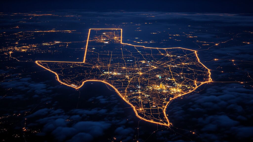
- Nearly three times the size of Texas
- Bigger than every European country except Russia
Despite its size, about 80 percent of Greenland is covered by a single massive ice sheet. That means the habitable, ice-free land is primarily located along its coasts, where small towns and settlements cling to rocky shores between mountains and sea.
Greenland vs. the United States
Many Americans are surprised to learn that Greenland, although visually exaggerated on many maps, is still enormous even when corrected for projection distortion.
If you overlay Greenland onto the continental United States, it would stretch from Florida to roughly northern Canada. If placed over Texas, it would dwarf the Lone Star State by a wide margin. In fact, Greenland’s land area is more than triple that of Texas.
Yet unlike the United States, Greenland has no interstate highway system, no massive urban centers, and no sprawling suburbs. Its vast size is defined by ice fields, glaciers, and Arctic wilderness rather than highways and cities.
The Mercator Projection Illusion
One of the reasons Greenland’s size is so widely debated is because of the Mercator projection, the map style most commonly seen in classrooms and online. The Mercator projection stretches land masses closer to the poles, making them appear much larger than they actually are. That’s why Greenland can look similar in size to Africa on a flat world map. In reality, Africa is about 14 times larger than Greenland.
This visual distortion has become so famous that interactive tools now allow users to drag Greenland around the globe to see how its true size compares. When moved closer to the equator, Greenland shrinks dramatically relative to continents like Africa, South America, or Asia.Still, even when corrected, Greenland remains an immense landmass—just not continental in scale.
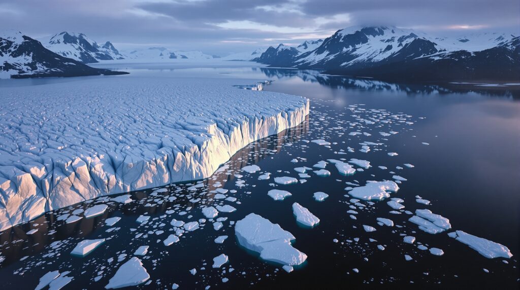
The Greenland Ice Sheet: A Frozen Giant
That means Greenland’s size isn’t just horizontal. It has vertical mass on a staggering scale. The weight of the ice is so immense that it depresses the land beneath it. In fact, parts of central Greenland sit below sea level but are held above water only because of the ice pressing downward.
The sheer volume of ice stored here makes Greenland one of the most critical regions on Earth in discussions about climate change and global sea levels.
How Big Is Greenland Compared to Other Islands?
Greenland holds the title of the largest island in the world, excluding continents. The next largest island is New Guinea, which is less than half Greenland’s size. After that come islands like Borneo and Madagascar. Unlike many other large islands, Greenland is located almost entirely within the Arctic Circle. Its northernmost point, Cape Morris Jesup, is one of the northernmost land points on Earth.
Greenland’s isolation and harsh climate have kept it relatively untouched compared to other large islands. There are no sprawling rainforests like Borneo, no tropical beaches like Madagascar, and no massive cities like those on Honshu in Japan. Instead, Greenland’s size is expressed through ice, fjords, and tundra.
Greenland’s Population Density: Vast and Nearly Empty
Despite being the largest island in the world, Greenland has one of the lowest population densities anywhere on Earth. With fewer than 60,000 residents spread across more than 836,000 square miles, Greenland averages fewer than 0.1 people per square mile. Most residents live along the southwestern coast, where the capital city of Nuuk is located. Nuuk itself has fewer than 20,000 residents, making it smaller than many suburban towns in the United States. The size-to-population ratio is staggering. Greenland is bigger than many nations, yet its total population could fit inside a modest American college football stadium.
Greenland’s Geography: Mountains, Fjords, and Frozen Deserts
Greenland’s landscape is dramatic and rugged. Massive fjords slice into the coastline, some stretching hundreds of miles inland. Sheer cliffs rise from icy waters, and glaciers calve enormous icebergs into the sea.
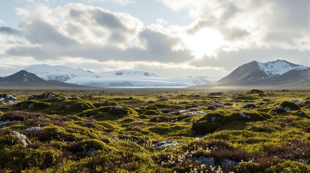
In the far north, Greenland transitions into polar desert, one of the driest environments on Earth. Snowfall is surprisingly limited in some regions, even though temperatures remain frigid.
The ice-free areas along the coast feature tundra ecosystems filled with mosses, lichens, and hardy Arctic plants. Wildlife such as musk oxen, Arctic foxes, and polar bears roam across landscapes that feel almost extraterrestrial in their scale and isolation.
Greenland’s Political Size and Influence
Greenland is an autonomous territory within the Kingdom of Denmark. Although geographically part of North America, it maintains strong political and historical ties to Europe.
Its size has made it strategically important. During World War II and throughout the Cold War, Greenland’s vast Arctic position made it a critical location for military bases and monitoring stations. Today, its location continues to draw global attention as Arctic shipping routes become more accessible due to melting sea ice. Greenland’s physical size gives it geopolitical weight far beyond its population.
What If the Ice Melted?
One of the most sobering ways to grasp Greenland’s scale is to consider what would happen if its ice sheet melted entirely.
Scientists estimate that complete melting would raise global sea levels by over 20 feet. Major coastal cities around the world would face severe flooding. Entire island nations would be submerged. Shorelines across continents would be redrawn.
Greenland’s size, therefore, is not just a geographic statistic. It represents one of the largest reservoirs of freshwater on Earth, stored in frozen form. Even small changes in Greenland’s ice mass have measurable impacts on global sea levels. That gives this vast Arctic island an outsized role in the planet’s climate system.
Traveling Across Greenland: A Journey of Scale
Traveling across Greenland is not simple. There are no roads connecting most towns. Transportation is primarily by boat, small aircraft, dog sled, or snowmobile. Driving from one end of the island to the other is impossible because the massive ice sheet blocks inland travel. To truly cross Greenland, explorers must traverse the ice sheet itself, a journey that can take weeks in extreme Arctic conditions. That logistical reality reinforces just how big Greenland is. Its size is not just measurable on a map; it is physically overwhelming in real life.
Why Greenland Still Feels Mysterious
Despite its enormous size, Greenland remains one of the least explored and least populated large landmasses on Earth. Satellite imagery and scientific expeditions have revealed much about its ice and geology, but vast areas remain untouched wilderness.
In an era when most of the planet has been mapped, developed, or urbanized, Greenland stands apart. Its size preserves a sense of frontier and remoteness that few other places can match. It is large enough to contain hidden valleys beneath ice, unknown geological formations, and ecosystems that are only beginning to be understood.
So, How Big Is Greenland?
Greenland is 836,330 square miles of Arctic immensity. It is the largest island on Earth, larger than most countries, yet home to fewer people than a small city. It is 80 percent ice, thousands of miles of coastline, and a towering reservoir of frozen freshwater that influences global sea levels. It looks enormous on a Mercator map, and while that projection exaggerates its scale, the truth is still remarkable. Greenland is vast. It is powerful. It is critical to the planet’s future. Its size challenges our perception, reshapes our understanding of maps, and reminds us that some parts of Earth remain dominated not by cities or highways, but by ice and wilderness. Greenland is not just big. It is one of the grandest landscapes on Earth.