
Quechee Ski Hill 3D Map with a Clear Alpine Boundary
Quechee's alpine hill is compact enough to support a highly readable physical map, but it sits within a wider club recreation landscape. The key planning decision is where the alpine subject ends and whether Nordic or uphill information belongs on the same display, in a restrained inset, or on a separate panel.
Plan a Quechee Map
Protect the compact Quechee hill from boundary creep
A 13-trail alpine map can remain direct and readable when the boundary stays close to the hill and its essential base relationship. Adding the wider Nordic network to that same scale would enlarge the footprint substantially. If both are important, an inset or companion panel can explain the connection without shrinking the alpine routes.
The designated uphill information is another distinct layer. It should use a symbol or line treatment that cannot be mistaken for a downhill trail and should be based on the current approved source.
A compact proof can test the alpine labels at their real display size before any wider network is added. If the hill remains the primary subject, Nordic context and uphill guidance can occupy distinct supporting zones. This keeps route direction clear while preserving the physical prominence of the alpine terrain.
Assign each Quechee route system a clear role
The primary map can stay simple even when the broader property supports several activities.
Alpine terrain
Give the 13 trails and chairlift the dominant scale and contrast.
Uphill route
Use a dedicated line style and update process when this route belongs on the display.
Nordic context
Place the longer network in a locator or companion map rather than forcing it onto the alpine hill.
Club facilities
Include only the permanent anchors required from the installation's viewing point.
Compare a Yampa River Basin museum map
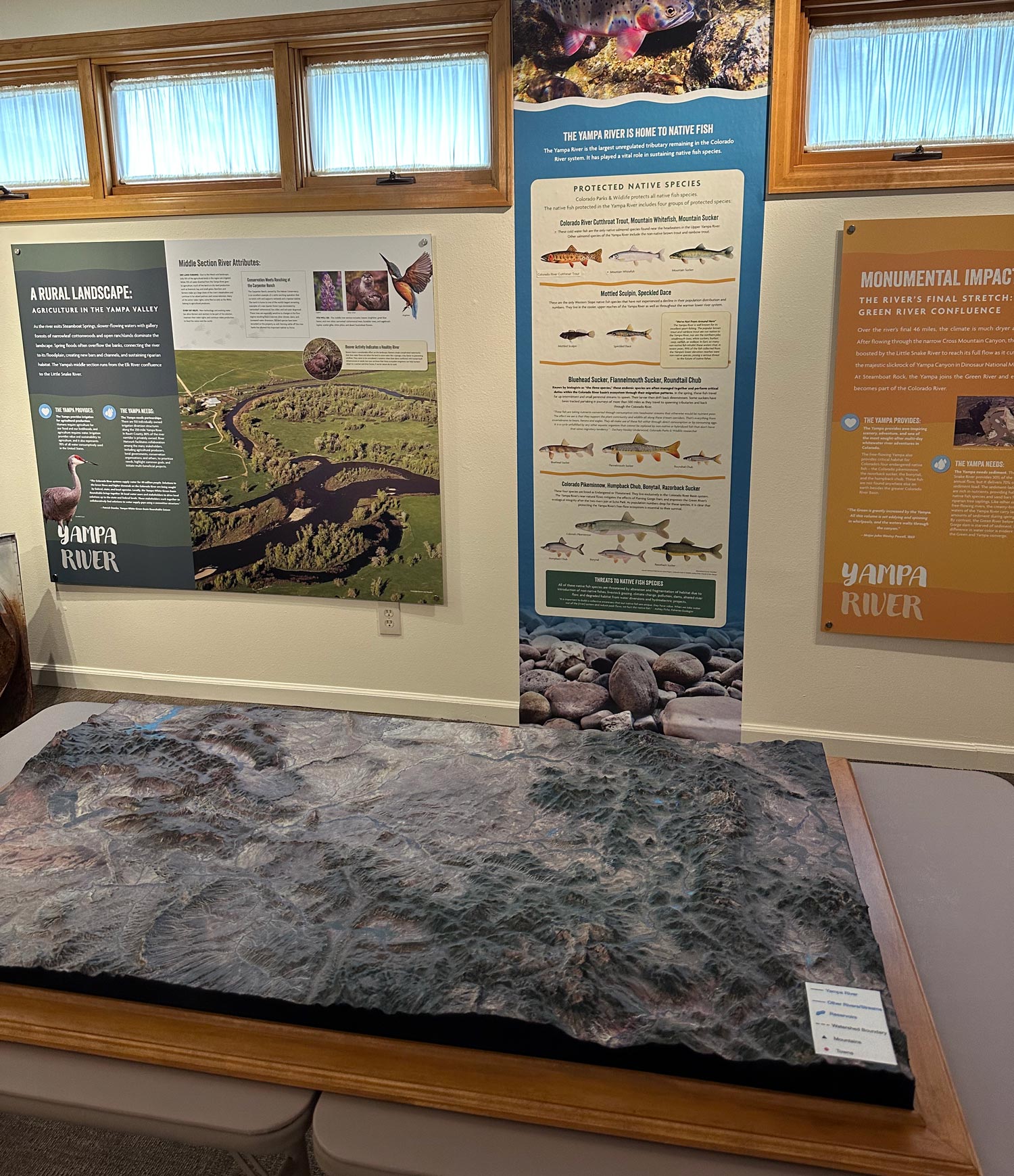
The supporting WhiteClouds photograph depicts the Yampa River Basin in Colorado in a museum display. It demonstrates how terrain and interpretive information can meet in a public interior. It is not Quechee imagery and contributes no Vermont trail data.
Approve the alpine and optional wider layers separately
The finished map should make its primary network obvious without requiring visitors to decode several unrelated legends.
- Current alpine trail source and exact hill boundary
- Chairlift, base, and priority route labels
- Approved designated uphill source if included
- Nordic locator or companion-map decision
- Essential club facilities and viewer approach
- Finished size, relief, mounting, and legend format
- Installation access, destination, and required date
Request pricing for a Quechee Ski Hill 3D map
Send the current alpine source, approved boundary, uphill or Nordic inclusion decision, required club anchors, dimensions, orientation, viewing distance, installation details, destination, and schedule.