
McCauley Mountain 3D Map for a Town-Operated Ski Center
McCauley Mountain offers a focused summit-to-base terrain subject just outside Old Forge. A physical map can make the lift-served mountain clear on its own or add a restrained locator showing the ski center's relationship to the town, depending on whether the buyer needs on-mountain orientation or a broader civic presentation.
Plan a McCauley Map
Set the McCauley boundary from the display's civic role
A ski-center map can devote nearly all of its surface to the lift-served mountain. A town presentation may benefit from a small locator that establishes the relationship to Old Forge. The locator should remain secondary; enlarging the regional boundary until the trails become tiny defeats the purpose of raised relief.
The official mountain information identifies 21 trails and several transport types. Those systems should receive distinct symbols only where that distinction helps the intended audience.
For a civic or visitor-facing display, title hierarchy can explain ownership and place without turning the relief into a regional road map. The mountain remains the primary physical subject, while a restrained locator establishes Old Forge context. This division lets trail and transport labels retain enough space to work at the intended viewing distance. A separate key can distinguish transport types when direct symbols would compete with trail names on the steeper relief. The buyer should choose that level of detail according to the map's audience, not simply because the information is available.
Build a clear McCauley reading sequence
The physical map should make orientation possible before a viewer studies individual names.
Summit
Use terrain form and a restrained label to establish the upper reference point.
Route network
Separate major returns, junctions, and skill information through an approved graphic hierarchy.
Transport
Differentiate chair, T-bar, tow, and conveyor routes only as the current source requires.
Town locator
Add Old Forge context in a small inset when civic orientation is part of the brief.
Compare the Bent Creek watershed model
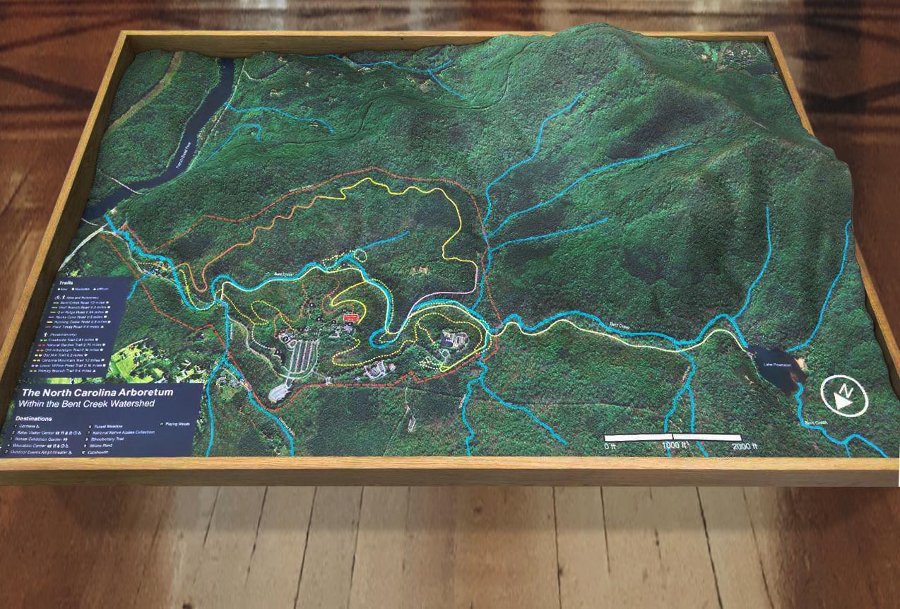
The supporting WhiteClouds example depicts the Bent Creek watershed in North Carolina. Its contained geographic boundary and integrated legend offer one reference for a focused terrain display. It is not McCauley Mountain and carries no New York route information.
Separate mountain detail from regional context
The buyer can keep both layers useful by approving their purpose and scale independently.
- Current ski-center trail and lift source
- Exact summit-to-base terrain boundary
- Required transport symbols and direct labels
- Base facilities and access points
- Optional Old Forge locator extent
- Wall or tabletop size and viewing direction
- Municipal installation, access, destination, and schedule
Request pricing for a McCauley Mountain 3D map
Send the current mountain source, approved boundary, priority routes and lift systems, any town-locator requirement, dimensions, display setting, installation access, destination, and deadline.