
One Physical Map or Two for Jack Frost and Big Boulder?
Jack Frost and Big Boulder create a map-boundary decision before any visual styling begins. The two mountains are separate locations with different top-to-bottom relationships, so a physical display must either give each terrain subject enough scale on its own or connect two models through a clear regional locator.
Plan a Two-Mountain Display
Do not shrink two mountains into one unreadable panel
A single base can be visually cohesive, but it should not imply that the two terrain surfaces touch. One approach is to place two relief panels side by side with a small locator map between them. Another is to create separate pieces that share materials, legend design, scale logic, and mounting height.
The top-down Jack Frost arrangement and bottom-up Big Boulder arrangement also affect viewer orientation. Each model can be rotated for intuitive arrival reading, or both can follow geographic north if comparison is the primary purpose. That decision should be explicit.
A paired proof should test the mountains both individually and as one composition. The legend, title treatment, locator, and spacing between panels must explain the relationship without stealing useful terrain area. If one mountain requires substantially more label room, coordinated pieces may work better than forcing both into equal rectangles.
Give both mountain maps a common visual grammar
Consistency can connect the display without erasing the differences between sites.
Independent relief
Size each terrain panel from its own route density and minimum readable labels.
Shared legend
Use coordinated symbols where trail and lift categories truly match across both source maps.
Regional locator
Show the relationship between sites at a small scale without filling the gap with false continuous terrain.
Arrival cues
Mark the top or base approach clearly when the two mountains are read from opposite directions.
Use Park City as a different-location ski-map example
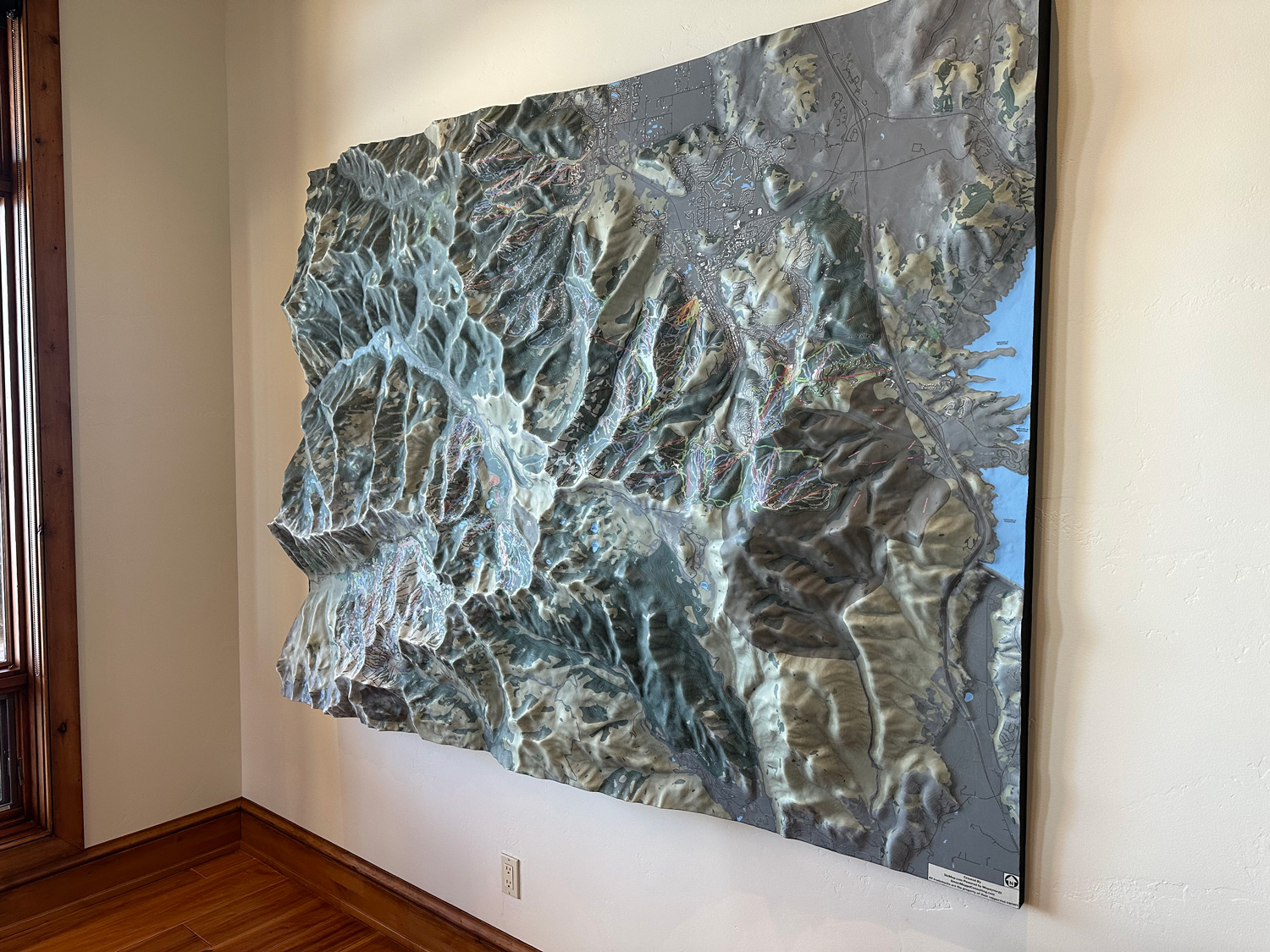
The supporting WhiteClouds photograph depicts a large raised-relief ski-trail wall map of Park City, Utah. It demonstrates how detailed mountain routes can be carried across a substantial surface. It is not Jack Frost or Big Boulder imagery and supplies no Pennsylvania geography.
Coordinate both source packages before proofing
The two halves should be approved together even if they become separate physical pieces.
- Current Jack Frost trail and base references
- Current Big Boulder trail and base references
- Boundary, scale, and orientation for each terrain panel
- Shared versus site-specific symbols and labels
- Regional locator extent and information
- One base, paired panels, or separate mounting plan
- Installation locations, access, destination, and completion date
Request pricing for a Jack Frost and Big Boulder display
Provide the current source files for both mountains, desired boundary and scale for each, shared legend requirements, locator preference, physical format, installation constraints, destination, and schedule.