
Planning a 3D Map of Hidden Valley Resort, Pennsylvania
A Hidden Valley Resort terrain map has two related but different orientation layers: the ski network and the base-area plan. Combining them successfully means deciding which questions relief should answer and which facilities belong in a simpler plan or legend around the terrain.
Plan a Hidden Valley Map
Decide how trail and base information should meet
A trail map follows routes and lift relationships across the mountain. A base-area map answers different questions about arrival, buildings, parking, and services. Putting every symbol onto one physical surface can weaken both. Identify the primary viewer task, then give the secondary layer a controlled inset, border, or adjacent panel.
The official count of 26 slopes and trails and eight lifts indicates enough route density to require a label proof at finished size. Labels that look comfortable on screen can collide once they are placed over relief.
Viewer approach can settle the hierarchy. A map encountered near arrival may emphasize base-area orientation before the eye moves uphill; a sales, planning, or commemorative display may give the terrain more visual weight. Establish the viewing direction and reading distance early so the inset, legend, and relief do not compete for the same space. A coordinated color and symbol key can connect both map layers without repeating every facility name across the terrain. It can also make the inset feel related without suggesting that plan symbols follow the same scale as the relief.
Review a visitor map created for Banff
The supporting image shows a WhiteClouds topographical map of Banff National Park at the Fairmont Banff Springs Adventure Centre in Alberta, Canada. It demonstrates a central pedestal presentation for visitor information. It does not depict Hidden Valley or establish a Hidden Valley commission.
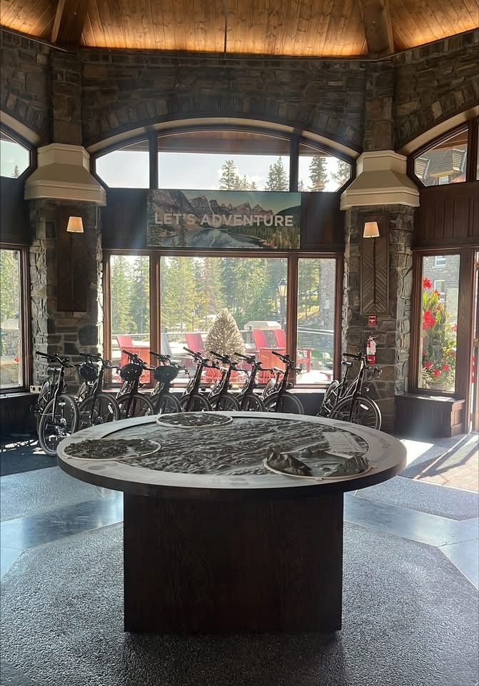
Assign each feature to the right layer
A short content hierarchy keeps the terrain readable.
On the relief
Reserve the terrain surface for major slopes, lift paths, and fixed landmarks tied directly to geography.
In the base inset
Use plan-oriented space for buildings, parking, and arrival details that need a different scale.
In the legend
Move repeated symbols and secondary names away from crowded junctions.
Bring the two official source sets into one brief
Both maps should share a version date and a single approval path.
- Current winter trail map
- Current base-area map and facility list
- Exact physical terrain boundary
- Priority trails, lifts, and slope-area labels
- Arrival point and primary viewing orientation
- Inset, legend, or paired-display preference
- Finished size, installation access, destination, and deadline
Request a Hidden Valley Resort 3D map quote
Send the current trail and base-area sources, intended terrain boundary, priority information, viewer approach, display format, dimensions, mounting or pedestal needs, destination, and schedule.