
Planning a Physical Trail Map for Buffalo Ski Club
A Buffalo Ski Club physical map should be built from the club's current trail-map authority and the way members actually approach the terrain. The design problem is not to add generic mountain drama; it is to make the approved slope boundary, lift or tow network, lodges, and key route choices readable in a durable member-facing display.
Plan a Buffalo Ski Club Map
Design from the club's real viewing position
A map near an entrance may need an immediate relationship among parking, lodge, lifts, and the first route choices. A display deeper inside a member space may support a more terrain-focused or commemorative treatment. Record that placement before choosing orientation, because a north-up map is not automatically the most intuitive map on a wall.
The official downloadable trail map should control names and route relationships. Club-supplied changes can be layered onto that source only after an identified approver confirms them.
A finished-size proof should be reviewed from the planned distance inside the club space. Trail lines, lift paths, building markers, and legend symbols may be clear individually but still crowd one another on relief. Testing that hierarchy early helps reserve direct labels for the decisions members need most and moves secondary detail into a concise key. The same review can identify information likely to change and assign it to a replaceable legend rather than the permanent terrain surface. Wall placement should also account for furniture, doors, and nearby signs that affect how closely members can approach the finished map.
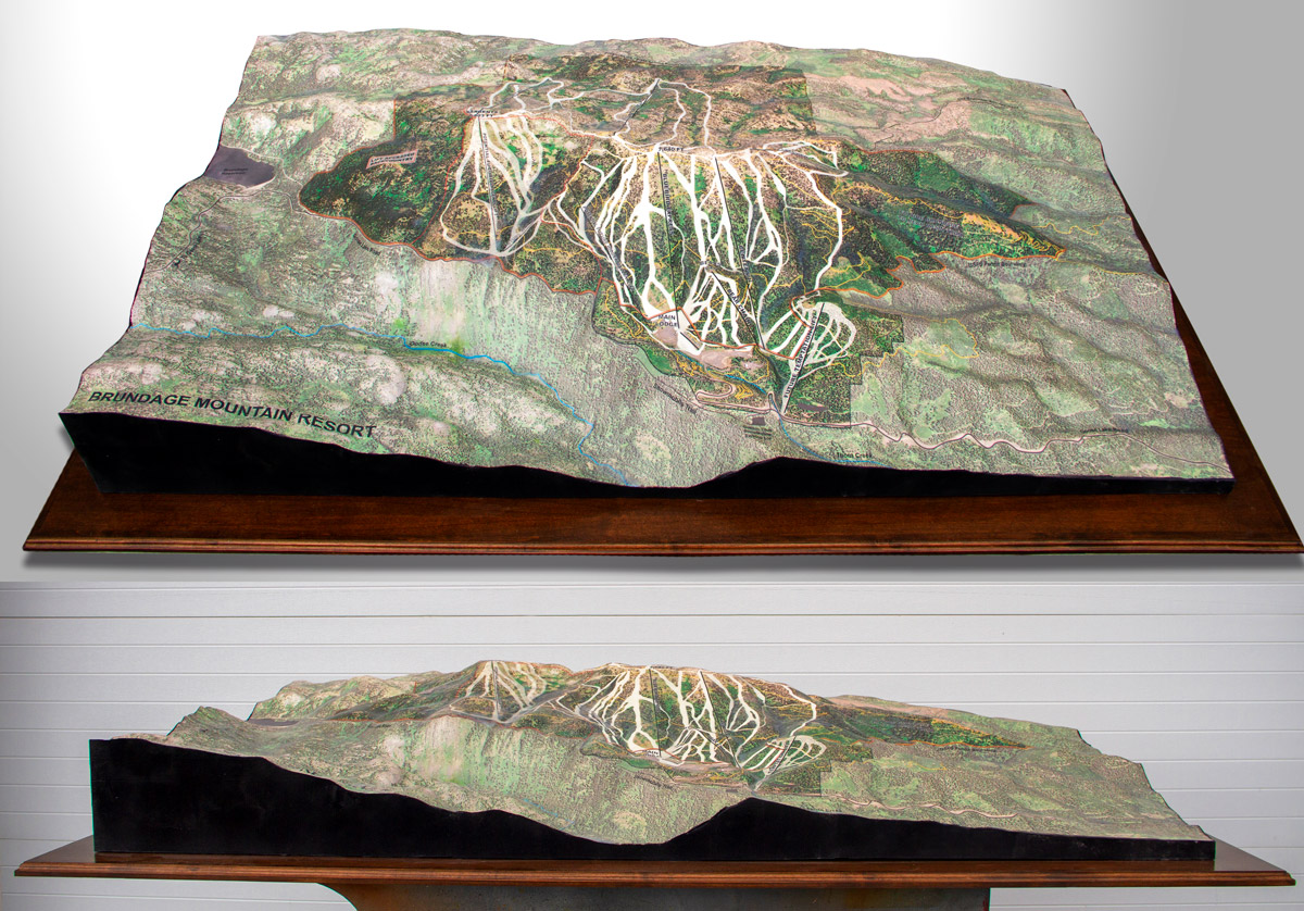
Look at a Brundage Mountain terrain model
The supporting WhiteClouds example depicts Brundage Mountain Resort in Idaho. Its raised terrain and freestanding base offer one reference for a club display. It is not Buffalo Ski Club imagery and provides no Buffalo-specific route information.
Separate terrain, movement, and club facilities
Three visual layers can keep the model useful without making it diagram-heavy.
Landform
Let relief establish ridge, slope, and base relationships before graphics are applied.
Routes
Use an approved line and symbol system for trails and uphill transport.
Club anchors
Identify only the lodges, entrances, gathering points, or other permanent features the audience needs.
Prepare a controlled Buffalo source package
A small approval set protects both map accuracy and future maintenance.
- Current official trail-map file and issue date
- Approved boundary and terrain data
- Permanent lifts, tows, routes, and facility markers
- Member-facing labels and legend terms
- Primary wall or table viewing direction
- Finished dimensions and mounting constraints
- Update owner, delivery access, destination, and due date
Request a Buffalo Ski Club 3D map quote
Provide the approved club map, geographic boundary, information layers, display location, viewer orientation, finished dimensions, installation details, destination, and required date.