How Big Is Utah? From Red Rock Deserts to Alpine Peaks
Utah often feels larger than it looks on a map. From red rock deserts that seem to stretch forever to alpine peaks rising sharply from quiet valleys, the state carries a sense of scale that surprises first-time visitors and longtime residents alike. Ask someone, “How big is Utah?” and you’ll get answers that range from square miles and borders to something harder to measure—distance, elevation, silence, and sky. Utah isn’t just big in terms of land area. It’s big in contrast, verticality, and variety. Within a single day’s drive, you can move from salt flats to slot canyons, from pine forests to sun-bleached desert basins. The state’s size shapes how people live, travel, build, and explore—and it plays a huge role in why Utah feels so expansive, even when compared to much larger states. Let’s break down what “big” really means when it comes to Utah.
Utah by the Numbers
Utah covers approximately 84,900 square miles, placing it among the larger states in the western United States. It’s not the largest state by area, but it comfortably sits in the top third nationwide. To truly understand Utah’s size, though, numbers alone aren’t enough.
The state stretches roughly 350 miles from north to south and about 270 miles from east to west. These distances translate into long road trips, dramatic climate shifts, and a landscape that changes constantly as you move across it. Utah’s borders touch five states—Idaho, Wyoming, Colorado, Arizona, and Nevada—making it a crossroads of the American West.
While Utah’s population is relatively modest compared to its land area, the space between cities and towns is what gives the state its oversized feel.
How Utah Compares to Other States
Utah is larger than many people expect. It’s bigger than Florida, bigger than Wisconsin, and larger than all of New England combined. Yet it’s smaller than neighboring states like Colorado and Arizona, which sometimes makes Utah feel overlooked on maps of the West. What sets Utah apart isn’t just acreage but how that land is distributed. Large portions of the state are federally managed, preserved, or undeveloped, creating massive open areas uninterrupted by urban sprawl. This contributes to Utah’s sense of vastness far more than raw square mileage ever could. Compared to densely populated states, Utah feels wide open, even empty in places. But that emptiness is part of its scale—it’s intentional, protected, and deeply tied to the state’s identity.
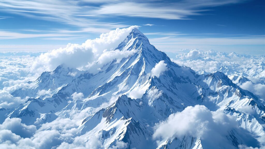
A State Defined by Vertical Scale
Utah’s size isn’t just horizontal. It’s vertical.
The lowest point in Utah sits at about 2,180 feet above sea level near the Beaver Dam Wash. The highest point, Kings Peak, rises to over 13,500 feet. That’s an elevation difference of more than 11,000 feet within a single state.
This vertical range creates dramatic visual scale. Mountains tower over valleys. Canyons plunge thousands of feet below flat plateaus. Even short drives can feel epic when elevation shifts so quickly.
Utah’s verticality also shapes its climate, ecosystems, and lifestyle. Ski resorts sit just miles from desert trails, and snow can fall in one part of the state while another bakes in summer heat.
The Five Geographic Regions of Utah
Utah’s size becomes even more impressive when you realize how many distinct landscapes it contains.
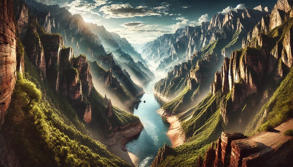
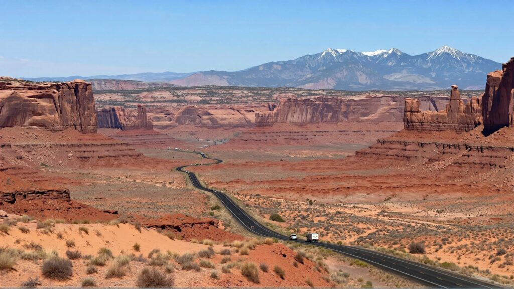
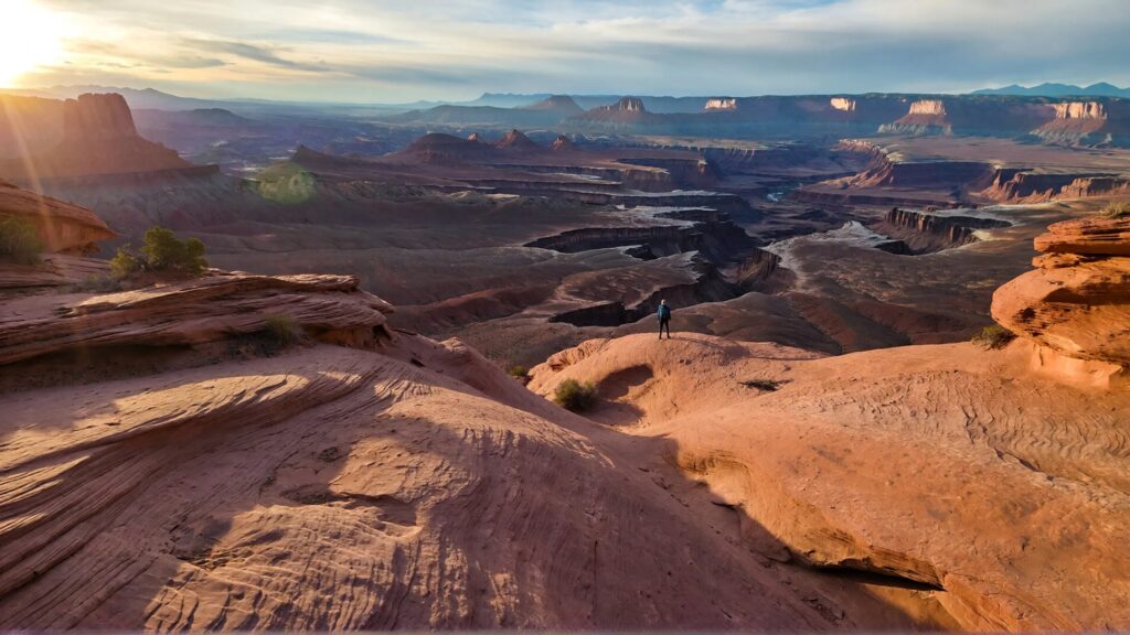
The Colorado Plateau dominates southern Utah, featuring iconic red rock formations, mesas, arches, and slot canyons. This region alone feels like a world unto itself, with landscapes that seem endless and otherworldly.
The Basin and Range region covers western Utah, where wide valleys stretch between parallel mountain ranges. This area feels especially vast, with long sightlines and minimal development.
The Middle Rocky Mountains rise in northern and eastern Utah, bringing dense forests, alpine lakes, and dramatic peaks.
The Uinta Mountains, unique for running east to west rather than north to south, add another layer of geographic complexity and scale.
Together, these regions make Utah feel less like one state and more like several worlds stitched together.
How Big Is Utah’s Desert?
Much of Utah’s perceived size comes from its deserts. Southern and western Utah are dominated by arid and semi-arid landscapes that stretch uninterrupted for miles.
These deserts aren’t empty wastelands—they’re textured, layered, and full of subtle detail. Sandstone cliffs, dry riverbeds, salt flats, and wide basins create a sense of openness that exaggerates distance and scale. When you can see the horizon clearly in every direction, even small movements feel monumental.
Driving through Utah’s deserts often feels like crossing entire countries rather than a single state. Towns are spaced far apart, and the silence between them reinforces just how big the land really is.
Utah’s National Parks and Protected Lands
One of the biggest reasons Utah feels so large is that so much of it remains protected.
Utah is home to five national parks, commonly known as the “Mighty Five,” along with dozens of national monuments, state parks, and wilderness areas. These protected lands cover millions of acres and preserve the state’s natural scale.
In many places, development simply stops. Roads narrow, cell service disappears, and landscapes stretch uninterrupted for hours. This preservation allows Utah’s size to remain visible and tangible, rather than being broken up by urban expansion.
Protected land also means that Utah’s size is experienced slowly—on foot, by trail, or through long scenic drives that reveal just how much space still exists.
How Big Is Utah’s Urban Footprint?
Despite its massive land area, Utah’s population is concentrated along a narrow corridor known as the Wasatch Front. This urban strip runs from Ogden through Salt Lake City and down to Provo, housing the majority of the state’s residents. Outside of this corridor, cities thin out quickly. Large portions of Utah have very low population density, with entire counties containing fewer people than a single city block in more urbanized states. This imbalance between land and population is a major contributor to Utah’s scale. You can leave a dense metro area and find yourself surrounded by open land in less than an hour.
Driving Across Utah: Distance in Real Time
One of the best ways to understand how big Utah is involves a steering wheel and a tank of gas.
Driving from the northern border near Idaho to the southern edge near Arizona can take six to seven hours without stops. East-to-west travel across the state can be equally time-consuming, especially when crossing mountainous terrain.
These aren’t dull highway miles either. Utah’s roads wind through canyons, climb mountain passes, and stretch across deserts that make time feel elastic. Long drives don’t feel repetitive; they feel expansive. For many travelers, it’s on the road that Utah’s size truly reveals itself.
Utah Compared to Countries
To put Utah’s size into a global perspective, it’s roughly comparable in area to countries like Austria, Hungary, or Portugal. This comparison helps explain why Utah can support such a wide range of climates, cultures, and ecosystems within its borders.
Thinking of Utah as a country rather than a state makes its diversity easier to grasp. Each region has its own identity, pace, and visual language, contributing to the sense that Utah is far bigger than expected.
How Utah’s Size Shapes Its Lifestyle
Utah’s size affects how people live in subtle but important ways. Outdoor recreation isn’t just a hobby—it’s woven into daily life. Access to space means hiking, skiing, camping, and exploring are often minutes away, not hours. Homes are designed with views in mind. Towns are spaced to allow breathing room. The scale also influences architecture and infrastructure. Roads are wide, buildings often sit lower against the landscape, and development tends to respect sightlines rather than dominate them. Living in Utah means living with space—and learning to measure distance differently.
Why Utah Feels Bigger Than It Is
Utah isn’t the largest state by area, but it often feels larger than states that technically surpass it. This perception comes from a combination of low population density, dramatic elevation changes, protected lands, and visual openness. There are few barriers to the eye. Mountains don’t crowd each other. Valleys open wide. Horizons stretch uninterrupted. In Utah, scale is experienced emotionally as much as physically. The land invites contemplation, movement, and exploration, making its size feel limitless.
Utah’s Size Through the Seasons
Utah changes dramatically with the seasons, altering how its size is experienced.
- In winter, snow blankets mountains and expands visual contrast, making distances feel sharper and more dramatic.
- In summer, heat and light flatten the desert into vast planes that seem endless.
- Spring and fall reveal transitions—green valleys framed by red rock, golden leaves against granite peaks.
Each season highlights a different dimension of Utah’s scale, ensuring the state never feels static.
How Big Is Utah, Really?
Utah is big in every way that matters. It’s wide, tall, varied, and open. It’s a place where distance still matters, where land remains visible, and where space shapes experience. You can measure Utah in square miles, driving hours, or elevation changes—but its true size is felt in the way it stretches the imagination. Utah reminds you that there is still room to roam, to explore, and to breathe. And once you’ve seen it, the question “How big is Utah?” stops being about numbers and starts being about perspective.