
Fairmont Banff Springs 3D Topographical Map
WhiteClouds created a 76-inch by 76-inch topographical map display of Banff National Park for the Adventure Centre at Fairmont Banff Springs in Canada.
- Customer
- Fairmont Banff Springs
- Location
- Adventure Centre, Canada
- Map Size
- 76 x 76 inches
- Display
- Custom pedestal base
WhiteClouds created a large topographical map display of Banff National Park for the Adventure Centre at Fairmont Banff Springs. The 76-inch by 76-inch map sits on a custom pedestal and combines raised terrain with trail and destination information in a format that can be viewed from several sides.
A broad relief view of the Banff landscape
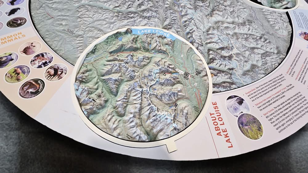
The map presents mountain ranges, valleys, waterways, roads, and labeled destinations across a nearly square footprint. Raised terrain provides the primary geographic structure, while color and printed information separate the main landforms and routes.
At 76 inches in both directions, the display provides room for a substantial geographic area without reducing every feature to a small graphic. The terrain can be viewed from overhead or from a standing visitor's perspective.
Mounted on a custom pedestal within the resort
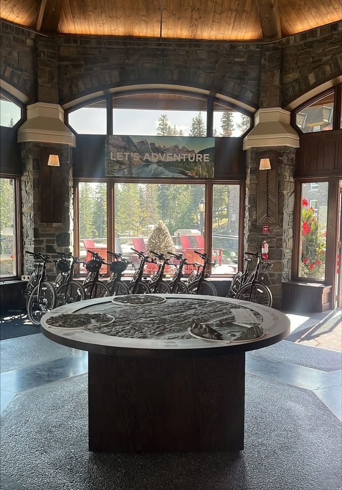
The map is installed on a dark custom pedestal in the Fairmont Banff Springs Adventure Centre. Its broad top and central support place the relief surface at a practical standing height and allow people to approach more than one side.
The surrounding interior shows the map in its intended resort setting, where the broad surface can be approached from several directions.
Terrain, routes, and destination labels in one display
A relief map for this setting must balance physical elevation with readable information. Terrain color, linework, and labels are integrated across the surface so geographic form and route information can be read together.
Raised contours, printed routes, and destination labels share the same surface, so the terrain and visitor information remain readable as one display.
Planning a resort or visitor map
A useful brief identifies the map boundary, elevation and imagery sources, finished footprint, vertical treatment, required routes and labels, viewing distance, base or wall configuration, access route, destination, and schedule. Physical samples or agreed color references can help define how the terrain and information should read together.
Planning a custom 3D map?
Share the geographic boundary, map size, elevation source, routes, labels, display base, viewing sides, destination, and schedule.