
Red Rocks Park Raised-Relief Map and Custom Table
CWH Graphics commissioned WhiteClouds to create a raised-relief topographical map and custom display table for the Red Rocks Park & Amphitheatre Visitor Center in Colorado.
- Commissioner
- CWH Graphics
- Location
- Red Rocks Visitor Center, Colorado
- Project Type
- Raised-relief topographical map
- Display
- Custom table
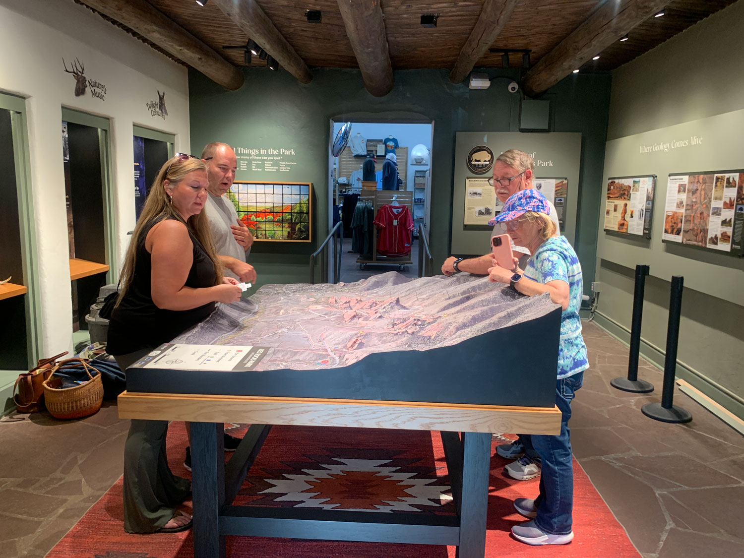
CWH Graphics commissioned WhiteClouds to fabricate a raised-relief topographical map and custom table for the Red Rocks Park & Amphitheatre Visitor Center in Colorado. The installed display presents the amphitheatre, surrounding rock formations, paths, roads, and terrain as one physical landscape that visitors can view from around the table.
Red Rocks represented as a physical landscape
The map uses elevation and surface color to distinguish the steep sandstone formations from the lower surrounding terrain. The amphitheatre seating and stage occupy the middle of the model, with roads, paths, vegetation, and built features providing context around them.
An overhead view makes the relationship between those features easier to read than a single ground-level image. The raised forms also provide visible shadows and edges that clarify changes in slope across the park.
A map and table planned as one visitor-center installation
WhiteClouds produced the custom table along with the map. The custom table has a broad wood top supported by dark legs, with the topographical model fitted into the center and an open perimeter where visitors can stand.
Treating the terrain and furniture as one display establishes the viewing height, map footprint, edge clearance, and overall presence together. It also gives the completed installation a defined place within the visitor-center interior.
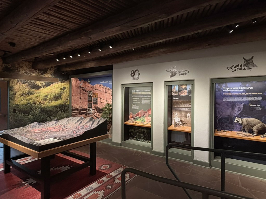
Installed at the Red Rocks Visitor Center
The completed table is installed in a public area of the visitor center. The broad perimeter allows several people to view the terrain from different sides at the same time.
This is a physical terrain display with an integrated table, built for close viewing inside the visitor center. The raised landscape itself provides the geographic information without relying on a screen-based presentation.
Planning a raised-relief map with custom furniture
A comparable brief should identify the geographic boundary, elevation source, scale, vertical treatment, labels, desired landmarks, viewing sides, finished map size, furniture dimensions, access route, destination, and installation responsibilities. Any lighting, protective cover, electronics, or hands-on use should be specified separately.
Planning a custom 3D map?
Share the geographic boundary, scale, elevation source, labels, map and furniture dimensions, viewing sides, destination, and schedule.