
Monarch Ski Resort 3D Topographical Map
WhiteClouds created a 78-by-78-inch physical topographical map for Monarch Ski Resort, now displayed at the Monarch at the Crest visitor center and gift shop.
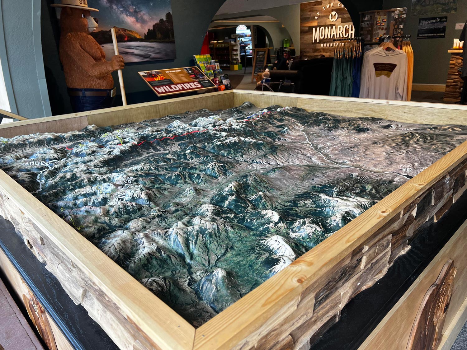
- Customer
- Monarch Ski Resort
- Display Location
- Monarch at the Crest visitor center and gift shop
- Approximate Size
- 78 x 78 inches
- Map Type
- Physical 3D topographical display
Monarch Ski Resort's physical map turns a broad area of Colorado mountain terrain into one viewable display. The 78-by-78-inch model is installed at Monarch at the Crest, where its raised landforms and marked routes can be examined from several sides. WhiteClouds created the three-dimensional Monarch Ski Resort map.
A large physical map for a mountain visitor center
The finished map represents the Monarch area as a raised physical landscape. At approximately 78 inches square, it provides enough surface area for major ridges, valleys, roads, and marked routes to remain visible within one composition.
The installation places the map in a framed, waist-high display at the Monarch at the Crest visitor center and gift shop. Visitors can circulate around the display and view the terrain from multiple angles.

Installed at Monarch at the Crest
The completed model occupies its public-facing location at Monarch at the Crest. The square format and raised display height make the full terrain visible while allowing closer inspection of individual landforms and marked corridors.
The project gives Monarch Ski Resort a physical representation of its surrounding landscape. It supports geographic interpretation without relying on a flat screen or requiring the terrain to be viewed from a single fixed angle.
Planning a custom 3D map?
Share the geographic area, intended display use, approximate footprint, required labels or branding, deadline, shipping destination, and available map data.