Terrain Models
We build custom 3D Terrain Models
Table of Contents
Tradition + Technology
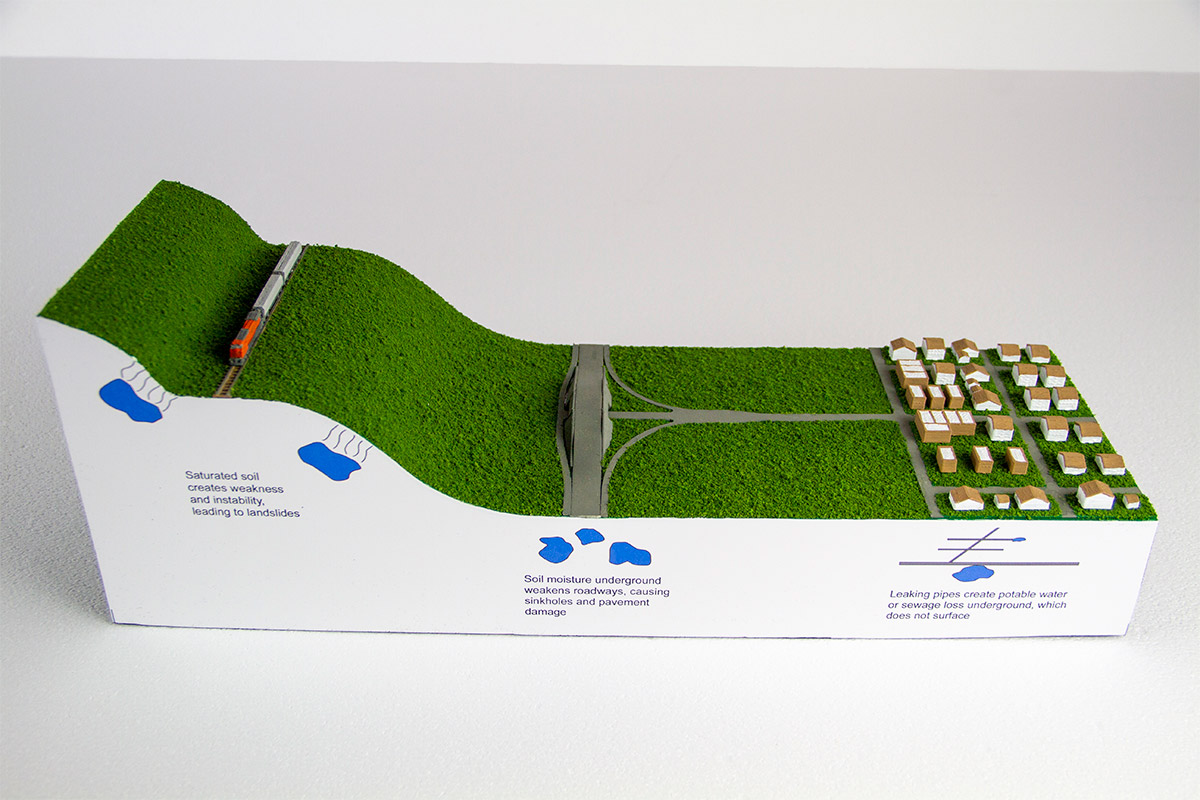
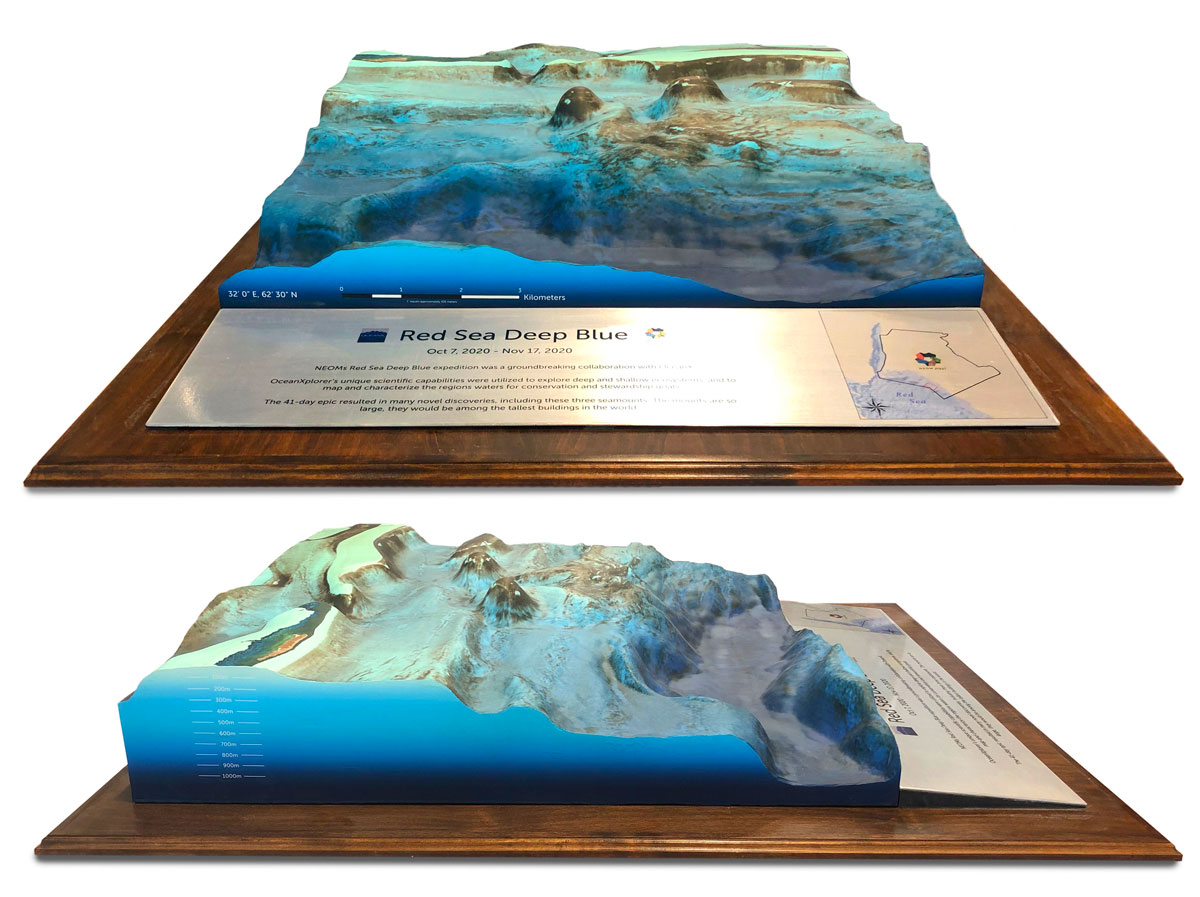
3D printing technologies are helping humans venture into new frontiers. 3D printers can accurately create realistic 3D views of planet surfaces, ocean floors, drone captured terrains and underground geology formations, and even the surface of the moon. Terrain models can benefit developers, mining companies, outdoor sports industries, and educational organizations.
Creating 3D raised maps used to be extremely laborious even with the best equipment. 3D printers can create models faster than ever before, make them more precise, and are lower-priced (considering man hours). 3D terrain models can be created using a wide variety of technologies to create as accurate as possible models. Models can be printed using thousands of colors and texturized elements, and traditional handwork for landscape can be added.
WhiteClouds is a full-service company and can also provide customized, handcrafted bases to hold your terrain models and offers 3D cutting services if requested. It is simple to submit design ideas and start a conversation with WhiteClouds. There are no limitations to what can be created or what technologies can be used to make the terrain models.
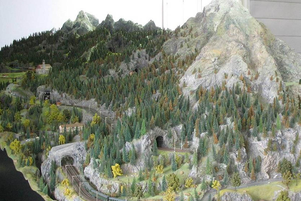
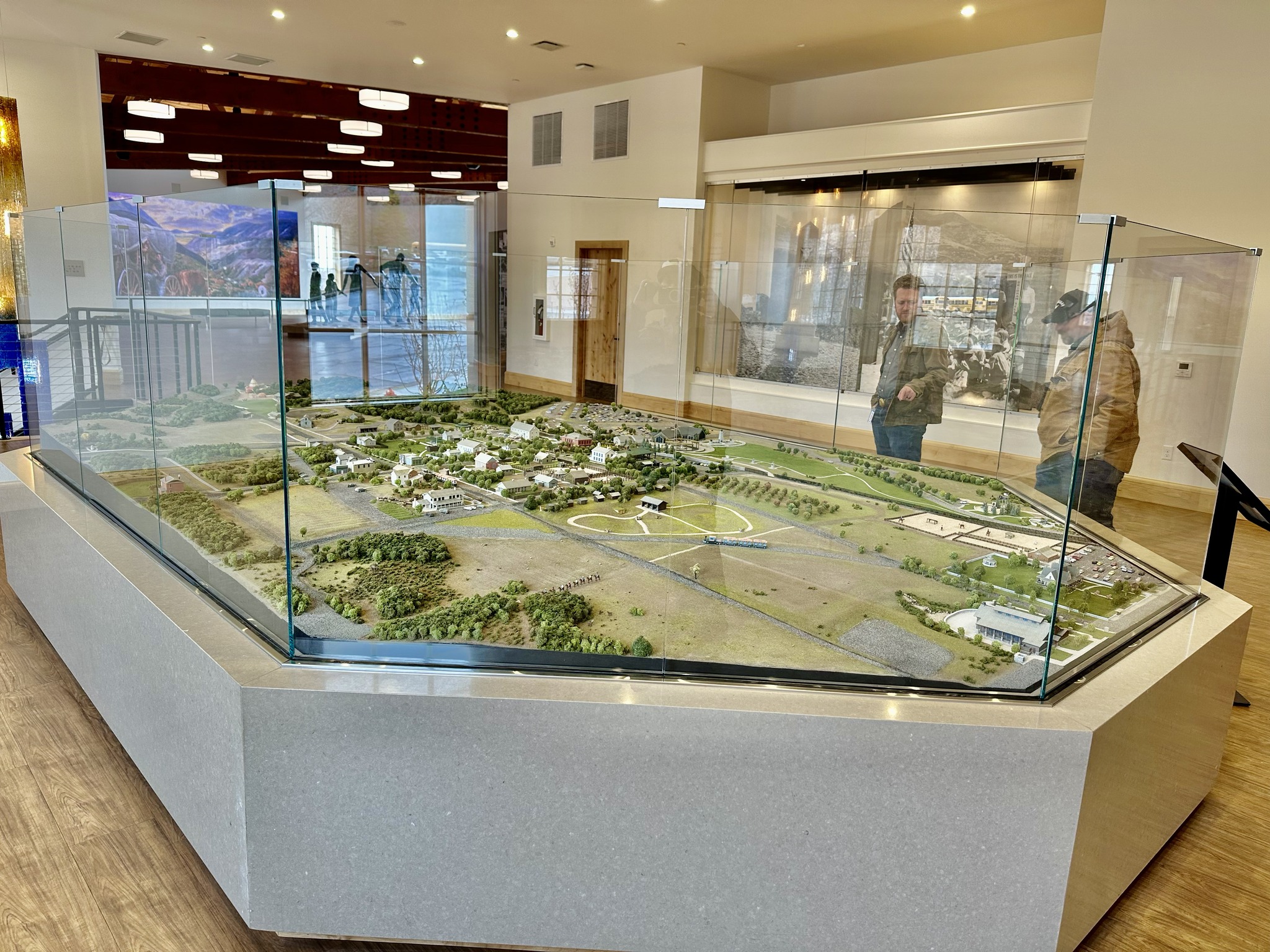
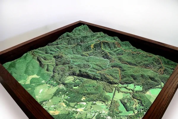
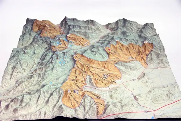
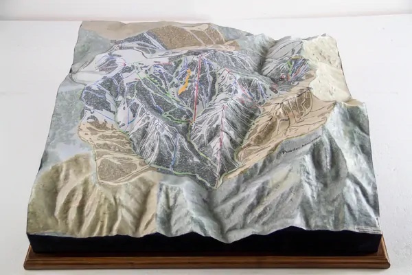
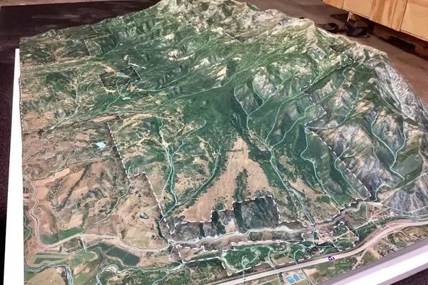
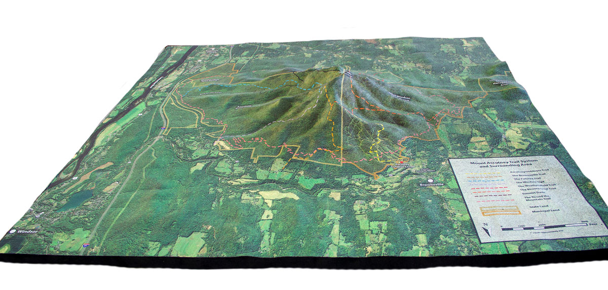
One of our most recent terrain projects was of the Great Smoky Mountains National Park and some surrounding area.
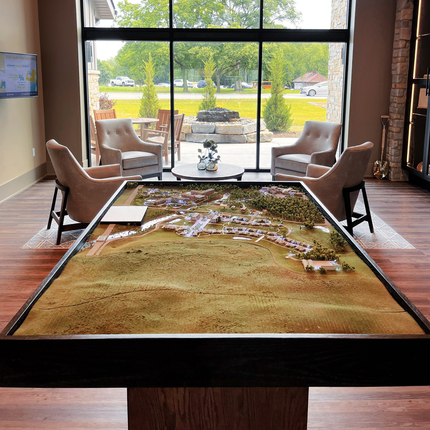
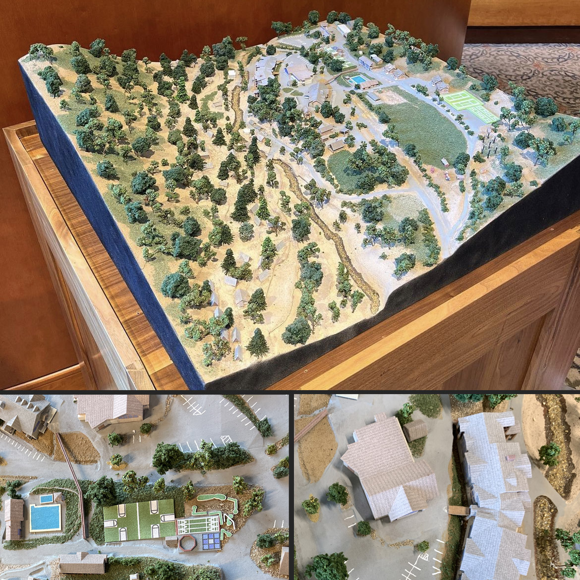
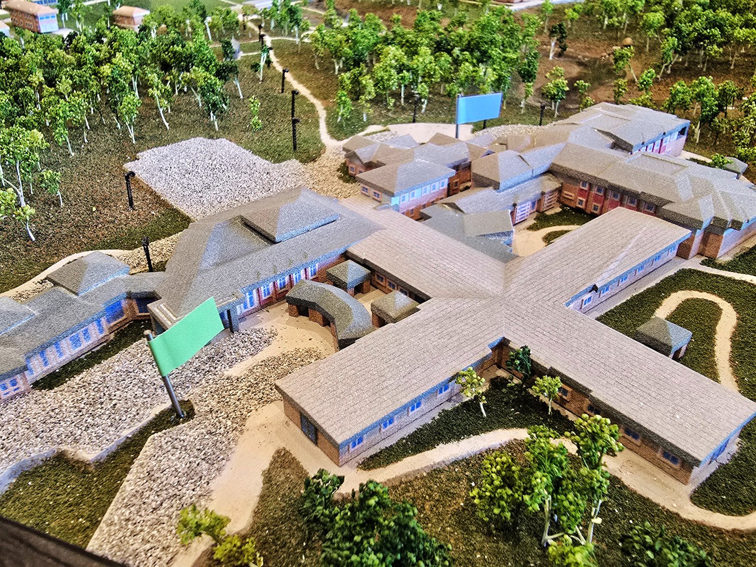
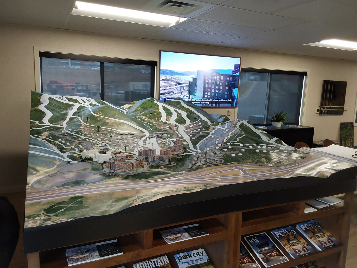
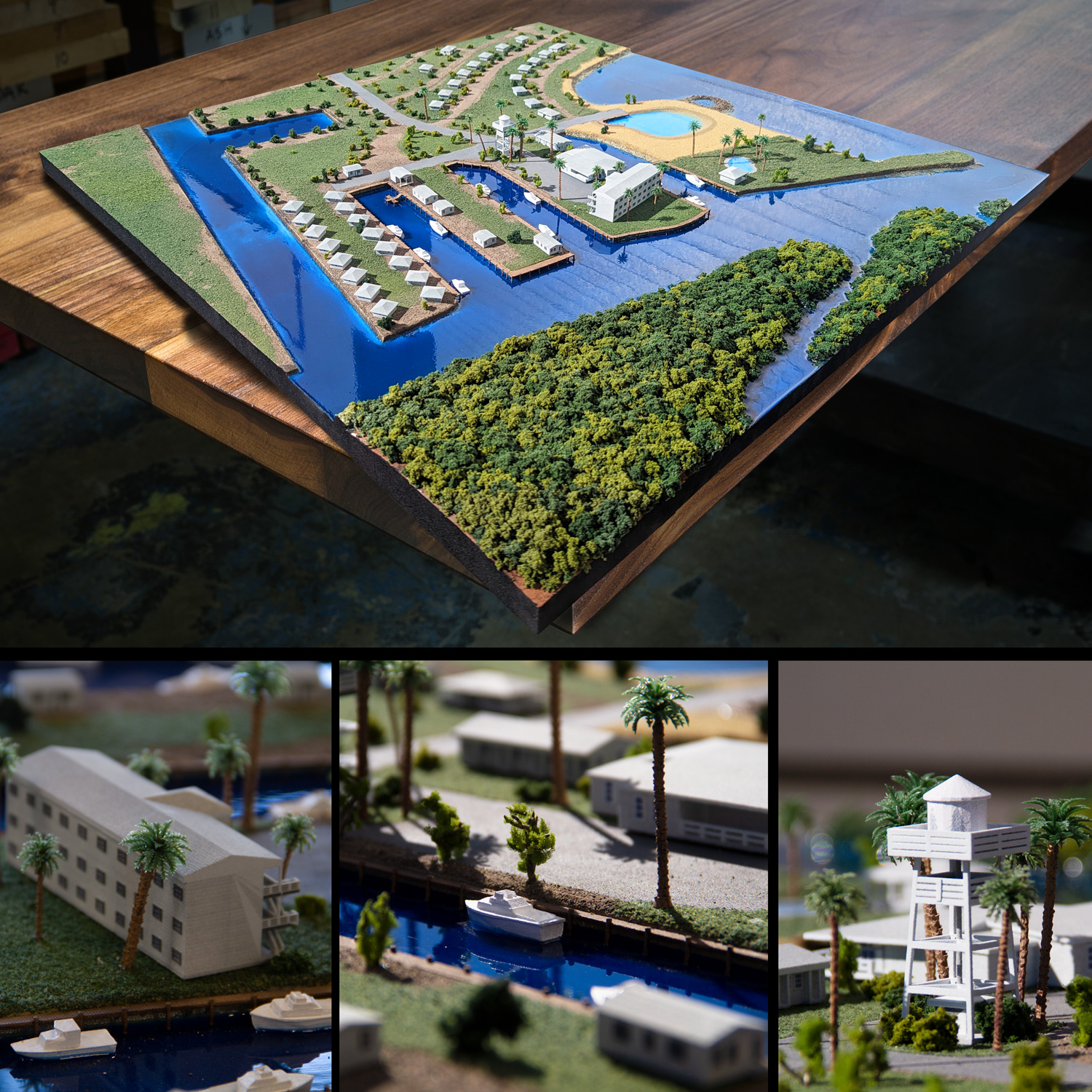
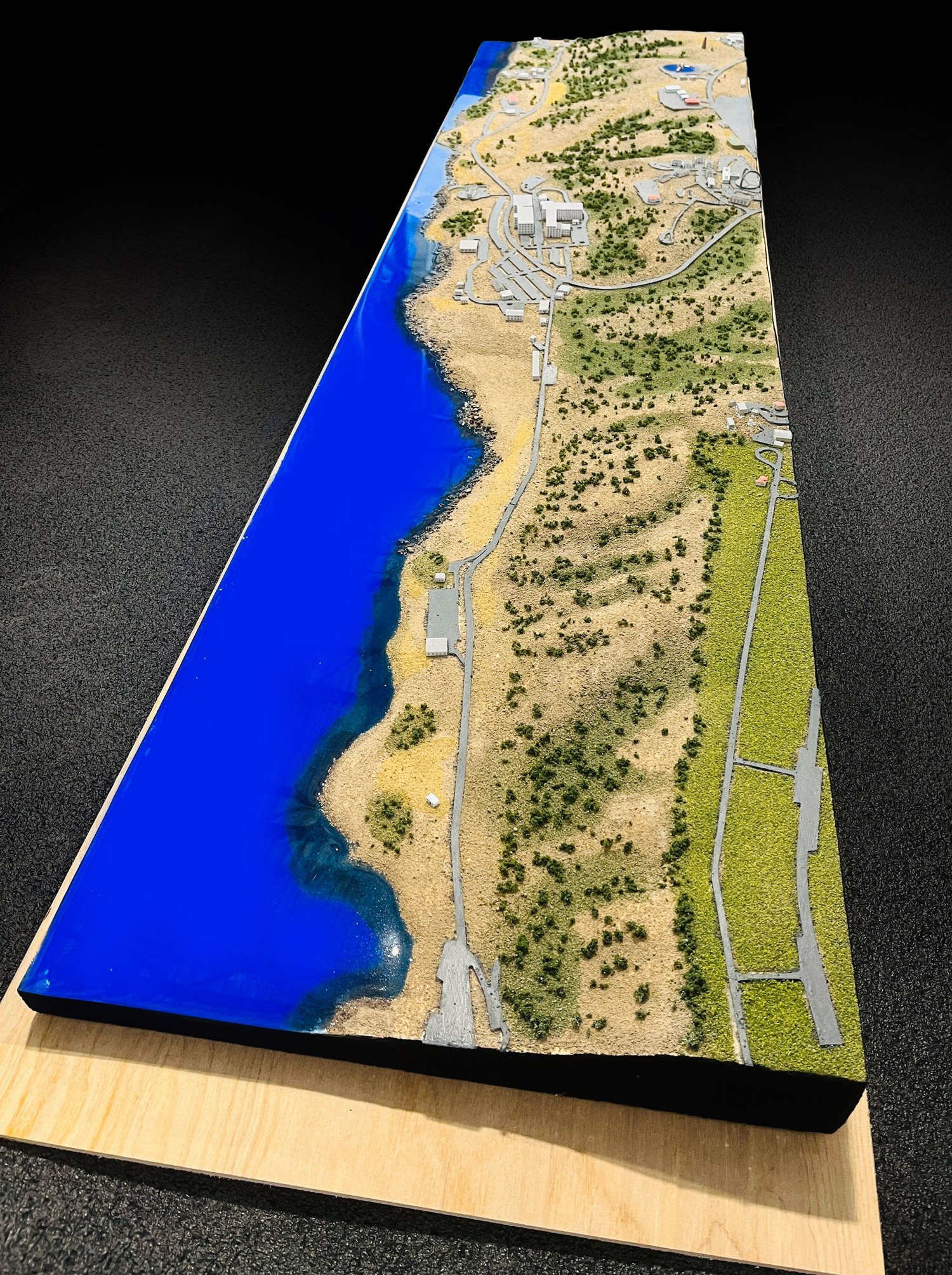
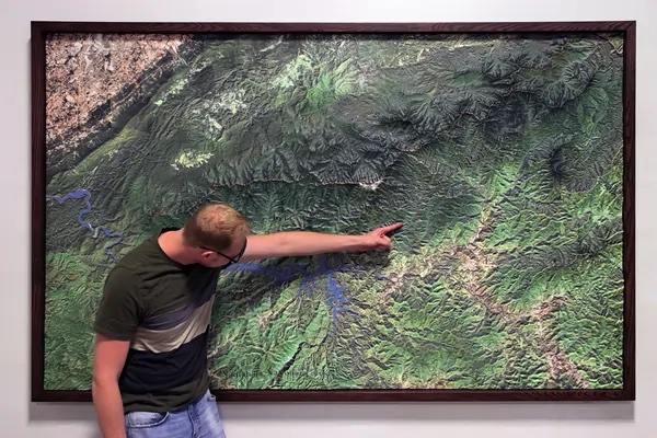
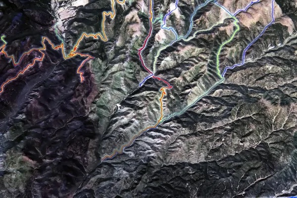
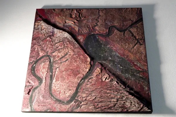
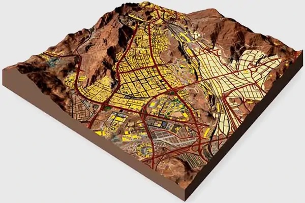
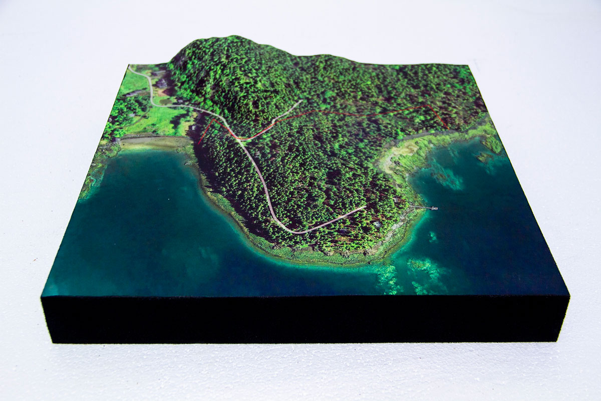
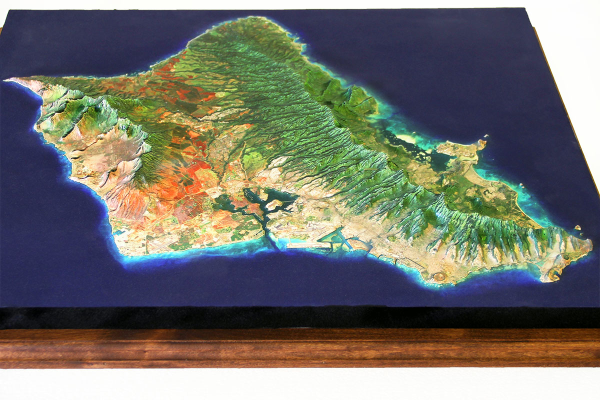
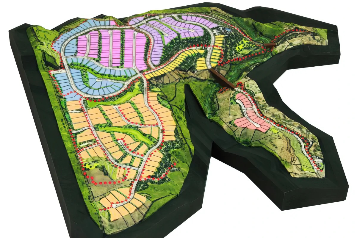
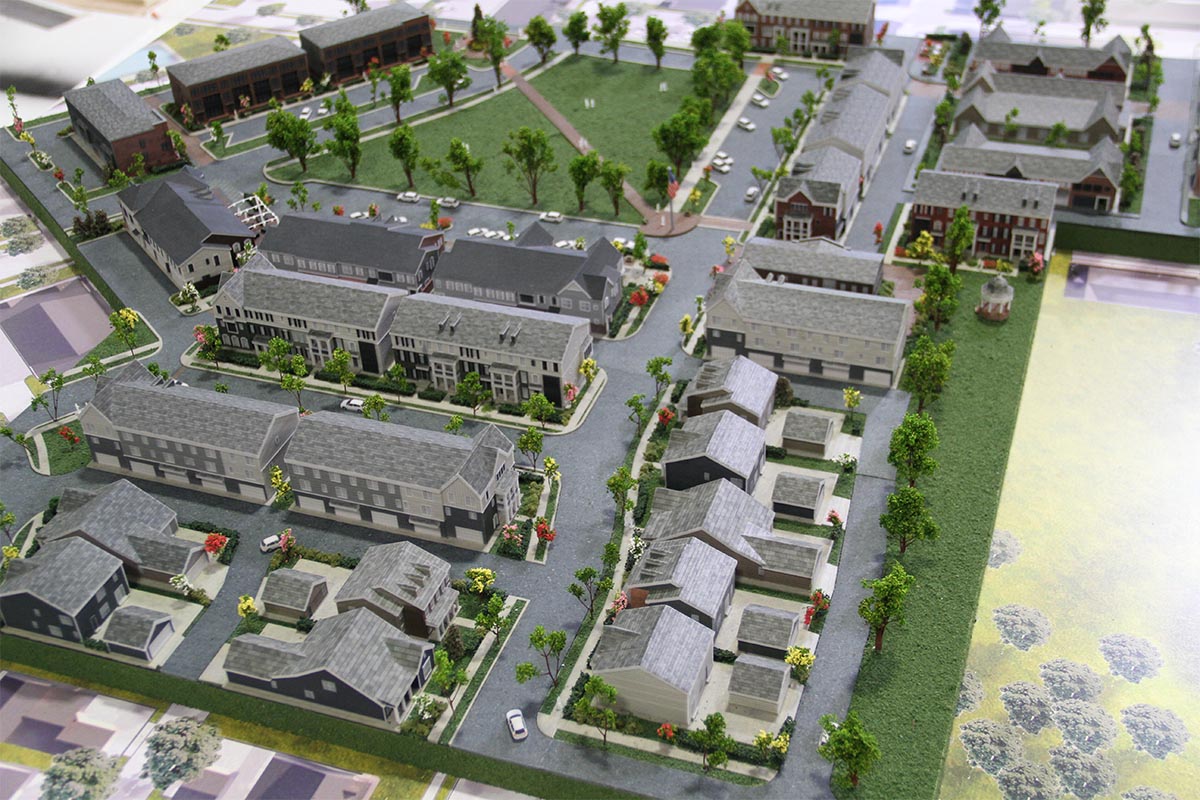
Gallery of Selected Terrain and Topography Projects
Features & Benefits
- Time saving. 3D print technologies can produce accurate terrain maps quicker than any previous technology used.
- Precision. Maps can be as exact as the information given to create the maps.
- To scale. They can be built to scale within any parameters needed.
- High tech. WhiteClouds utilizes all types of technologies including simple drawings, Google Earth, drone images, and LIDAR data to create terrain maps.
- Affordability. 3D printing is becoming reasonably priced, making it advantageous enough for many industries to use.
- Enthusiasm. 3D maps communicate across languages to excite interest in your project regardless of people’s background or language.
- Details. Prints can depict the tiniest of details as well as thousands of colors.
- Portability. Maps can be created using lighter materials than what was available in the past, making them easier to transport
3D Terrain Raised Relief Model Videos
Technology and Materials
- With 3D printing technology, you aren’t limited to straight lines and boxes. A 3D printer can easily print jagged edges, curved walls, and rounded rooflines.
- We can 3D print models in different materials including UV-cured resin. The type of model determines which material will produce the best results. We can help you choose the material that is best for your project.
- We use foam fabrication technologies such as CNC Cutting, Hot Wires, Laser Cutting, Hot Knifing, and Sculpting.
- 3D Printed Terrain models, architectural models, and topographical models show incredible detail. The resolution of our printers is finer than a human hair.
- Terrain models can be 3D printed in full-color (over 750,000 variations of color) for awe-inspiring presentations and displays. No painting required!
- Our in-house spray booth gives us flexibility in different types and grades of paint and finishing capabilities.
Pricing
The cost of terrain 3D models is based on the volume of material (size of the model), the time it takes to create the 3D printable file or CNC file, and other elements of the model. Each model is bid individually and the best way to determine cost is to email us, call us at 385-206-8700, or fill out the form below and let us bid on your project.
Get a Free Price Estimate for Custom Terrain Models
Workflow

Common Questions & Answers
-
What file type is required to 3D print a model?
We work with all architectural CAD programs including AutoCAD, Revit, Chief Architect, ArchiCAD, and Sketchup, just to name a few. If you desing in 3D, we will start with your 3D files. If you have 2D blueprints and elevations, artist’s sketches (or even napkin drawings), we can build a model from these as well. -
Do the printers print in color?
Yes. Most of our terrain models are printed in a material that prints in full color (up to 750,000 different colors). Anything printed in UV-cured resin materials are a single color but can be painted. -
What is the material used?
We match the correct material and fabrication process to your requirements in terms of presentation, size, and transportability. We fabricate in our model shop using different types of foam, wood, metal, resins, and acrylics. We can also 3D print in uv-cured resin, plastic, rubber-like acrylic, and nylon. -
What is the largest model you can 3D print?
There is no limit to the size for a terrain model. If we are using 3D printing technologies for building the terrain, our 3D print envelope on our larger printers is 9″ x 15″ x 20″. This is the largest model we can print in a single piece. We can 3D print larger models in multiple pieces. We have built many terrain models that are finished anywhere from 2’x2′ to 10’x14′ (including base). If we are using a foam type structure, it is very easy to build out very large models. -
What is the turnaround time for a 3D-printed terrain model?
We usually ask for four to six weeks from the time we take the order to when you will receive the model. We understand that sometimes deadlines are tight and we can accommodate rush orders in as little as one week. -
Can you 3D print homes, buildings, swimming pools, arbors, hardscaping features, etc.?
Yes. We 3D print many of these items in our terrain models.
Do you have a question we didn’t answer? Don’t hesitate to contact us at 1-385-206-8700 or [email protected].
Worldwide Delivery
WhiteClouds has delivered models around the world.
History of Terrain Models
Terrain maps have been used since the simplest of flat maps existed. Raised terrain maps show landscape details that can be understood without the use of language or modern mathematics. Some historians speculate that simple terrain maps existed since the 15th century. Other may argue they existed before spoken language to show through simple soil drawing the location of food sources or the path of herd migrations.
In recorded history, some of the most notable terrain maps include Emperor Maximillian the First’s commissioned terrain models of the eastern Alps during the 1500s. During this time, terrain maps were mostly used for military operations or siege plans. More modern terrain maps emerged from Switzerland in the 19th century using more reliable map contour lines.
Long before 3D printers, countries such as Germany, Italy, France, and the USA used a pantograph to guild a milling cutter to create raised maps and terrain models. This method was refined during World War II. Again, mostly used for military operations. Nowadays, 3D maps are used for more than just military uses. They can be used to depict a variety of terrains including the surface of other planets, ocean floors, prospective mining locations, watershed flows, and new development areas.