What is a Bathymetric Map
We Build Custom 2D and 3D Bathymetric Maps
Did you know we make
3D raised-relief maps

and
3D raised-relief maps

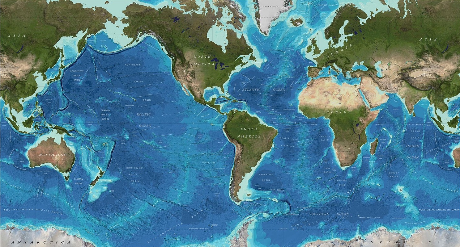
Bathymetry is the study of underwater depth and topography. A bathymetric map is a type of map that shows the underwater topography, just like a topographic map shows the terrain on land. Bathymetric maps are crucial in oceanography, marine biology, and other fields that require an understanding of the seafloor’s topography.
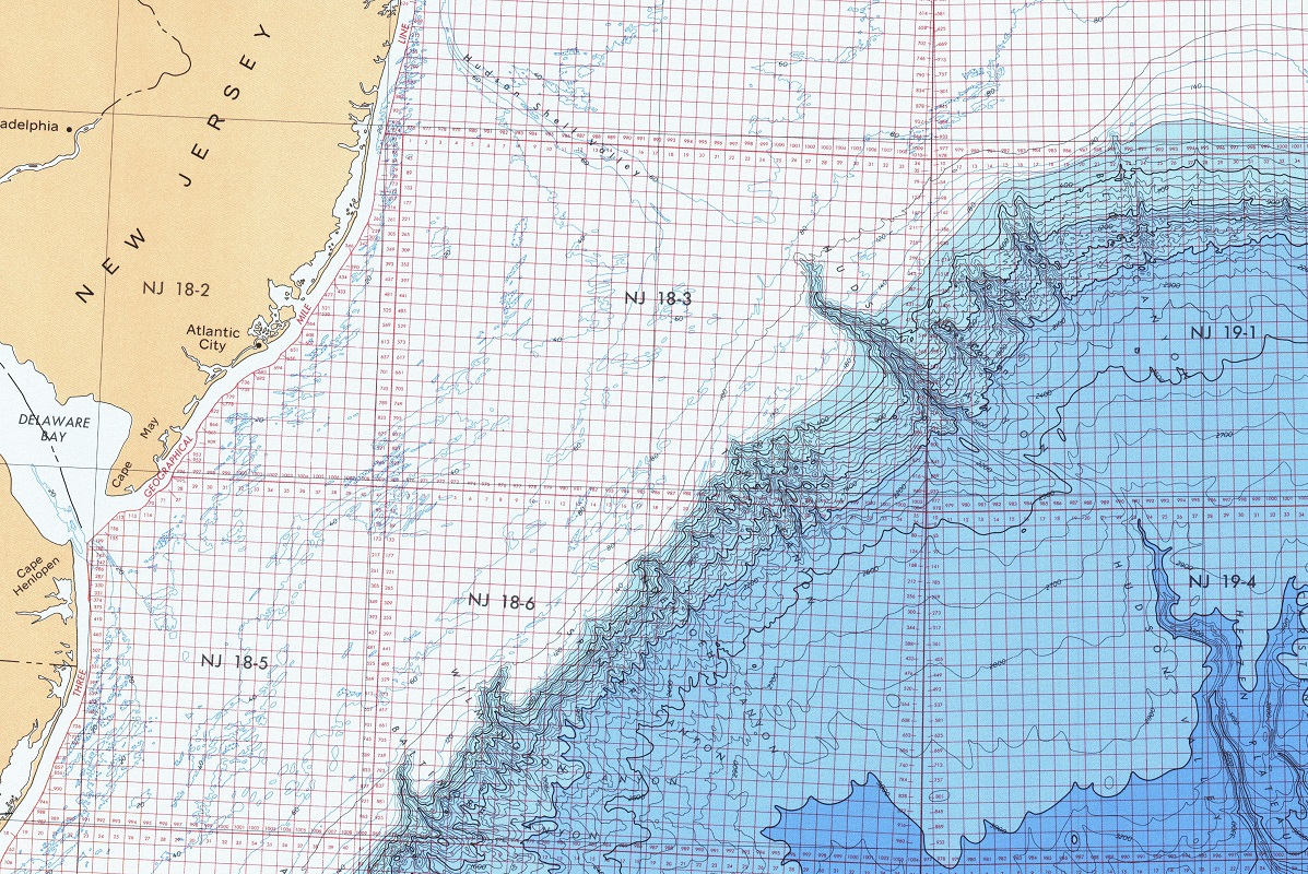
Bathymetric maps are created using a process called bathymetry, which involves measuring the depth of the seafloor. This can be done using several different methods, including acoustic sounding, satellite altimetry, and sonar mapping. Acoustic sounding is the most commonly used method, where a ship sends out a sound wave that bounces off the seafloor and returns to the ship, allowing scientists to measure the distance to the seafloor. Satellite altimetry uses radar to measure the height of the sea surface, which can then be used to calculate the depth of the seafloor. Sonar mapping, on the other hand, uses sound waves to create a detailed picture of the seafloor.
Once the data has been collected, it is used to create a bathymetric map. Bathymetric maps are often color-coded to show different depths, with darker colors indicating deeper water and lighter colors indicating shallower water. Bathymetric maps can also include other features, such as underwater canyons, ridges, and seamounts.
Bathymetric maps have many practical uses. For example, they are used by the shipping industry to help navigate ships safely through underwater hazards such as reefs and shoals. They are also used by oil and gas companies to locate underwater oil and gas reserves. Bathymetric maps are also important for understanding the geology of the seafloor and the processes that shape it, such as plate tectonics and erosion.
But bathymetric maps are not just useful for practical purposes. They are also fascinating and beautiful in their own right. Bathymetric maps can reveal the hidden beauty of the seafloor, with its underwater mountains, canyons, and valleys. They can also reveal the patterns of ocean currents and the ways in which the seafloor affects marine life.
One example of a stunning bathymetric map is the Seafloor Topography map produced by the National Oceanic and Atmospheric Administration (NOAA). This map shows the topography of the seafloor around the world, with colors indicating different depths. The map is both beautiful and informative, providing a wealth of information about the seafloor and the processes that shape it.
To learn more in-depth about 2D and 3D bathymetric maps, view Bathymetric Maps.
In conclusion, a bathymetric map is a type of map that shows the topography of the seafloor. Bathymetric maps are created using a variety of methods, including acoustic sounding, satellite altimetry, and sonar mapping. They are important for practical purposes such as navigation and resource exploration, as well as for scientific study of the seafloor. But they are also fascinating and beautiful in their own right, revealing the hidden beauty of the seafloor and providing a window into the processes that shape our planet.
Contact us today to learn more about our services and how we can help you achieve your goals.