
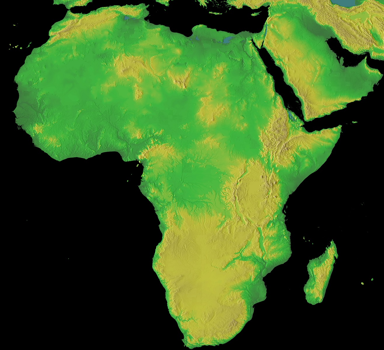
Africa Unearthed: Deciphering the Topographical Map
Africa, often hailed as the birthplace of humanity, is a continent of extreme contrasts — from the sprawling Saharan dunes to the dense rainforests of the Congo basin. A topographical map of Africa serves as a lens, revealing intricate details of this vast land’s elevation, valleys, plateaus, and water systems. Join us as we embark on an enlightening trek through the landscapes that have shaped cultures, histories, and ecosystems.
A Primer on Topographical Maps
Topographical maps are not just your everyday maps. They dive deeper, illustrating the physical features of a region using contour lines, symbols, and gradients. These lines represent altitude, guiding readers through a three-dimensional understanding of terrains.
Africa’s Peaks: Mountains that Touch the Sky
Africa’s topography is punctuated by remarkable mountain ranges, each with its unique tale.
The Atlas Mountains: Stretching across Morocco, Algeria, and Tunisia, they form a natural barrier between the Mediterranean and the Saharan desert.
Mount Kilimanjaro: Located in Tanzania, this dormant volcano stands as Africa’s tallest peak. Its snow-capped summit provides a stark contrast to the savannahs below.
The Drakensberg Range: Spanning Lesotho and South Africa, these mountains are a hotspot for biodiversity and ancient rock art.
Expanses of Sand and Grass: Deserts and Savannas
Africa’s vastness encapsulates both arid expanses and rolling grasslands:
The Sahara: The world’s largest hot desert, it spans a whopping 9 million square kilometers across North Africa. Its dunes, some as tall as the Eiffel Tower, are a testament to nature’s artistry.
The Savannas: These grasslands, especially the Serengeti, are emblematic of Africa. They play host to the iconic “Great Migration”, one of the most spectacular wildlife events.
The Cradle of Life: River Valleys and Lakes
Africa’s water systems have nurtured civilizations and ecosystems:
The Nile: As the world’s longest river, the Nile has sustained societies for millennia, with Egypt and its pyramids standing as testimony.
The Congo Basin: Drained by the Congo River, this basin houses the world’s second-largest rainforest, a lifeline for countless species.
Lake Victoria: Situated in East Africa, it’s the continent’s largest lake, serving as a crucial resource for millions.
Abyssal Wonders: Africa’s Rift Valleys
The East African Rift is a tectonic marvel. This active divergent boundary is slowly splitting the eastern part of the continent away. The resultant landscapes, like the vast depressions housing lakes Tanganyika and Malawi, are geological wonders.
Islands and Coastal Gems
Beyond the mainland, Africa’s islands, from Madagascar to the Seychelles, are ecological treasures. Their diverse topographies, from rainforests to coral reefs, host unique species and cultures.
Interpreting History through Topography
Africa’s diverse terrains have directly influenced its history:
The Sahel: This transitional zone between the Sahara and savannas has been a crossroads for trade and cultural exchange.
The Great Rift Valley: Apart from its geological significance, it’s an anthropological goldmine, with sites like Olduvai Gorge revealing secrets of early human evolution.
A topographical map of Africa isn’t just an academic tool; it’s a tapestry of tales that have shaped our planet and species. Each contour narrates stories of ancient migrations, vibrant ecosystems, and the indomitable spirit of a continent.
As you trace these lines, valleys, and peaks, remember you’re navigating through the heartbeats of Mother Earth’s oldest land. Africa, in its topographical grandeur, beckons every soul to discover, respect, and cherish its myriad geographies and the life they sustain.
Contact us today to learn more about our 3D services and how we can help you achieve your goals.