
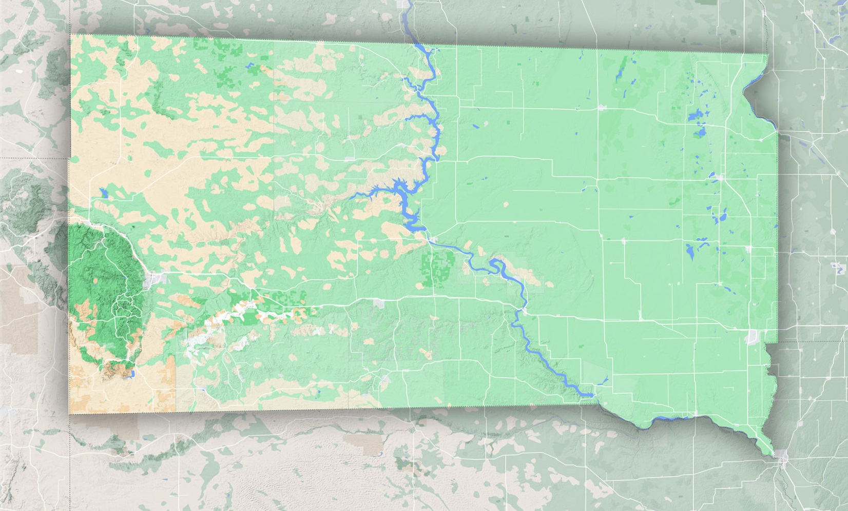
South Dakota’s Diverse Terrain
Topographic maps of South Dakota unveil a fascinating spectrum of landscapes:
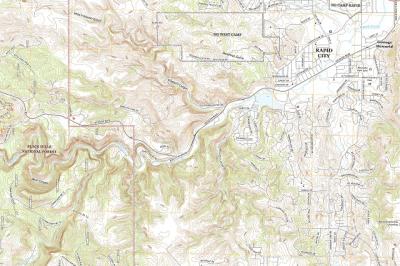
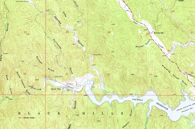
- The Black Hills: Located in the southwestern part of the state, this small mountain range is dense with pine forests and boasts the iconic Mount Rushmore. The highest peak, Black Elk Peak (previously known as Harney Peak), rises to an elevation of 7,244 feet, making it the tallest in the U.S. east of the Rocky Mountains.
- Badlands: East of the Black Hills, the Badlands are a stark contrast with their eroded buttes, pinnacles, and spires. This surreal, almost alien landscape is an outcome of millions of years of erosion, rich in fossils and history.
- Missouri River: Bisecting the state from north to south, this river and its surrounding plains play a significant role in South Dakota’s topography and history.
The Importance of Topographic Maps in South Dakota
- Hiking and Adventure: South Dakota’s landscapes are varied, making them perfect for numerous outdoor activities. Trails in the Black Hills, like the Black Elk Peak trail or the Mickelson Trail, and treks in the Badlands offer different levels of challenges for enthusiasts. With a topographic map, adventurers can gauge elevation changes, locate water sources, and plan their routes efficiently.
- Archaeological and Paleontological Research: South Dakota’s Badlands are a treasure trove of ancient fossils. Paleontologists and archaeologists rely on detailed topographic maps to identify potential excavation sites and study geological layers.
- Land Development and Conservation: For urban planners, builders, and conservationists, topographic maps are essential. They provide insights into the best areas for construction, drainage patterns, and land conservation efforts.
- Historical Exploration: South Dakota’s rich Native American and colonial history can be traced and understood better using old topographic maps. They give a glimpse of how the land was used and occupied over time.
Decoding a Topographic Map of South Dakota
If you’re new to topographic maps, they might seem overwhelming. However, with a bit of guidance, they become a gateway to understanding the landscape:
- Contour Lines: These are the heart of topographic maps, representing elevation. Lines close together indicate steep terrains like cliffs, while spaced-out lines represent gentler slopes.
- Colors: Typically, blue indicates water bodies, green represents forests or dense vegetation, brown or black represents contour lines and man-made structures, and white shows open or barren land.
- Symbols: Maps use various symbols to denote features. For instance, a tent symbol might indicate a campsite, while a dashed line could represent a hiking trail.
Exploring South Dakota with Topographic Maps
With a good topographic map, South Dakota’s wonders are at your fingertips:
- Embark on a Journey in the Black Hills: Locate hidden trails, identify scenic viewpoints, and find serene lakes nestled within the hills.
- Traverse the Badlands: Navigate this dramatic landscape, pinpointing its unique geological formations and understanding the lay of the land.
- Follow the Missouri River: The river has been a historical pathway and source of sustenance. Trace its winding journey and discover towns and landmarks along its course.
- Historic Sites: From Mount Rushmore to the Crazy Horse Memorial, use topographic maps to understand their locations in relation to the larger landscape.
South Dakota’s landscapes tell tales of ancient oceans, indigenous tribes, intrepid explorers, and monumental events. Through topographic maps, these tales come alive, offering a detailed, bird’s-eye view of the state’s topographical wonders.
Whether you’re plotting a hiking adventure in the Black Hills, undertaking a research expedition in the Badlands, or simply immersing yourself in the state’s rich history, a topographic map is an indispensable tool. As you unfold these maps, you’re not just looking at lines and symbols; you’re stepping into a vivid narrative of South Dakota’s past, present, and future.
Check out WhiteClouds’ 3D Maps for more information on topographic maps of South Dakota. Also available:
2D Canvas Prints of South Dakota Maps
- 2D South Dakota State Maps
- 2D South Dakota USGS Topographic Maps
- 2D South Dakota Historical USGS Topographic Maps
- 2D South Dakota USGS Satellite Maps
- 2D South Dakota USGS Terrain Maps
3D Raised Relief South Dakota Maps
- 3D Raised Relief-South Dakota USGS Topographic Maps
- 3D Raised Relief-South Dakota Historical USGS Topographic Maps
- 3D Raised Relief-South Dakota Satellite Maps
- 3D Raised Relief-South Dakota Terrain Maps
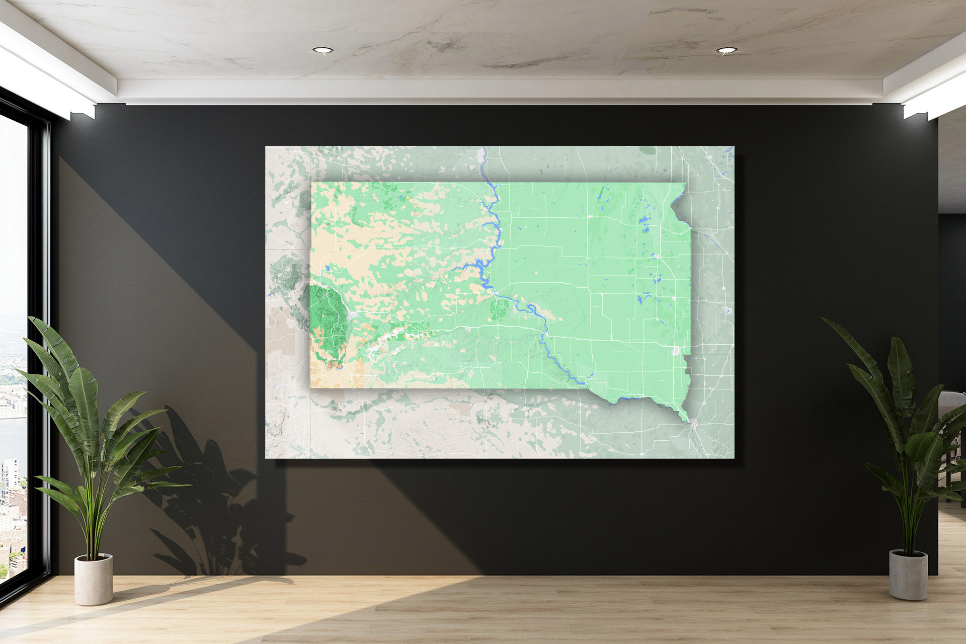

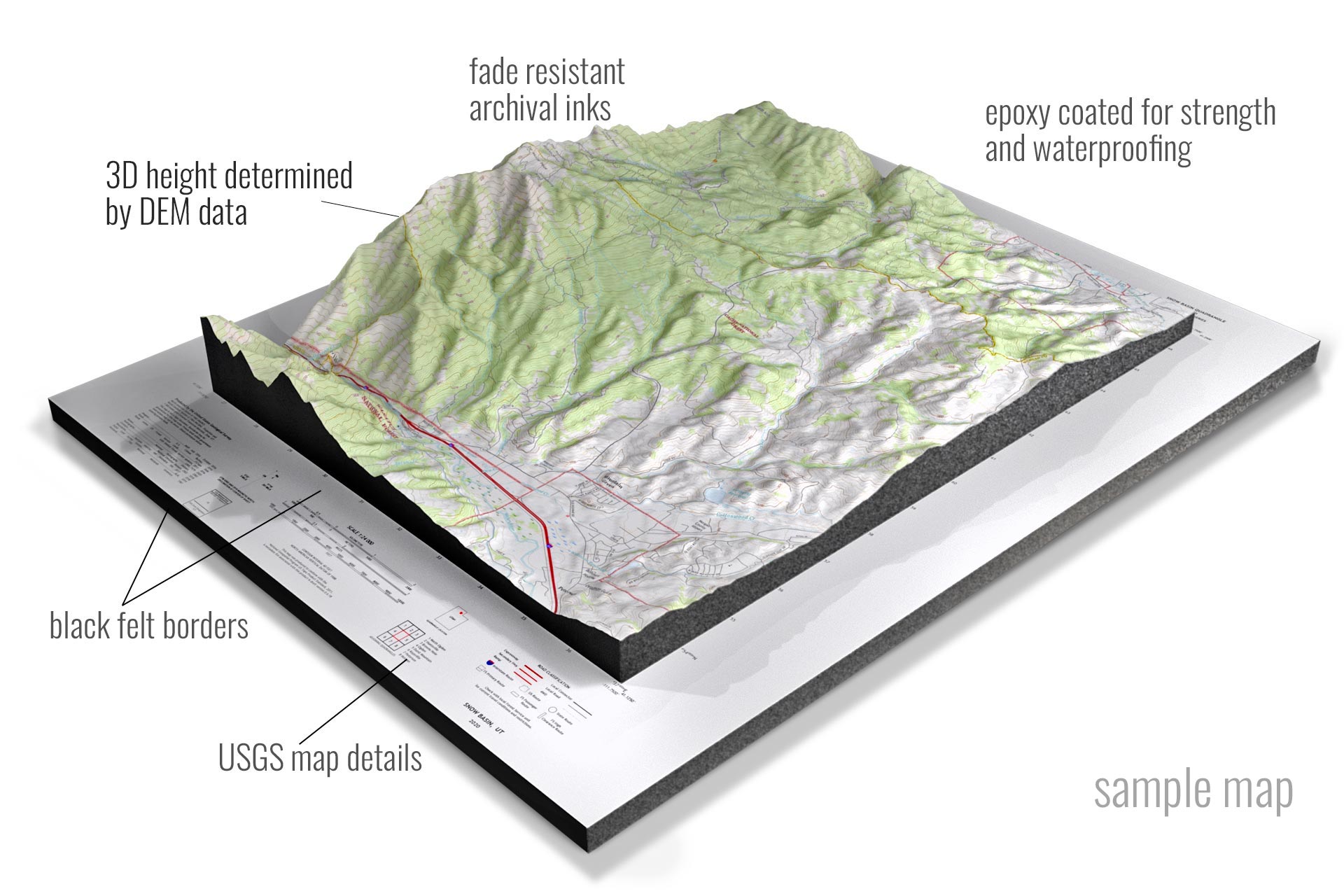 Sample 3D Topographic Map
Contact us today to learn more about our 3D services and how we can help you achieve your goals.