
Unveiling the Satellite Map of Minnesota: A Deep Dive
Minnesota, popularly known as the “Land of 10,000 Lakes,” boasts not only of its water bodies but also its vast landscapes of forests, farmlands, and urban areas. While most of us are familiar with its borders and maybe some famous landmarks, there’s an entire world of discovery to be made from up above. Thanks to advancements in satellite imaging technology, we can now embark on a virtual tour from space. Dive in with us to explore Minnesota as you’ve never seen it before.
Satellite Maps: A Quick Introduction
Before we plunge into our visual tour of Minnesota, let’s demystify what satellite mapping is. Satellite maps are images of Earth or other planets captured by imaging satellites operated by governments and businesses around the world. Unlike traditional maps which are based on abstract representations, satellite maps show actual photographs of locations from space.
Google Earth, NASA’s World Wind, and Bing Maps are some of the widely used platforms to view these high-resolution images. And now, as we focus on Minnesota, you’ll understand why such views are truly exhilarating.
Minnesota from Above: A Tapestry of Land and Water
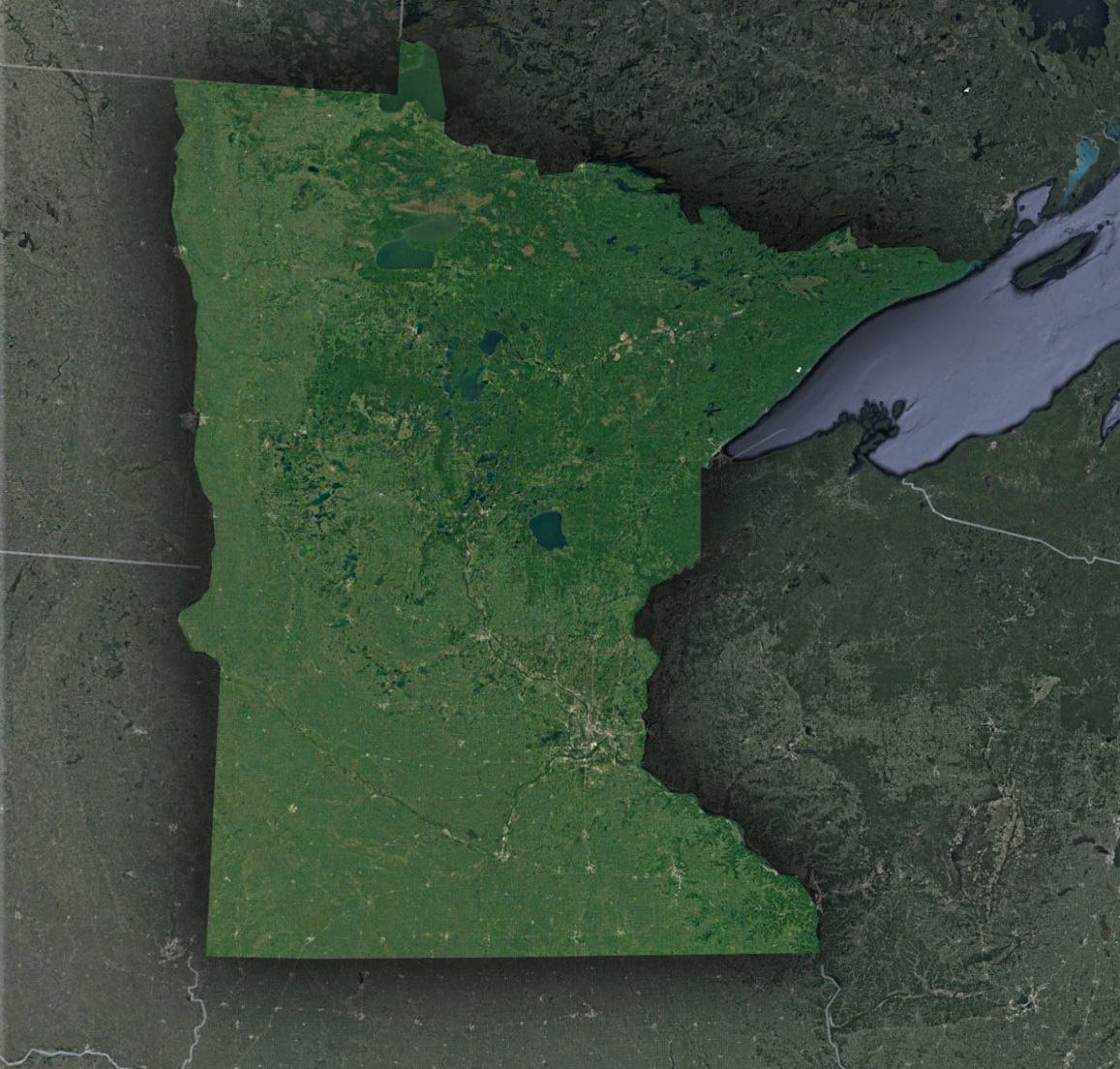
The Shimmering Lakes: Minnesota’s moniker isn’t an exaggeration. From the sky, the state appears as a dazzling mosaic of blue against the green of its landscapes. The largest, Lake Superior, acts as a gleaming northern boundary. The clarity of satellite images allows you to see even small water bodies, such as the mesmerizing Lake Itasca – the source of the Mississippi River.
The Twin Cities – Minneapolis and Saint Paul: Further south, the urban sprawl comes into view. The Twin Cities, differentiated by the snaking Mississippi River, is a blend of green spaces and city grids. From above, Minneapolis showcases its skyscrapers and grid-pattern streets, while St. Paul displays a more historic feel with curvier roadways.
Vast Forests and The Boundary Waters: To the north, you’ll find a sprawling green expanse: the Superior National Forest and the Boundary Waters Canoe Area Wilderness. This region is a jumble of water bodies and forestland, providing a pristine playground for outdoor enthusiasts. Satellites capture the untouched beauty of this vast wilderness, making it a sight to behold.
Minnesota’s Agriculture Prowess: Further west and south, the green gives way to a patchwork quilt of farmlands. Minnesota is a significant player in America’s agriculture scene, especially for corn and soybeans. Through satellite imagery, you can view the precision of agricultural plots and marvel at the state’s contribution to the nation’s food supply.
The Rocky Outcrops and Prairies: The southwest corner, particularly around the Pipestone region, showcases the state’s geological diversity. These reddish quarries have been a source of pipestone, a sacred stone for Native Americans. Adjoining these are the remnants of Minnesota’s tallgrass prairie, a sea of undulating grasses and wildflowers that once covered the entire Midwest.
The Power of Technology: How Satellite Imagery Benefits Minnesota
Beyond the visual spectacle, satellite maps have tangible benefits for the state of Minnesota:
Environmental Monitoring: Conservationists utilize these images to track changes in forests, lakes, and wildlife habitats. Any significant deviations can be an alert for potential ecological issues.
Urban Planning: City developers employ satellite imagery to plan infrastructure developments, monitor urban sprawl, and ensure sustainable growth.
Agriculture: Farmers harness these images for precision agriculture, assessing the health of their crops and optimizing irrigation, leading to better yields.
Disaster Response: In case of natural calamities like floods or forest fires, satellite maps are invaluable for rescue and relief operations, providing real-time data on affected areas.
The Future of Satellite Imaging in Minnesota
Minnesota is poised to benefit further from the advancements in satellite technology. Plans for more detailed and frequent imaging, combined with machine learning, can lead to insights ranging from early detection of drought to predicting urban growth patterns.
Moreover, as satellite technology becomes more accessible, local businesses, educational institutes, and even hobbyists are finding innovative applications. For instance, tracking seasonal changes in tourist hotspots or studying the movement of invasive species in lakes.
The satellite map of Minnesota is not just a visual treat; it’s a confirmation to the state’s incredible geographical diversity and the power of technology. It provides a perspective that challenges our grounded views and compels us to appreciate the intricate tapestry of land, water, and human influence that shapes the state.
So, the next time you gaze at the sky, remember there’s a satellite up there, capturing the breathtaking beauty of Minnesota, making it accessible for you to explore, study, and admire.
Check out WhiteClouds’ 3D Maps for more information on satellite maps of Minnesota. 2D Canvas Print Satellite Maps of Minnesota are also available.
Contact us today to learn more about our 3D services and how we can help you achieve your goals.