
Michigan’s Majesty: A Celestial View of the Great Lake State
Michigan, renowned for its mitten shape and bordered by four of the five Great Lakes, is a mesmerizing blend of urban landscapes, dense forests, and vast bodies of water. But what happens when we elevate our vantage point and glimpse this state from the expanse of space? Dive into the satellite revelations of Michigan’s grandeur!
The Satellite Odyssey
Satellite imagery is our window to the world from a cosmic standpoint. Every twist and turn, every ridge and valley, and even the vastness of the blue lakes, come to life, creating a tapestry of beauty and knowledge. As we focus our lens on Michigan, the mosaic of nature and human endeavor unfolds.
Soaring Over Michigan: A Satellite’s Tale
Perched miles above our blue planet, satellites have a unique vantage point, capturing vistas untouched by human eyes. When these celestial travelers set their gaze upon Michigan, they unveil a narrative that’s both intriguing and enchanting.
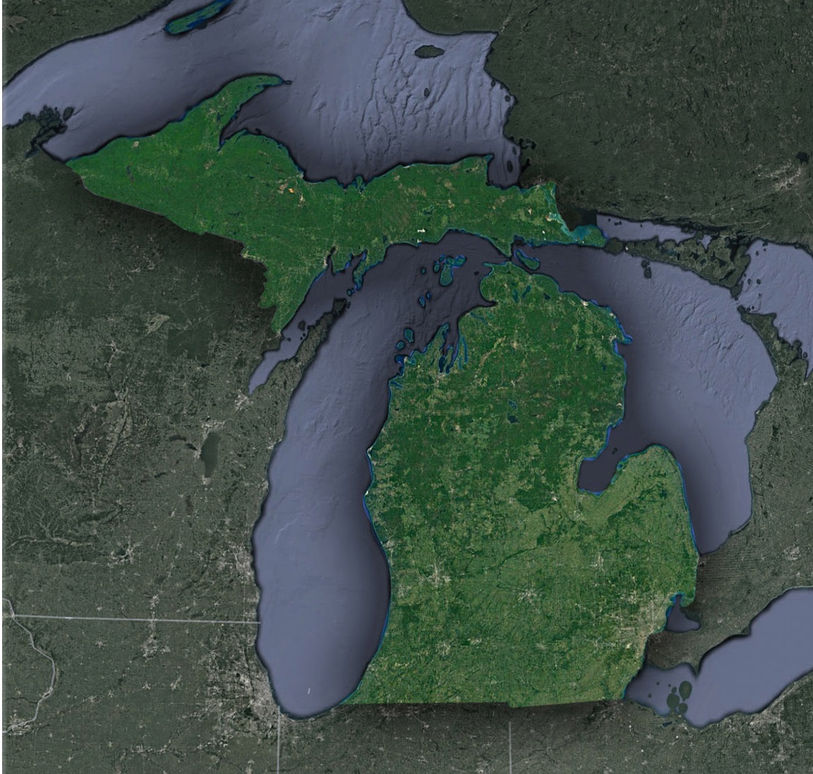
Michigan, known as the Great Lakes State, is a blend of vibrant urban landscapes and untouched natural beauty. As the satellite’s lens focuses on this northern gem, it unveils a myriad of colors and textures. The Great Lakes – Superior, Michigan, Huron, Erie, and Ontario – stretch out like shimmering mirrors, reflecting the sun’s rays in a dazzling display of blues and greens.
Yet, it’s not just the vastness of these freshwater lakes that captures the attention. The intricate coastlines, with their dunes, harbors, and inlets, tell tales of ancient geological processes and human endeavors. The Sleeping Bear Dunes, rising majestically from Lake Michigan’s shores, appear as a golden ribbon from above, inviting one to ponder the forces that shaped them.
Venturing inwards, the dense forestry of the Upper Peninsula showcases a lush green canopy, with rivers like the Tahquamenon meandering gracefully, carving pathways through the wilderness. Here, the changing seasons are particularly profound, with fall foliage painting a riot of colors and the snowy winters transforming the land into a white wonderland.
On the other hand, urban landscapes such as Detroit, known as the Motor City, showcase a stark contrast. From above, the city grid, intertwined roadways, and the Detroit River portray human ingenuity and adaptation. Historical landmarks, industrial zones, and vast recreational areas become even more apparent, revealing the intricate blend of history, culture, and modernity.
Moreover, Michigan’s agricultural tapestry cannot be missed. The cherry orchards of Traverse City, apple farms, and expansive cornfields appear as meticulous patterns, revealing the state’s rich farming heritage. From a satellite perspective, one can almost visualize the rhythmic dance of seasons, from planting to harvest.
Satellite in Action: Michigan’s Environmental and Urban Narratives
Beyond the pure visual wonder:
- Monitoring the Great Lakes: Satellites play a crucial role in observing water quality, tracking pollutants, and detecting harmful algal blooms, ensuring that these freshwater treasures remain healthy.
- Urban Growth and Sustainability: Areas like Grand Rapids and Lansing undergo transformation over the years. Satellite time-lapses can aid urban planners in ensuring that development is sustainable and environmentally friendly.
- Agriculture Insight: Michigan’s agricultural belt, particularly its fruit orchards, benefits from satellite imagery. By assessing soil health, water availability, and crop health, farmers can optimize their yields and reduce waste.
- Forest Conservation and Management: With vast forests, especially in the UP, monitoring tree cover, logging activities, and potential threats like forest fires becomes paramount. Satellites offer a vigilant eye over these invaluable ecosystems.
Futuristic Visions: The Satellite Revolution Continues
Tomorrow’s satellite technology will offer:
- Climate and Weather Analysis: With Michigan’s distinct seasons, satellites can aid in predicting harsh winters, lake-effect snow, or potential summer droughts.
- Ecosystem Interactions: By continuously monitoring areas like Isle Royale National Park, we can understand the intricate balance between predators like wolves and prey like moose.
Michigan Through the Celestial Lens: Final Musings
Michigan, with its lakes and lands, cities and forests, offers a panorama of contrasts. When observed from space, these contrasts blend into a harmonious narrative of a state that has thrived amidst its watery bounds.
Whether you’re sailing on Lake Huron, hiking in the Porcupine Mountains, or attending a music festival in Ann Arbor, remember: the satellites above capture it all, weaving every moment into the grand tapestry of Michigan’s celestial saga. Through their gaze, Michigan isn’t just a place on a map; it’s a pulsating, living entity in the vast universe.
Check out WhiteClouds’ 3D Maps for more information on satellite maps of Michigan. 2D Canvas Print Satellite Maps of Michigan are also available.
Contact us today to learn more about our 3D services and how we can help you achieve your goals.