A Wall Hanging:
The Great Smoky Mountains
We Build Custom 3D Topographical Models
The Great Smoky Mountains National Park spans across 800 square miles, with acreage divided almost evenly between Tennessee and North Carolina. This popular destination boasted 12.5 million visitors in 2019 alone, making it one of the most visited national parks in the United States. Rich with history, natural beauty, and adventure, this park is truly an extraordinary place to visit and enjoy.
A resident of the park had the vision to create two topographical wall-hangings of the park to showcase in his home. Knowing that WhiteClouds creates high-quality and customizable topographical maps, we were the place to come to make the map he so envisioned. The client desired a topo that was both informational and beautiful, with an old-world style. Special care and attention, and much discussion with the client, formed a topography well-suited for display.
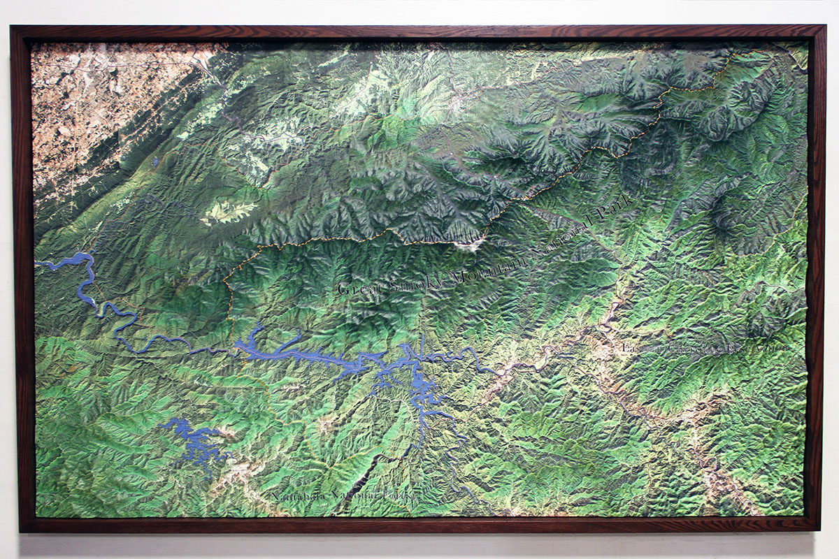
The larger of the two models measures 91 by 56 inches and weighs around 150 lbs. The smaller map is roughly 28 by 24 inches and weighs about 40 lbs. These topographies are made to last. Each map is 3D printed PLA plastic, covered with many layers of polymer for strength, and then treated with our exclusive ink-jet processing that attaches the map’s features and coloring.
For more detail on the creation of our Great Smoky Mountains topography, please visit our project study page here. Check out our topographical models’ page for general knowledge about topographies.