
Elevating Perspectives: The Magic of Colorado’s Raised Relief Map
Nestled in the heart of the American West, Colorado stands as a confirmation to nature’s grandeur and the enduring spirit of discovery. Known for its dramatic Rocky Mountains, verdant forests, and crystal-clear rivers, it’s a state that beckons explorers, both young and old. The raised relief map of Colorado is a powerful tool, offering a tangible and comprehensive view of this captivating state. Dive with us into the peaks and valleys of this exceptional map.
Understanding Raised Relief Maps: A Primer
Before we traverse Colorado’s unique landscapes, let’s first demystify the concept of a raised relief map. Unlike conventional flat maps, raised relief maps are three-dimensional representations of geographical features. They physically elevate topographical highlights, allowing users to touch and feel the undulations of a region’s terrain.
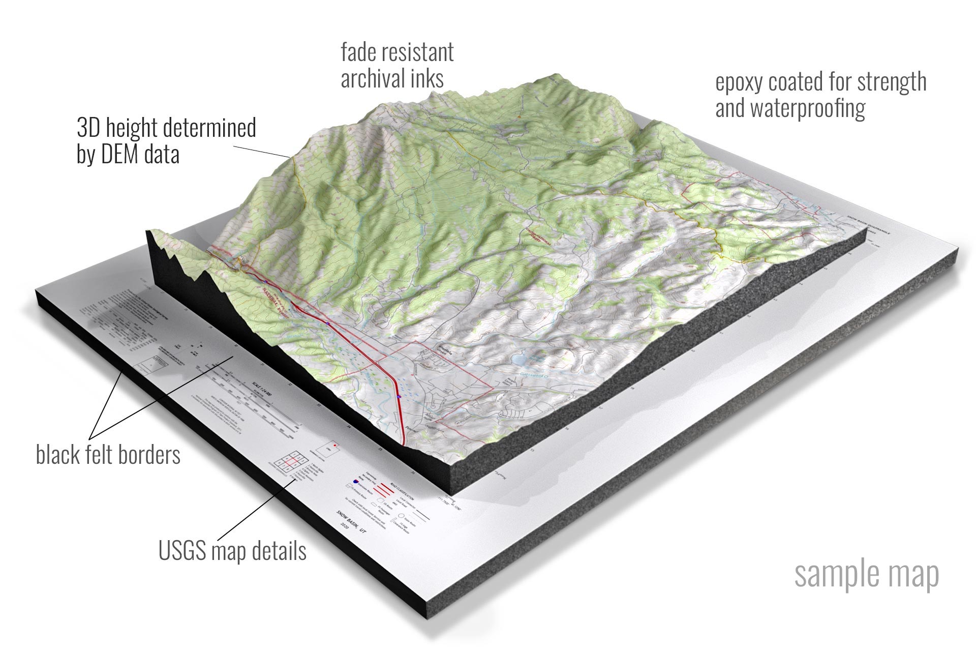 Topographical Raised Relief Sample Map
The Rocky Mountain High: Colorado’s Backbone
At the heart of Colorado’s raised relief map are the iconic Rocky Mountains. Stretching in a north-south direction:
Front Range: Featuring Pikes Peak and the vibrant city of Denver, this region is characterized by striking elevation changes, evident in the map’s pronounced ridges.
San Juan Mountains: Nestled in the southwestern part, their ruggedness and higher elevations become tactile experiences on the raised relief map.
Plateaus and Plains: Colorado’s Diversity
Beyond the Rockies, Colorado unfolds into expansive plateaus and plains.
The Colorado Plateau: Witness the mesa lands and canyons, especially the dramatic dips representing the Black Canyon of the Gunnison.
The Eastern Plains: Stretching to the east of the Rockies, they offer a stark contrast with their relative flatness, a calm expanse after the mountainous crescendo.
The Tactile Allure of Colorado’s Waterways
Colorado’s rivers, lakes, and reservoirs play a pivotal role in shaping its terrain.
The Colorado River: Running westward from the Rockies, its course is traceable by the slight depressions on the map, revealing its winding journey.
The South Platte River: Flowing through Denver, its presence is a testament to the intricate detailing of raised relief maps.
Human Landmarks & Infrastructure
Raised relief maps don’t solely focus on natural landscapes. Significant urban areas and infrastructural elements are showcased too:
Denver’s Basin: Notice the gentle slope leading to the city, embodying the transition from mountains to plains.
The I-70 Corridor: Trace one of Colorado’s primary highways, an indented line cutting through the Rockies and connecting east to west.
The Educational Power of the Raised Relief Map
Such maps are incredible educational tools. They cater to tactile learners, those who grasp concepts better when they can touch and feel. Imagine school students tracing Colorado’s terrain with their fingers, solidifying their geographical understanding.
Mapping Techniques: The Art & Science Behind It
Creating a raised relief map, especially of a diverse state like Colorado, is no small feat. It’s a blend of cartographic data, topographical research, and artistic representation. Modern versions often employ digital terrain data, which is then converted into physical models through processes like 3D printing.
Colorado Through Time: A Historical Gaze
Historically, explorers and settlers relied on rudimentary raised maps, crafted manually to navigate and understand Colorado’s challenging terrain. These artifacts, while less precise than today’s versions, were critical in shaping our knowledge and exploration routes.
A raised relief map of Colorado is more than just a geographical tool. It’s a tactile journey through the state’s profound beauty, diverse landscapes, and rich history. As we touch the Rockies’ ridges, trace the flow of rivers, and feel the expansive plains, we connect with Colorado on a deeper, more tangible level.
So, the next time you encounter a raised relief map of Colorado, pause for a moment. Allow your fingers to wander, let your imagination soar, and immerse yourself in the topographical tales of this wondrous state. Whether you’re a seasoned explorer, a budding geographer, or merely a curious soul, Colorado’s raised relief map promises a sensory experience like no other.
Also:
Contact us today to learn more about our 3D services and how we can help you achieve your goals.
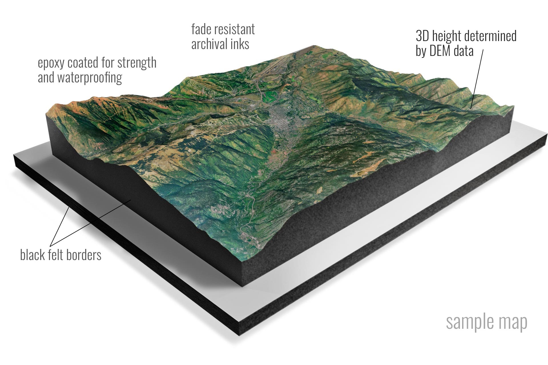 Satellite Raised Relief Sample Map
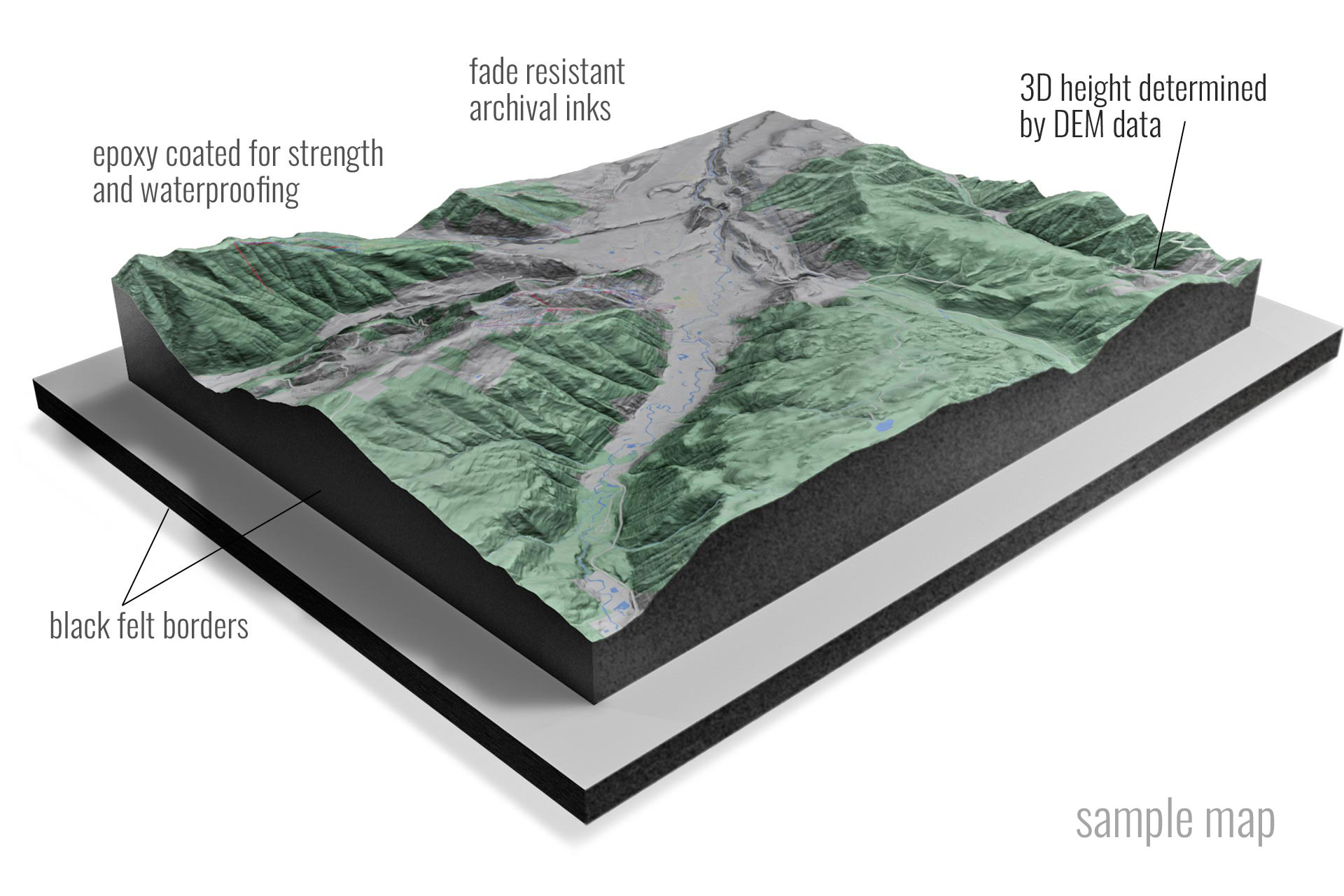 Terrain Raised Relief Sample Map