
Great Lakes Watershed Maps
Stretching majestically across the northeastern expanse of North America, the Great Lakes confirm nature’s grandeur and mankind’s enduring relationship with these vast waters. Encompassing Lakes Superior, Michigan, Huron, Erie, and Ontario, this formidable group of freshwater bodies boasts the distinction of being the planet’s largest collective freshwater system by surface area. Each drop of water, each tributary that contributes to their vastness, is a story unto itself, intricately woven into the watershed that binds these lakes together. As we delve deeper, this comprehensive exploration will traverse the topographical and cultural narratives depicted by the Great Lakes watershed maps, shedding light on the lakes’ multifaceted ecological, economic, and cultural roles, while underlining the urgency of their conservation.
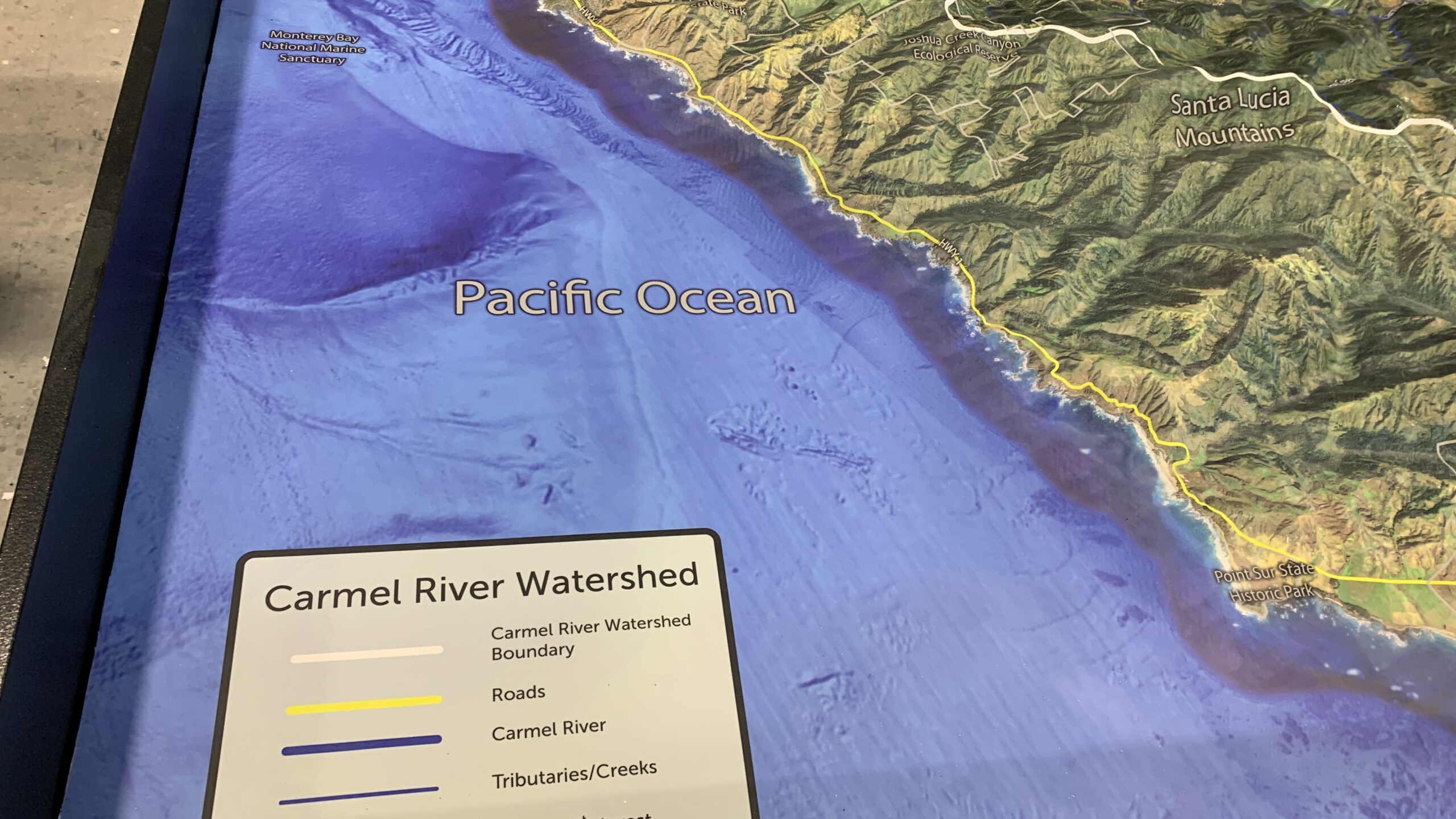
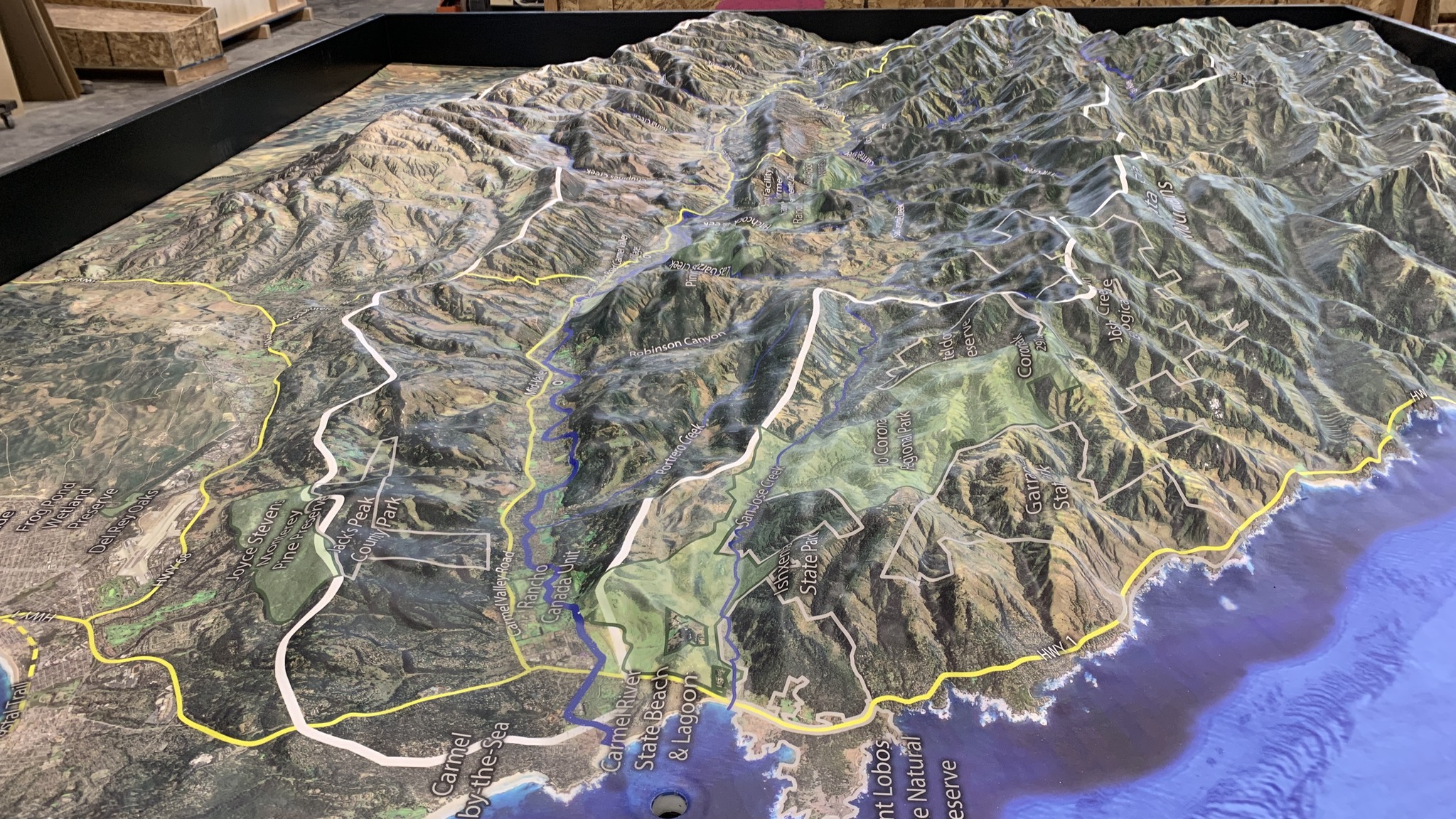
Decoding the Language of Watershed Maps
Watershed maps are more than mere graphical representations; they are the cartographic language articulating nature’s hydrological blueprints. Acting as navigational guides, they spotlight regions of land that contribute their aquatic wealth to a shared destination. When it comes to the illustrious Great Lakes, the watersheds paint a vast canvas that bridges territories across the United States and Canada. Through these detailed cartographic marvels, one can trace the intricate network of smaller tributaries, meandering streams, and mighty rivers that converge, bestowing their aquatic treasures upon the Great Lakes.
Embarking on the Great Lakes Watershed Voyage Lake Superior
Holding the title of the largest and situated furthest to the west among its peers, Lake Superior’s watershed weaves through three U.S. states – Minnesota, Wisconsin, and Michigan. It also extends its embrace to the Canadian province of Ontario. The waters of notable tributaries such as the St. Louis, Nipigon, and Pigeon rivers infuse life into this great lake.
Lake Michigan
Uniquely positioned entirely within the United States, the shores of Lake Michigan caress four states, namely Wisconsin, Illinois, Indiana, and Michigan. This lake is nurtured by significant rivers, including the Fox, Grand, and Kalamazoo, each adding to its vastness.
Lake Huron
Distinguished by its expansive presence and the breathtaking Georgian Bay, Lake Huron’s watershed touches the terrains of Michigan in the U.S. and extends into parts of Ontario in Canada. Rivers such as the Saginaw and the Au Sable play a pivotal role in its hydrology.
Lake Erie
As the shallowest member of the Great Lakes family, Lake Erie’s watershed encompasses regions of Michigan, Ohio, Pennsylvania, New York, and Ontario. It proudly receives the waters of significant tributaries, notably the Detroit River (which brings in the bounty from Lake Huron) and the Maumee River.
Lake Ontario
Located downstream of its siblings, Lake Ontario’s banks receive nourishing waters from Lake Erie, transported via the Niagara River. Rivers including the Genesee, Oswego, and the Salmon contribute to its volume. The culmination of its journey witnesses the waters of Lake Ontario flowing seamlessly into the vast Atlantic Ocean, channeled through the Saint Lawrence River.
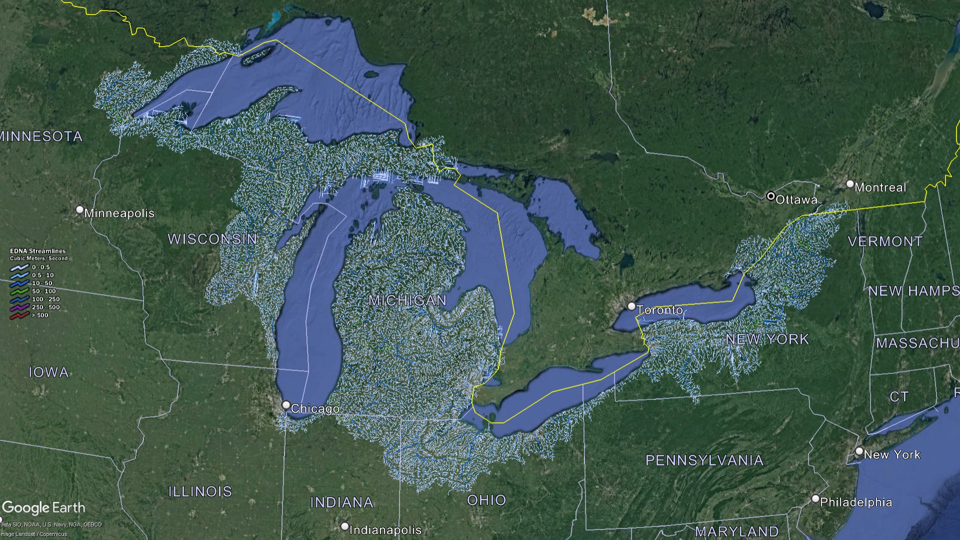 Great Lakes Watershed Streams
The Vast Importance and Splendor of the Great Lakes
- A Biodiversity Haven: The Great Lakes, together with their encompassing terrains, are teeming pockets of rich biodiversity. From the majestic sand dunes to the serene wetlands and expansive forests, these regions provide critical habitats for an array of species. The piping plover, a bird often found in the shores of these lakes, is a stark reminder of the fragility of life, being critically endangered. Beneath the shimmering surfaces of these lakes, a dynamic aquatic world unfolds. Native species like the lake trout swim alongside invaders such as the zebra mussel, showcasing a complex interplay of species within these freshwater realms.
- An Economic Linchpin: Beyond their natural beauty, the Great Lakes are veritable engines driving the regional economy. Serving as natural highways, they are central to shipping routes, facilitating the transport of goods across vast distances. Furthermore, they bolster a flourishing fishing industry, with their waters rich in fish varieties that sustain local communities and feed distant markets. Additionally, the Great Lakes play an indispensable role in the region’s agricultural practices. Their presence helps moderate climatic extremes, while their waters irrigate vast stretches of farmlands, making the soil more fertile and productive.
- Centers of Cultural and Historical Narratives: The shores and waters of the Great Lakes are steeped in history and culture. Indigenous tribes once thrived along these waters, understanding and respecting their ebb and flow. European explorers and settlers later navigated these vast expanses, seeking new lands and opportunities. Over the centuries, these waters have borne witness to bustling trade, fierce battles, and significant migrations. The stories, songs, and legends inspired by the Great Lakes resonate through time, echoing the adventures, hopes, and dreams of countless souls.
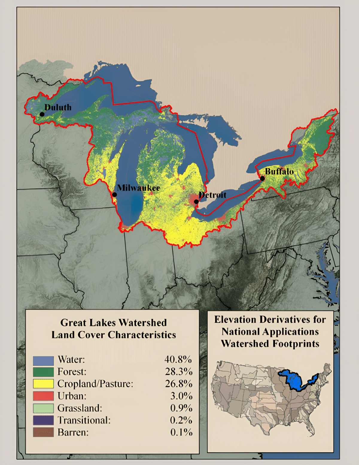
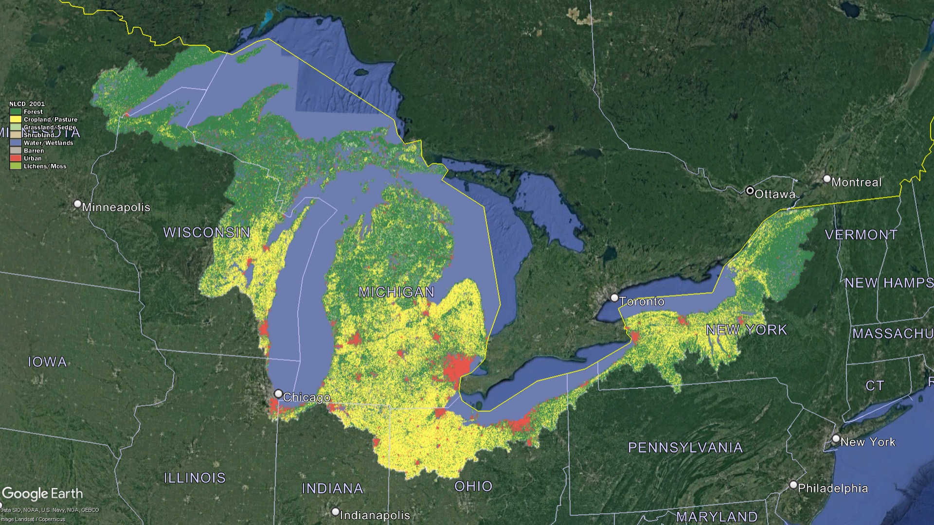 Great Lakes Watershed Land Characteristics
Challenges Beckoning the Great Lakes
While the Great Lakes stand as symbols of nature’s grandeur, they face formidable challenges in the contemporary age:
- Pollution: The surge in industrial activities, coupled with sprawling urban centers and intensified agricultural practices, has given rise to alarming pollution levels within the Great Lakes. Harmful chemicals, non-biodegradable plastics, and heavy metals have been found in concerning concentrations in the waters. Such pollutants not only deteriorate the water quality but also pose severe threats to the rich aquatic life that calls these lakes home.
- Invasive Species Challenge: The introduction of species foreign to the lakes’ ecosystem, like the notorious Asian carp and zebra mussels, has disrupted the ecological balance. These invasive species often outcompete the native fauna, leading to reduced biodiversity and altered aquatic environments.
- The Threat of Climate Change: The repercussions of global climate change are palpably felt in the Great Lakes region. Shifts in precipitation patterns, escalating temperatures, and inconsistent water levels present immense challenges. These climatic changes not only disturb the ecological balance but also impact human activities, from agriculture to recreation, that are intertwined with the well-being of these lakes.
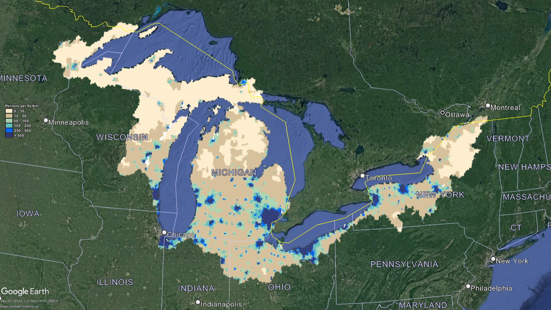 Great Lakes Watershed Population
Harnessing the Power of Cartography for Conservation
A deep understanding of the Great Lakes watershed is vital for its protection, and this understanding is immensely enhanced through the use of meticulously crafted maps:
- Educational Foundations: Incorporating these detailed maps into school curriculums and community outreach programs plays a pivotal role in educating the younger generation and the wider public. By visualizing the vast network of tributaries, habitats, and human-influenced zones, individuals can gain a profound understanding of the lakes’ ecological intricacies and their personal responsibilities towards its safeguarding.
- Scientific Exploration & Analysis: For researchers and scientists, these maps are invaluable assets. They facilitate in-depth studies of water dynamics, enabling the tracking of flow patterns and the sources and paths of pollutants. Furthermore, they assist in the monitoring of species distributions, offering insights into potential migration and habitat changes, especially in the light of evolving climate conditions.
- Guidance for Decision-Makers: The clarity and precision of watershed maps make them indispensable tools for those in the realm of policy formulation and land-use planning. By distinctly showcasing ecologically sensitive zones juxtaposed with urban regions and agricultural expanses, these maps provide a blueprint for sustainable development, ensuring the harmonious coexistence of nature and human endeavors.
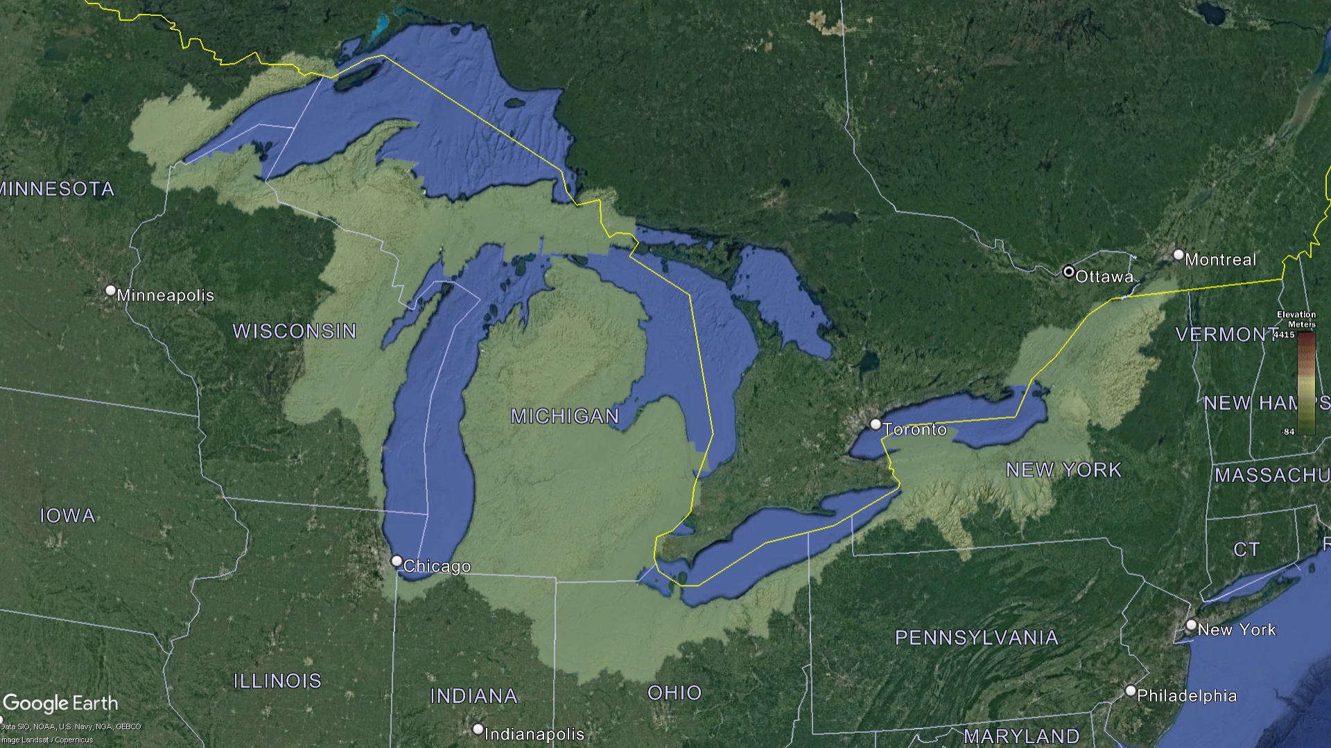 Great Lakes Watershed Elevation
Mapping as a Conservation Tool
The splendor of the Great Lakes is undeniably awe-inspiring, and concerted efforts have been mobilized to ensure their preservation for future generations:
- Vigilant Water Quality Surveillance: Implementing regular and rigorous water quality monitoring regimes is paramount. These checks, often facilitated by advanced technologies and community participation, allow for the immediate detection of pollutants. Such timely identification aids in the implementation of corrective measures and also pinpoints the sources, enabling preventive strategies.
- Rejuvenation and Rehabilitation: Throughout the vast expanse of the watershed, various projects have been initiated with the primary goal of environmental rejuvenation. These include endeavors to restore native habitats, combat shoreline erosion, and breathe life back into wetlands. Such projects not only enhance the beauty of the region but also bolster its ecological resilience.
- Legislative Frameworks & Collaborations: Recognizing the transboundary nature of the Great Lakes, both the United States and Canada have come together to enact robust legislative measures. These regulations focus on diverse areas such as curtailing pollutant discharges, sustainable fisheries management, and conservation of endangered species. This collaborative approach underscores the shared commitment of both nations to protect this unparalleled natural heritage.
 Great Lakes Watershed Land Percentages
A Legacy Worth Preserving
The Great Lakes, with their vast expanse and profound significance, are more than just bodies of water; they are the heartbeats of a continent. The intricacies revealed through the watershed maps underscore the delicate balance and profound interdependence of nature and humanity. As we stand at the crossroads of conservation and development, it becomes imperative for us to cherish, protect, and steward these freshwater titans. By harnessing knowledge, embracing collaboration, and championing sustainable practices, we can ensure that the legacy of the Great Lakes continues to shimmer, inspire, and sustain for generations to come.
Check out our Watershed Maps for more information on Great Lakes Watershed Maps. You can also learn more at our 3D Maps Learning Center.
Contact us today to learn more about our 3D services and how we can help you achieve your goals.