
Colorado Watershed Maps
When you think of Colorado, images of towering Rocky Mountains, vast plains, and sprawling forests likely come to mind. These landscapes aren’t just breathtaking—they’re essential components of the state’s vast watersheds, which sustain its ecosystems, industries, and communities. Let’s embark on an immersive journey into the heart of Colorado through its intricate watershed maps, revealing the intricate dance of nature and humanity.
Diving into the Watershed Concept
To grasp the significance of Colorado’s watershed maps, one must first understand what a watershed is. At its simplest, a watershed is a region where all water that falls converges into a single point, like a river, lake, or reservoir. In a state where water is both a precious resource and a major driving force for various activities, understanding its flow and distribution is of paramount importance.
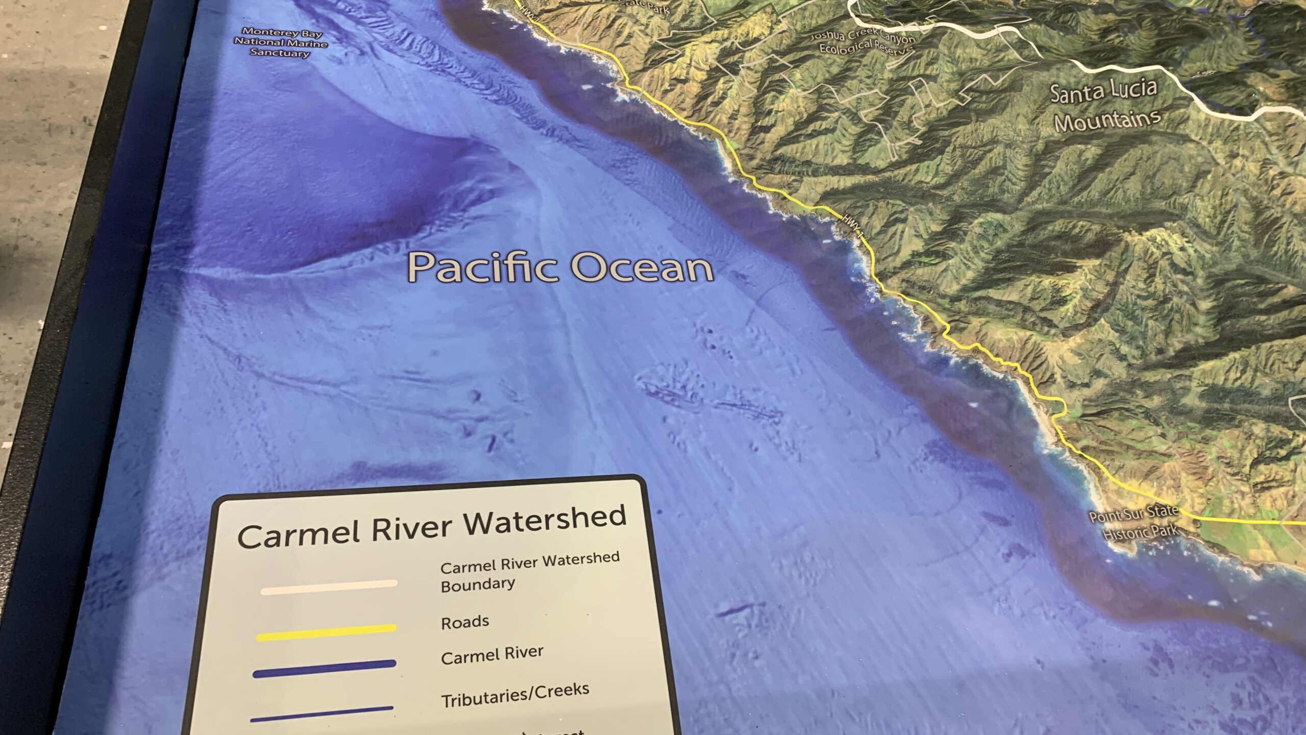
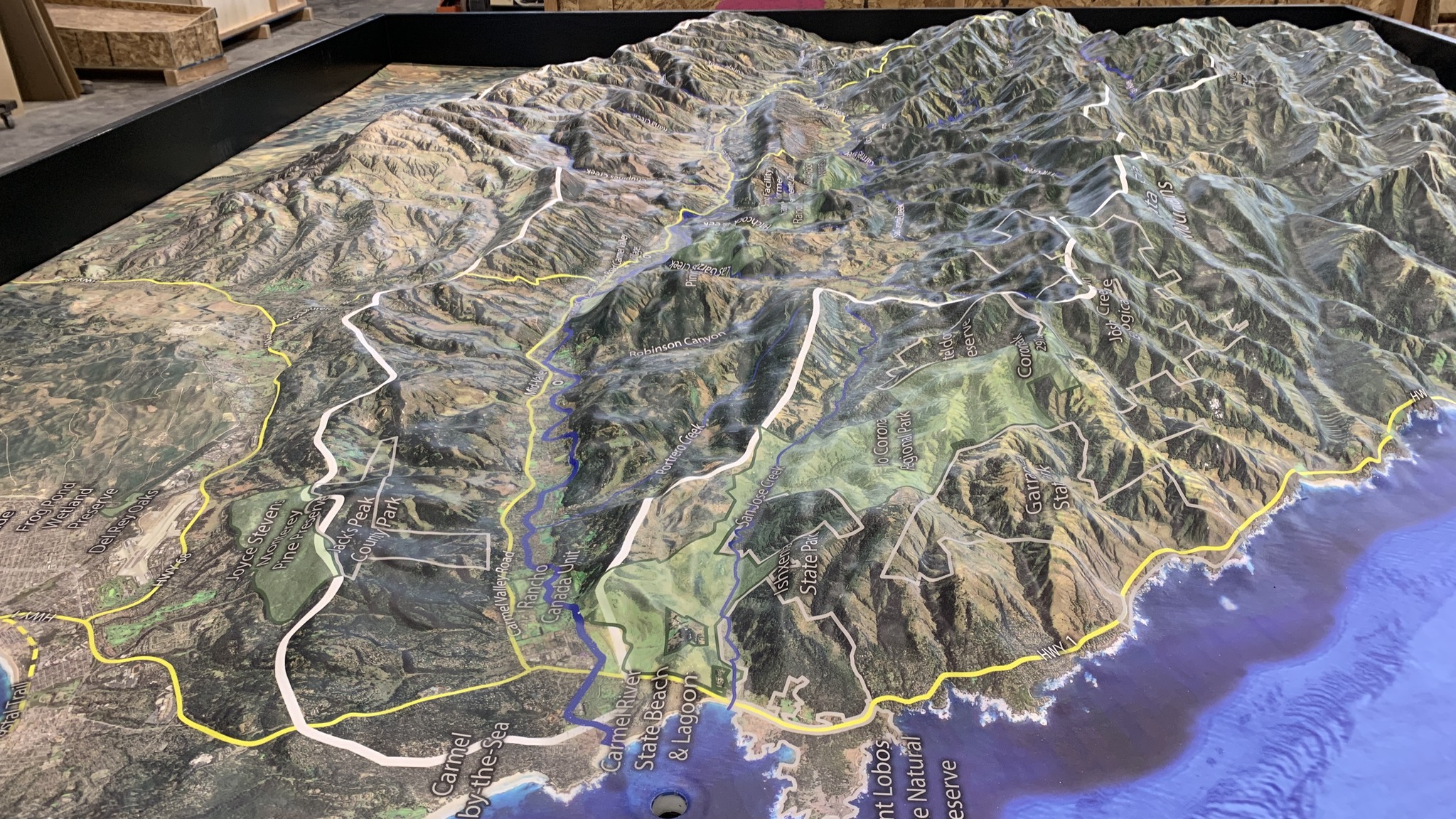
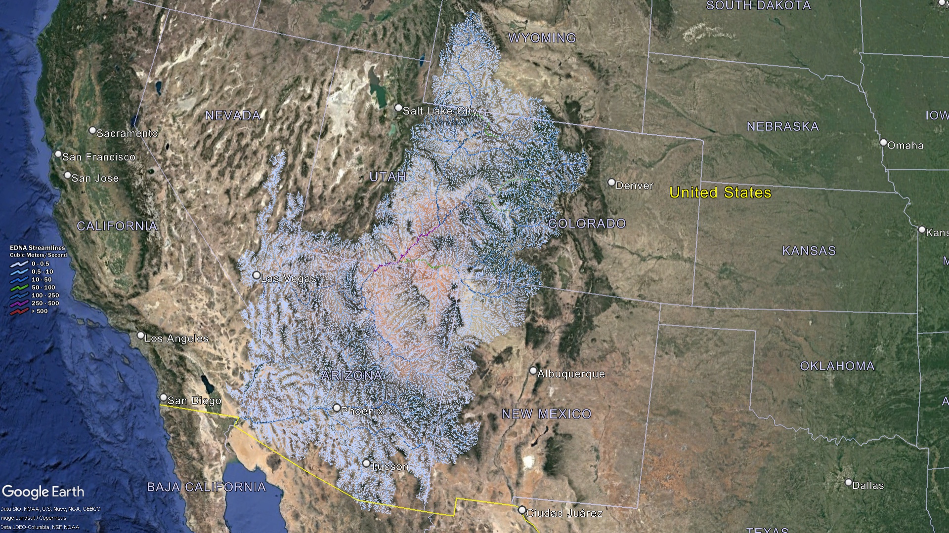 Colorado Watershed Streams
A Mosaic of Watersheds: Colorado’s Hydrological Diversity
Colorado, affectionately christened the “Mother of Rivers,” is more than just a state; it’s a cradle of some of the most iconic rivers that the United States has been blessed with. This hydrological richness is evident in the multiple major watersheds that sprawl across its terrains, each with its unique characteristics, significance, and stories:
Colorado River Basin
One of the most recognized basins, the Colorado River Basin’s origins lie nestled within the rugged western slopes of the majestic Rocky Mountains. The Colorado River, with its untamed power, carves its path through deep canyons, presenting a spectacle of nature’s artistry. Along its journey, it feeds an array of reservoirs, playing the role of both nurturer and provider. This river doesn’t just belong to Colorado—it extends its generosity to several states downstream, making it a lifeline in the truest sense.
South Platte River Basin
Acting as the aqueous artery of the state’s Front Range, the South Platte River Basin is integral to Colorado’s human and ecological landscape. It quenches the thirst of the populous cities that dot the Front Range, ensuring that both communities and the diverse ecosystems they coexist with thrive. The basin stands as a testament to the delicate balance between human needs and ecological preservation.
Arkansas River Basin
Emerging from the breathtaking vistas of the Sawatch Range, the Arkansas River charts its course eastward. As it meanders through the state, it serves as a vital source for agricultural needs, sustaining farms and nurturing crops. Moreover, its waters pulsate with recreational opportunities, beckoning enthusiasts for activities like white-water rafting and fishing, thereby intertwining nature’s bounty with human adventure.
Rio Grande Basin
With its birthplace in the scenic San Juan Mountains, the Rio Grande charts a course that impacts not just Colorado but also the states to its south. Its waters, flowing with history and cultural significance, are pivotal for various ecosystems and communities along its path. The basin embodies a rich blend of nature, culture, and history, linking past legacies with present endeavors.
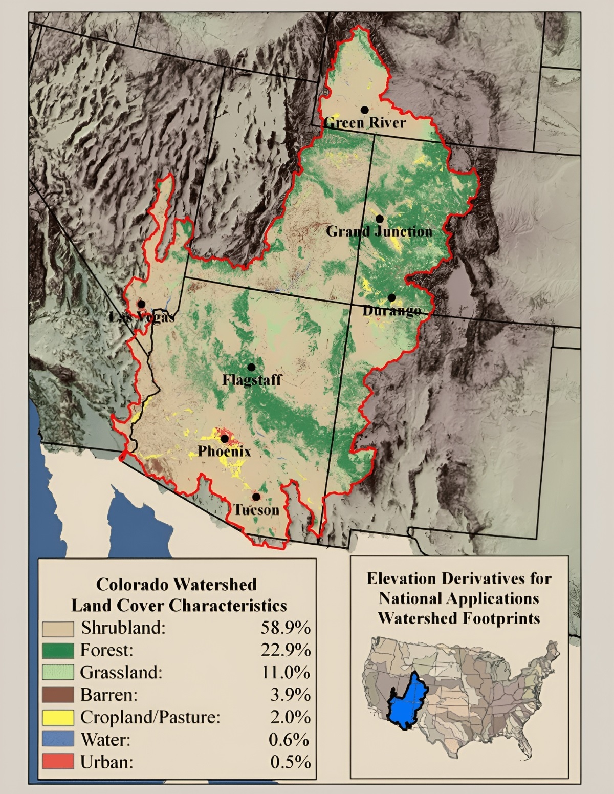
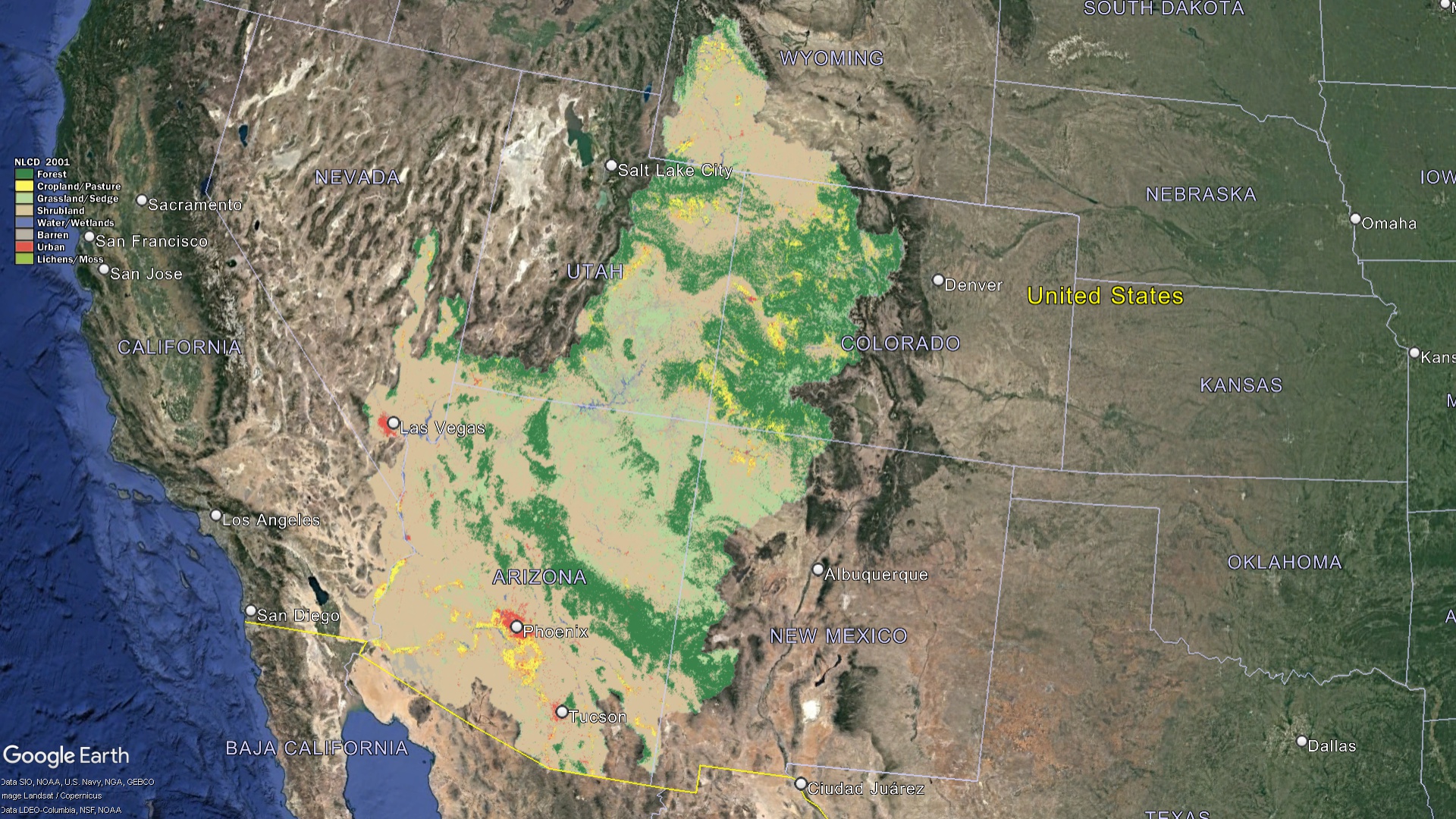 Colorado Watershed Land Characteristics
Why Colorado’s Watersheds Matter
The watersheds of Colorado, with their vast expanses and intricate networks, hold a significance that resonates deeply with various facets of life in the state:
Ecological Importance: At the heart of Colorado’s diverse landscapes are its watersheds, sustaining a myriad of ecosystems that span from the lush alpine meadows to the rugged beauty of desert terrains. These watersheds, acting as nature’s reservoirs, play host to an array of wildlife. This includes not just the commonly sighted species, but also those that teeter on the brink of extinction. The watersheds become sanctuaries, offering these endangered species a fighting chance for survival, and showcasing the delicate balance of life in the Centennial State.
Economic Significance: The economic tapestry of Colorado is interwoven with the vitality of its watersheds. Agriculture, especially in the rain-shadowed eastern plains, leans heavily on the consistent water supply from these watersheds. Beyond farming, the waters pulse with recreational opportunities. The serenity of fishing, the adrenaline rush of rafting, and the winter allure of skiing are just a few activities that draw enthusiasts from around the globe. These activities not only enrich lives but also invigorate Colorado’s tourism industry, contributing substantially to its economic well-being.
Cultural & Historical Value: The waters of Colorado are more than mere life-sustaining elements; they are the veins of cultural and historical narratives. Indigenous communities, the original stewards of this land, revered these waterways, integrating them into their daily life, rituals, and legends. As the pages of history turned, these waters bore witness to explorations, migrations, and the evolving tapestry of Colorado’s identity. They stand as liquid monuments to times gone by and the ever-evolving story of the state.
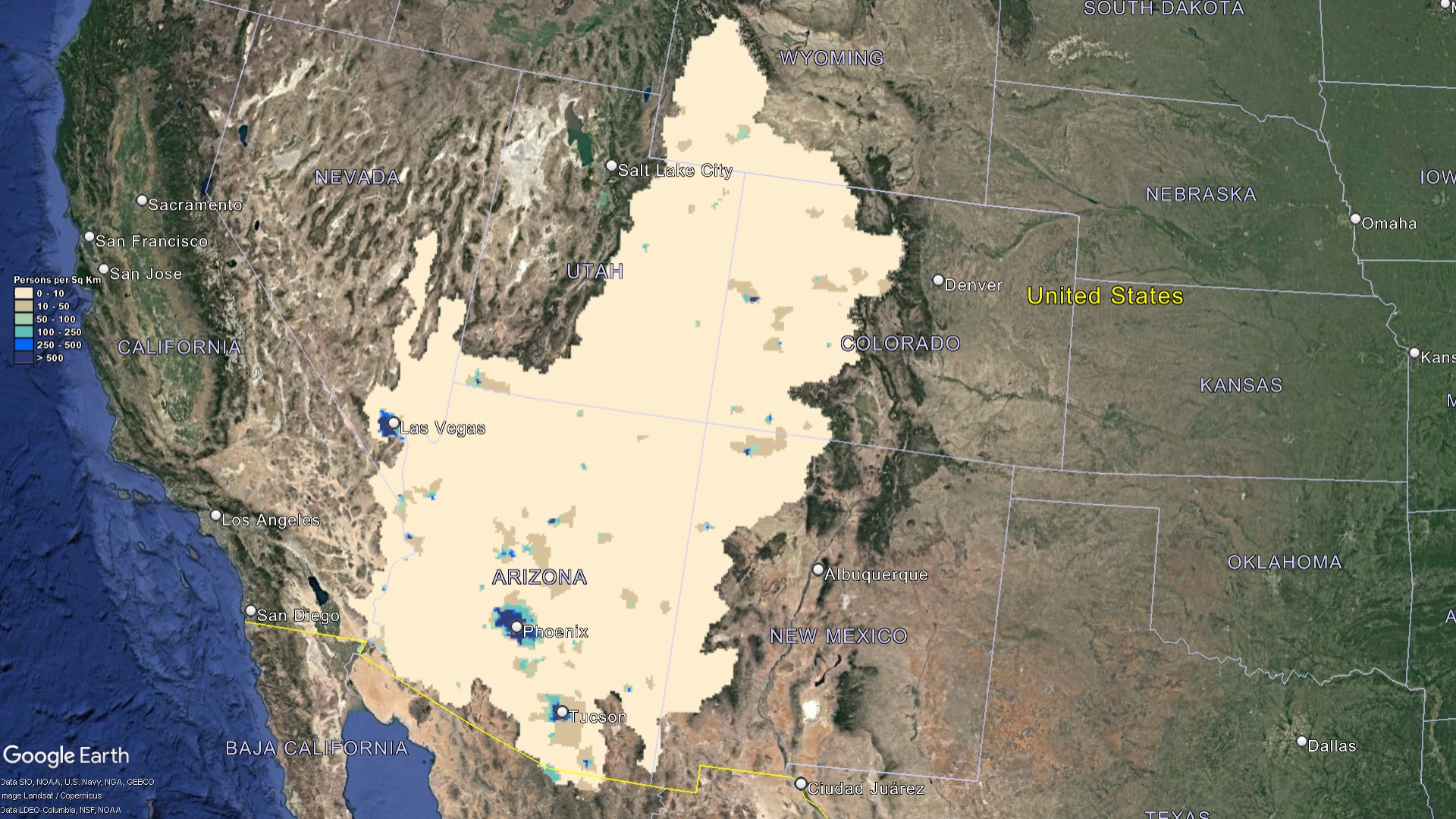 Colorado Watershed Population
Challenges Facing Colorado’s Watersheds
For all their significance and the richness they bestow, Colorado’s watersheds are not without their challenges, many of which have intensified over the years:
Water Scarcity: The dance of urban sprawl, growing agricultural demands, and the thirst of burgeoning industries is increasingly drawing upon the waters of Colorado. This, paired with the inherent challenges of limited rainfall and the state’s semi-arid climate, has catapulted water scarcity to the forefront of concerns.
Pollution: The purity of Colorado’s waters, once taken for granted, faces threats. Runoffs from expansive agricultural lands introduce chemicals and pollutants. Meanwhile, the remnants of mining activities and the byproducts of urbanization further mar the quality of these pristine waters, impacting both human and ecological health.
Climate Change: The specter of global climate change casts long shadows over Colorado’s watersheds. The once predictable patterns of snowfall are now fraught with uncertainties. Earlier snowmelts disrupt traditional water flow timelines, and erratic precipitation patterns further complicate water resource management. These changes ripple through the ecosystems and communities, necessitating adaptive strategies for the future.
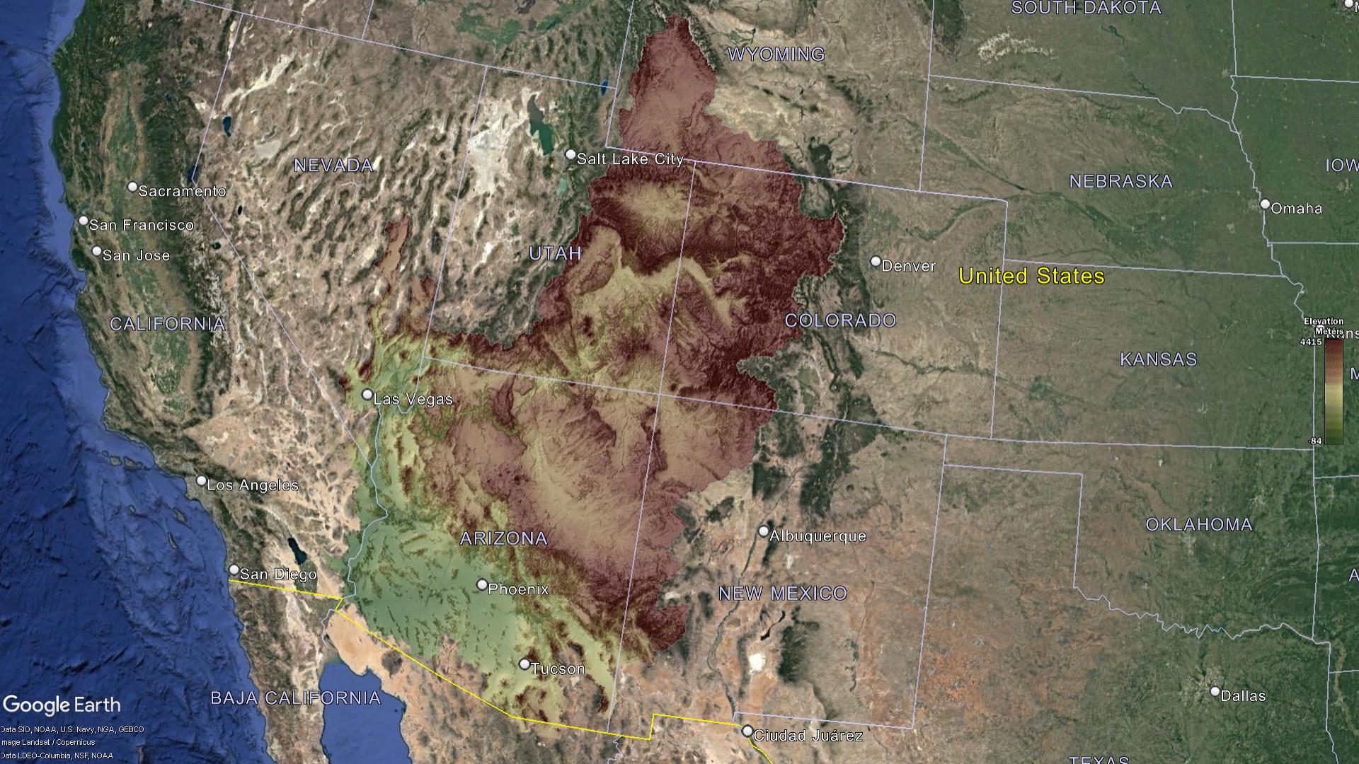 Colorado Watershed Elevation
Mapping: The First Step to Conservation
The intricate web of watersheds in Colorado is beautifully captured in the state’s watershed maps. But these maps are not just about lines and markers; they serve as foundational tools in several pivotal areas:
Education & Awareness: In the age of information, these watershed maps act as powerful educational instruments. They not only delineate the flow of water but also offer insight into the sources, utilization patterns, and the need for conservation. By incorporating these maps into educational curricula and public outreach programs, Coloradans of all ages can cultivate a profound appreciation for their water resources and the need to protect them.
Research & Monitoring: On the forefront of conservation are scientists and researchers dedicated to preserving Colorado’s watersheds. For them, these maps are more than just tools—they’re compasses. They aid in closely monitoring shifts in water quality, changes in flow patterns, and even subtle ecological transformations. With the ever-evolving environmental landscape, having up-to-date and comprehensive maps is indispensable for targeted research.
Policy & Planning: The intricacies of governing a state as diverse as Colorado are compounded when it comes to making decisions related to its waters. For policymakers and urban planners, these watershed maps offer a clear, birds-eye view of the hydrological dynamics. This clarity aids in crafting land use policies, allocating water resources judiciously, and framing conservation strategies that resonate with the state’s topographical and ecological nuances.
 Colorado Watershed Land Percentages
Pioneering Conservation: Colorado’s Proactive Measures
Fully cognizant of the irreplaceable value of its watersheds, Colorado has championed several measures, both at grassroots and legislative levels:
River Watch: At the heart of community-driven initiatives is the River Watch program. A widespread volunteer-driven water quality-monitoring endeavor, it sees Coloradans from various walks of life coming together. They collect crucial data, offer real-time insights, and play an integral role in shaping conservation decisions at local and state levels.
Restoration Projects: With some parts of the watershed facing degradation from various factors, concerted efforts are underway to breathe life back into them. Projects span across diverse domains— from stabilizing vulnerable riverbanks to combat erosion, to spearheading reforestation drives to restore green canopies, and creating habitats to bolster local fauna. Each project, regardless of its scale, underscores Colorado’s commitment to rejuvenating its watersheds.
Legislative Safeguards: Recognizing the need for robust legal frameworks, Colorado has established a series of water laws that stand as sentinels protecting its waters. These laws are continually reviewed and updated to stay relevant in the face of emerging challenges. Recent legislations underscore the emphasis on sustainable water use, proactive conservation, and stringent pollution control measures, ensuring that the state’s waters remain pristine for generations to come.
Colorado’s watersheds are more than just channels of water; they’re the lifeblood of the state. From supporting diverse ecosystems to driving economic activities, they touch every aspect of life in the Centennial State. The Colorado watershed maps are not just informative tools; they confirm the state’s commitment to understanding, preserving, and celebrating its most vital resource. As we move forward in an era marked by environmental challenges, these maps serve as a compass, guiding Colorado’s journey toward sustainable coexistence with its waters.
Check out our Watershed Maps for more information on Colorado Watershed Maps. You can also learn more at our 3D Maps Learning Center.
Contact us today to learn more about our 3D services and how we can help you achieve your goals.