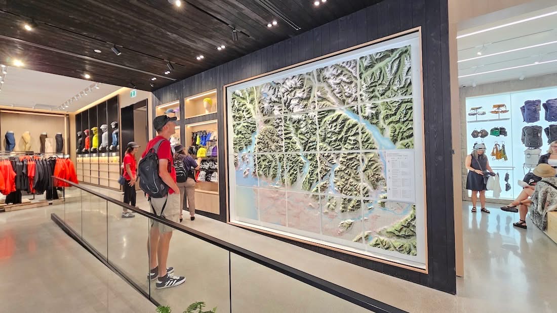
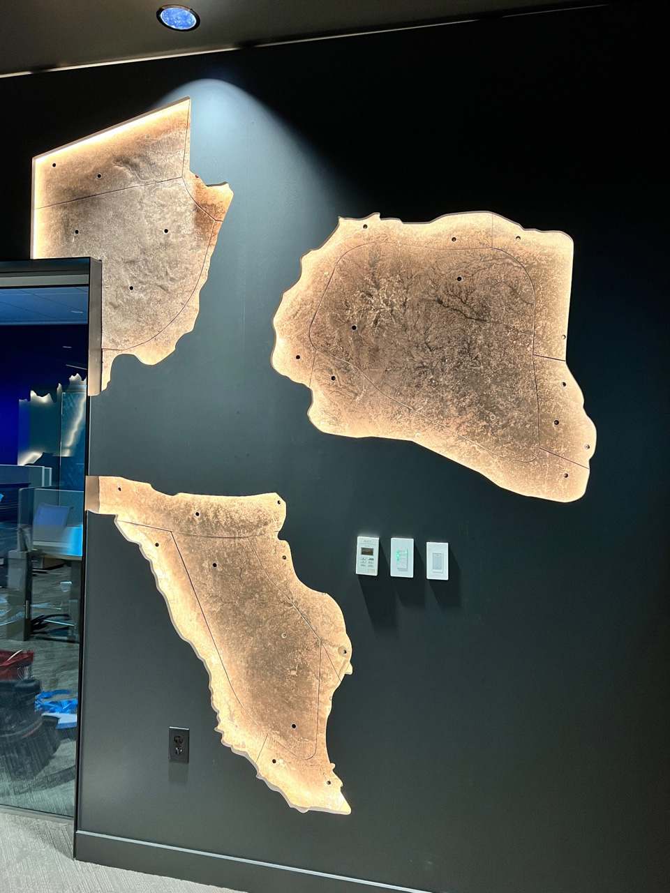
Arc'teryx Vancouver Interactive Retail Wall Topography
Interactive illuminated 3D wall topography used as retail decor inside the Arc'teryx flagship store in downtown Vancouver, featuring LED hiking trail markers and push-button controls.
WhiteClouds 3D Topographical Models Gallery
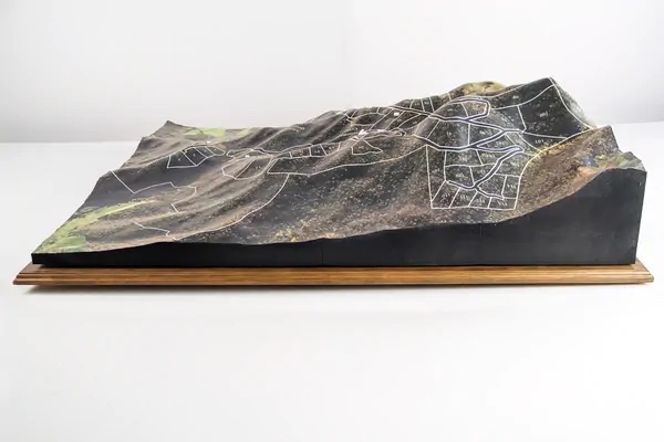
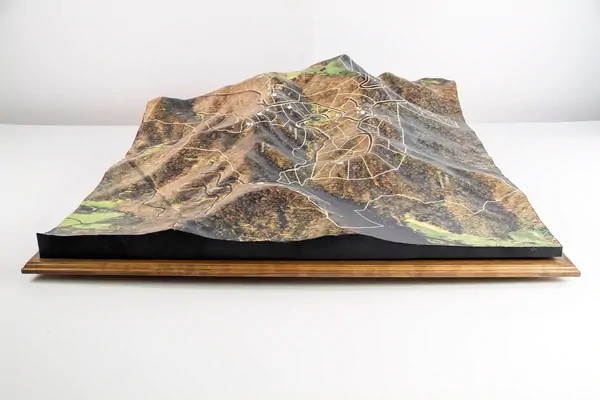
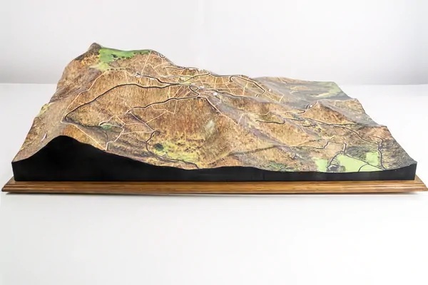
Browse custom 3D topographical models, raised relief maps, terrain displays, watershed models, resort maps, visitor-center exhibits, campus models, interactive lighted map displays, and custom display bases fabricated by WhiteClouds.
Each custom topographical model can serve more than one purpose. A visitor-center map may also be interactive. A watershed display may also be educational and lighted. A resort map may function as both wayfinding and wall decor. Some models are also built with custom bases, stands, cabinetry, or exhibit structures to support permanent display environments. Use the filters to browse examples by audience, environment, feature, display type, and base style.
Interactive illuminated 3D wall topography used as retail decor inside the Arc'teryx flagship store in downtown Vancouver, featuring LED hiking trail markers and push-button controls.
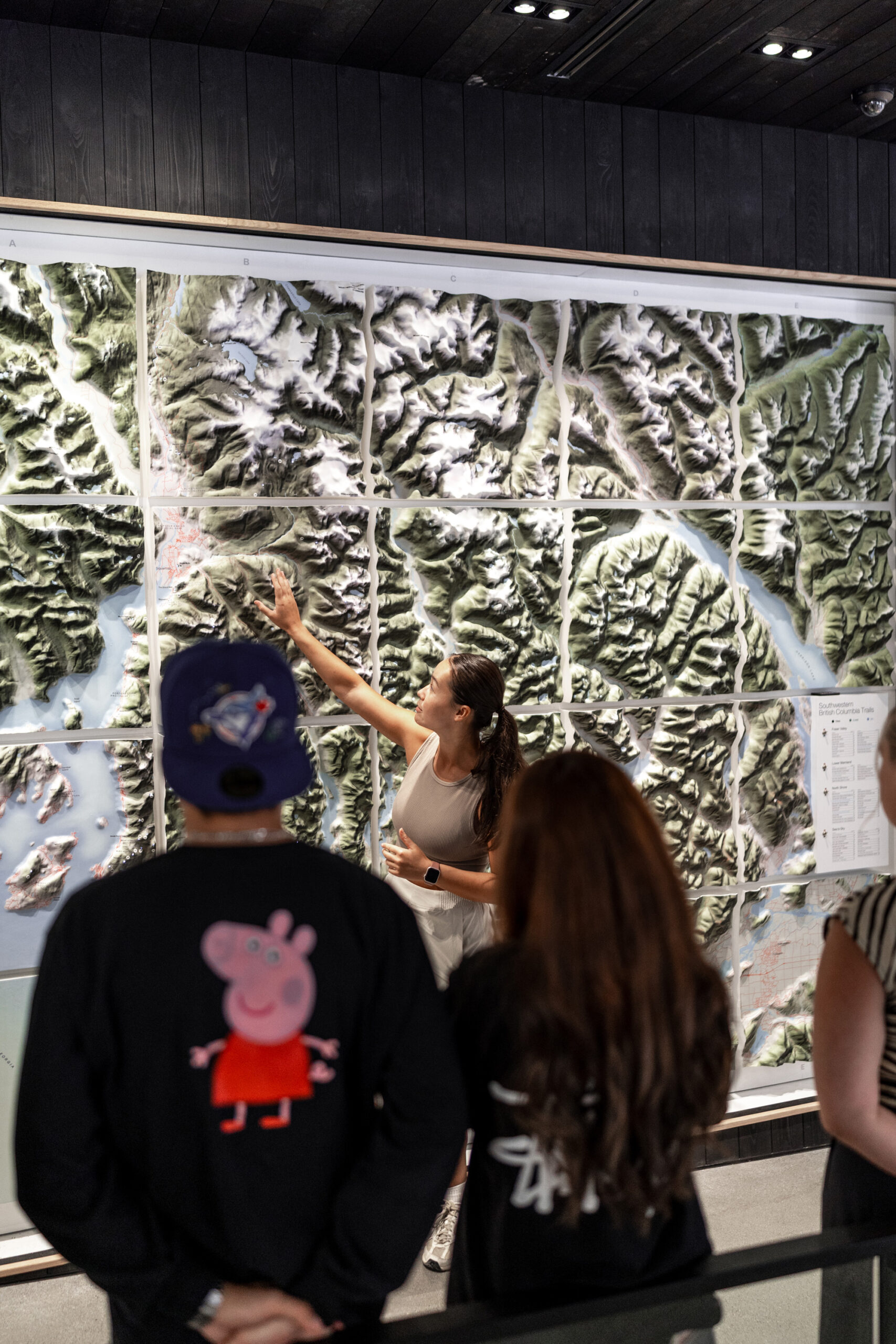
Interactive illuminated 3D wall topography at the Arc'teryx flagship store in downtown Vancouver, featuring LED hiking trail markers and push-button controls for visitors.

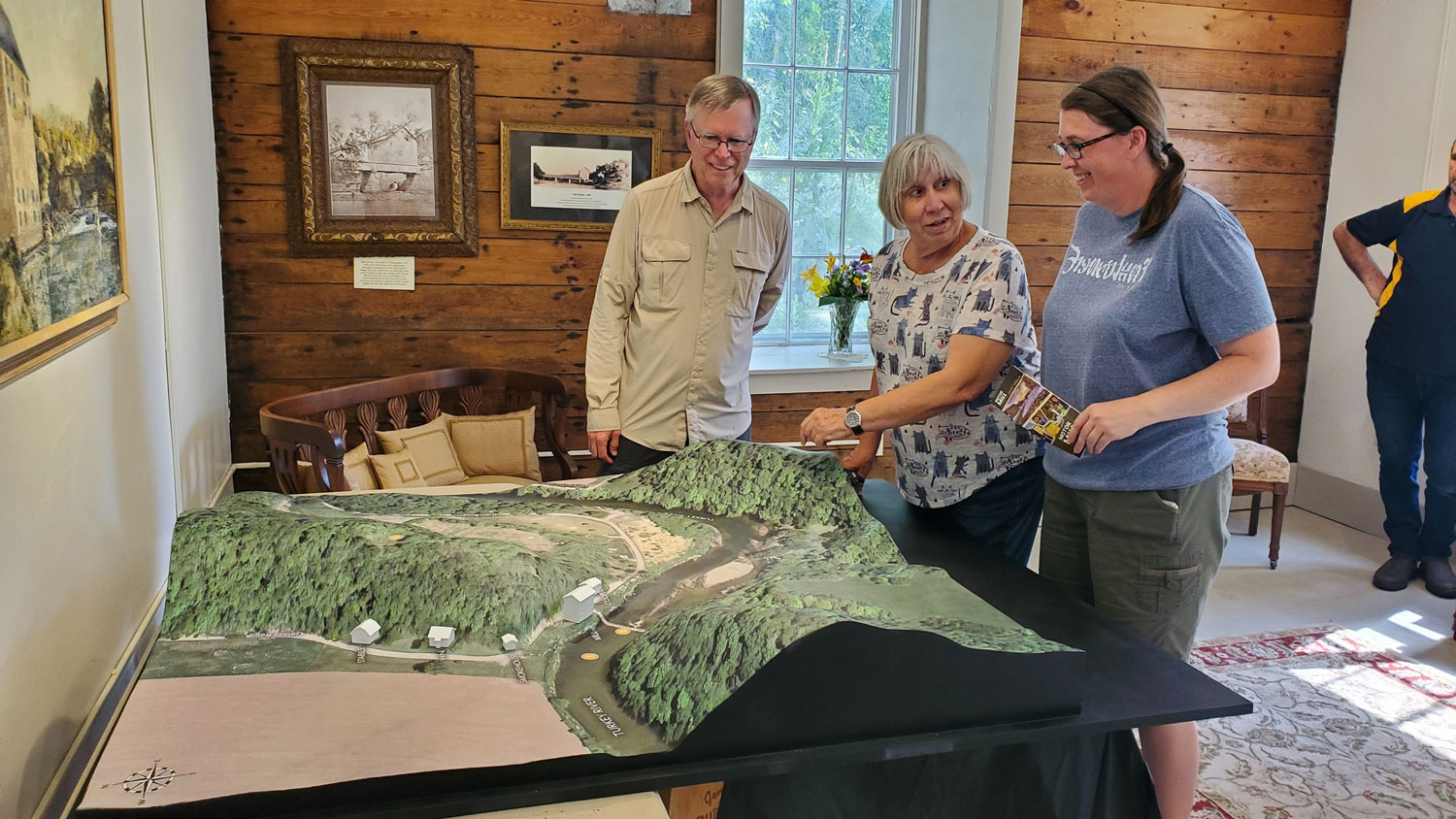
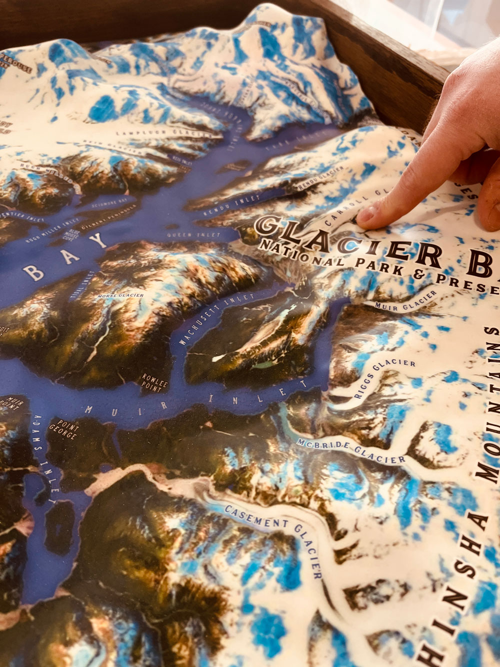
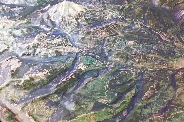
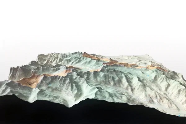
11-foot-long 3D-printed raised-relief map of Southeast Alaska displayed in the lobby of a new restaurant in Ketchikan, featuring nearly 2,000 place names.
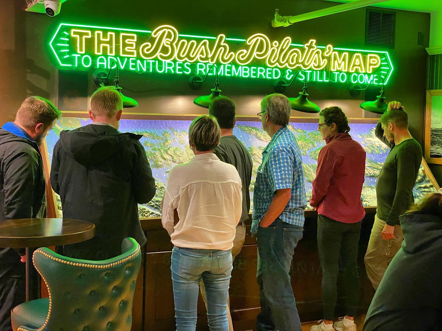
11-foot-long 3D-printed raised-relief map of Southeast Alaska displayed in the lobby of a new restaurant in Ketchikan, featuring nearly 2,000 place names.
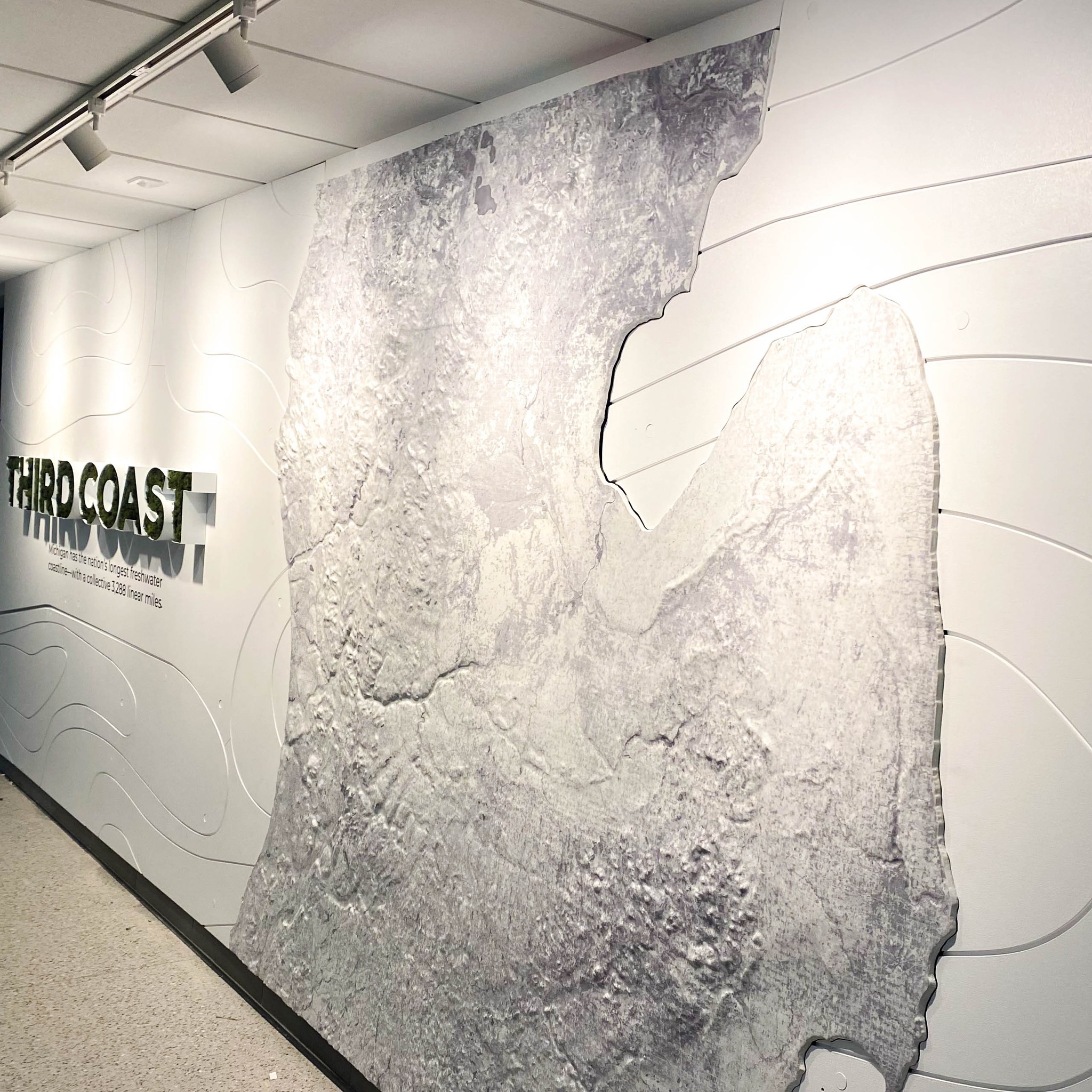
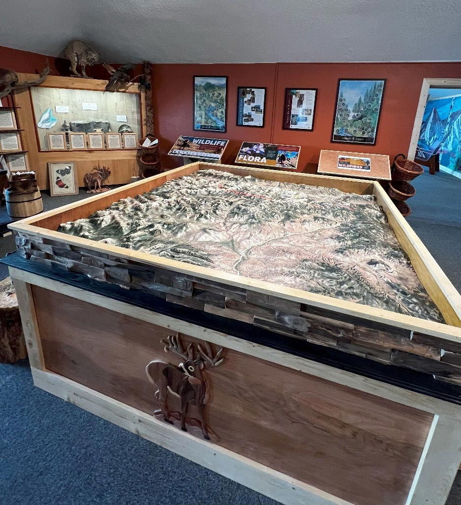
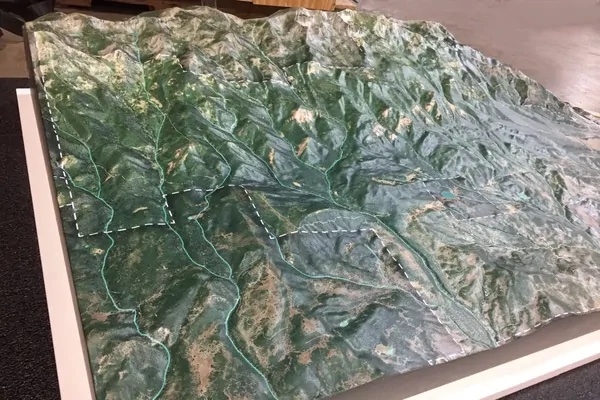
Michigan 3D wall map at the WMU College of Arts and Sciences.
This wall 3D raised-relief map for the WMU College of Arts & Sciences is approximately 21 feet tall.
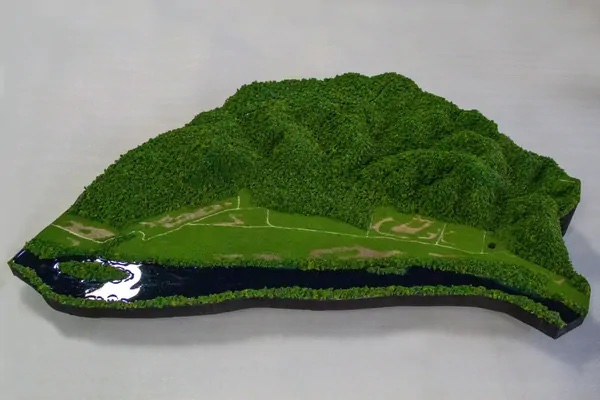
This 7'6" x 9' x 1'11" diorama model is the focal point of a marketing trailer for an exclusive gated community of 143 single-family home lots.
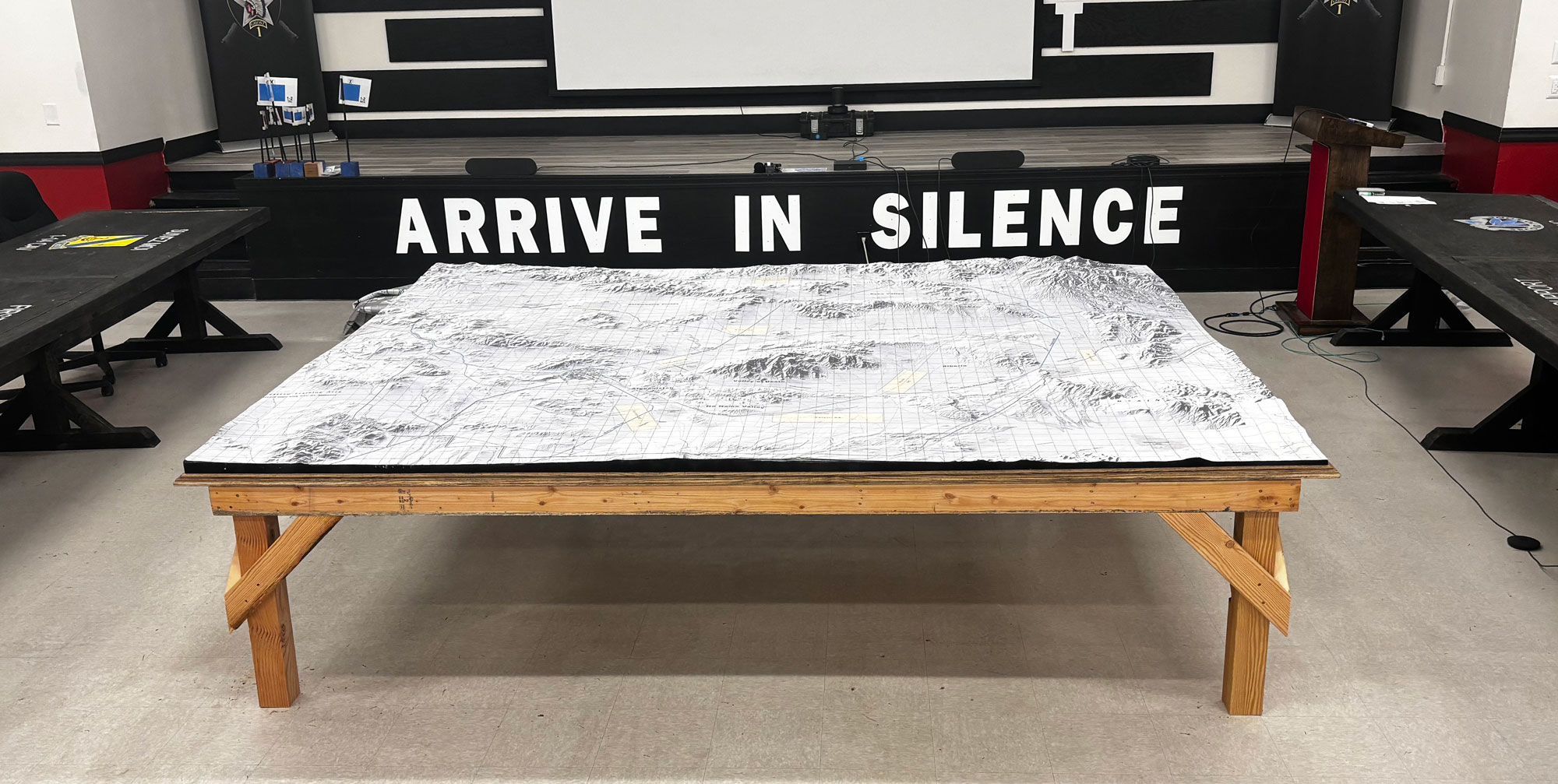
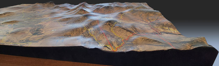
Large 8-foot by 10-foot 3D raised relief map of Fort Irwin Army Base in California and the surrounding Mojave Desert, created for U.S. Army tactical educational training.
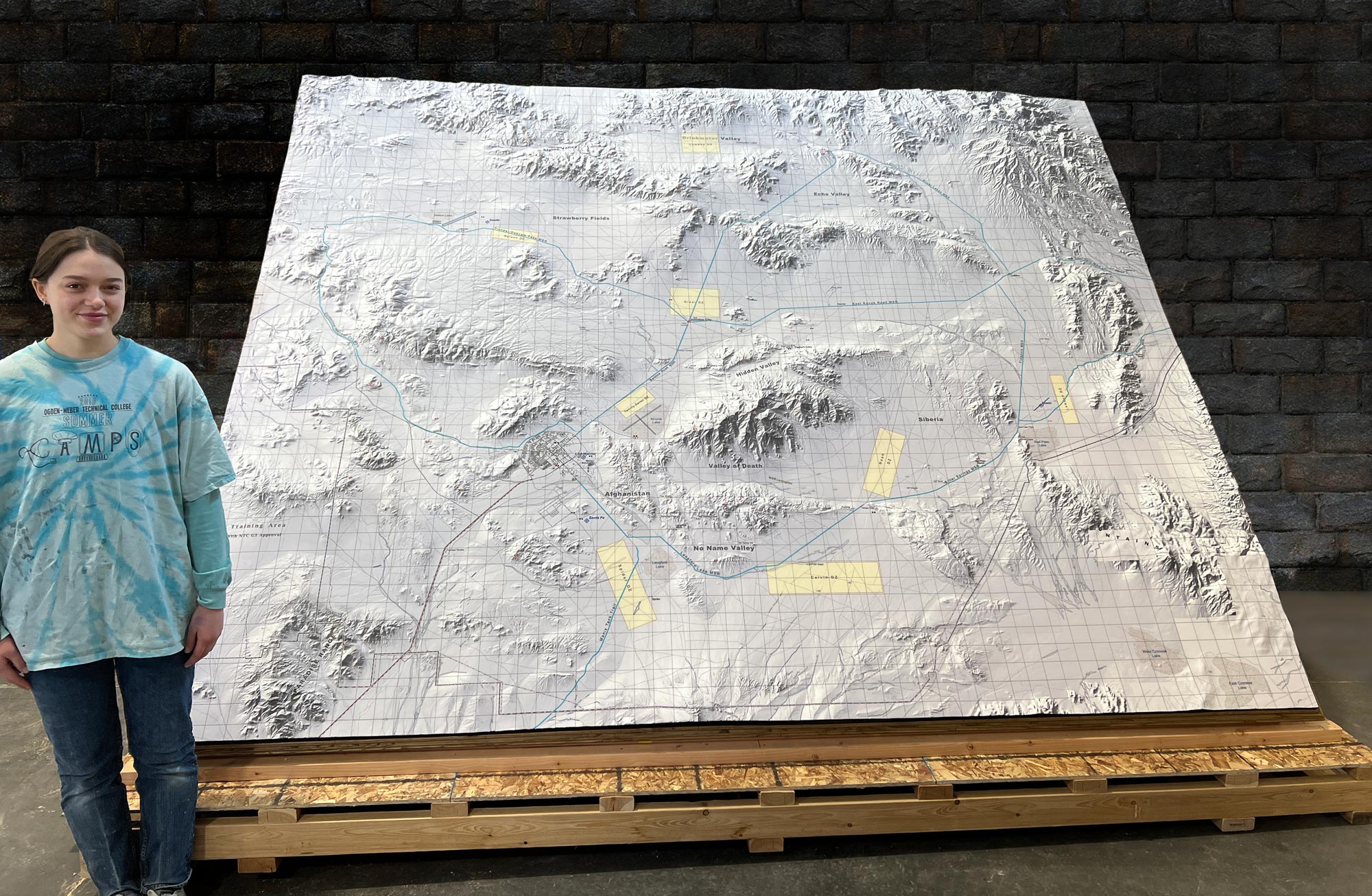
Commissioned 3D raised relief map of Fort Irwin Army Base and the surrounding Mojave Desert, created for the U.S. Army as a large-scale tactical educational training tool.
Custom 3D topographical map of the Monarch Ski Resort area in Colorado, displayed at the visitor center and gift shop as a centerpiece that helps skiers and visitors engage with the terrain they've...
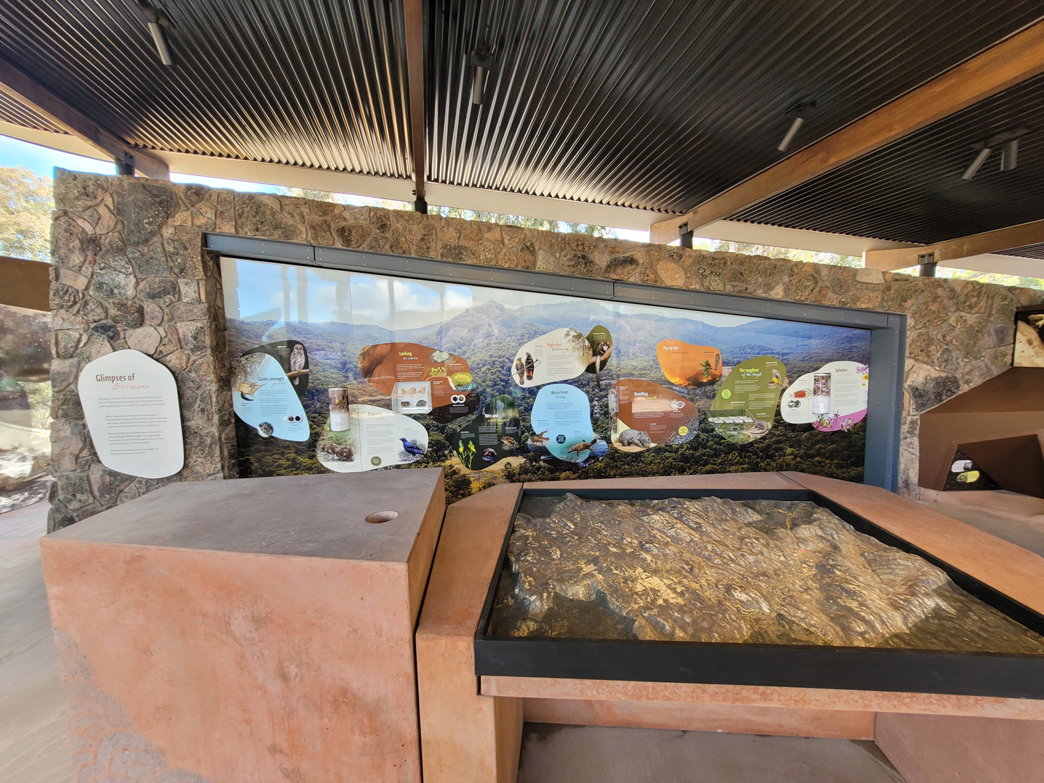
Outdoor 3D raised relief topographical map created for the Girraween National Park Visitor Information Centre in Queensland, Australia, built from high-density foam to withstand the elements.

ADA-compliant custom base with custom signs or legends built into the base, created for the Malibu Creek State Park Visitor Center.
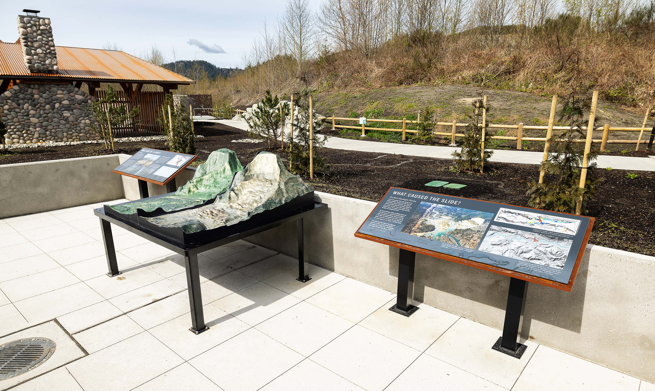
Permanent outdoor 3D raised relief topographical model created for the Oso landslide memorial near Oso, Washington, depicting the historic landslide site in a durable custom metal table display.
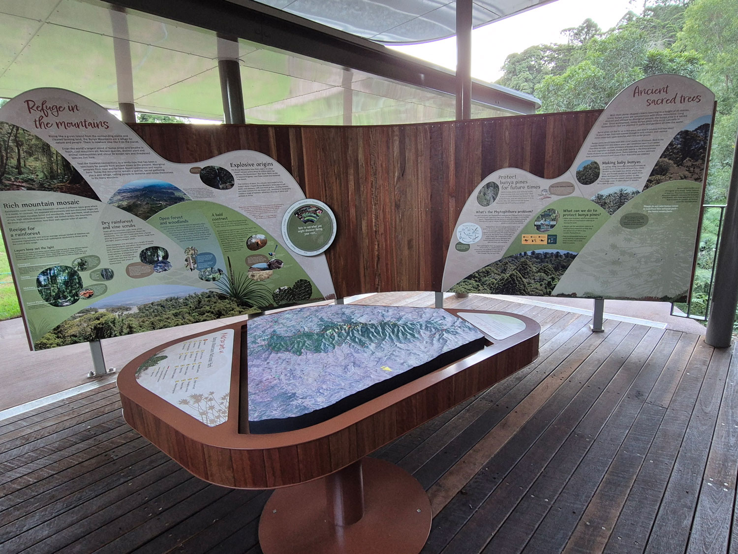
Designed for permanent installation at a trailhead in Bunya Mountains National Park, built from HDU foam for durability and weather resistance with 2–3x exaggerated landforms.

3D map of Malibu Creek State Park featuring trails, creeks, customized satellite imagery, and an ADA-compliant oak wood pedestal base.
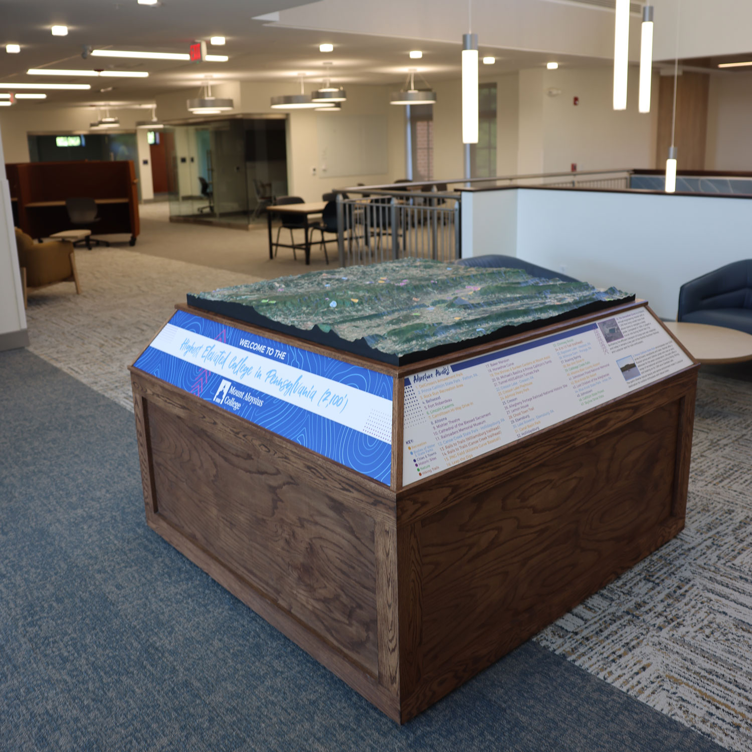
3D topographical map with a wooden base display created for the renovated library at Mount Aloysius College in Pennsylvania, featuring reader rails and more than 40 surrounding points of interest.
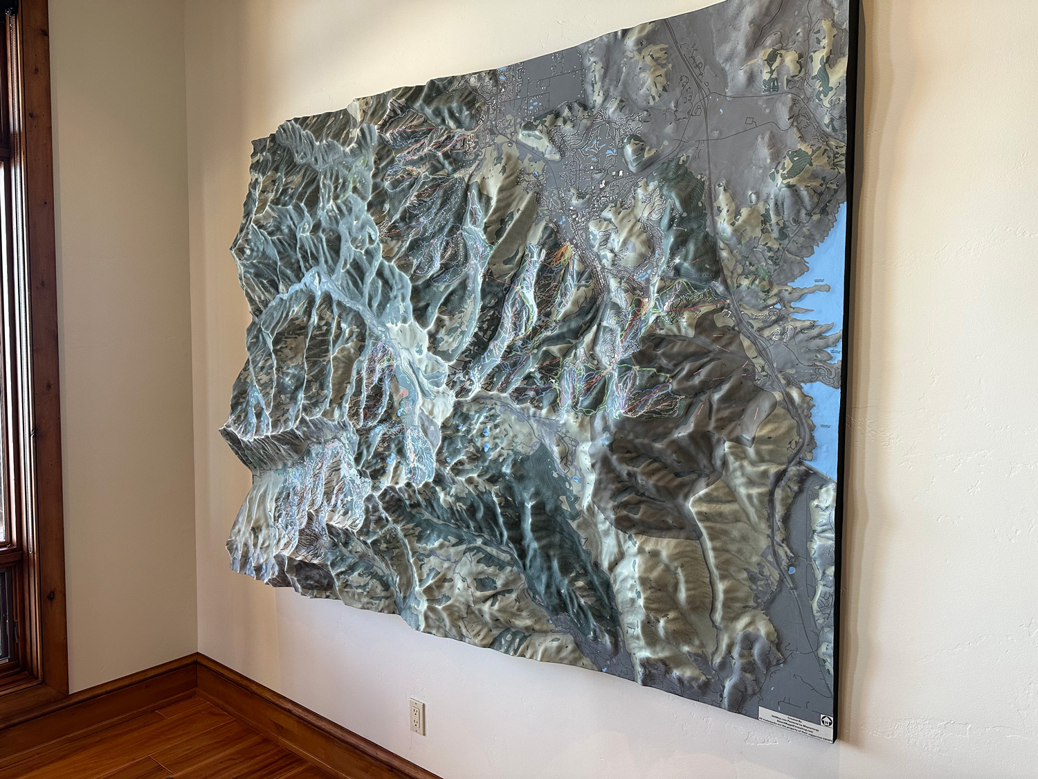
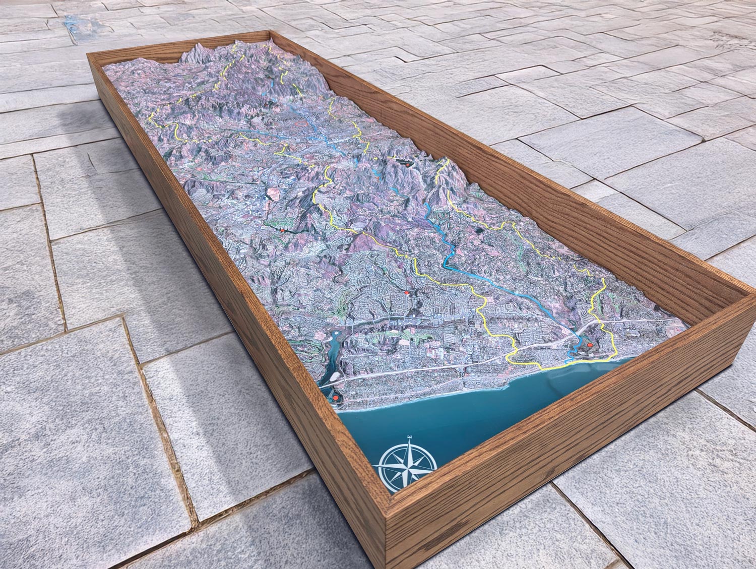
Large 88-inch by 66-inch 3D raised relief map of the Park City, Utah area, including ski trails and surrounding terrain, installed on the wall of a private residence.

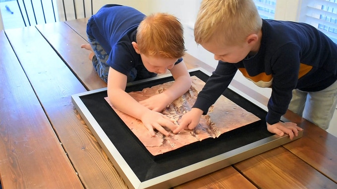
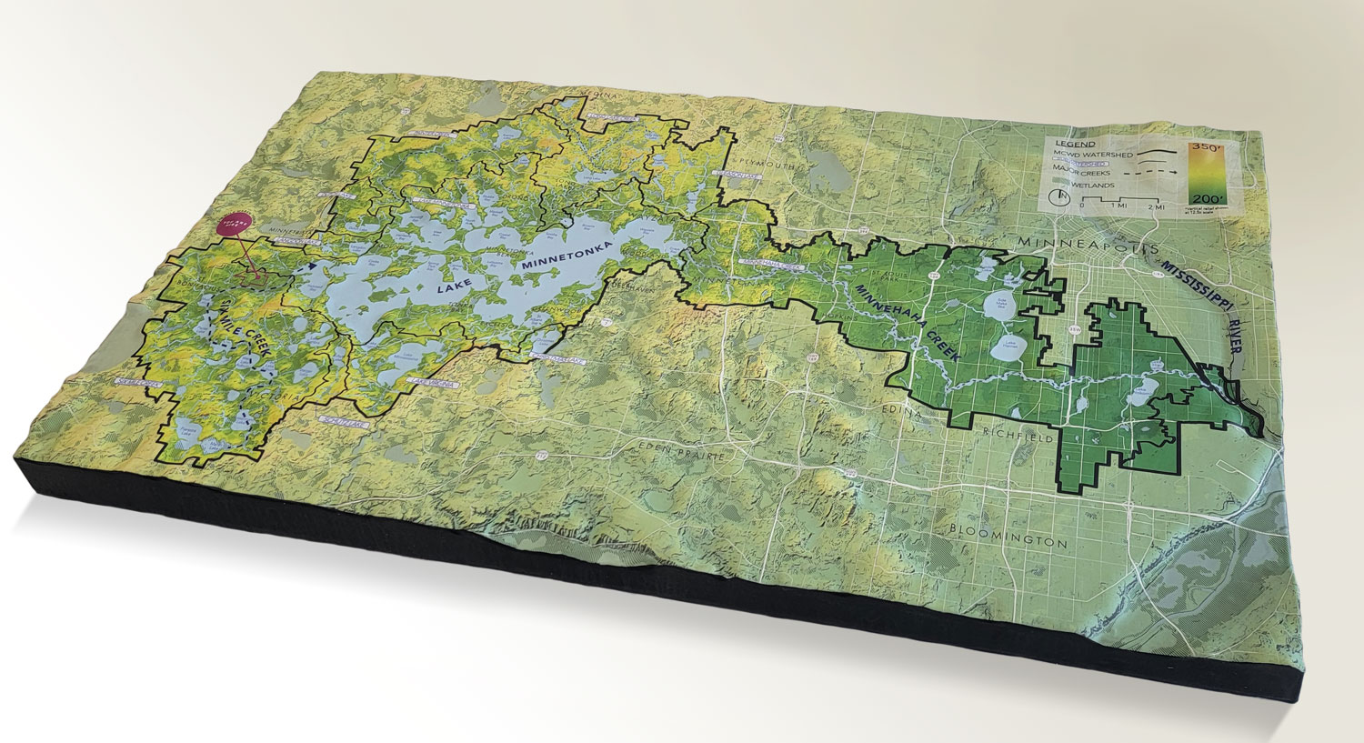
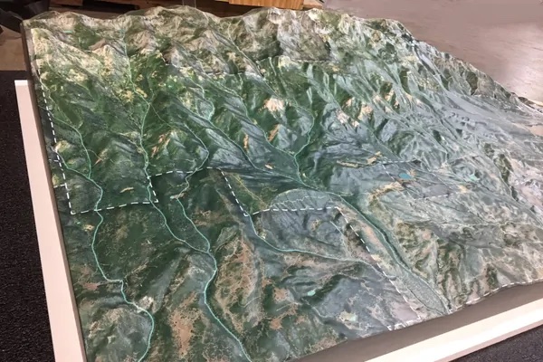
3D Topography of Bent Creek Watershed in North Carolina (mid production).
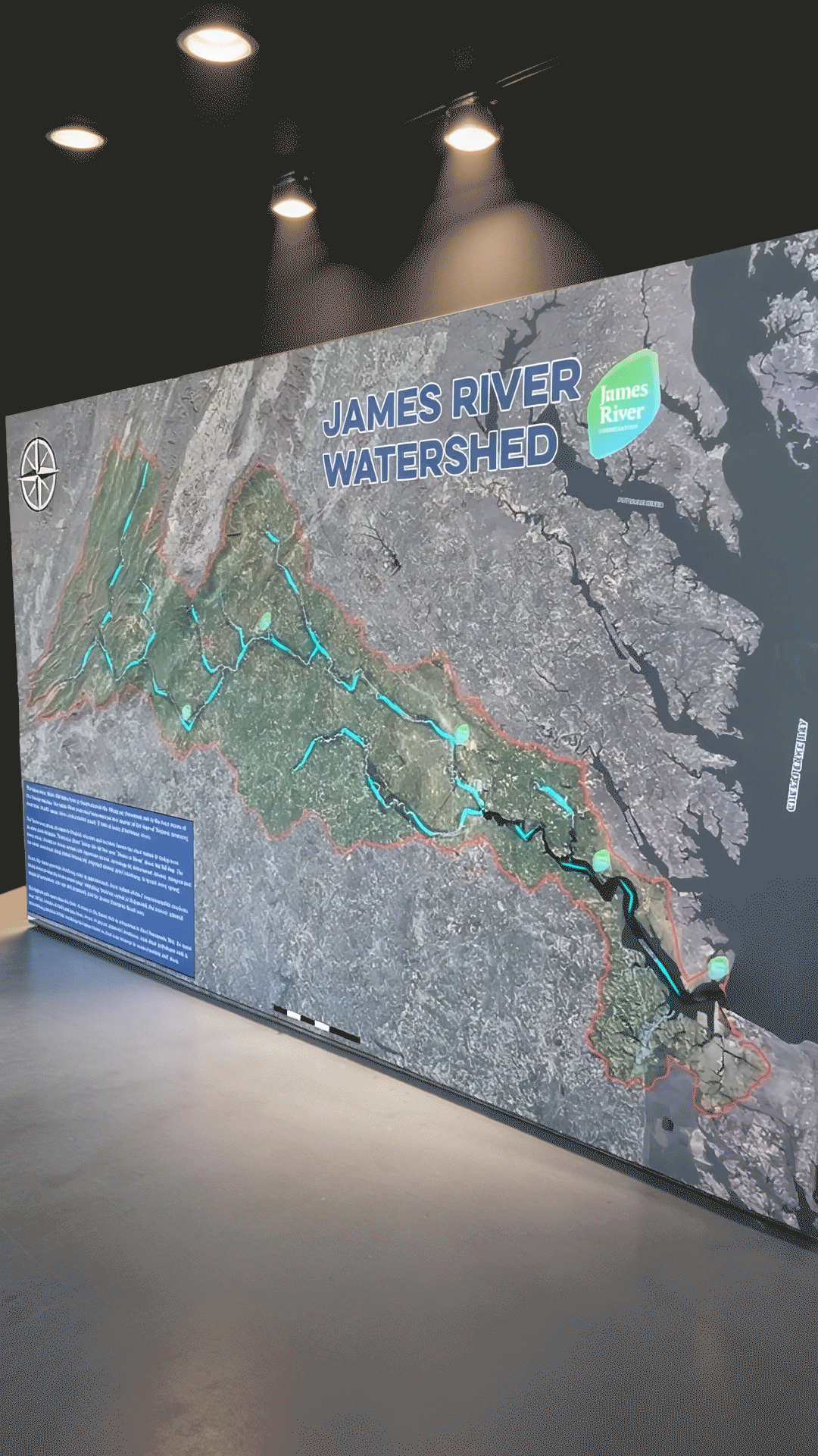
Custom interactive 3D watershed model created for the James River Association, featuring animated illuminated LED lighting that shows river flow, drainage features, and student LEGO Build the Chang...
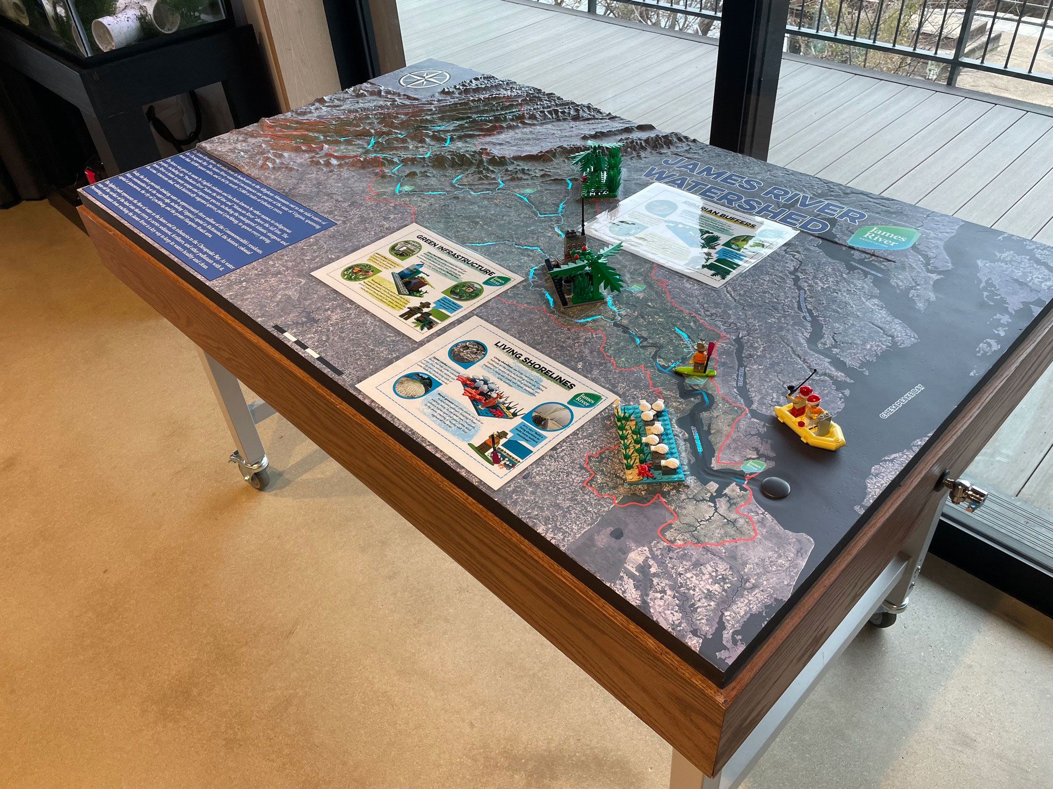
Custom interactive 3D watershed model designed and fabricated for the James River Association, featuring detailed terrain, animated illuminated LEDs that show river flow and drainage features.
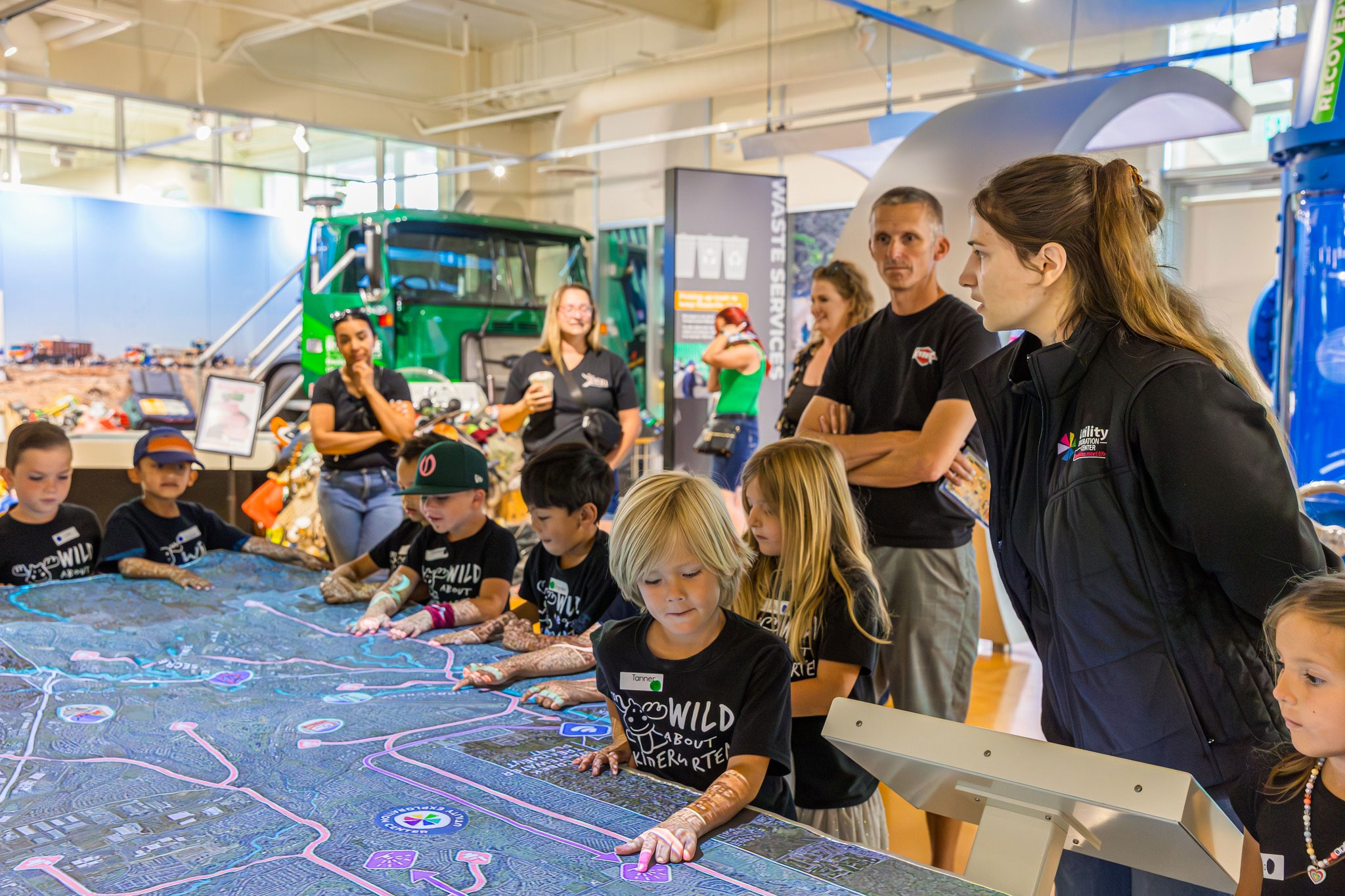
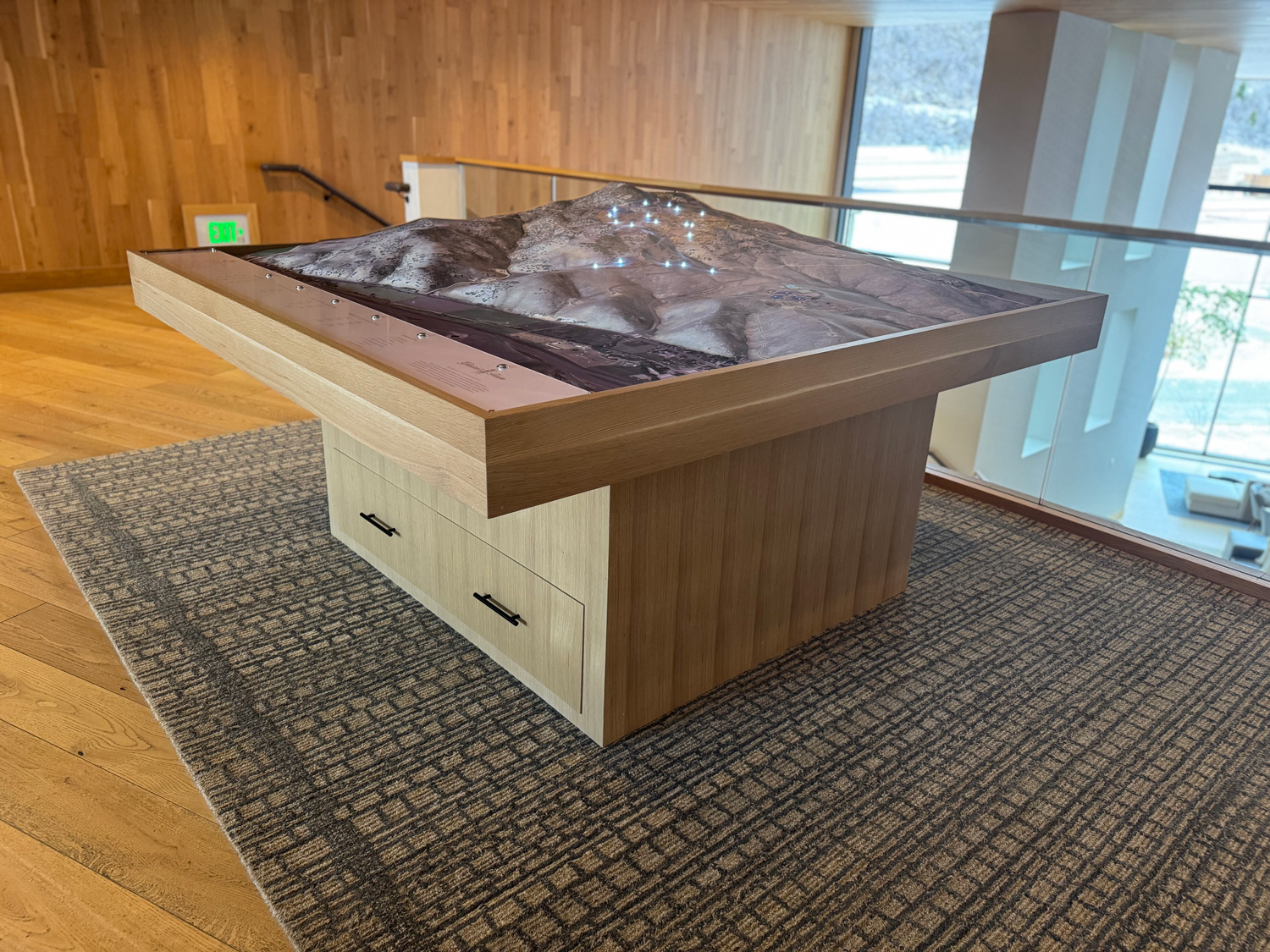
Massive hands-on 3D raised relief map created for the Utility Exploration Center in Roseville, California, designed as an interactive projection-mapped educational display.
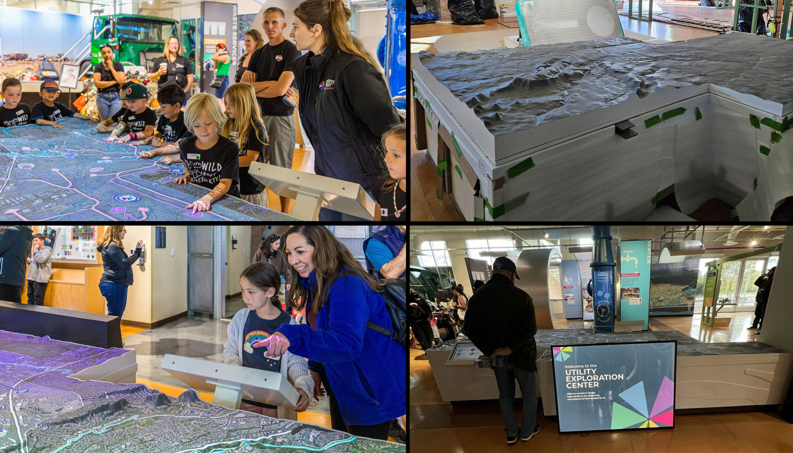
This 3D topographical map at the Roseville Utility Exploration Center Museum in California uses projection mapping and a digital kiosk to educate children.
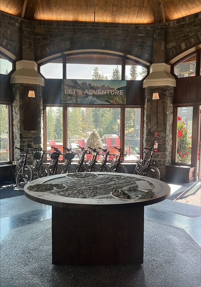
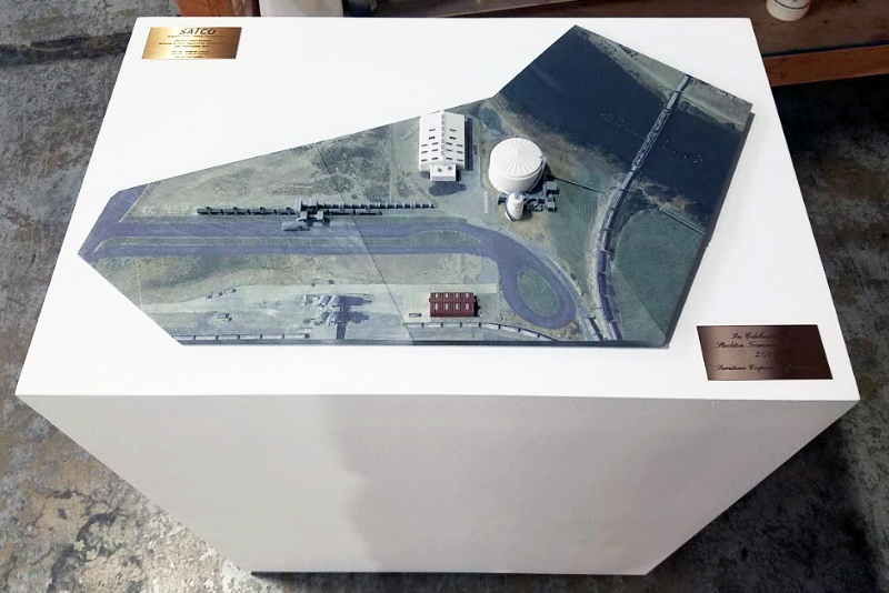
Custom 3D topographical map display created for the Fairmont Banff Springs.
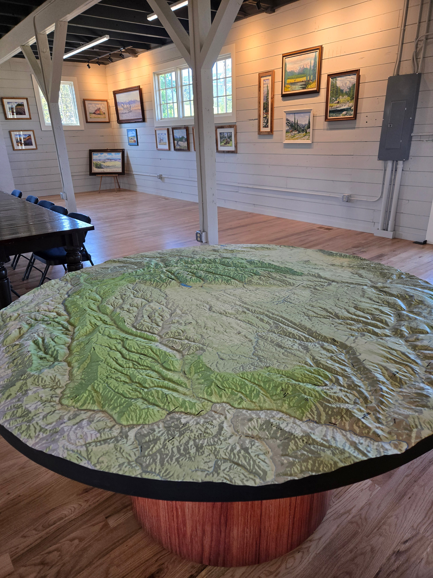
Custom 66-inch circular 3D raised relief topography map with a custom base, created for the Wallowa History Center in Wallowa, Oregon.
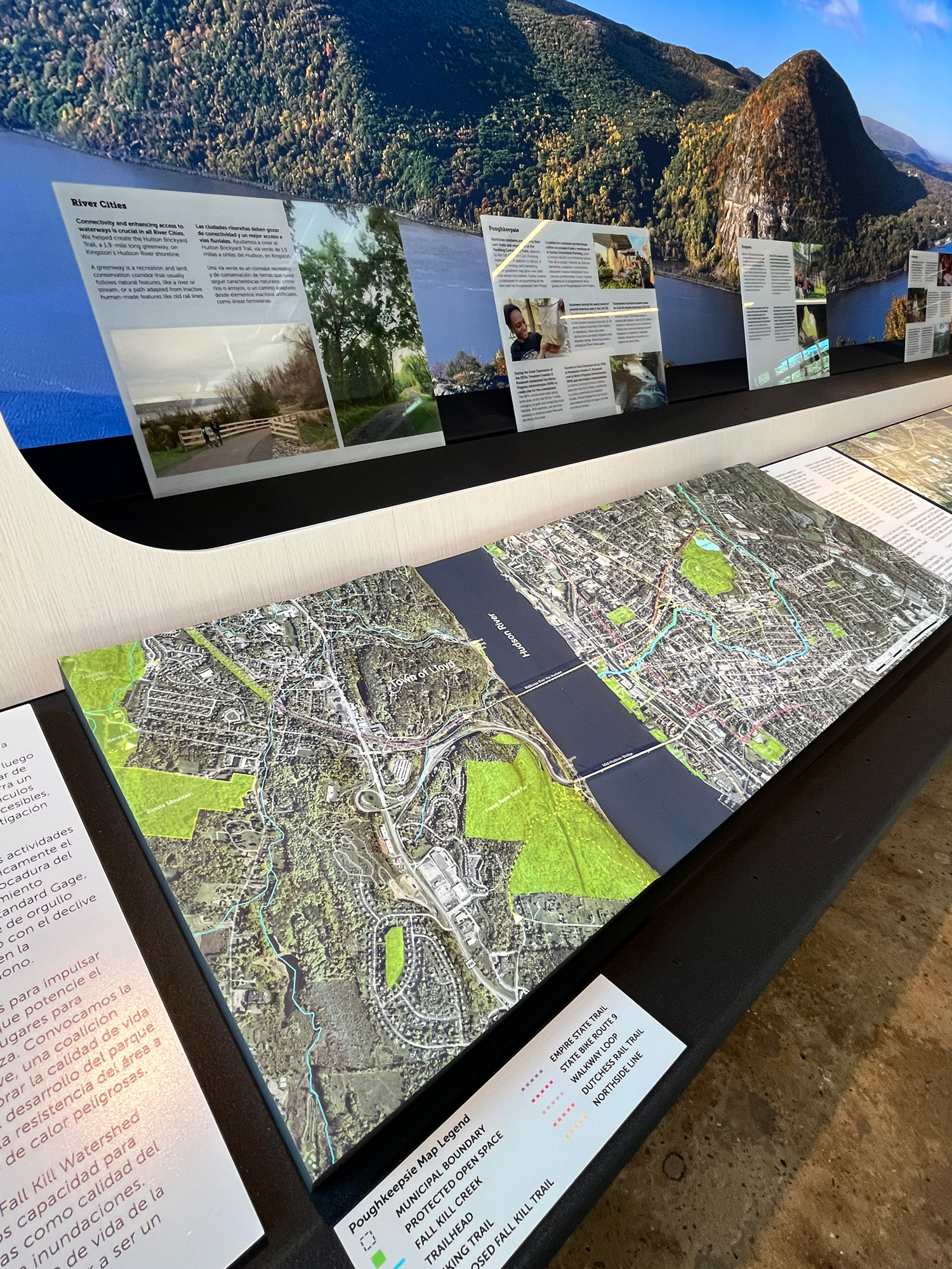
Custom 3D topographical model of Poughkeepsie, NY and the surrounding region, created for a museum display to give visitors an up-close view of the area's terrain.

This display shows school kids where water flows from different sources. The under-vinyl lighting is animated to show water flows.

7.5-foot-wide 3D topographical map of the ski areas in Park City, Utah.

72"×84" 3D terrain map of the Carmel River Watershed featuring satellite hybrid imagery, a waterproof surface, and an ADA-accessible 30-inch pedestal base.
Recessed illuminated 3D maps created for Zions Bank corporate offices, used as custom office wall decor throughout the workspace.
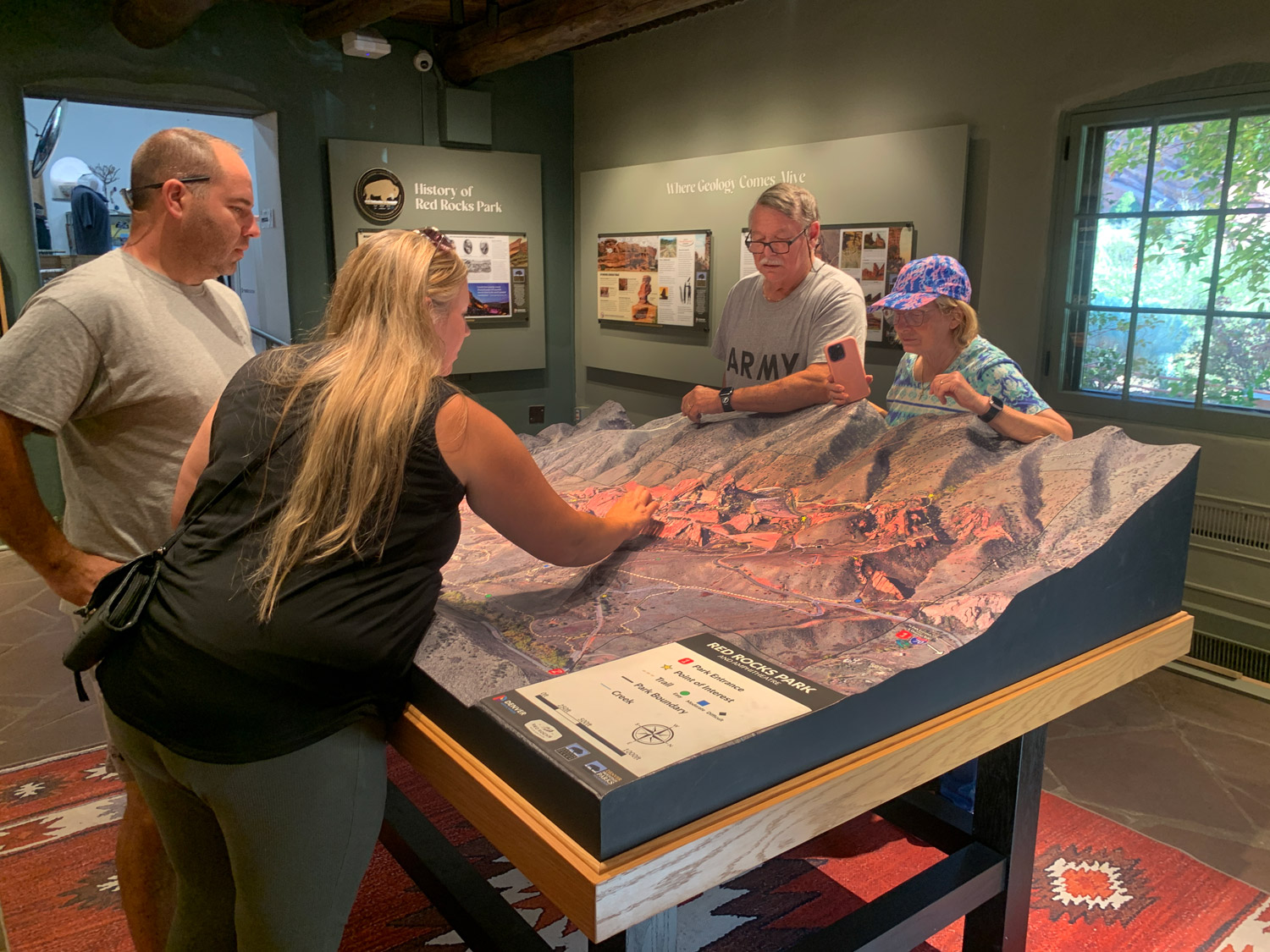
Custom 3D park map concept for the Red Rocks Visitor Center Trading Post Building, featuring trails, named rock formations, wildlife, and geologic history.
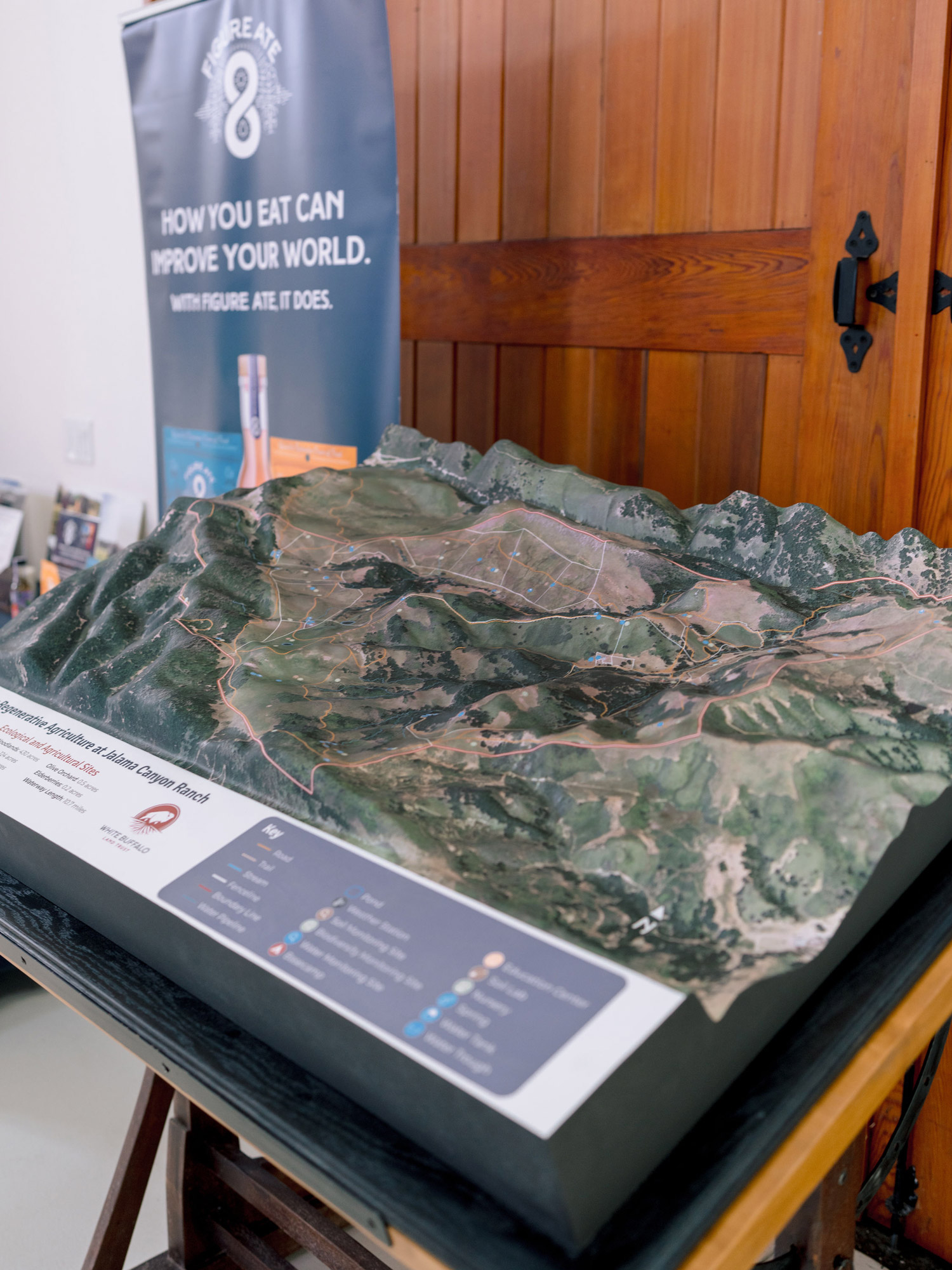
Custom 3D topographical map of Jalama Canyon Ranch created for the White Buffalo Land Trust in California, featuring detailed geological earth layers on all sides.

Custom 3D topographical map of the Winter Park resort area in Colorado, created as wall decor for the Zero Creek Gear House ski and snowboard shop.

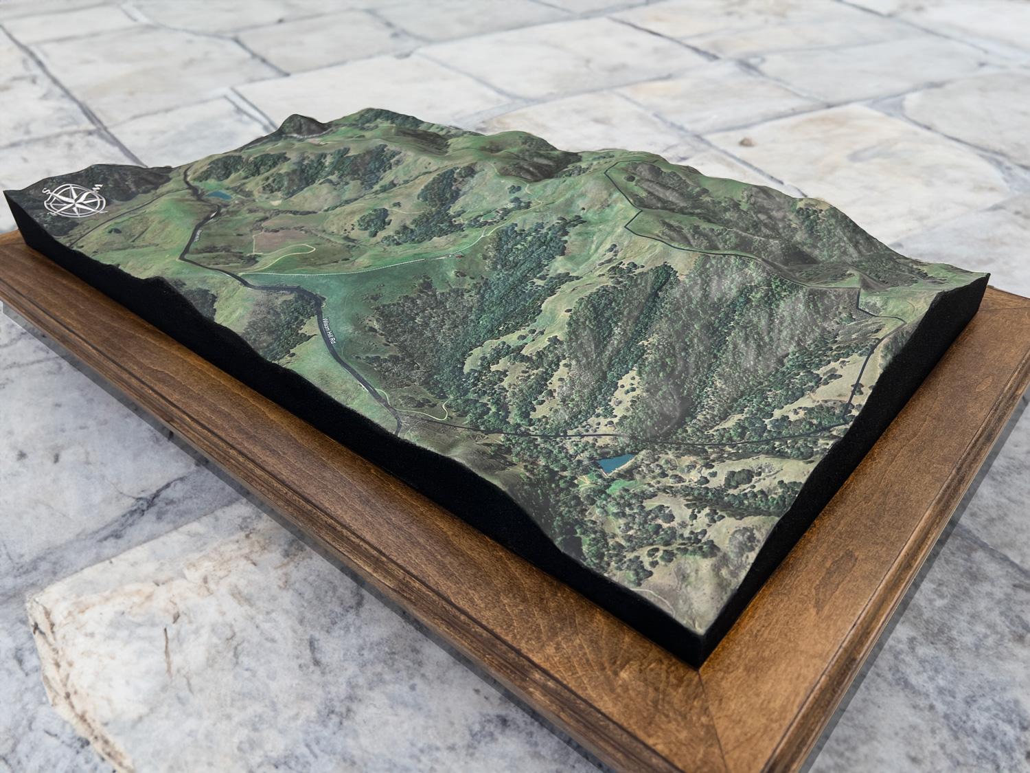
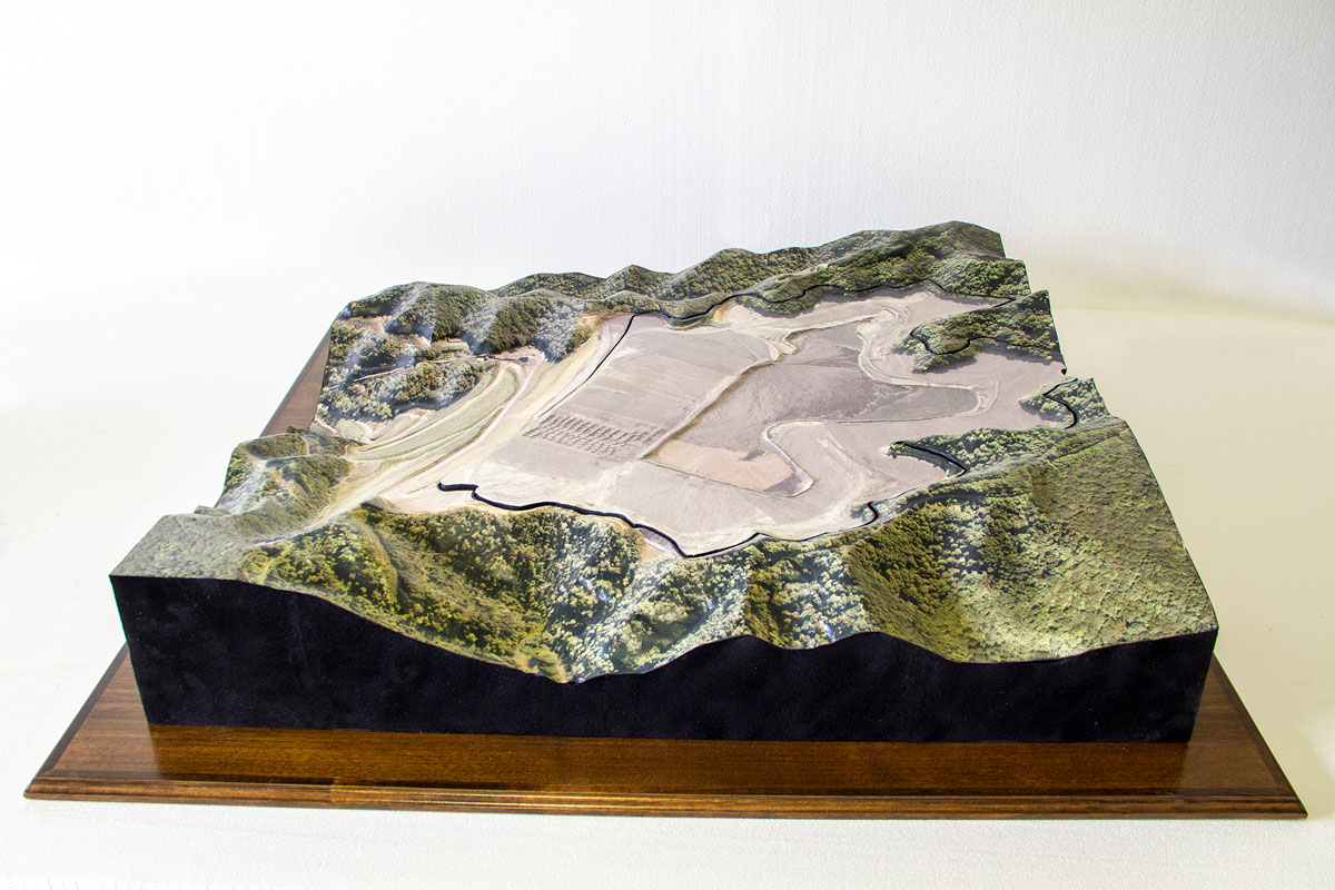
3D raised relief landscape model of the Motor Mill Historic Site in Northeast Iowa, showing the surrounding hillsides and river valley.
Custom 3D raised relief landscape model created for the Motor Mill Historic Site in Northeast Iowa, helping visitors visualize the site's surrounding terrain.
Custom hanging 3D topographical map of Great Smoky Mountains National Park, showcasing detailed terrain, textured waterways, and personalized surface details.
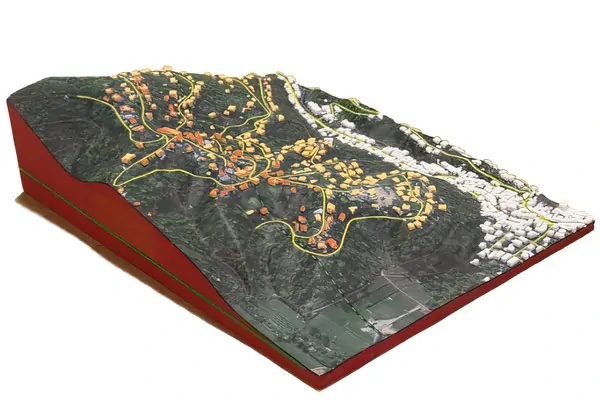
Custom 6' × 6' illuminated subdivision sales map with color-coded lots, lot numbers, interactive lighting controls, and a custom pedestal base.
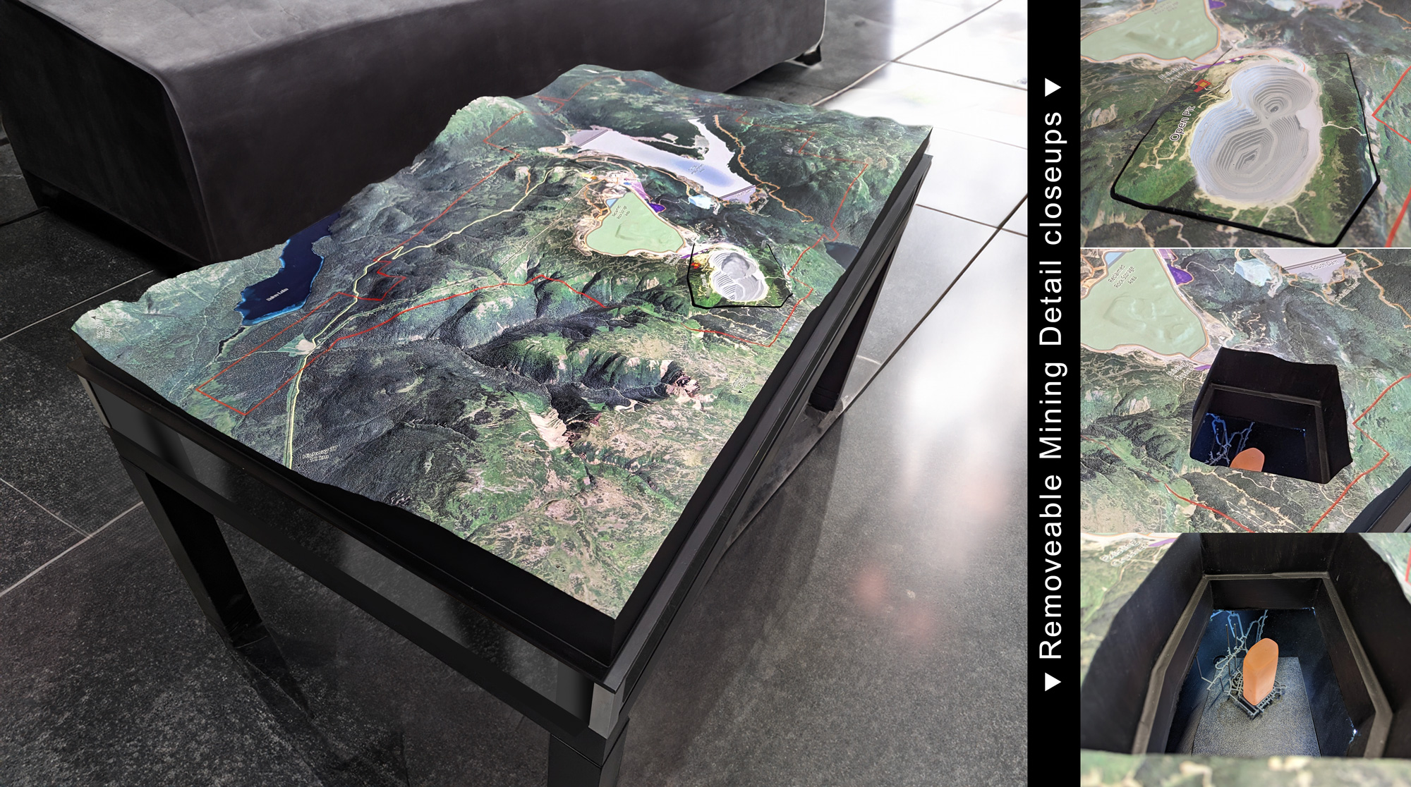
Expansive 60-inch by 37-inch 3D topographical model of a functioning mine, featuring a removable section, illuminated underground details, and transparent acrylic viewing windows.
Custom 2-foot by 3-foot 3D map of an estate spanning Pennsylvania and New Hampshire, commissioned as a personal gift for the estate's owner.
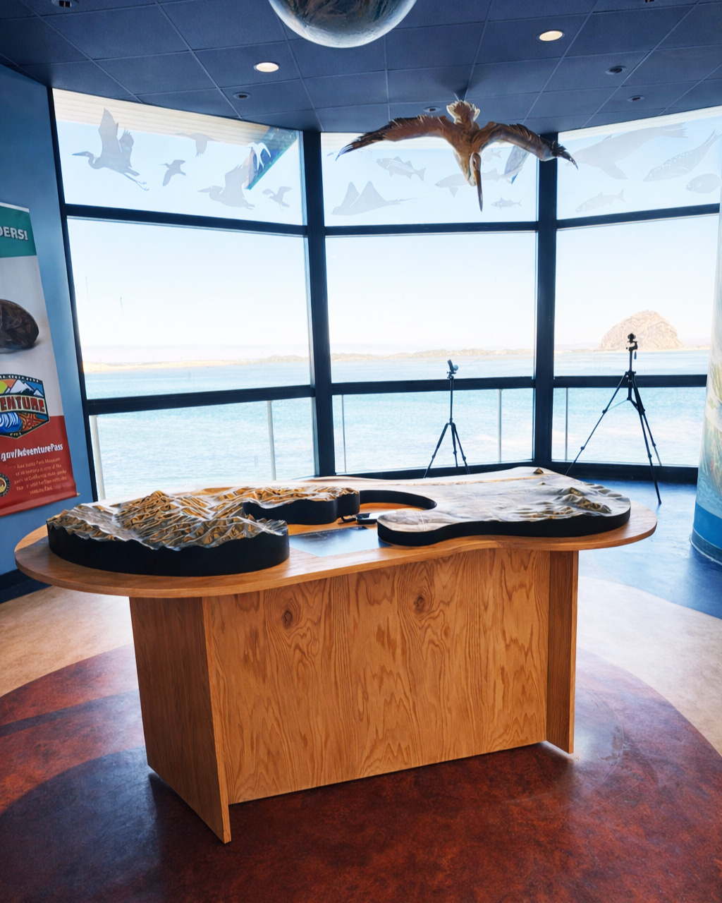
Raised-relief 3D map of the Morro Bay Estuary created as a centerpiece exhibit, featuring an immersive relief surface and custom ADA-accessible pedestal base.
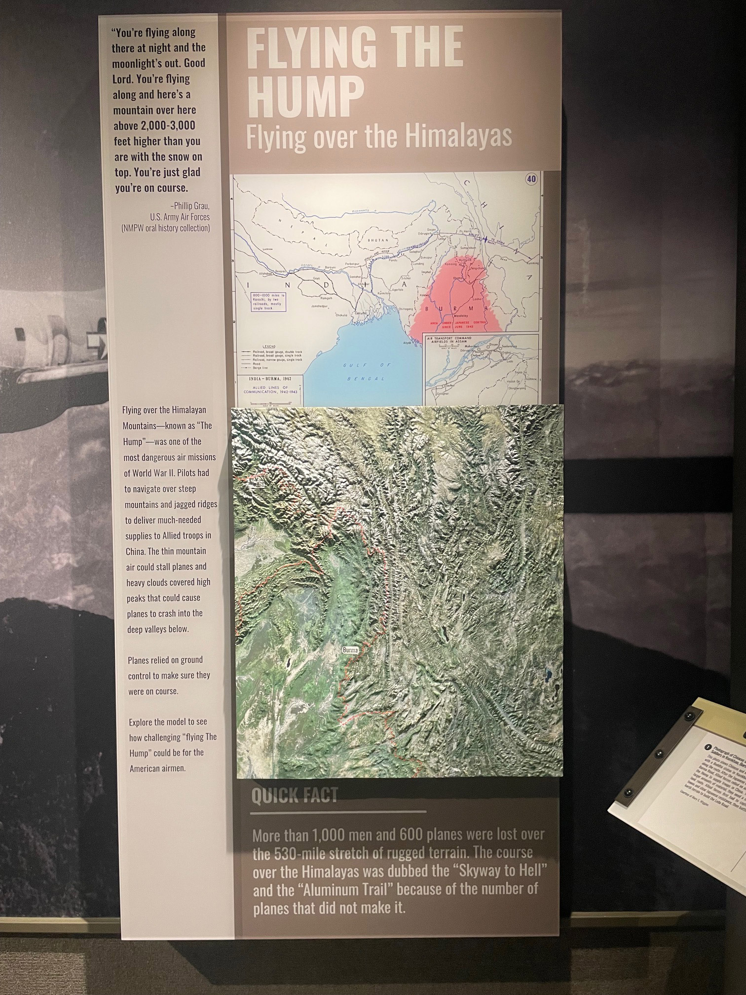
Custom 3D raised-relief historical map of The Hump over the Himalayas, created for the National Museum of the Pacific War.
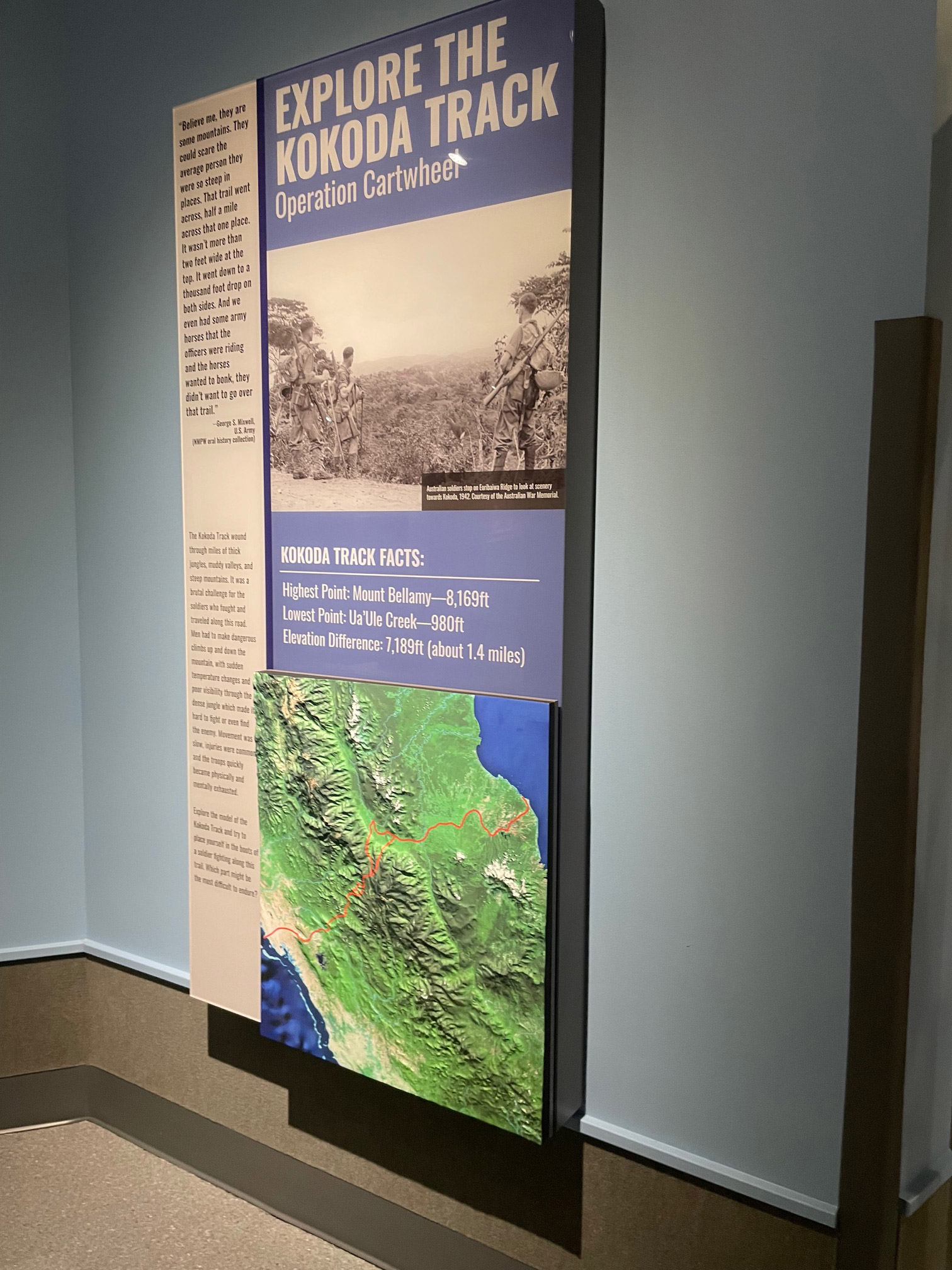
Custom 3D raised-relief historical map of the Kokoda Track, created for the National Museum of the Pacific War to give visitors an immersive, tactile way to explore history.
Custom 3D artwork designed for the Depths exhibition, exploring illuminated geological surfaces and transforming Earthly forms into a balance between reality and hyperreality.
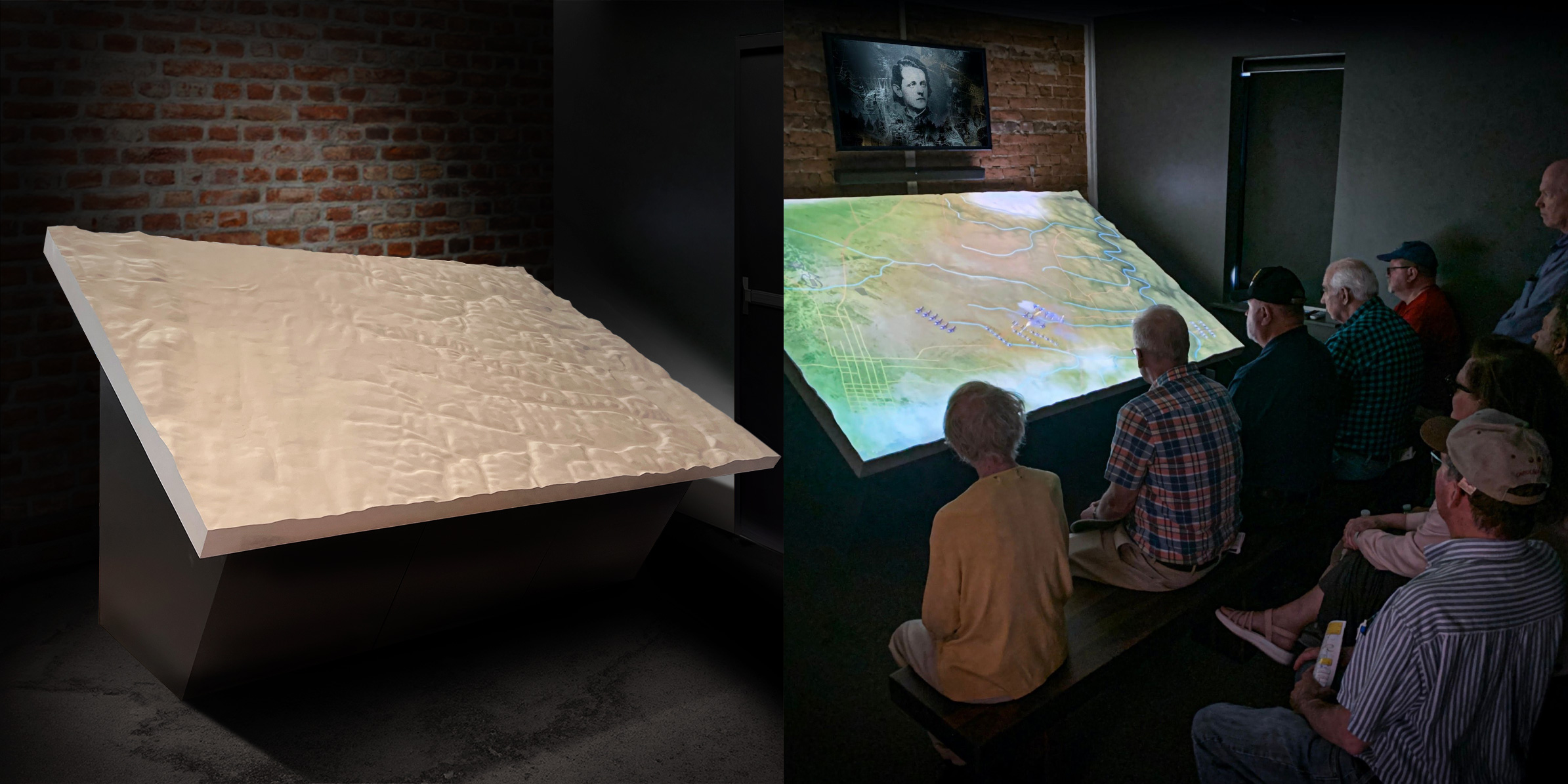
This experience depicts the site's infamous battle in sharp relief, featuring a bespoke 3D map of the region and cutting-edge projection mapping.
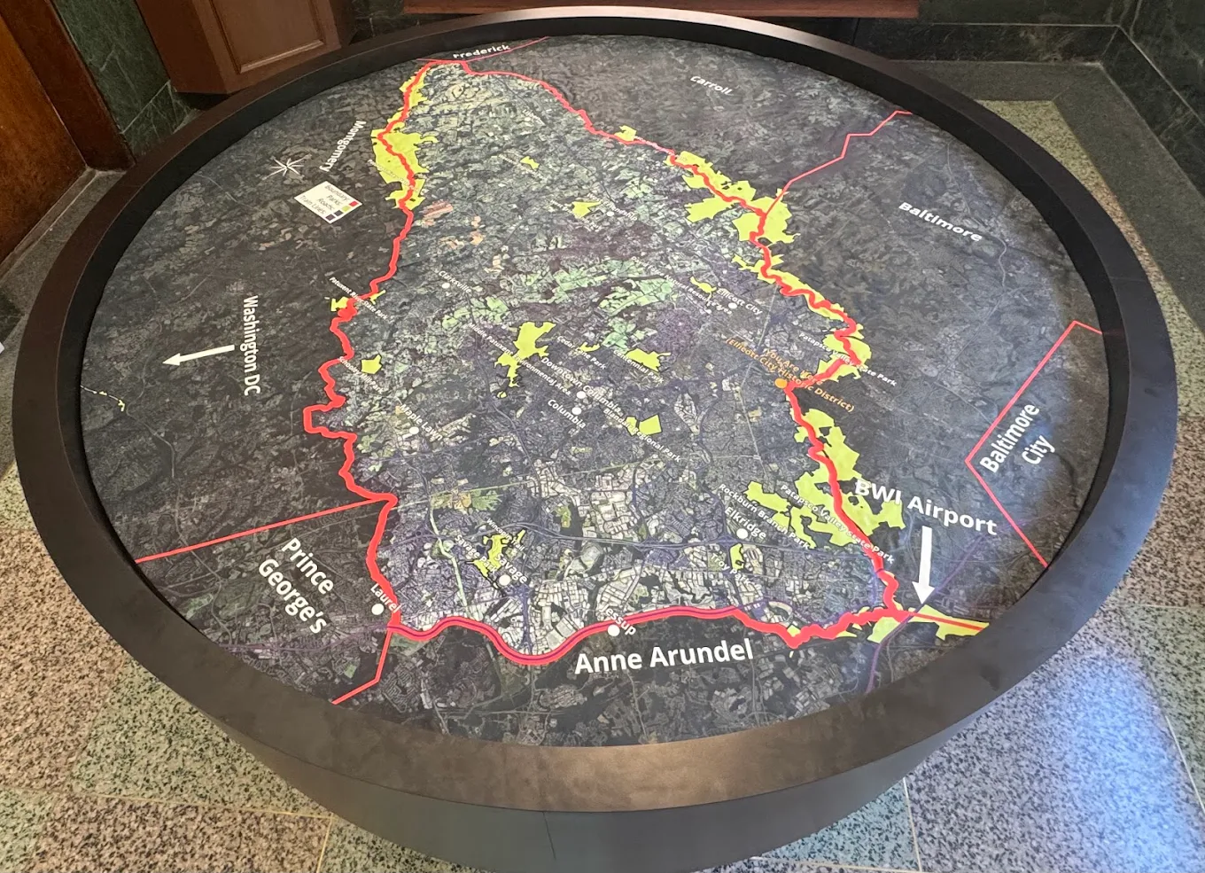
Nearly 5-foot-wide 3D map of Howard County, Maryland, created for the Welcome Center in Ellicott City, showing local terrain and landmarks in detail.

Custom 60-inch by 38-inch 3D map of the United States featuring custom graphics that highlight major highways.
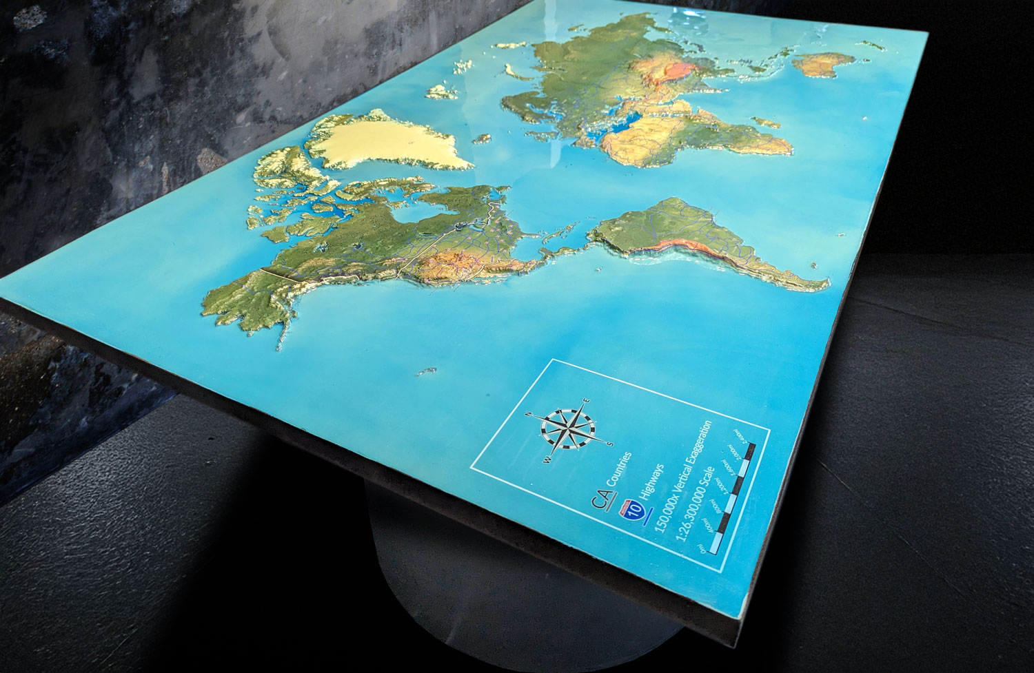
Custom 3D topographical world map designed to showcase global terrain along with major highways and transportation routes.

Custom 4-foot by 6-foot 3D topographical map created for the North Carolina Arboretum, in a white oak shadowbox base with a 30-inch-tall podium.

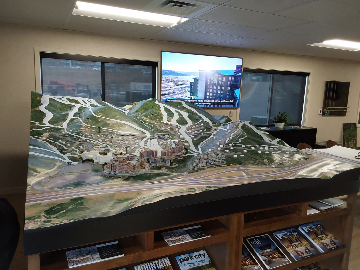
Custom 48-inch by 34-inch 3D topographical map of Deer Valley ski resort in Utah, showing the resort terrain and future development areas.
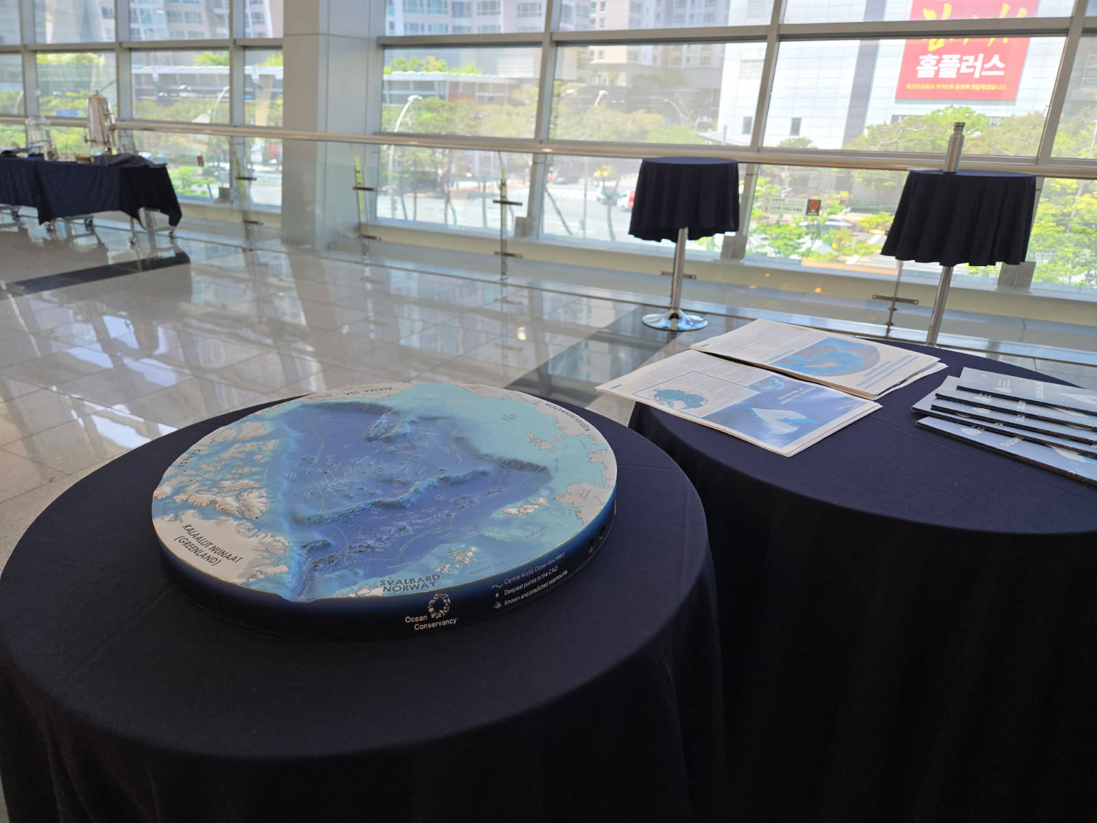
3D topographic map of the Arctic Ocean created to promote the Heart of the Arctic at the Our Ocean conference in Korea.
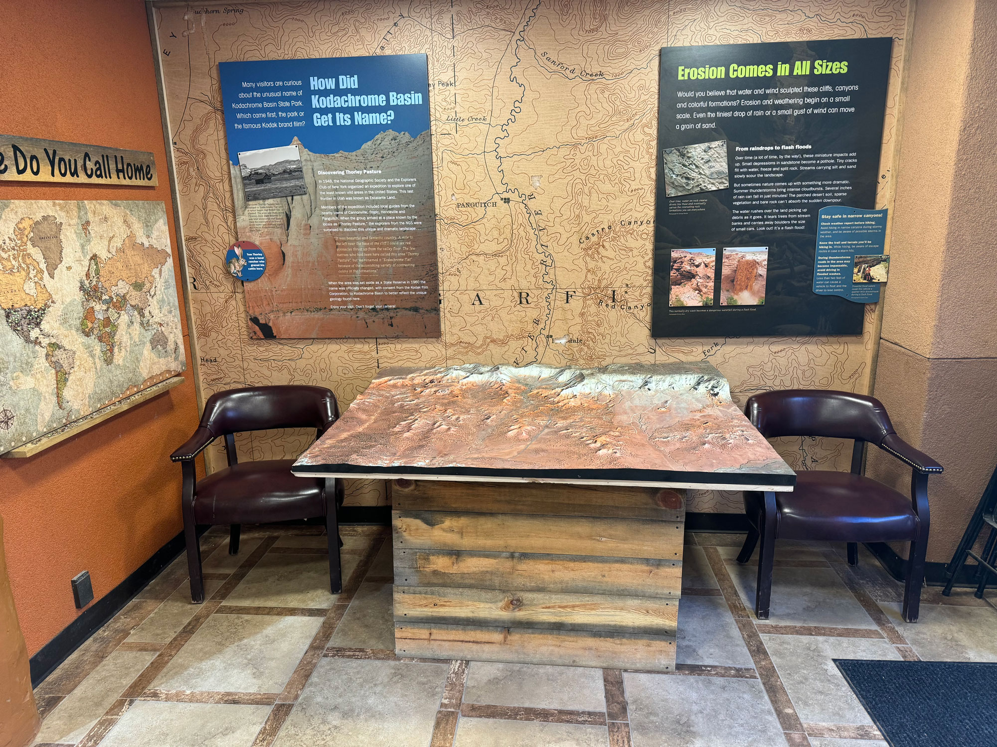
Custom 3D raised relief topography map of Kodachrome Basin State Park, created for the visitor center in Southern Utah to help visitors explore the park's terrain.

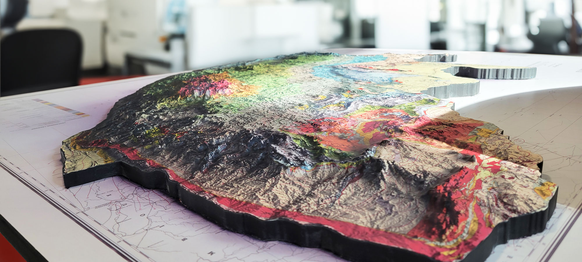
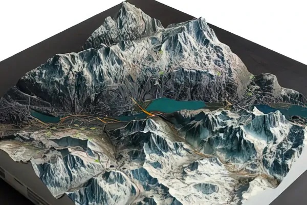
3D topography model closeup showing extreme elevation detail in a custom raised relief terrain map.
Six 3D raised relief maps of major U.S. National Parks, featuring imagery from official National Park Service maps, installed at the Parks Project Store in California.
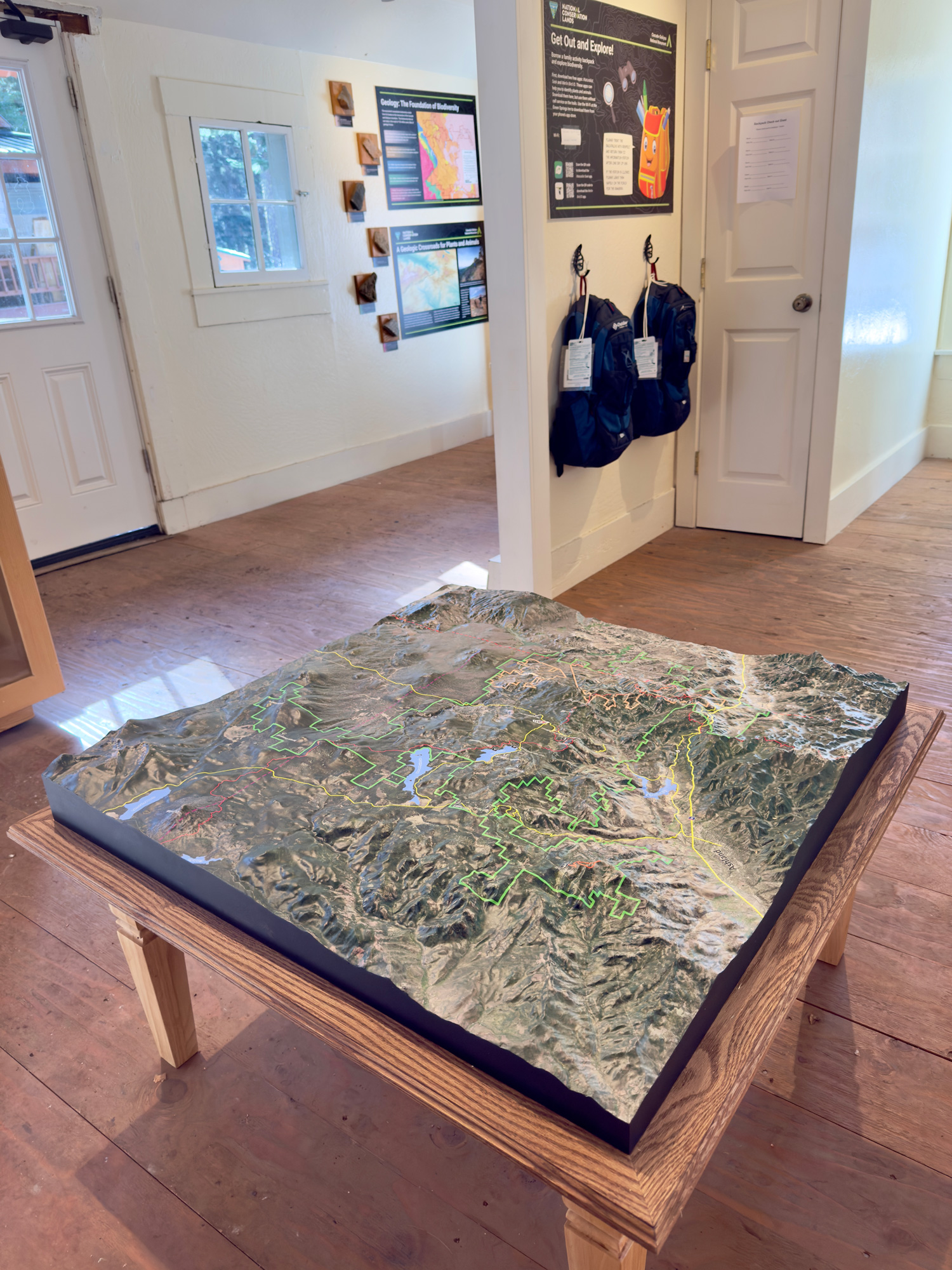
Custom 36-inch by 36-inch 3D topographical map of Cascade-Siskiyou National Monument, created for the Bureau of Land Management as a permanent indoor display.
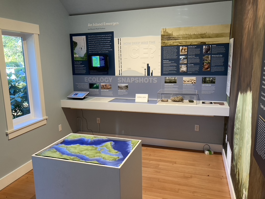
3D raised relief map of Vashon Island displayed at the main entrance of the Vashon-Maury Island Heritage Museum in Vashon, Washington.
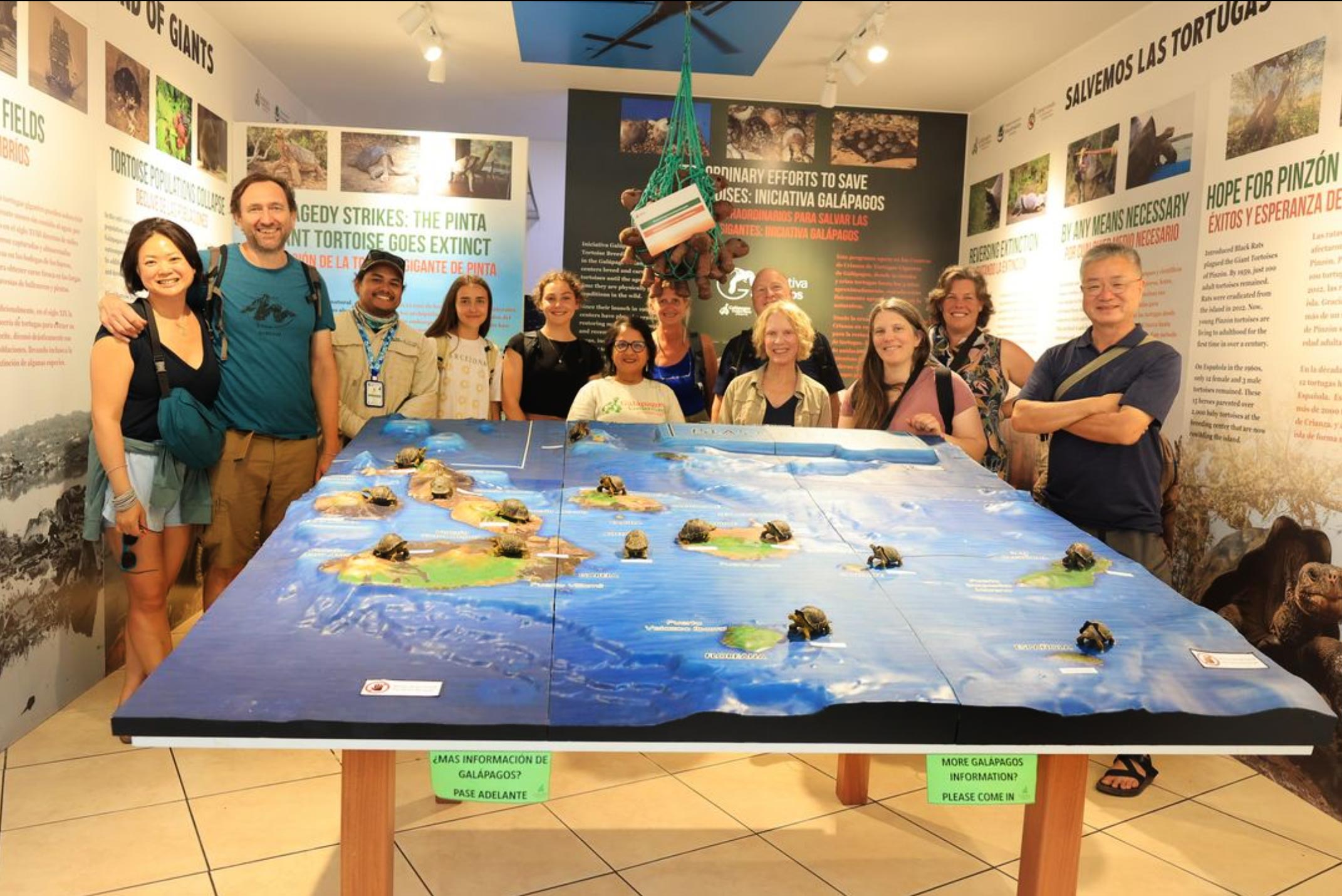
Custom 3D topographical map of the Galápagos Island chain created to support the Galápagos Conservancy's mission to protect and restore the islands.
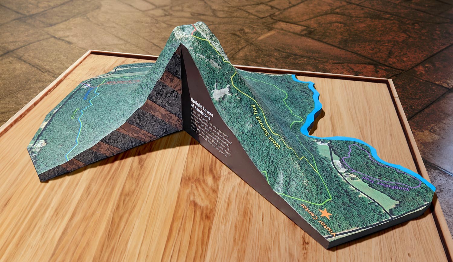
Permanent 3D map display at the Pinnacle Mountain State Park Visitor Center in Arkansas, featuring hiking trails, terrain contours, and a cutaway view of sandstone and shale layers.

Custom cutaway topographical map illustrating the above-ground and below-ground features of an undisclosed nuclear test site.

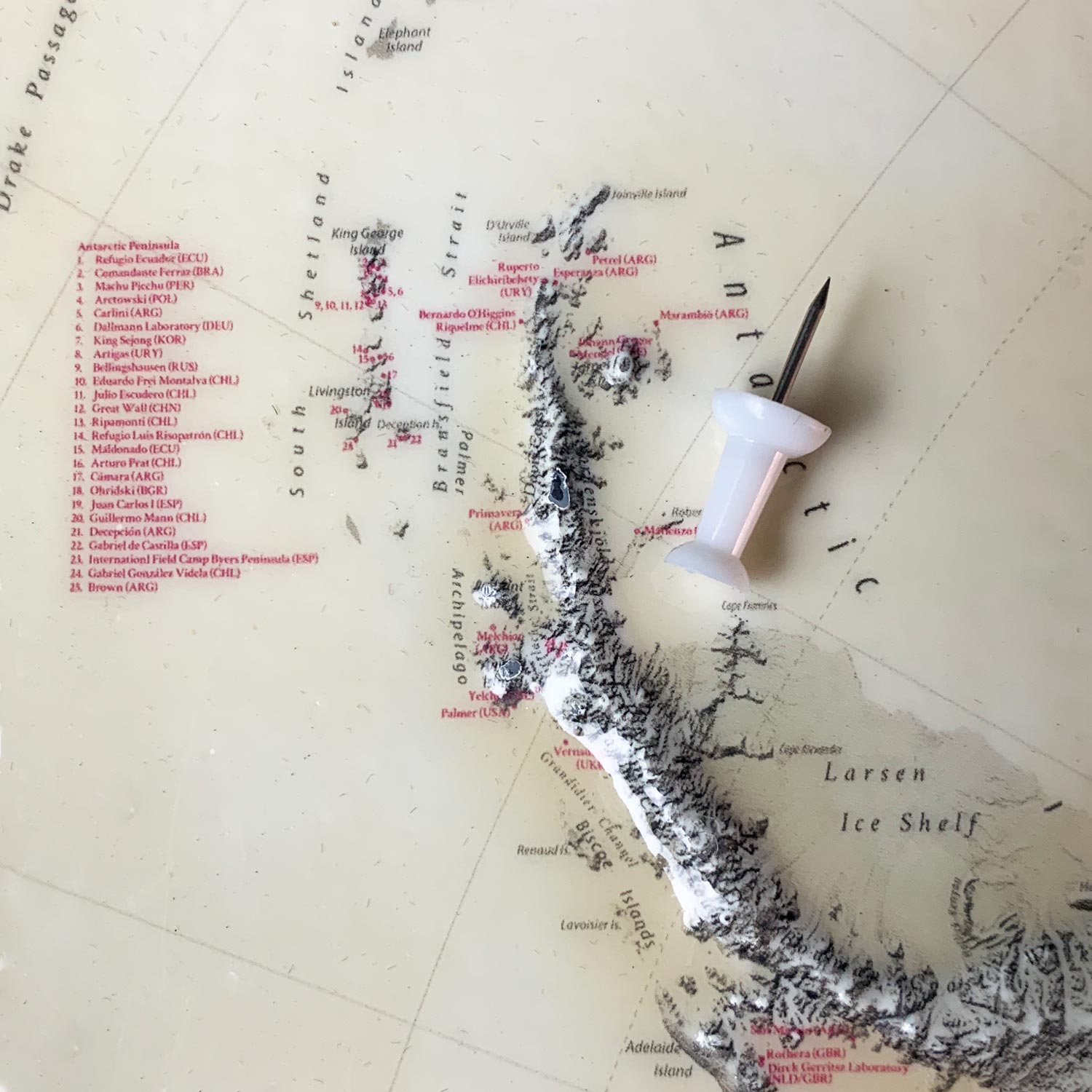
Custom tabletop 3D raised relief map of Antarctica measuring 26 inches by 22.5 inches, featuring fine terrain details and small text labels.
Closeup of a custom topographical raised relief map showing surface detail and terrain texture.
Custom 3D tactile map of the Escondido Creek Watershed created for the Escondido Creek Conservancy, showing how water flows through the watershed for student field trips.
Custom tabletop 3D topographical map created for Stubb's Vineyard, designed as a tasting room display in a compact 15.5-inch by 28-inch format.

Custom 3D raised relief map of private property near Sedona, Arizona, showing the surrounding buttes, Dry Creek Canyon, and Mogollon Rim terrain.
3D printing elevation details combined with high-resolution graphic printing showcasing fine detail over accurate topography of Southeast Alaska.

Custom 3D topographical map of the Yampa River Basin in Colorado, created for the Tread of Pioneers Museum to showcase the region's terrain and waterways.
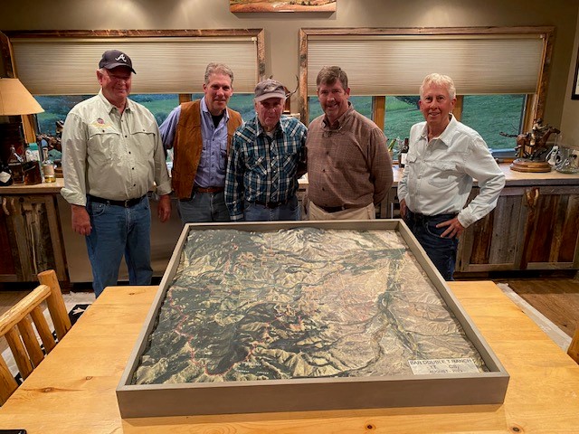
Custom 42-inch by 42-inch 3D topographical wall map of Bar Double T Ranch in Montana, featuring custom property labels and a shadowbox display.
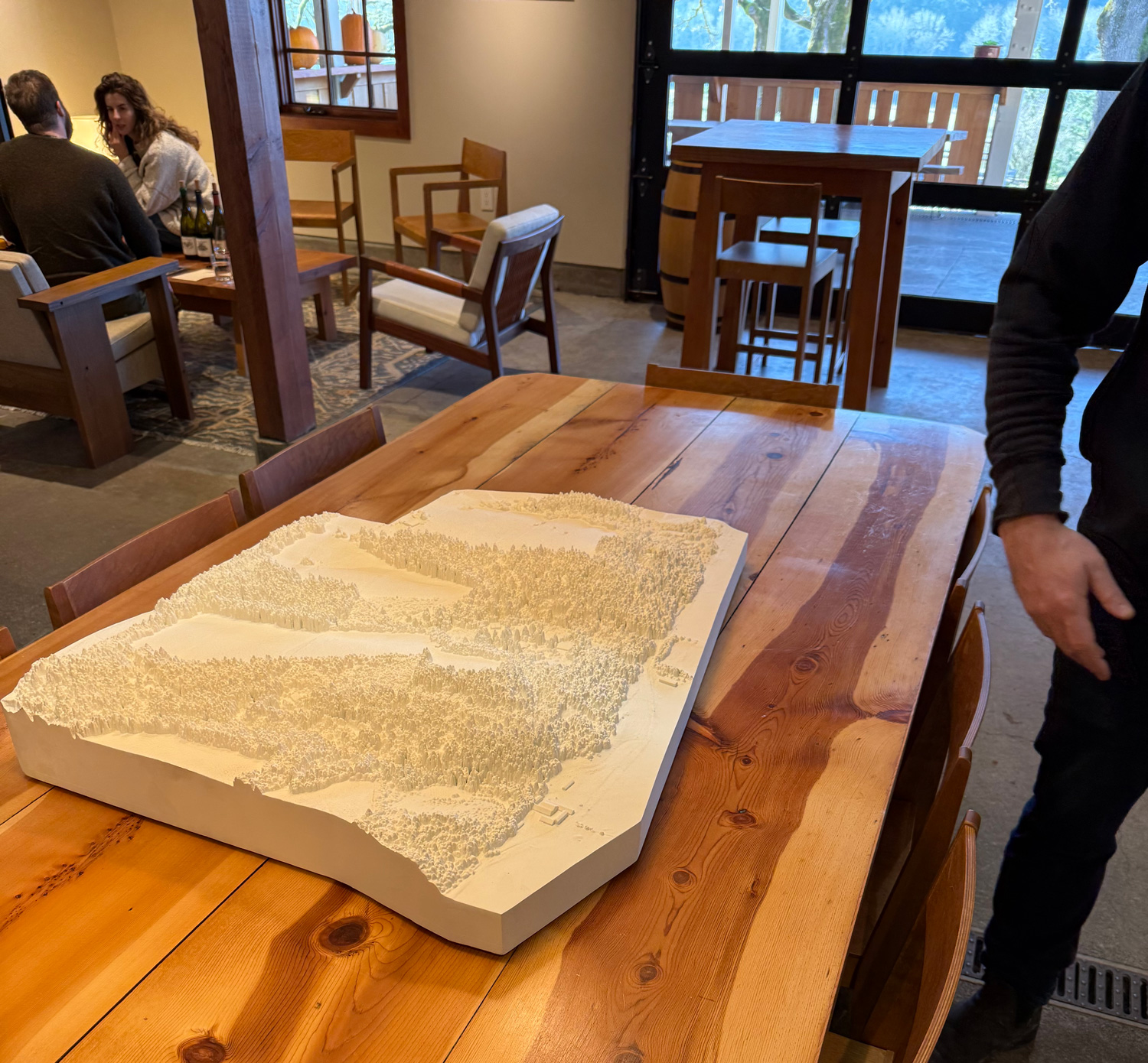
Custom 3D topographical model of Beaux Frères Winery in Oregon, created to mimic the look of plaster castings while offering a durable, stain-proof centerpiece for the tasting room.
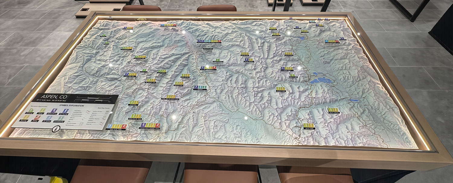
Custom 3D topographical map of the Aspen, Colorado landscape displayed in an LED-lit glass tabletop case at the Arc'teryx retail store.
Permanent 3D topographic display showcasing the Mississippi Driftless Area in detailed raised relief with a presentation-quality hardwood base.
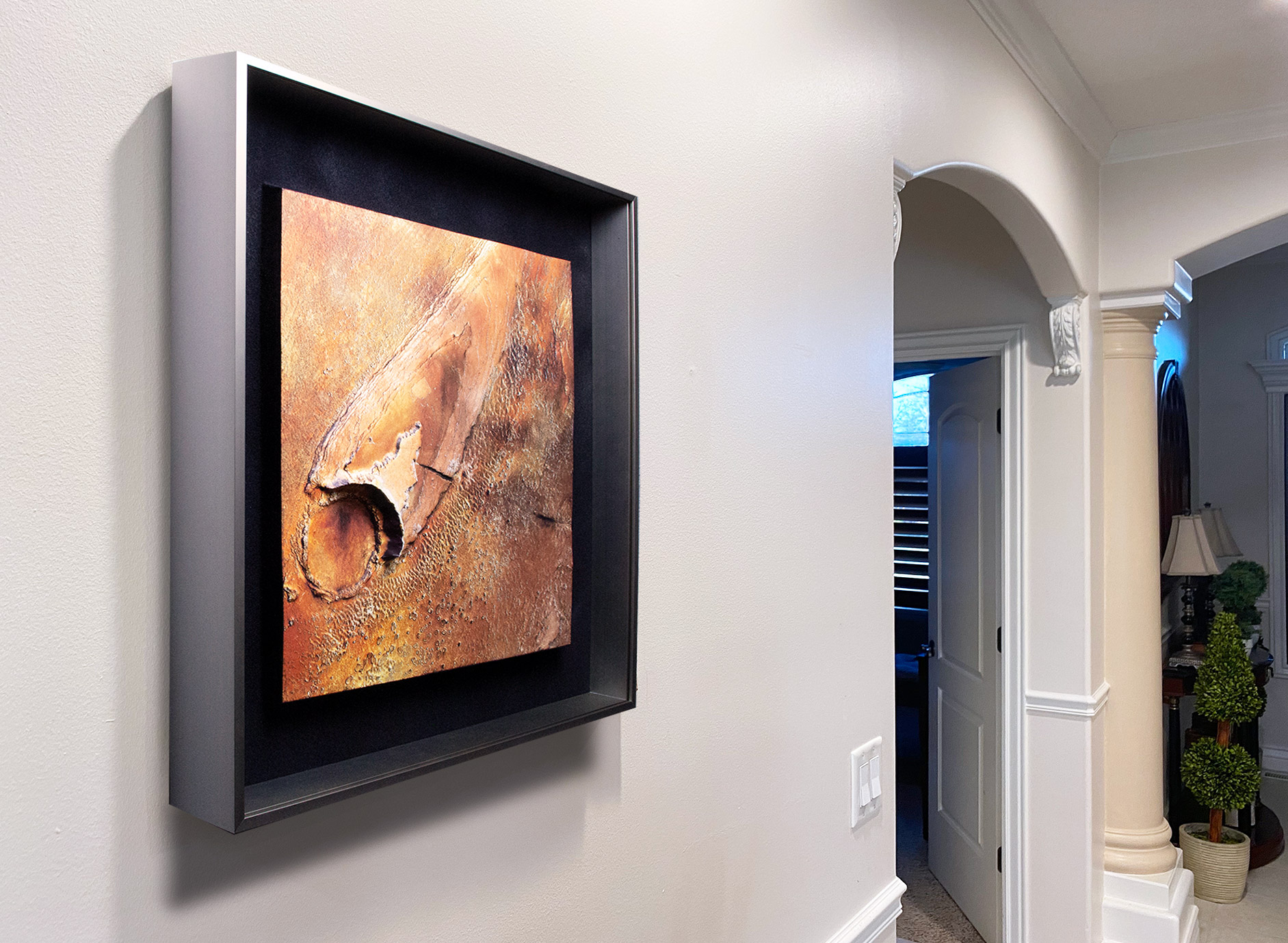
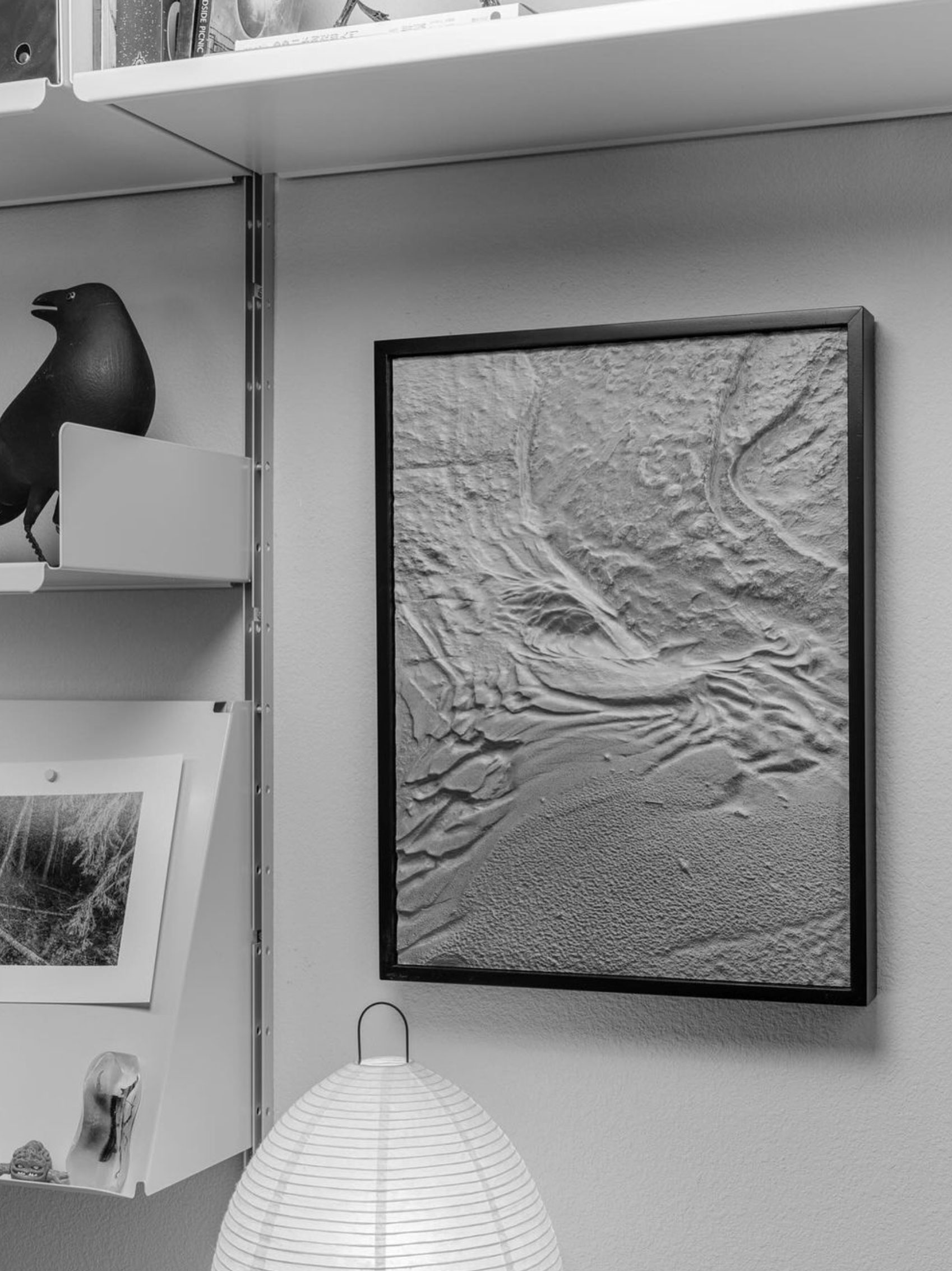
Custom 3D raised relief map of Athabasca Valles on Mars, created from satellite imagery and digital elevation model data to show the Martian landscape.
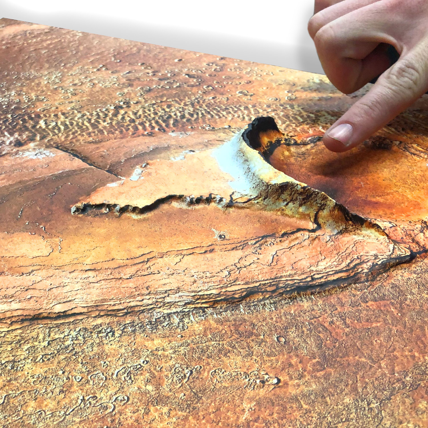
Custom 3D raised relief map of Athabasca Valles, Mars, created from satellite imagery and digital elevation data to bring the Martian landscape to life.
Custom 3D raised relief map of Valles Marineris on Mars, designed as striking home or office wall decor showcasing the planet's dramatic canyon landscape.
Custom 3D topography model showing extreme elevation detail, created for NOAA scientific display.
Custom outdoor 3D raised relief property map of Point Loma, California, created for a construction company as a 16.5-inch by 65-inch display.
Custom 3D raised relief map of a remote hunting area in the Idaho wilderness, detailed with trails and key points of interest across the landscape.

Custom 3D raised relief wall map of Cashes Valley in Georgia.
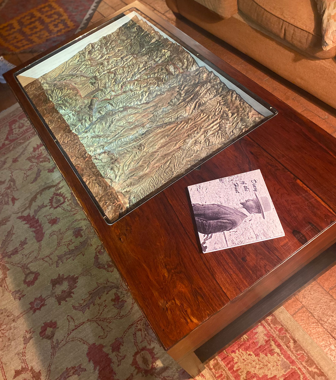
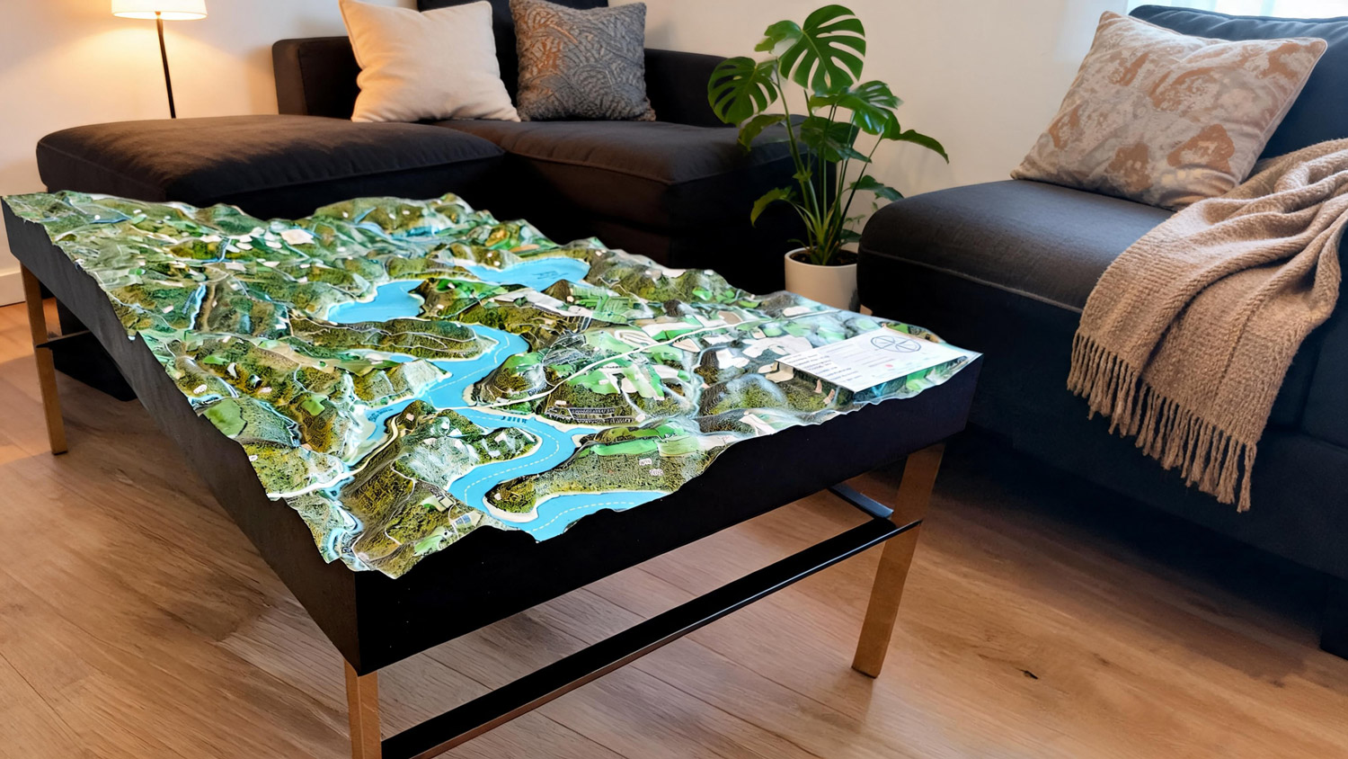
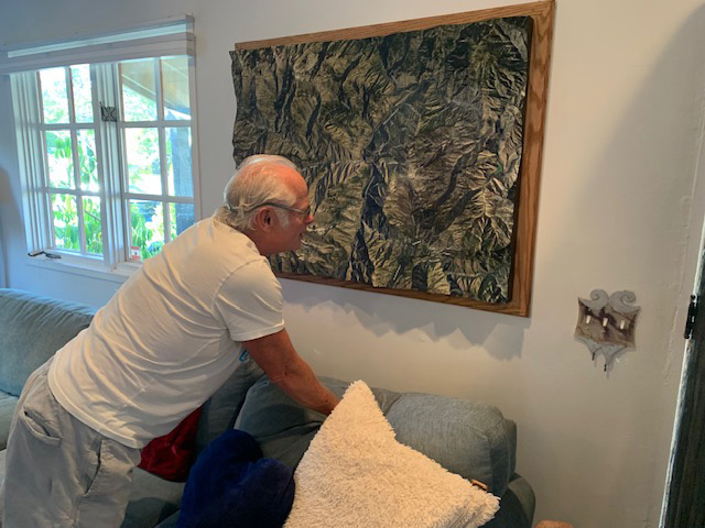
Custom 3D topography map of an area near Hillsboro, New Mexico, built into a customer-made coffee table highlighting a family hunting trail.
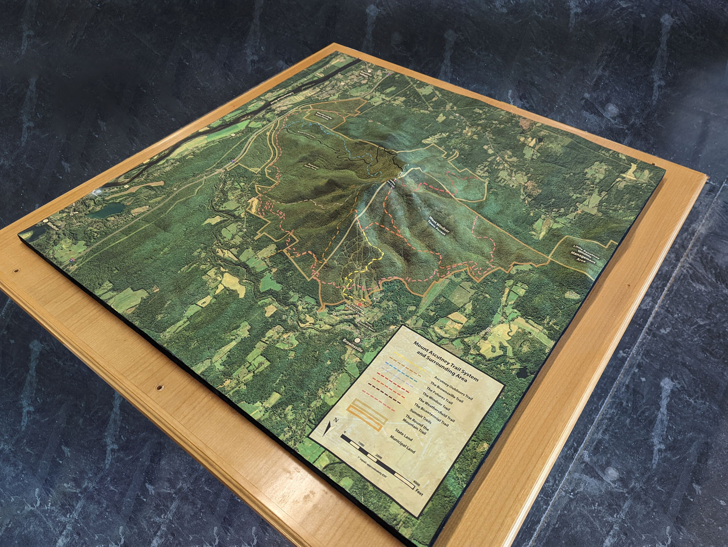
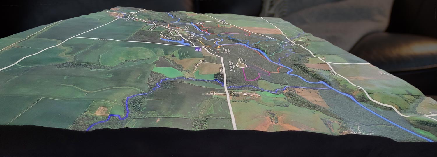
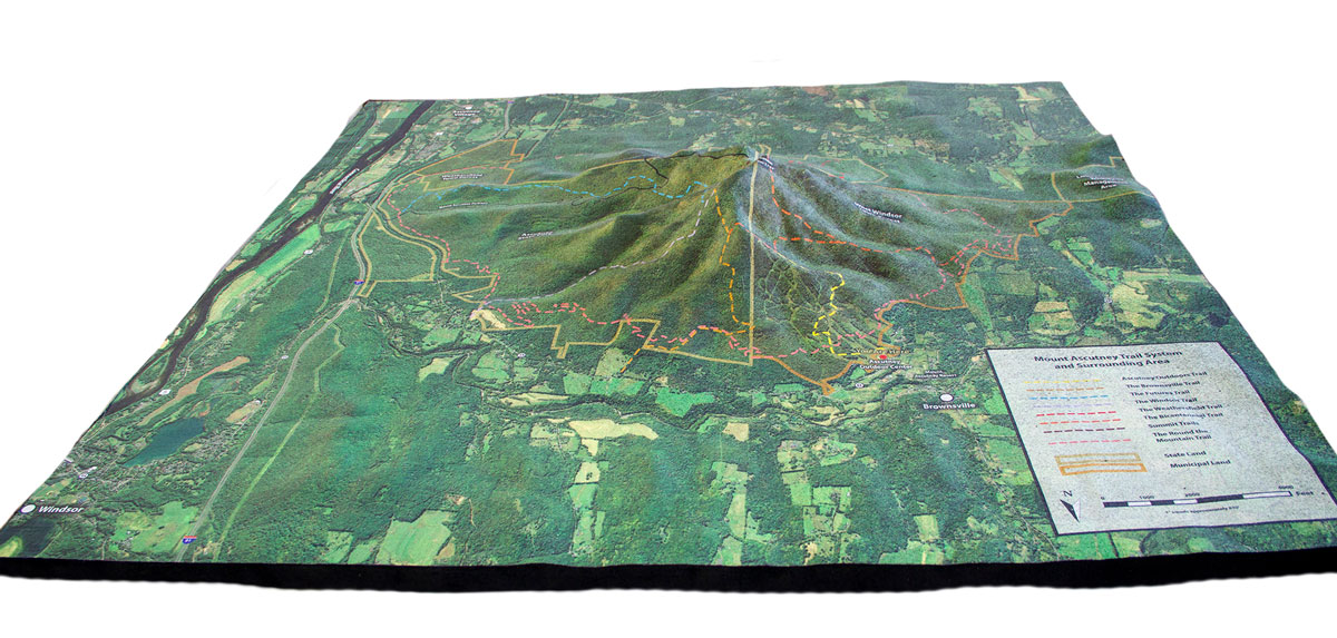
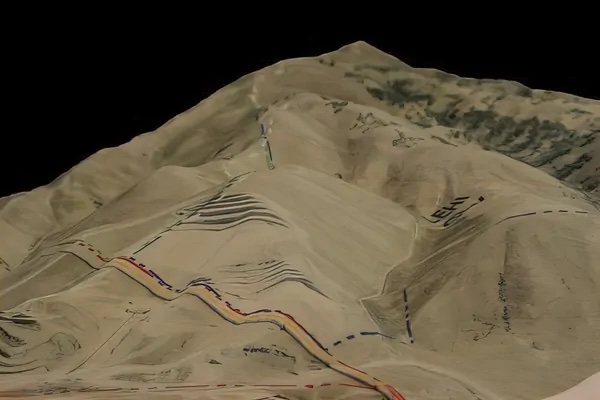
Custom 3D topography display of the Mount Ascutney trail system, showing terrain, elevation, and trail networks in raised relief.

Custom 44-inch by 44-inch 3D topography model created as a courtroom exhibit, designed to present terrain and site details in a clear physical format.
Custom 3D raised relief geological topography map of South Africa, created for a customer in the Netherlands using authentic elevation data.
Custom 3D property map created for NYSERDA, showing site terrain and property details in raised relief.
Custom 3D topographical model of Howard County, fabricated for educational display.
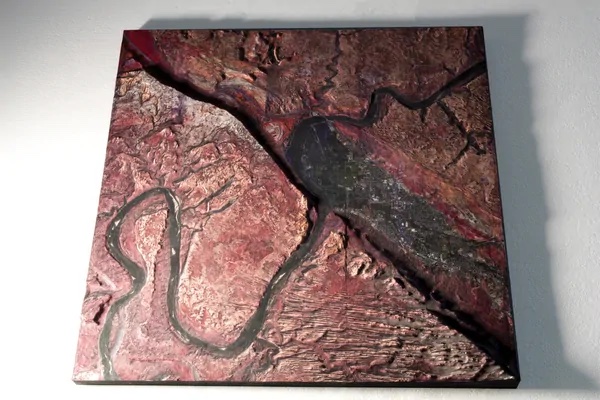
Custom 3D topographical terrain model with a striking red landscape surface finish.
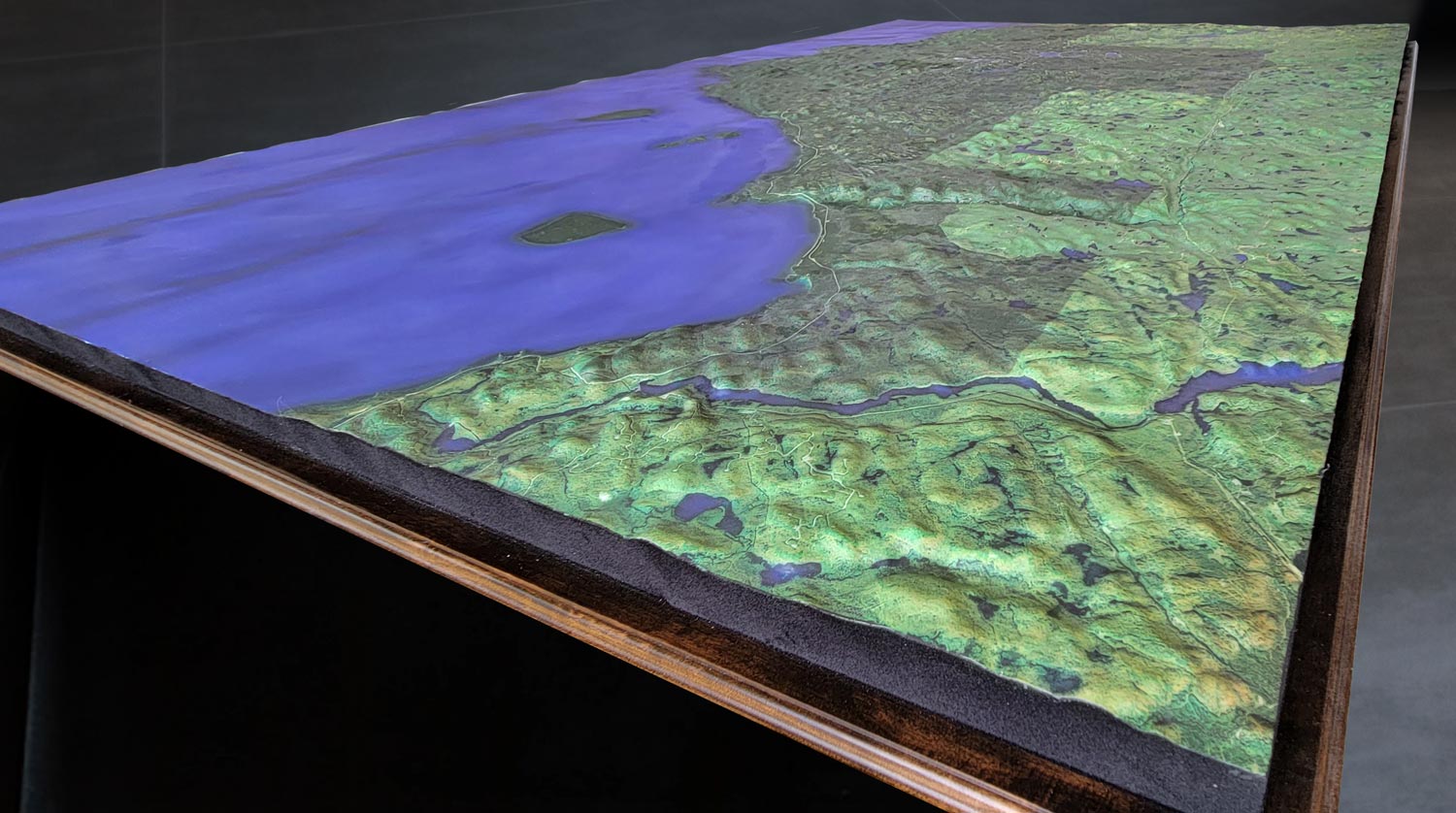
Custom 3D topographic map of Lake Superior, capturing the lake's basin, shoreline, and surrounding terrain.

3D Topography of Bent Creek Watershed in North Carolina. Measures 6'×4' with a White Oak shadowbox base and a 30-inch-tall podium.
Permanent outdoor 3D watershed map created for a landscape architecture company display area, showing terrain, waterways, and watershed features in raised relief.
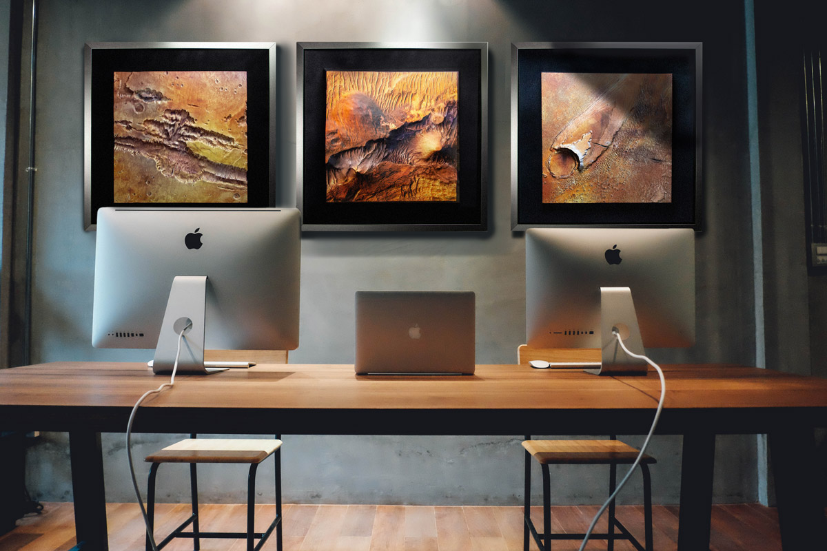
Custom 3D raised relief map of Mars landscapes designed as striking office wall decor, built from satellite imagery and elevation data.
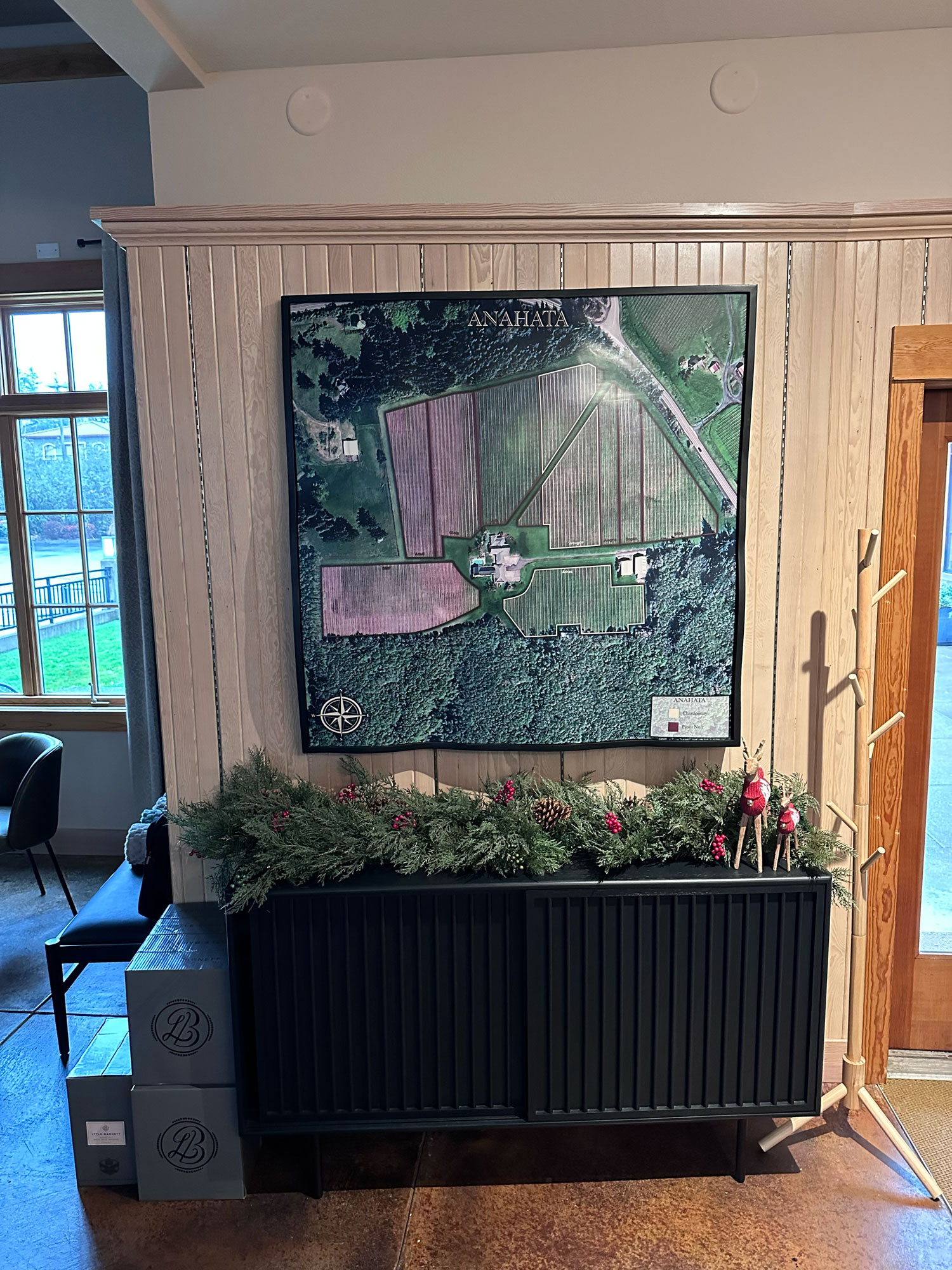
Two 3D topographical aerial view maps created for the AtTheJoy vineyard in Oregon, displayed permanently in the tasting rooms with custom contour-following shadowbox bases.

Custom 3D topographical map of the Hairecienda Ranch, showing property terrain in raised relief.
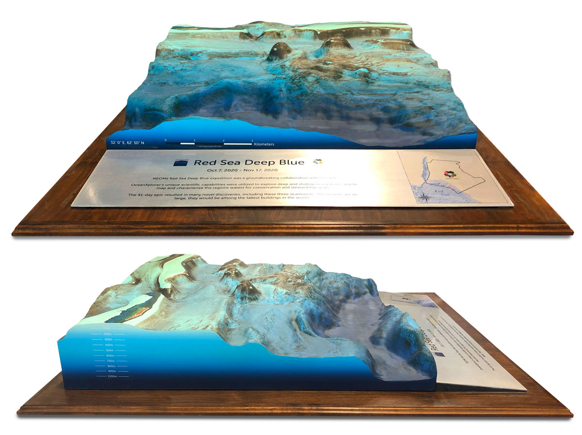
Commemorative 3D tabletop topography of NEOM's Red Sea Deep Blue region, representing OceanXplorer's exploration of deep and shallow marine ecosystems.
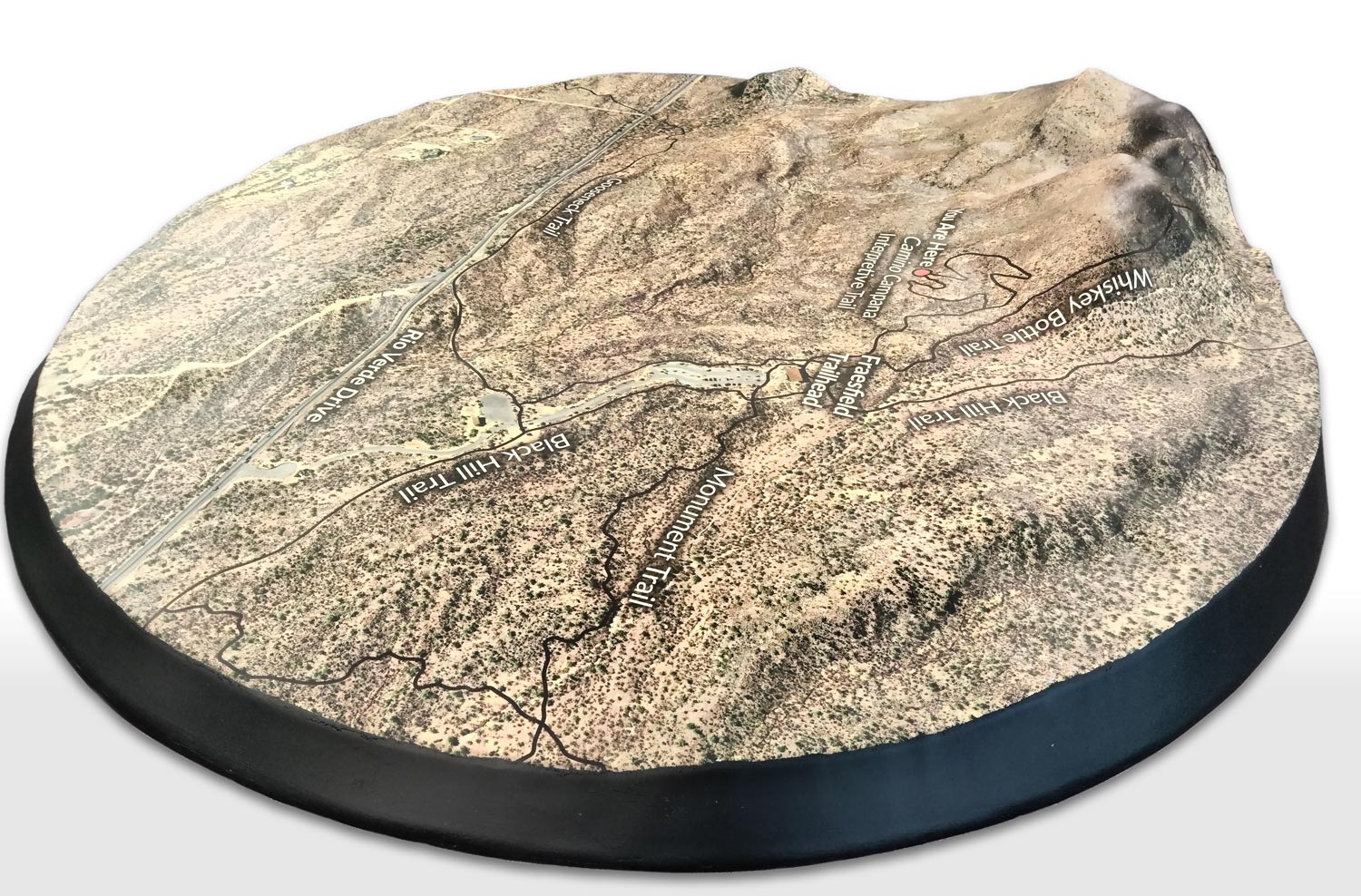
Custom 3D topography of the Fraesfield trail in Arizona, showing terrain and trail features in raised relief.
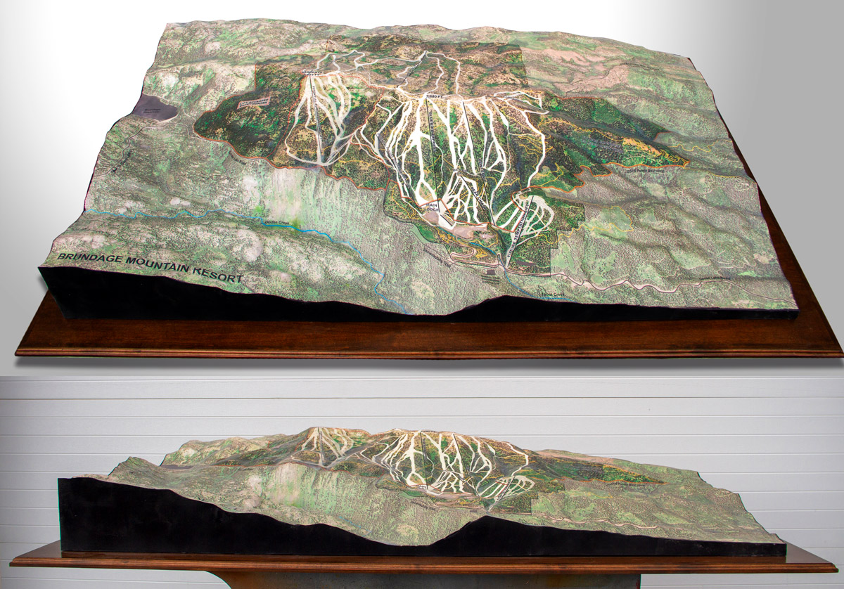
Custom 3D topographical model of Brundage Mountain Resort, showing the mountain terrain, runs, and surrounding landscape.

Wall-mounted 3D printed topography map created for the lobby of a new hotel resort in Switzerland, with a custom legend and 3-inch-tall shadowbox frame.
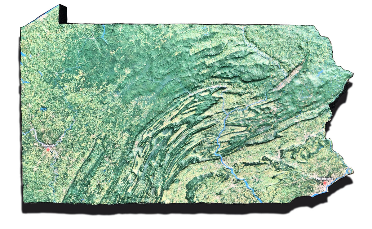
Custom 3D topography of the State of Pennsylvania, showing terrain features, mountain ranges, and valleys in raised relief.
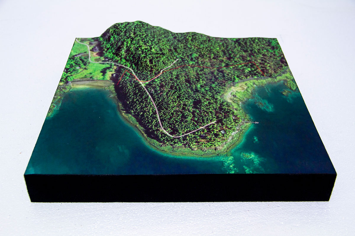
Custom 3D topographical model of an island, showing terrain features and elevation in raised relief.
Custom 3D topographical map showing island terrain in raised relief.
Custom 3D topographic map of the Allerton area, created for display in a museum or visitor center setting.
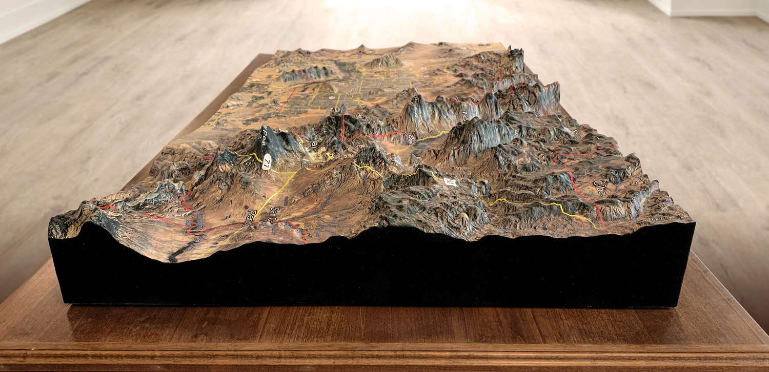
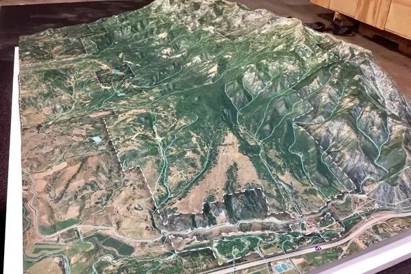
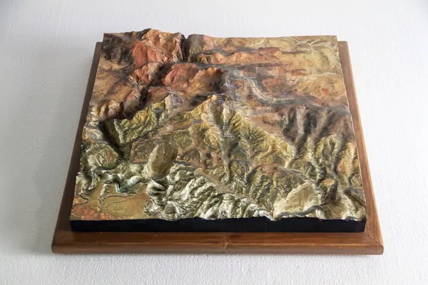
Custom 3D topographical model of a mountain range, showing elevation and terrain in raised relief.

Custom 3D topographical map of a Montana ranch watershed, showing terrain, waterways, and property boundaries in raised relief.
Custom 3D topographical map of Skull Canyon Zipline featuring satellite-view graphics, terrain elevations, and trails in a 27-inch by 27-inch hardwood-base display.
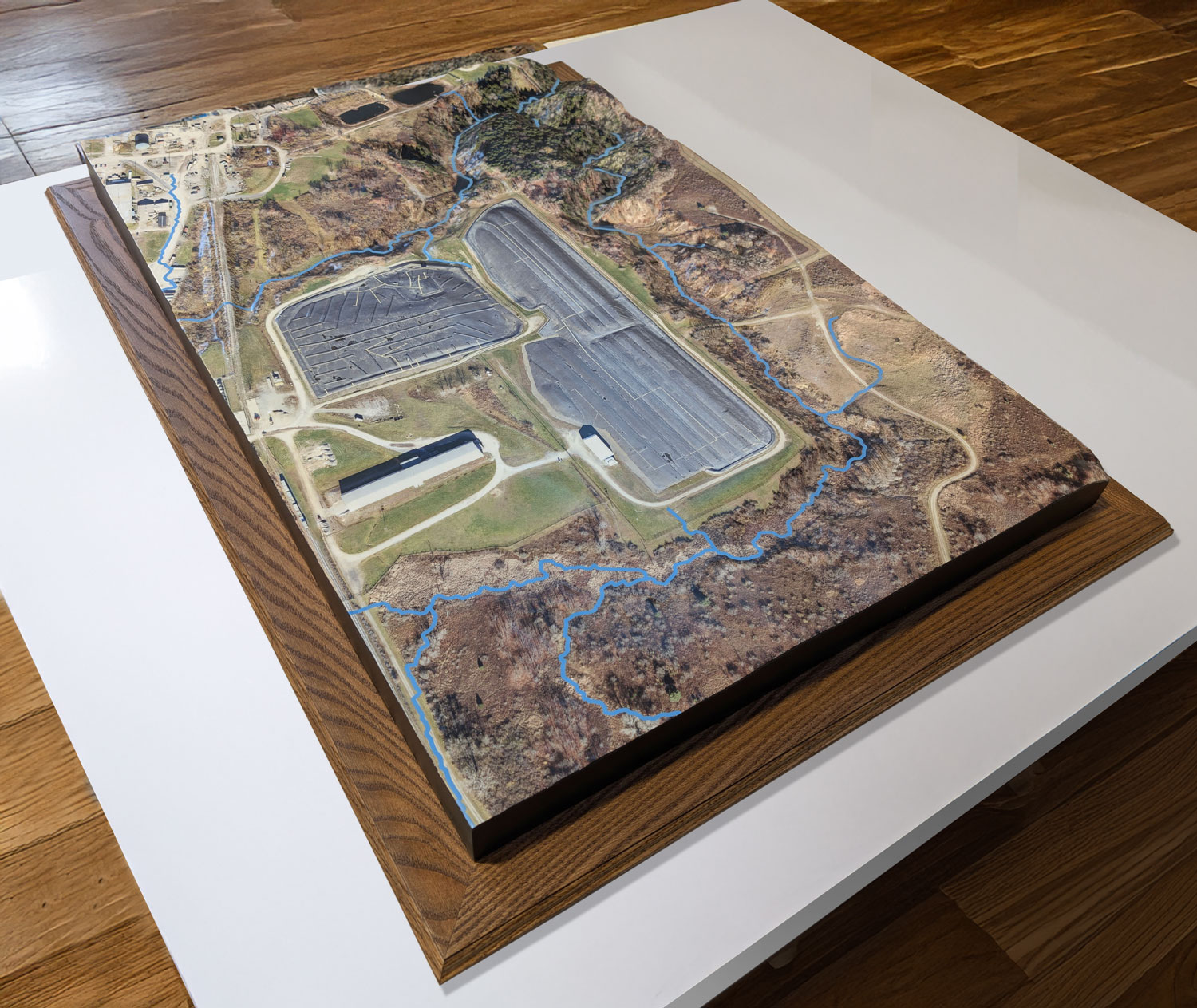
Custom topographical model used for road and infrastructure planning, showing terrain and proposed development.

Custom 3D topography map of a watershed range, showing drainage features, terrain, and water flow patterns.
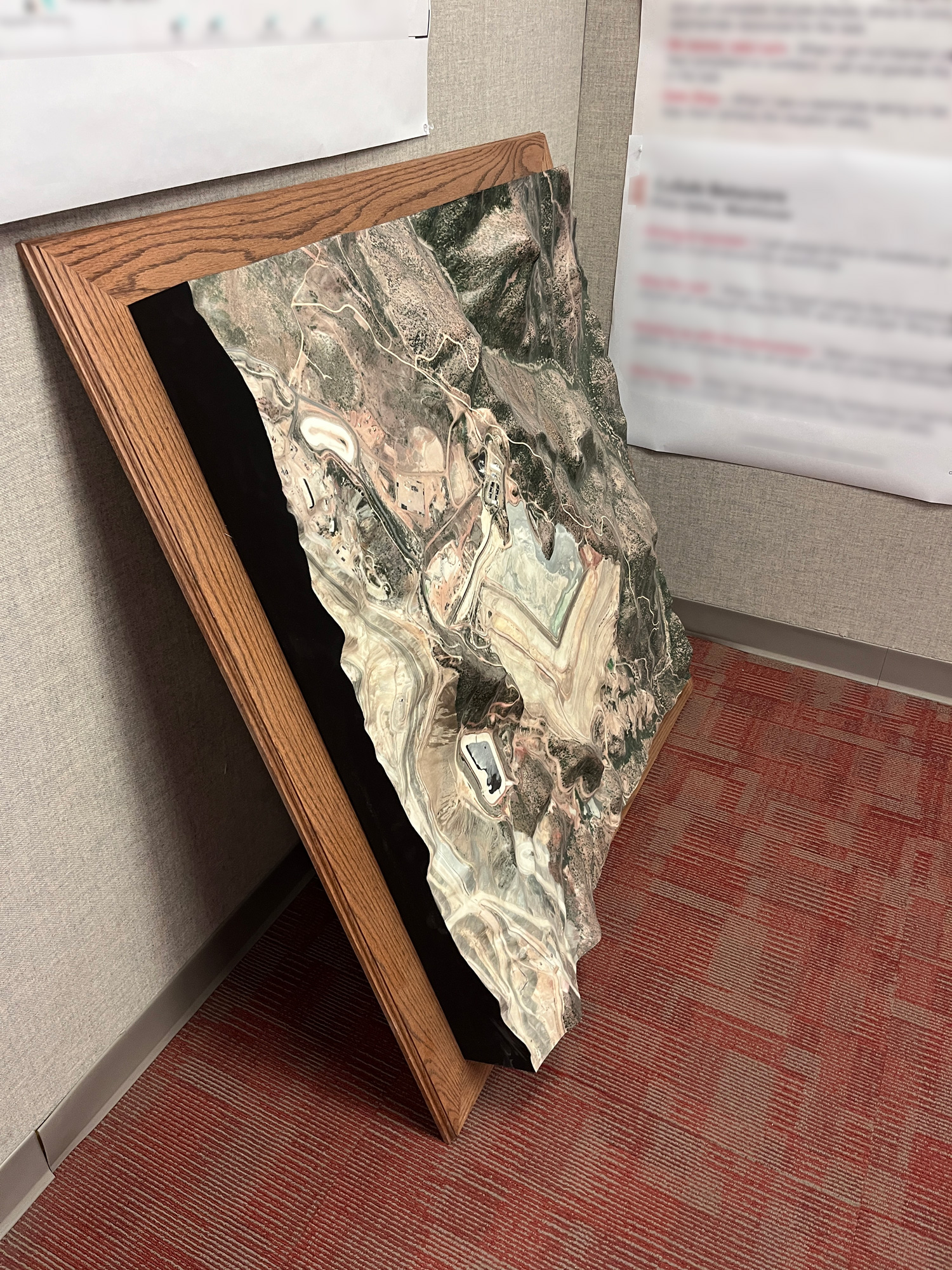
Custom 3D topographic map of the Capstone Mining Pinto Valley property, used to highlight a new road built for a community event.
Custom 3D topographical model of a neighborhood area, showing terrain and street layout in raised relief.
Custom 3D topographical terrain model fabricated by WhiteClouds.
Custom 3D raised relief topographical map fabricated by WhiteClouds.
Custom 3D topographical terrain display fabricated by WhiteClouds.
Detailed view of a custom 3D printed topographical terrain model fabricated by WhiteClouds.
Custom 3D topographical model showing terrain features in raised relief.
Custom 3D topographical map of Big Sky, Montana, showing the mountain terrain and ski area landscape.

Custom 3D topographical map of a California watershed, showing drainage features and terrain in raised relief.
Custom 3D topography terrain model created for a planning firm, showing site features and terrain in raised relief.
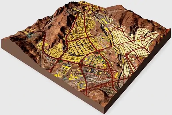
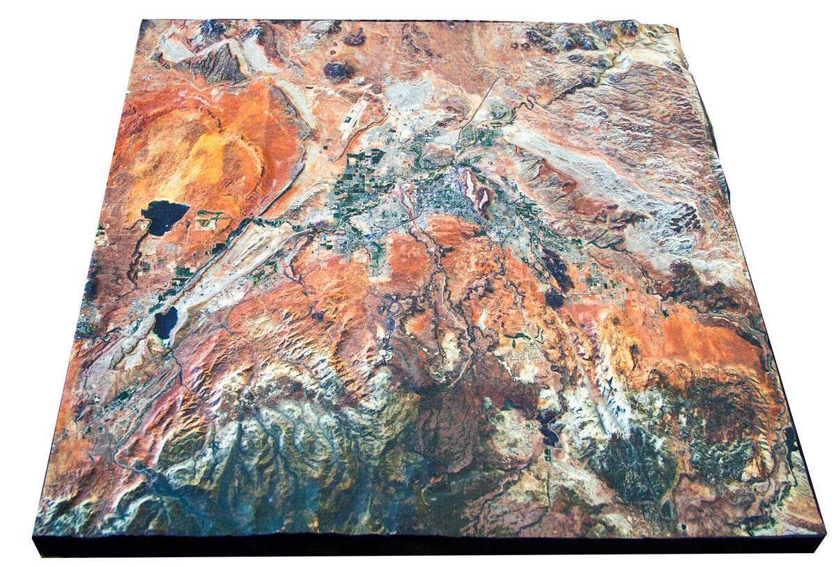
Custom 3D topography model of Huntsville, showing city terrain and development areas in raised relief.

Custom 3D topographical map of a mountain range, showing elevation and terrain features.

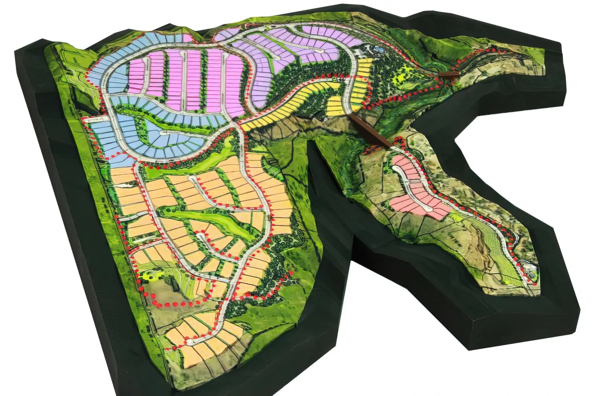
Custom 3D topographical model of a planned development in Colorado, showing terrain and site context.
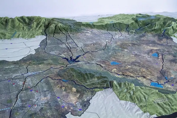
Custom 3D topographical map of the San Joaquin region, showing valley terrain and waterways in raised relief.
Custom monochrome 3D topographical wall map showing terrain features in a clean, single-tone finish.
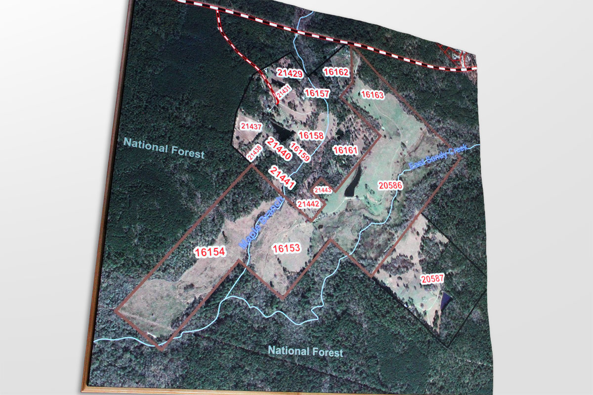
Custom 3D topographical model of Walker Ranch, created for SmartMaps Consulting to show property terrain and boundaries.
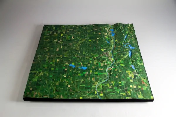
Custom 3D topographical model of western Minnesota, showing regional terrain and county geography.
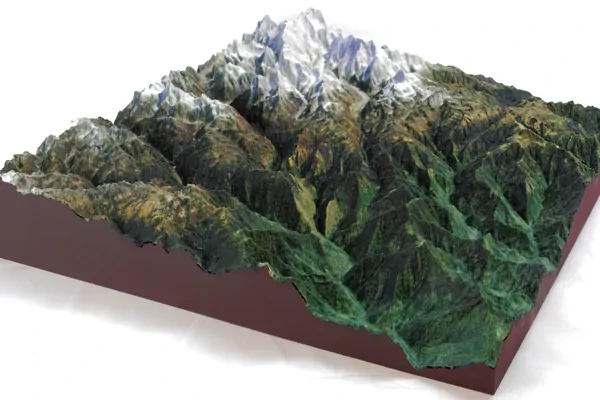
Custom 3D topographical map of a mountain range, displaying elevation and terrain in raised relief.
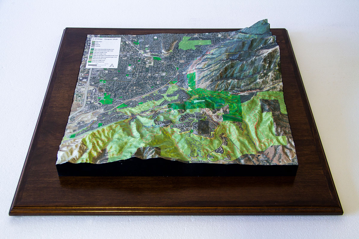
Custom 3D topographical terrain map of the Park City, Utah ski area, showing mountain features and resort terrain.
Custom 3D topographical terrain map fabricated by WhiteClouds.
Custom 3D raised relief terrain model fabricated by WhiteClouds.
Custom 3D topographical map display fabricated by WhiteClouds.
Custom 3D terrain map fabricated by WhiteClouds.
Custom 3D topographical map showing terrain and elevation detail in raised relief.
Custom 3D raised relief terrain display fabricated by WhiteClouds.

Custom 3D topographical map of Aitkin County, Minnesota, showing county terrain and landscape features.
Custom 3D terrain topographical display fabricated by WhiteClouds.
Custom 3D raised relief map of a California watershed, showing drainage features and terrain in raised relief.
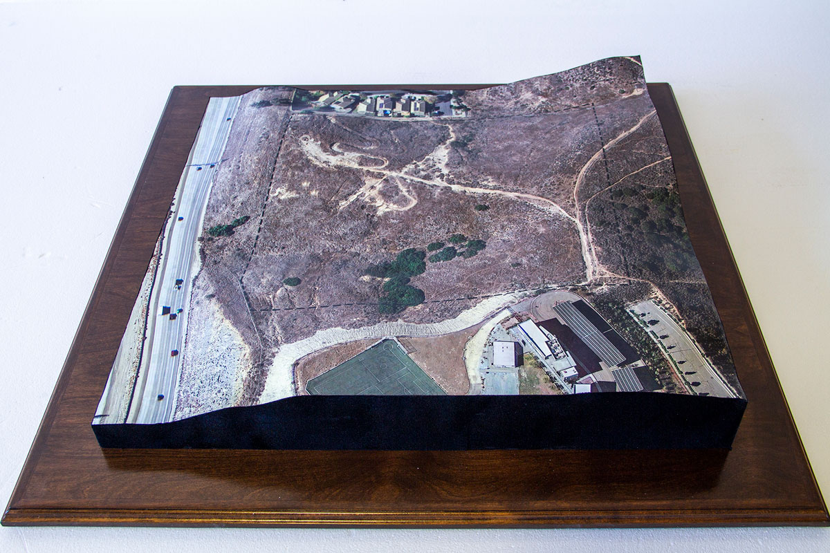
Custom 3D topographical map created for Ecogy Solar, showing terrain and site context for a solar energy development project.
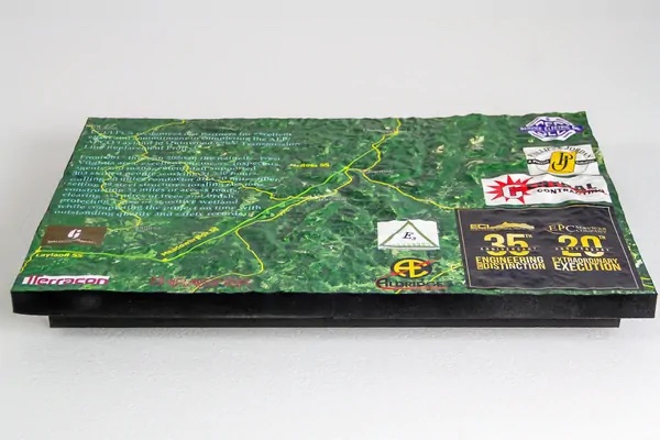
Custom 3D topographical site map created for EPC Services, showing terrain and infrastructure in raised relief.
Custom 3D topographical map created for the Franconia Museum, showing local terrain and landscape features.

Custom 3D topographical map of a hunting ranch, showing terrain, waterways, and property features.
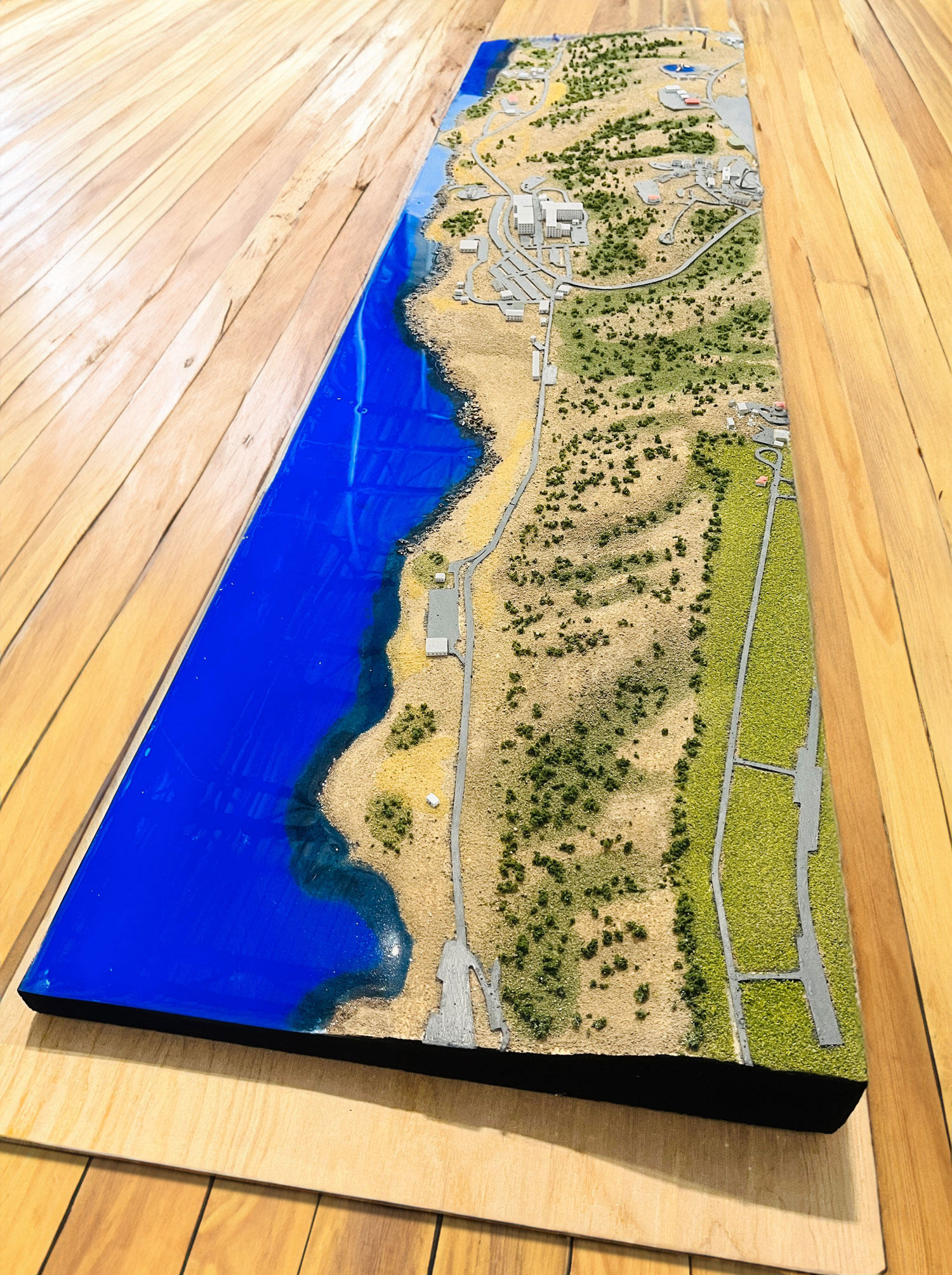
Custom 3D topographical map featuring a resin-filled river effect, showing water flow and terrain in raised relief.
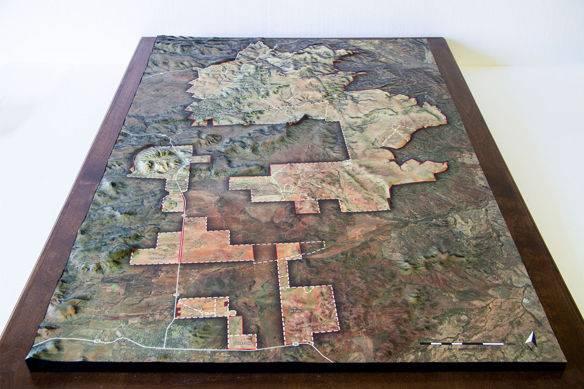
Custom 3D topographical map of the RFB Avalon real estate development, showing terrain and development layout.
Custom 3D topographical map of the RFB Avalon real estate development, showing terrain and site features.
Custom 3D topographical map of the RFB Avalon real estate development, showing site layout and terrain context.
Custom 3D topographical map display fabricated by WhiteClouds.
Custom 3D raised relief topographical map fabricated by WhiteClouds.
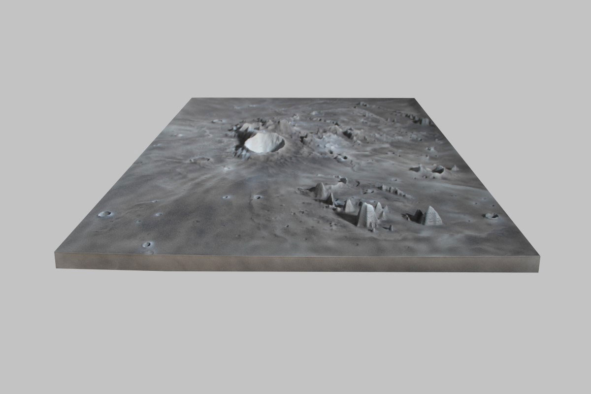
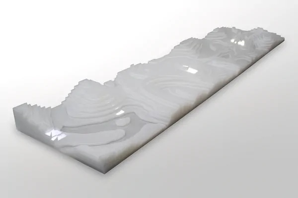
Custom 3D raised relief map of Moon topography, created from NASA elevation data for educational or decorative display.
Custom 3D topographical model created for SmartMaps Consulting, showing site terrain and property context.
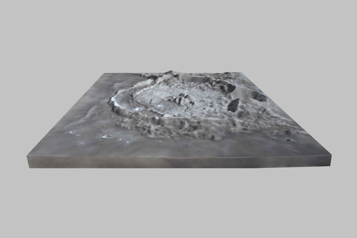
Custom 3D raised relief map of Moon topography in large format, created from NASA elevation data.
Custom 3D topographical terrain map fabricated by WhiteClouds.
Custom 3D raised relief topographical map fabricated by WhiteClouds.
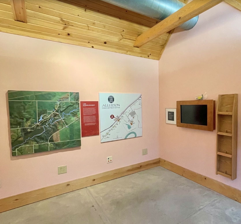
Custom 3D raised relief topographical map of the Allerton area, created for museum or visitor center display.
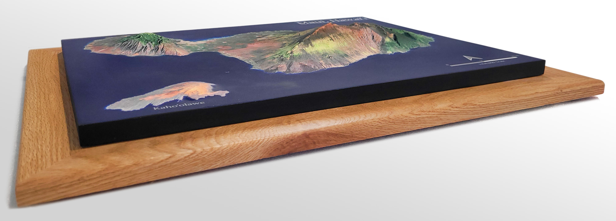
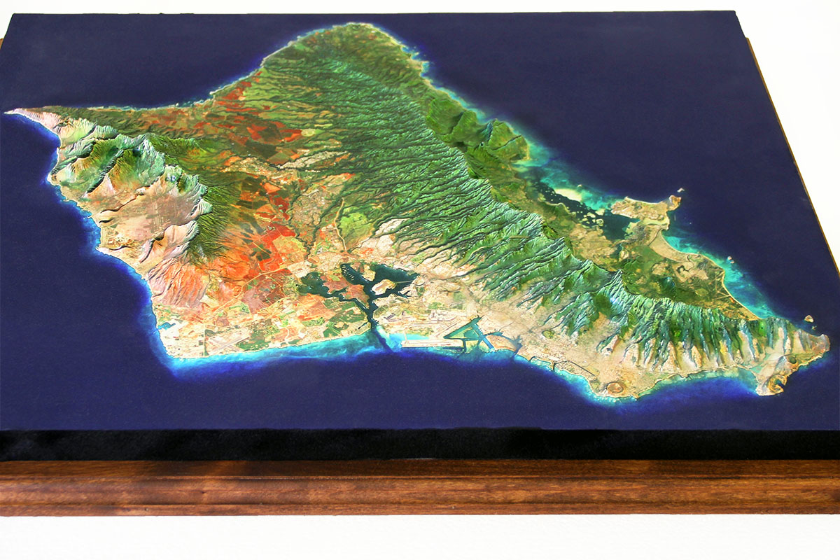
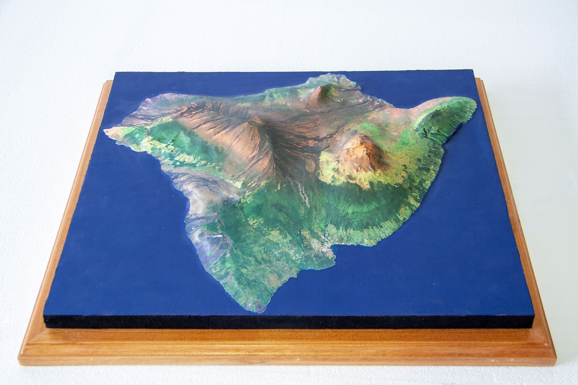
Custom 3D raised relief map of Maui, Hawaii, showing the island's volcanic terrain, coastal features, and elevation in detail.
Explore related services
Ready to start?
Share the area, size, use case, deadline, and any map features you already know. WhiteClouds can help refine the scale, terrain data, graphics, materials, lighting, display format, custom base, and next steps.