
What if you could trace every raindrop’s journey?
Imagine standing in your backyard holding a single drop of water on your fingertip. The moment that drop falls to the ground, gravity takes over—sending it on a winding, unseen adventure. It might trickle into a tiny ditch, join a creek, flow into a river, rush through a wetland, then finally meet the ocean. That incredible journey doesn’t happen randomly. Every drop has a destination, and that destination is determined by the land around it. This is the story a watershed tells. And the tool that lets us visualize that story is a watershed map. Watershed maps are the hidden superheroes of hydrology, environmental planning, and even public safety. They reveal where water travels, where it collects, and how it connects everything around us—from forests to farmlands, skyscrapers to shorelines. So let’s dive in. Why do watershed maps matter? How do they work? And what makes them so vital to our planet’s health and our own?
Understanding the Watershed: More Than Just a River’s Home
A watershed is a geographic area where all precipitation—rain, snow, or meltwater—funnels toward a common outlet. That outlet could be a river, lake, bay, or even a tiny marsh behind a rural road. If water flows downhill into the same basin, it belongs to the same watershed. Every inch of land on Earth is part of a watershed. Cities have watersheds. Farmlands have watersheds. Mountain peaks and desert plains? Watersheds. Even the drainage grates on your street are part of a local watershed system guiding stormwater into larger networks. Some watersheds are enormous—like the Mississippi River Basin, draining 40% of the United States. Others are incredibly small, capturing runoff from just a few acres. But every watershed is deeply connected to the ecosystem, economy, and lifestyles of the people living within it. And the way we understand those relationships often starts with a map.
What Exactly Is a Watershed Map?
A watershed map visually outlines how water flows in a region. It shows:
- The high points of land—called divides—where water parts ways
- The low-lying collection zones and drainage pathways
- River systems and their branching tributaries
- How humans, infrastructure, soil, and vegetation interact with water
Think of a watershed map as the circulatory chart of the landscape. Instead of arteries and veins, it traces streams and rivers. Instead of organs, it highlights ponds, lakes, wetlands, and groundwater recharge zones.
These maps reveal crucial relationships:
- Where water comes from.
- Where it goes.
- What influences its movement.
- What depends on it to survive.
Scientific? Yes. But also surprisingly artistic. Watershed maps paint the planet’s water story in branching tree-like patterns—beautiful snapshots of flow and connection.
Why Do Watershed Maps Matter? Protecting What We Can’t See
Even though most of us rarely think about watersheds, they protect our lives every day. Watershed maps help us prepare for floods, maintain clean drinking water, preserve wildlife, and make responsible decisions about development.
Here’s why these maps are essential to modern life:
Clean Water Starts With Smart Mapping
Where water flows, pollutants follow. Chemicals, trash, pesticides, and industrial runoff all travel downhill—sometimes into our drinking water. Mapping watersheds helps communities identify contamination risks before the water reaches a tap.
They’re Critical to Flood Prevention
Storms are becoming more frequent and intense. Watershed maps show: Where floodwaters will collect. Which rivers will overflow first. How urban development disrupts natural water flow. Flood planning without watershed maps? Pretty much guesswork.
Watershed Maps Help Restore and Protect Habitat
Fish migrations, wildlife corridors, and wetland ecosystems all depend on healthy water pathways. These maps allow environmental scientists to pinpoint areas needing cleanup, protection, or restoration.
Agriculture Relies on Watershed Awareness
Farmers depend on watershed data to: Prevent soil erosion. Improve irrigation planning. Protect water quality for crops and livestock. A depleted or contaminated watershed can devastate entire food systems.
They Shape Smart Urban Growth
A new road, parking lot, or housing development can entirely redirect where water flows. Watershed maps guide land planning to reduce costly drainage problems later.
From daily resource management to long-term ecological survival, watershed maps help us make decisions grounded in how the Earth truly works.
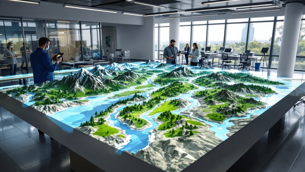
How Watershed Maps Are Created: The Science Behind the Art
A watershed map isn’t just drawn with guesswork—it’s constructed using powerful scientific tools. Geographers and hydrologists rely on:
- Topographic data from ground surveys or satellites
- Elevation modeling, showing slopes and drainage divides
- Hydrological modeling software to simulate water flow
- Field truthing, confirming map details on the ground
- GIS technology, turning huge datasets into readable visuals
One essential technique involves analyzing a Digital Elevation Model (DEM)—a detailed 3D representation of land height. By simulating how water behaves on slopes, experts can mark where water naturally pools or drains. These digital watershed maps can get incredibly advanced, incorporating soil permeability, vegetation cover, climate patterns, and even predicted sea-level rise. The result? A map that is both scientifically precise and deeply meaningful for anyone who depends on water—which is every one of us.
Watershed Boundaries: Nature Doesn’t Respect Political Lines
One of the most important lessons watershed maps teach is that water doesn’t care about human boundaries. A watershed might stretch across cities and suburbs, multiple counties or even states. Private, public, and protected lands, tribal territories and international borders. That makes cooperation essential. When one region pollutes or overuses water, everyone downstream pays the price. Watershed maps empower water managers to work together, using the land’s true boundaries—not just legal ones. They remind us that ecology is shared, and responsibility is not optional.
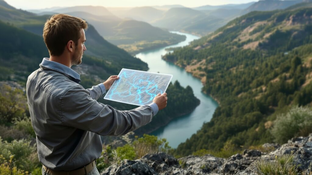
Reading a Watershed Map: The Story in the Symbols
If you’re looking at a watershed map for the first time, you’ll notice some common features:
- Ridges form the watershed divide
- Blue branching lines represent rivers and streams
- Shaded regions show drainage basins
- Arrows may indicate water flow direction
- Wetland symbols mark key filtration zones
- Labels identify river names, reservoirs, or tributaries
Some maps break watersheds into nested levels—sub-watersheds within larger basins. It’s like zooming in from a continent-sized drainage system to the ditch next door. Understanding these maps is like unlocking a detective story: What is this creek connected to? Where does this river end? Why is this area prone to flooding? Every detail gives a clue.
Watershed Maps and Climate Change: A Tool for Resilience
As climate change reshapes weather patterns, watersheds respond dramatically. More rain in shorter bursts can overwhelm drainage systems. Drought can starve landscapes of water for months. Melting snowpacks change seasonal river cycles entirely.
Watershed maps help communities adapt to new realities: Designing stronger stormwater systems. Anticipating drought-risk zones. Strengthening flood barriers. Protecting coastal waters from storm surge. These maps are becoming planning lifelines—helping cities re-engineer themselves for the climate of tomorrow.
Where We Live vs. Where Our Water Lives
Most people never ask this question: What watershed do you live in? But once you know, your whole view of water changes. You begin to understand: How your backyard connects to distant coastlines. Why local development affects regional waterways. What wildlife depends on your local streams. How your own choices influence water quality miles away. Watershed maps give us a new sense of place—one more powerful than a zip code. They connect us to every puddle, stream, and river that shapes our identity.
Real-World Uses: Where Watershed Maps Show Up Every Day
Even if you’ve never seen one directly, watershed maps already play a role in your life. They guide:
- Drinking water protection zones
- Flood insurance requirements and pricing
- Highway storm drainage systems
- Building codes and land permits
- Habitat conservation laws
- Recreational planning for fishing, boating, and hiking
- National and local sustainability programs
From engineers to farmers, from biologists to homeowners, watershed maps guide decisions constantly—all to keep our water flowing safely and sustainably.
Watershed Maps as Educational Tools: Inspiring Curiosity and Care
Schools increasingly use watershed maps to help students connect environmental science to real life. Kids learn:
- What happens when pollutants enter storm drains
- Why wetlands are nature’s filtering systems
- How planting trees along streams prevents erosion
- How healthy watersheds protect drinking water
The knowledge encourages stewardship. When students see how their neighborhood links to rivers and oceans, they feel responsibility—not just information. Maps teach that water is not a spectator sport. We’re part of the system.
Digital Watershed Maps and the Future of Water Management
Technology is leveling up how we explore and protect watersheds. Interactive mapping tools allow anyone—from professionals to curious residents—to zoom into detailed watershed features online.
New advancements include:
- Augmented reality maps that bring watershed topography into 3D life
- Predictive simulations for extreme storms or urban expansion
- Open-data platforms that allow public access to science once locked away
- Mobile apps that let hikers identify watersheds on the go
Every smartphone can now be a window into water movement across the landscape. Watershed understanding is no longer specialized—it’s democratized.
Why Watershed Maps Inspire Awe: The Art of Flow
There’s more beauty hidden in a watershed map than you might expect. If you’ve ever noticed how rivers branch like trees or resemble lightning patterns across earth’s surface, you’ve already glimpsed something wondrous.
Nature repeats these branching shapes everywhere—in our veins, in roots beneath our feet, and in the tributaries feeding great rivers. Watershed maps reveal that the earth itself breathes and circulates much like a living organism. They’re not just functional tools, they’re portraits of the planet’s lifelines.
Our Shared Story: People and Watersheds
No matter where you stand, you are part of a watershed. The choices you make—what you pour into drains, how you treat soil, whether you conserve water—affect more than your own backyard. They influence ecosystems, communities, and even national water security. Watershed maps remind us that we’re all connected by water. From mountaintops to marshes, from neighborhoods to nations, we share one amazing, constantly flowing resource. Understanding a watershed is understanding our place in the world. It’s realizing that every drop counts. Including the one on your fingertip.


