
Bringing Mountains, Valleys, and Landscapes to Life in Three Dimensions
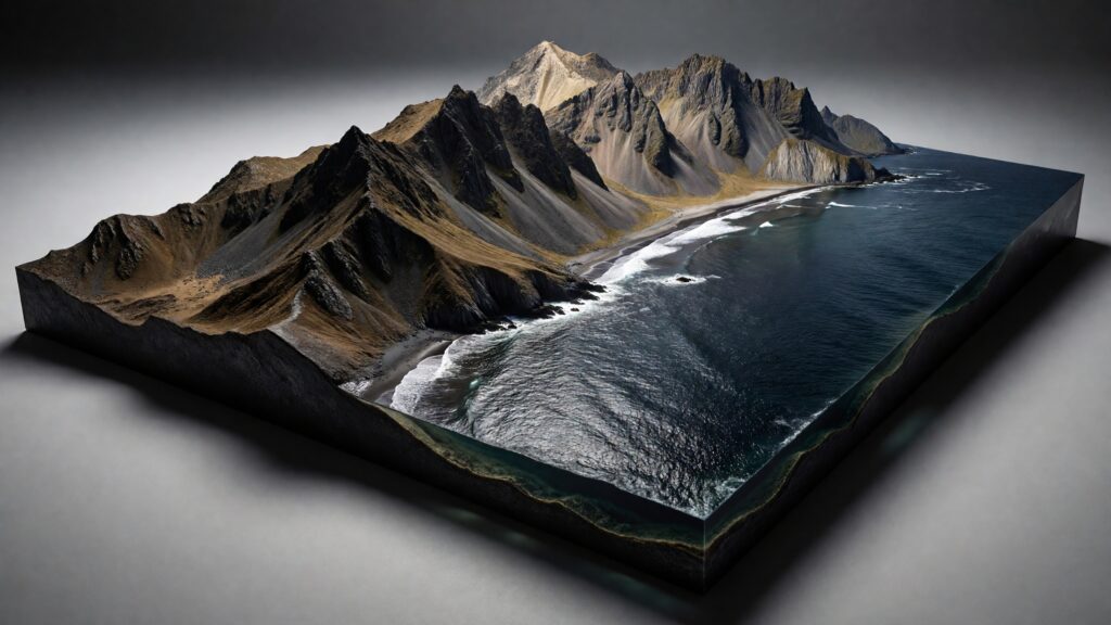
Maps have always helped humans make sense of the world, but some maps go beyond flat symbols and printed lines. A raised relief map turns geography into something you can see, touch, and almost feel beneath your fingertips. Mountains rise from the surface, valleys sink gently downward, and coastlines curve with physical depth. Instead of imagining terrain, you experience it. Raised relief maps transform abstract elevation data into a tangible landscape. They are used in classrooms, museums, national parks, military planning rooms, architecture studios, and even luxury homes. They sit at the intersection of science, art, engineering, and storytelling—bringing the Earth’s surface to life in three dimensions. In this article, we’ll explore what a raised relief map is, how it works, how it’s made, why it matters, and why these maps continue to captivate people centuries after their invention.

Understanding the Basics of a Raised Relief Map
A raised relief map is a three-dimensional map that physically represents changes in elevation. Unlike traditional flat maps that use color shading or contour lines to suggest height, raised relief maps use actual vertical variation. Mountains physically rise, plateaus stand tall, and valleys dip into the surface.
The vertical dimension is what defines relief. In a raised relief map, elevation is exaggerated or scaled to make topography easier to see and understand. This exaggeration helps viewers instantly grasp how steep a mountain range is, how deep a canyon runs, or how gently land slopes toward a coastline.
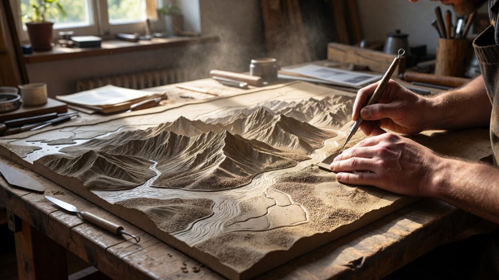
These maps are often built from materials such as molded plastic, carved wood, resin, foam, plaster, or layered composites. Modern versions may be CNC-milled or 3D-printed using digital elevation data, while historical examples were painstakingly sculpted by hand.
How Raised Relief Maps Differ from Other Maps
Flat maps rely on symbols. Colors indicate elevation zones, contour lines suggest slope, and shading hints at depth. While effective, these techniques require interpretation. Raised relief maps remove that barrier by turning terrain into form. Unlike topographic maps that demand careful reading, raised relief maps communicate instantly. A child, a visitor, or someone unfamiliar with cartography can look at one and immediately understand where the mountains are, how rivers flow, and why certain areas are hard to cross. They also differ from globes. While globes show planetary scale and curvature, raised relief maps focus on terrain detail. A globe may show where the Rockies are, but a raised relief map shows how rugged they are.
A Brief History of Raised Relief Maps
Raised relief maps have a surprisingly long history. Some of the earliest examples date back to ancient China, where terrain models were carved from wood or molded from clay to represent military regions.
In Europe, raised relief maps gained prominence in the 18th and 19th centuries, particularly for military planning. Armies needed to understand terrain before deploying troops, and physical models allowed commanders to visualize routes, defensive positions, and natural obstacles.
During the Renaissance and Enlightenment periods, relief maps became symbols of scientific advancement and power. Monarchs commissioned detailed models of cities and landscapes, often displayed in palaces or war rooms.
By the 20th century, raised relief maps found a permanent home in schools, museums, and national parks, helping the public understand geography in a tactile, intuitive way.
How Raised Relief Maps Are Made Today
Modern raised relief maps combine traditional craftsmanship with cutting-edge technology. The process often begins with digital elevation models (DEMs) derived from satellite imagery, LiDAR scans, or aerial surveys. Once the elevation data is collected, it is scaled and processed using mapping software. Designers decide how much vertical exaggeration to apply, balancing realism with visual clarity. Too little exaggeration can make terrain look flat; too much can distort geography. From there, the map may be produced in several ways. CNC milling machines carve terrain from foam or wood with extreme precision. 3D printers layer resin or plastic to build elevation gradually. Some high-end maps are finished by hand, with artists refining textures, smoothing slopes, and painting subtle color gradients. The final result is a detailed, durable object that blends scientific accuracy with artistic beauty.
Why Vertical Exaggeration Matters
One of the most misunderstood aspects of raised relief maps is vertical exaggeration. In reality, Earth’s elevation changes are subtle compared to its horizontal scale. Even the tallest mountains are tiny relative to the width of continents.
Without exaggeration, a relief map of an entire country would appear almost flat. Vertical exaggeration amplifies elevation differences so viewers can clearly see terrain features.
This exaggeration is not deception—it’s communication. It allows the map to tell a clearer story about landforms, drainage patterns, and geological structure while preserving accurate horizontal distances.
What Raised Relief Maps Teach Us Instantly
A raised relief map communicates geography in seconds. River systems suddenly make sense as water visibly flows downhill. Mountain passes reveal themselves as natural corridors. Coastal plains flatten out as they meet the sea. You can see why cities developed where they did, why roads follow certain routes, and why some regions are naturally isolated. Watersheds become obvious. Climate patterns begin to connect to elevation. This immediate understanding is why raised relief maps are powerful educational tools. They reduce cognitive load and turn abstract data into physical insight.
Common Uses of Raised Relief Maps
Raised relief maps are used across a wide range of fields. In education, they help students understand physical geography, geology, and environmental systems. In national parks, they orient visitors before hikes, showing trail elevation changes and landscape scale.
Architects and urban planners use relief maps to visualize land before development. Emergency management teams rely on them for flood planning, wildfire behavior analysis, and evacuation route design.
In museums, raised relief maps act as centerpiece exhibits, inviting visitors to explore geography with both eyes and hands. In homes and offices, they serve as functional art—beautiful objects that spark curiosity and conversation.
Raised Relief Maps and Accessibility
One of the most important modern roles of raised relief maps is accessibility. For visually impaired users, tactile maps provide access to spatial information that would otherwise be unavailable. By feeling elevation changes, coastlines, and landforms, users can build mental maps of regions they may never see visually. Many public institutions now include raised relief maps as part of inclusive design initiatives. This tactile dimension makes raised relief maps not just educational, but empowering.
Materials Commonly Used in Raised Relief Maps
The choice of material affects durability, detail, and aesthetics.
- Plastic and resin are common for mass-produced maps due to their consistency and durability.
- Foam and wood are popular for custom, large-scale installations.
- Metal relief maps, often cast in bronze or aluminum, are used in outdoor settings and monuments.
- Plaster and composite materials allow for fine detail but require protective finishes.
Each material carries a different tactile and visual experience, influencing how users interact with the map.
Raised Relief Maps as Works of Art
Beyond their educational value, raised relief maps are increasingly appreciated as art. The interplay of light and shadow across terrain creates natural drama. Subtle textures evoke erosion, time, and geological force.
Designers experiment with monochromatic palettes, metallic finishes, and minimalist bases, turning maps into sculptural objects. Some artists intentionally blur the line between scientific representation and abstract landscape art.
In this form, raised relief maps become more than references—they become interpretations of place.
How Raised Relief Maps Support Storytelling
Every landscape tells a story, and raised relief maps make that story visible. You can trace the path of ancient rivers, see where glaciers once carved valleys, and understand how tectonic forces shaped continents. Historians use relief maps to explain battles and migrations. Environmentalists use them to illustrate watershed protection and habitat connectivity. Travel writers use them to frame journeys through rugged terrain. By showing terrain as form, raised relief maps provide context that words alone cannot.
Raised Relief Maps vs 3D Digital Maps
With modern 3D mapping software widely available, one might wonder why physical relief maps still matter. The answer lies in human perception.
Physical objects engage the senses differently than screens. You can walk around a relief map, view it from different angles, and experience depth without filters or interfaces. It invites slow exploration rather than quick scrolling.
Digital maps are powerful tools, but raised relief maps offer presence. They anchor geography in the physical world.
Popular Subjects for Raised Relief Maps
Certain landscapes lend themselves especially well to raised relief maps. Mountain ranges, river basins, national parks, islands, and coastal regions are popular subjects because elevation plays a defining role.
Maps of the Grand Canyon, the Alps, Hawaii, or entire continents are common. Some maps focus on political regions layered over physical terrain, blending human and natural geography. The best subjects are places where elevation shapes identity.
The Future of Raised Relief Maps
As technology advances, raised relief maps continue to evolve. High-resolution LiDAR data allows for unprecedented accuracy. Sustainable materials reduce environmental impact. Hybrid maps combine physical terrain with subtle lighting or projection overlays.
Despite these innovations, the core appeal remains unchanged. People love to see the world rise up before them. Raised relief maps will continue to educate, inspire, and ground us in the physical reality of our planet.
Why Raised Relief Maps Still Matter
In an age dominated by digital screens, raised relief maps remind us that geography is physical. Mountains are not icons—they are massive, immovable forces. Rivers carve paths over time. Landscapes shape culture, history, and survival. A raised relief map makes these truths visible at a glance. It invites curiosity, encourages understanding, and connects us to the land in a deeply human way.


