
A Complete Guide to Understanding Map Keys and Symbols
Maps are more than drawings of land and water. They are visual languages—carefully crafted systems of symbols, colors, and lines that tell stories about our world. From ancient explorers sketching coastlines to modern GPS systems guiding daily commutes, maps have always depended on one essential element to make sense of their information: the legend. If you have ever unfolded a road atlas, studied a hiking trail map, or zoomed into a digital city map, you have encountered it. Sometimes called a map key, the legend quietly sits in the corner, decoding the entire visual experience. Without it, even the most beautifully designed map becomes confusing. With it, a map transforms into a powerful communication tool. So what is a legend on a map, and why is it so important? Let’s explore how this small but mighty component unlocks the meaning behind every symbol, color, and line.
Understanding the Basics: What Is a Legend on a Map?
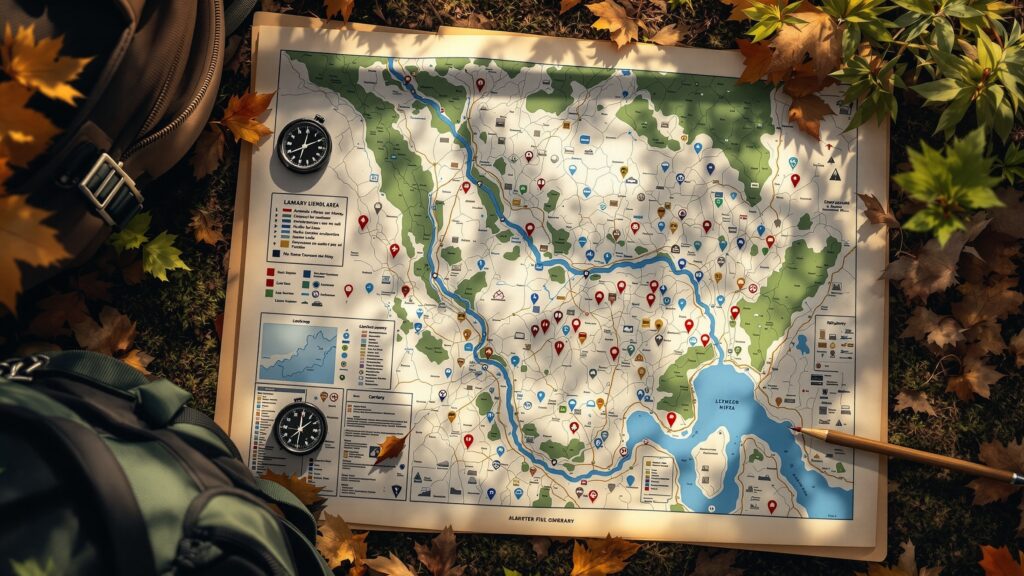
A legend on a map is a reference guide that explains the symbols, colors, and patterns used throughout the map. It functions like a translator, converting visual shorthand into clear meaning.
On a city map, a small airplane icon might represent an airport. A blue line could indicate a river. A green patch may signal a park. These visual cues would be meaningless without explanation. The legend provides that explanation, ensuring the map reader understands exactly what each symbol represents.
In simple terms, the legend turns abstract graphics into usable information. It is the key that allows you to read the map correctly.
Why Map Legends Matter More Than You Think
Imagine trying to read a book written in a language you do not understand. The letters are there. The words are structured. But without translation, the meaning is lost. That is what a map feels like without a legend. Legends are essential because they eliminate guesswork. They prevent misinterpretation. They standardize meaning. Most importantly, they empower users to navigate confidently.
For emergency responders, map legends can mean the difference between locating a hospital quickly or wasting precious time. For hikers, understanding trail difficulty symbols can prevent dangerous mistakes. For urban planners, color-coded zoning maps rely entirely on legends to communicate land use policies. The legend is not decorative. It is foundational.
The Evolution of Map Legends Through History
Maps have existed for thousands of years, and legends have evolved alongside them. Early maps were often symbolic and artistic, sometimes including illustrations of mountains, ships, or mythical creatures. These images were intuitive but not always standardized.
As cartography became more scientific, especially during the Renaissance and Age of Exploration, legends became more systematic. Cartographers began using consistent symbols to represent roads, borders, and terrain features. The legend became a formal component of map design.
In modern times, digital mapping platforms like Google Maps and GIS software rely heavily on interactive legends. Instead of a static box in the corner, legends may now appear as clickable layers that can be toggled on or off. Though the format has changed, the purpose remains the same: to clarify and explain.
Common Elements Found in a Map Legend
While legends vary depending on the type of map, most include similar elements. These typically explain symbols, colors, line styles, and patterns.
- Colors are often used to differentiate types of land or features. Blue commonly represents water. Green often indicates vegetation or parks. Brown might signify elevation or contour lines. Red may highlight highways or important routes.
- Symbols provide quick visual shorthand. A cross might represent a hospital. A tree icon could indicate a forested area. A tent symbol may show a campground.
- Line styles communicate boundaries and routes. Solid lines may represent highways, while dashed lines might indicate trails or administrative borders.
- Patterns are sometimes used in thematic maps, such as diagonal stripes for specific zoning categories or dotted areas for flood zones.
Each of these visual cues must be clearly defined in the legend to avoid confusion.
Types of Maps and Their Legends
Not all legends are created equal. The design and complexity of a legend depend on the type of map it accompanies.
- Road maps typically include symbols for highways, rest stops, airports, and service areas. The legend helps drivers quickly interpret route information.
- Topographic maps feature contour lines, elevation markers, and terrain features. Their legends explain how to interpret changes in elevation and natural formations.
- Political maps highlight boundaries between countries, states, or districts. Legends clarify border styles and administrative divisions.
- Thematic maps focus on specific data sets, such as population density, climate patterns, or income levels. These maps often use color gradients, and their legends explain what each shade represents.
- Digital maps add another layer of complexity. Interactive legends allow users to customize what information is visible. In Geographic Information Systems, or GIS, legends can dynamically update based on selected data layers.
The legend adapts to the map’s purpose, but its core function remains constant: clarity.
Map Legend vs. Map Key: Is There a Difference?
You may have heard the terms “map legend” and “map key” used interchangeably. In most contexts, they mean the same thing. Both refer to the explanatory section that decodes map symbols. Some educators prefer the term “map key” when teaching children, as it suggests unlocking meaning. The word “legend” may also refer to stories or myths, which can sometimes confuse younger learners. In professional cartography, however, “legend” is the standard term. Regardless of terminology, the purpose is identical.
How to Read a Map Legend Like a Pro
Reading a legend effectively involves more than glancing at symbols. It requires connecting visual elements to the map’s overall purpose.
Start by identifying what the map is trying to communicate. Is it showing roads, population data, weather patterns, or something else entirely? The legend will reflect that purpose.
Next, examine color coding. If the map uses gradients, determine what the range represents. For example, darker shades might indicate higher values, while lighter shades represent lower ones.
Pay attention to scale relationships. In thematic maps, symbols may vary in size to represent quantities. The legend will clarify these differences.
Finally, cross-reference symbols directly with map features. As you scan the map, refer back to the legend to confirm interpretations. Over time, this process becomes intuitive.
Designing an Effective Map Legend
For cartographers and designers, creating a clear legend is both an art and a science. A good legend should be concise but comprehensive. It must include all necessary explanations without overwhelming the reader. Visual hierarchy matters. Important symbols should be easy to locate. Grouping related symbols together enhances readability.
Consistency is critical. Symbols should match the style used throughout the map. If roads are shown in red lines on the map, they should appear exactly the same in the legend.
Placement also matters. The legend should be visible but not obstruct the main map content. Traditionally, it appears in a corner, but digital maps may incorporate expandable side panels. Accessibility considerations are increasingly important. Colorblind-friendly palettes and clear text labels ensure that more users can interpret the map accurately.
The Psychology Behind Map Legends
Map legends tap into human cognitive processes. Our brains are wired to recognize patterns and associate symbols with meaning. Legends provide the framework for these associations. Color psychology plays a role as well. Blue naturally suggests water. Green implies vegetation. These intuitive connections reduce cognitive load and speed up comprehension. When legends are poorly designed, users experience confusion and frustration. When they are well-designed, users feel confident and empowered. That emotional response matters, especially in high-stakes situations such as navigation or emergency planning.
Legends in the Digital Age
Today, mapping has gone far beyond paper atlases. Digital platforms have revolutionized how legends function.
Interactive legends allow users to toggle layers, filter data, and customize views. For example, a real estate map may allow users to switch between school zones, property values, and transportation networks. Each layer has its own legend components.
In Geographic Information Systems, legends can update automatically based on selected data sets. This dynamic functionality makes modern maps more powerful than ever.
Mobile apps also rely on intuitive legends, though they may be minimalistic due to screen size constraints. Icons and simplified symbols must be immediately recognizable.
Even in augmented reality navigation, legends are embedded into the interface through overlays and directional markers.
The core principle remains unchanged: maps need clear explanations to be useful.
Teaching Children About Map Legends
Introducing children to map legends is an important educational milestone. It teaches spatial reasoning, critical thinking, and visual literacy.
Educators often start with simple maps of classrooms or neighborhoods. Children learn to identify symbols for desks, trees, or playgrounds. By referencing the legend, they connect abstract drawings to real-world objects. As students advance, they explore more complex maps, including weather maps and historical maps. Understanding legends becomes essential for interpreting information accurately.
Encouraging children to create their own maps with legends strengthens comprehension. When they design symbols and explain them, they internalize the concept of visual communication.
Real-World Examples of Map Legends in Action
Consider a disaster response map used during a hurricane. It may include symbols for evacuation routes, shelters, flood zones, and emergency services. The legend ensures that responders and residents understand exactly what each symbol means.
Or think about a subway map. Colored lines represent different routes. Station symbols indicate transfer points. Without the legend, navigating a major city’s transit system would be chaotic.
In hiking and outdoor recreation, legends help interpret trail difficulty, elevation gain, and campsite locations. Misreading these symbols could lead to safety risks.
In each scenario, the legend serves as a safeguard against misunderstanding.
Common Mistakes in Map Legends
Despite their importance, legends are sometimes poorly designed.
- Overcrowding is a common issue. When too many symbols are crammed into a small space, readability suffers.
- Inconsistent labeling can create confusion. If symbols differ slightly between the legend and the map itself, users may misinterpret information.
- Overreliance on color without text labels can exclude users with visual impairments. Clarity must always be prioritized over aesthetic flair.
The best legends strike a balance between simplicity and completeness.
The Relationship Between Scale and Legend
A map’s scale affects how its legend is constructed. Large-scale maps that show detailed local areas may require more symbols and explanations. Small-scale maps covering entire countries may use broader categories. For example, a neighborhood zoning map might include specific land-use codes, while a world map legend might simply distinguish continents and oceans. Understanding scale helps map readers interpret legend information accurately.
Legends as Storytelling Tools
Beyond technical function, legends contribute to storytelling. Every map tells a story about space, relationships, and data. The legend shapes how that story is understood.
A climate map using bold color contrasts emphasizes temperature extremes. A demographic map using subtle gradients may convey nuanced patterns. The legend frames interpretation. In this way, legends influence perception. They guide readers toward certain conclusions based on how information is categorized and presented.
The Future of Map Legends
As mapping technology advances, legends will continue evolving. Artificial intelligence and real-time data integration may produce adaptive legends that adjust based on user behavior.
Augmented reality navigation could integrate context-aware legends that highlight relevant symbols dynamically. Voice-assisted mapping may even verbalize legend explanations for accessibility.
Despite technological shifts, the fundamental need for clarity remains constant. Whether printed on parchment or displayed on a smartphone, a map must explain itself.
Why Every Map Needs a Legend
A legend on a map is more than a helpful accessory. It is the foundation of understanding. It translates symbols into meaning, colors into categories, and lines into information. Without a legend, a map is decoration. With a legend, it becomes communication. The next time you glance at a map, pause and look at the legend. That small box in the corner is doing a remarkable job. It is guiding your eyes, informing your decisions, and connecting you to the world in a clear and structured way. In a world overflowing with data, the legend remains one of the simplest and most powerful tools for making sense of information.


