
The Hidden Navigator of Every Great Catch
Cast a line into any lake, river, or coastal shoreline, and you’ll quickly learn that fishing is a game of curiosity and patience. Some days, the fish practically invite themselves onto your hook—other days, the water feels strangely empty. But what if fishing didn’t have to be guesswork? What if anglers could rely on a highly visual treasure map designed specifically to reveal underwater secrets like hidden reefs, drop-offs, weed beds, and fish-rich hotspots? That’s where fishing maps come in. They transform the underwater world into a guide packed with data that helps you fish smarter, not harder. While traditional maps show roads, mountains, and shorelines, fishing maps go beyond the visible surface. They chart what’s happening underneath—where trophy bass lurk in submerged trees, where trout feed in cold currents, and where massive schools of tuna follow underwater ledges across the ocean. Fishing maps have evolved from simple paper guides into sophisticated digital tools with sonar imaging, live weather overlays, and AI-powered predictions. Whether you’re a weekend hobbyist or a competitive angler, these maps are the ultimate secret weapon. Let’s dive deep and explore what makes a fishing map an essential tool for every successful fishing adventure.

A Fishing Map Defined
A fishing map is a specialized navigational aid designed to help anglers locate fish by revealing underwater features and environmental data. It isn’t just a blueprint of water depth—it’s a multi-layered exploration tool. Fishing maps highlight:
- Bathymetry (underwater contours and depth changes)
- Bottom structure like rock piles, logs, humps, and ledges
- Vegetation zones where fish shelter and feed
- Water temperature gradients that attract specific species
- Known fish-holding locations identified by research and experience
Think of it as the “Google Maps” of angling—the deeper the map, the better your odds of landing a dream catch.
Above the Water vs. Below the Water
Most people see a lake as a smooth, blue shape stretching peacefully across a local park or mountain valley. But beneath that calm surface lies a rugged landscape every bit as dramatic as land terrain: hills and valleys, submerged forests, ancient riverbeds, even sunken structures left behind by history.
Fish navigate this submerged world with precision. They take advantage of depth changes, hide in reeds, and feed beside underwater drop-offs where prey gets swept along by shifting currents. Fishing maps reveal these invisible features so anglers can predict where fish will be at different times of day, seasons, or weather patterns.
Without a fishing map, you’re simply casting into mystery.
The Art and Science of Where Fish Live
Fish do not roam randomly. They follow environmental rules—structures and conditions that maximize safety and feeding opportunities. Fishing maps help anglers understand those key principles:
1. Structure
Fish cling to structure like skyscraper dwellers cling to cities. Underwater rocks, fallen timber, bridge pilings, and coral reefs all provide ideal hiding and ambush zones. When a fishing map reveals these places, you’ve discovered prime territory.
2. Depth
Temperature, oxygen concentration, and light penetration change with depth. Warm-water species like largemouth bass stay near shallow cover. Cold-loving lake trout dive deep during summer. Fishing maps show depth gradients, turning knowledge into results.
3. Movement
Water currents push food along corridors. Drop-offs, channels, and river inflows act like underwater highways. Spotting these on a fishing map tells you where dinner—and the diners—are traveling.
With these insights, the water becomes not just a place to relax, but a dynamic ecosystem you can read like a playbook.
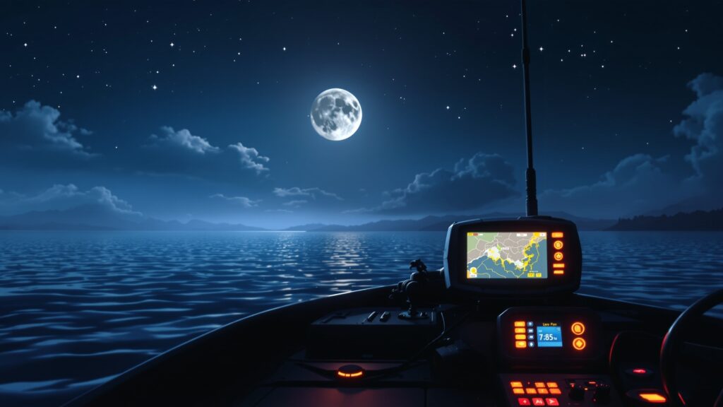
From Paper Charts to Digital Precision
Fishing maps used to appear only as waterproof fold-outs, sold at bait shops or printed by local fisheries. Today, technology has revolutionized them. Anglers now use apps and sonar-equipped chartplotters that record real-time underwater data.
Some modern tools include:
- GPS-enabled mapping systems to mark hotspots
- Side-scan and down-scan sonar to reveal detailed structure
- Live bathymetric updates as you explore new areas
- Predictive heat maps that show where fish are likely feeding
Companies like Navionics, Garmin, Lowrance, and Humminbird have turned fishing maps into dynamic fishing intelligence systems. You aren’t guessing anymore—you’re analyzing, tracking, and planning. It’s data meets adventure.
Freshwater vs. Saltwater Fishing Maps
Different environments demand different levels of detail.
Freshwater
Lakes, rivers, and reservoirs have complex structures close to shore. A good freshwater fishing map shows:
- Docks, weed lines, stump fields
- Stream inlets delivering nutrients and oxygen
- Underwater shelves where bass ambush prey
- Deep holes holding walleye and catfish
Because freshwater bodies are smaller, these maps are often more detailed in tight spaces.
Saltwater
The ocean is vast—but fish still concentrate where structure exists:
- Seamounts rising off the sea floor
- Reefs teeming with life
- Shipwrecks acting as artificial reefs
- Continental shelf edges that funnel ocean currents
Saltwater fishing maps may also include:
- Tide flow patterns
- Seasonal migration routes
- Offshore navigation data for safety
Whether you’re hunting salmon in a coastal inlet or mahi-mahi on the open sea, the right map is as important as your tackle box.
How Fishing Maps Boost Angling Success
Fishing maps elevate every stage of the fishing experience—from planning to casting to landing a personal best catch.
Better Strategy Before You Arrive
You can scout the best spots before even stepping foot on the water. Instead of wasting time, you start right where fish live.
Smarter Use of Time and Gear
Maps help pattern fish behavior. You switch tactics depending on depth, structure, and habitat: topwater lures near shallow grass flats at sunrise and jigging deep rocky ledges in midday heat
Safer Exploration
Maps reveal hazards like shallow sandbars or submerged boulders that could damage a boat.
Sustainable Fishing
Some fishing maps note protected zones or spawning areas so anglers can avoid disturbing vulnerable populations.
Whether you’re targeting bluegill with kids or chasing trophy muskies, efficiency leads to more fun—and better fish tales to share later.
Fishing Map Symbols: A Language of Success
Like any map, fishing maps use symbols and colors to communicate. Deeper blues mean deeper water. Shaded relief reveals slopes. Icons mark important features like submerged trees, known reefs, and boat ramps. Once you understand this visual language, a fishing map transforms from colorful guesswork into strategic intelligence. You’ll start seeing patterns: where wind pushes baitfish, where predator species intercept, where seasonal transitions shift habitats. Learning to read a fishing map feels like unlocking a cheat code.
Crowdsourced Fishing Intel
One of the newest advances in fishing maps is community knowledge. Anglers upload their own discoveries:
- Newly found brush piles
- Recent catch locations
- Uncharted underwater structure
It’s like thousands of scouts working together to improve a shared guide. With continual updates, hotspots appear as real-time as social media. Fishing may be a solitary sport, but the data powering success is now a collaboration.
Fishing Maps and Species-Specific Strategy
Every fish species prefers certain environments. Fishing maps allow anglers to target the exact type of fish they want.
- Bass gravitate toward cover and sudden depth changes
- Walleye migrate between deeper daytime zones and shallow nighttime feeding areas
- Salmon follow underwater currents like a roadway
- Redfish feed around coastal oyster beds and marsh edges
- Crappie seek brush piles and submerged treetops
When you match species behavior with fishing map intelligence, success skyrockets. Your technique becomes tailored, not random.
Environmental Science Behind the Cast
Fishing maps aren’t only about catching—it’s also about conservation. Fisheries scientists use mapping to monitor habitat health, invasive species spread, and water quality.
Maps help ensure that:
- Popular spots are not over-pressured
- Aquatic vegetation remains protected
- Migratory routes stay productive
Strong ecosystems produce better fishing… and better fishing produces lifelong fish lovers who care about the water.
It’s a cycle of respect that keeps the sport thriving.
Where to Find Fishing Maps
Fishing maps appear in many forms:
- Mobile apps and online subscriptions
- Printed lake maps at tackle shops
- Government and fisheries department websites
- Marina kiosks and boating centers
- GPS chartplotter downloads
Some anglers even create their own maps. Depth finders allow you to record terrain as you explore, crafting a custom underwater trail of discoveries. You don’t just use fishing maps—you contribute to them.
Beginner-Friendly and Pro-Approved
The beauty of a fishing map is that it meets you where you are:
- Beginners enjoy clearer direction and more rewarding early catches
- Seasoned anglers use maps to outsmart finicky fish and unlock overlooked spots
A fishing map doesn’t replace skill—it elevates it. The more you learn, the more powerful the map becomes.
Experience More, Guess Less
Fishing is never guaranteed—nor should it be. The unpredictable nature of water keeps the thrill alive. But fishing maps give you the upper hand. They turn hope into confidence. They transform a casual outing into a strategic quest. Instead of wondering where fish might be, you follow the same pathways they’ve followed for centuries. You read the underwater terrain as fluently as the fish themselves. That’s the magic of a fishing map: it reveals the invisible world beneath the waves, giving anglers the chance to connect more deeply with nature and its rhythms. Fishing becomes not just a relaxing escape but an intellectual adventure.
The Future of Fishing Maps: Predictive and Immersive
Imagine a fishing map that suggests where you should cast next based on:
- Live sonar feedback
- Wind direction
- Weather and water temperature
- Seasonal migration behavior
This future is already emerging. Artificial intelligence now analyzes years of data to generate catch predictions. Anglers can access 3D underwater modeling. Augmented reality overlays depth changes directly into wearable tech like smart glasses.
One day, you might see fish icons representing real-time sonar returns swimming around a virtual display above the water. The future isn’t just about locating fish—it’s about understanding how underwater environments evolve. Fishing maps will guide not just fishermen, but responsible stewards of water ecosystems.
Why Every Angler Should Use a Fishing Map
Fishing maps are useful for:
- Planning a trip to new waters
- Discovering overlooked hotspots in familiar lakes
- Learning species behavior
- Staying safe by avoiding unseen underwater hazards
- Improving catch rates without pressure or exhaustion
Whether fishing from a kayak, a bass boat, or a quiet dock, the right map gives you direction, knowledge, and excitement—even before your first cast hits the water. Fishing maps turn beginners into confident anglers and skilled anglers into legends.


