
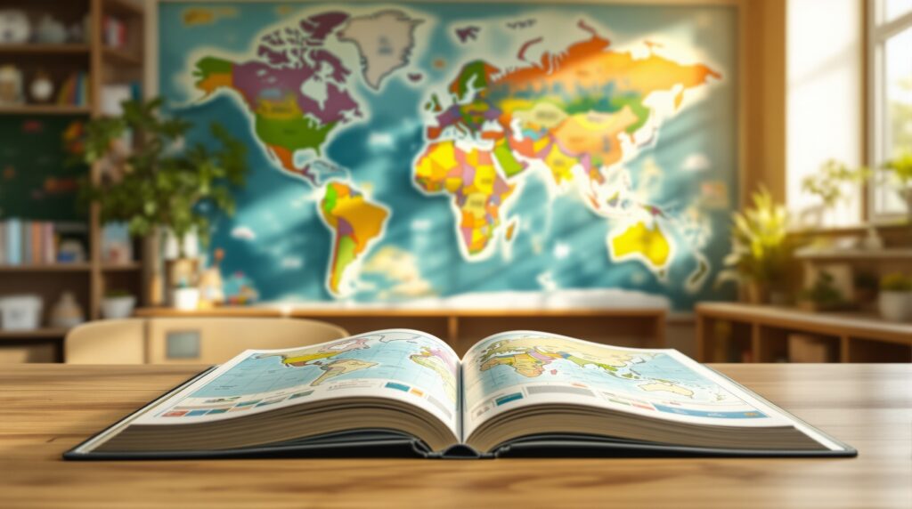
The Magic of a First Map
A child’s first atlas is often their first passport to the world. Long before they ever board a plane or step into a foreign city, they trace rivers with their fingers, imagine towering mountains, and dream about deserts, rainforests, and oceans they’ve never seen. A children’s atlas is far more than a book of maps—it is a gateway to curiosity, imagination, and global understanding. It turns abstract ideas like distance, culture, and geography into something tangible and exciting. Unlike traditional atlases designed for adults, children’s atlases are crafted to speak directly to young explorers. They simplify complex geography, add playful illustrations, and tell stories through visuals. Each page invites discovery, encouraging kids to ask questions, make connections, and see the world as a place full of wonder rather than lines on a page.
How a Children’s Atlas Differs From a Regular Atlas
At first glance, an adult atlas and a children’s atlas may look similar: both contain maps, country names, oceans, and borders. The difference lies in how the information is presented and how it feels to the reader. Adult atlases are often dense, technical, and focused on precision. Children’s atlases are built for storytelling, color, and approachability.
In a children’s atlas, maps are larger and clearer, with bold colors that make continents, countries, and regions easy to identify. Instead of overwhelming details, they focus on key features—major cities, famous landmarks, wildlife habitats, and cultural highlights. The goal is not to memorize every capital or boundary, but to spark interest and make geography feel alive.
Many children’s atlases include characters, icons, and visual scenes that show how people live in different parts of the world. A snowy village in Scandinavia, a bustling market in Africa, or a rainforest in South America becomes more than a location—it becomes a story waiting to be explored.
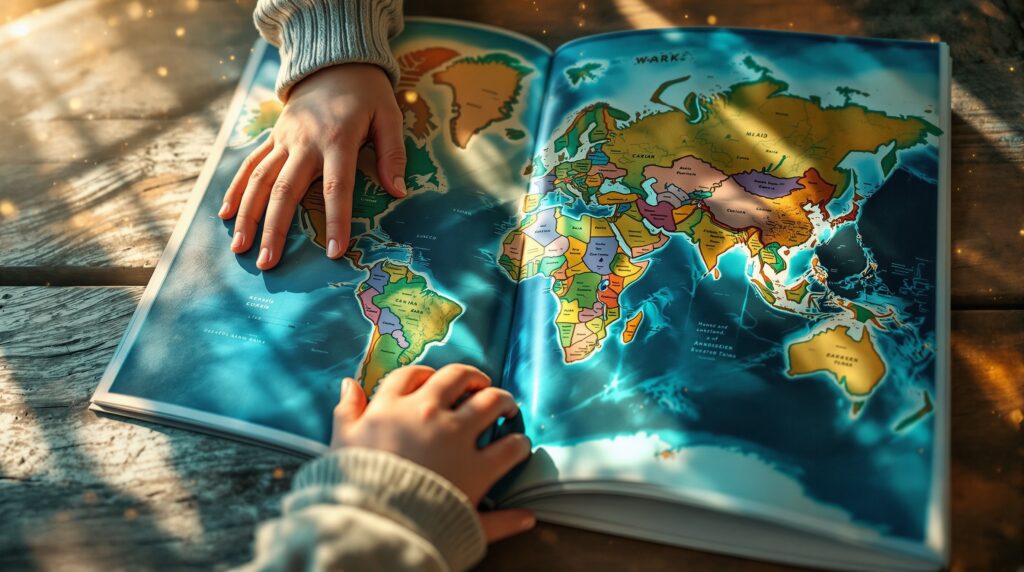
Why Children Are Naturally Drawn to Maps
Children are instinctively curious about space, scale, and movement. They want to know where things are, how far away they might be, and what lies beyond their own neighborhood. A children’s atlas satisfies this curiosity in a way that feels like play. Maps allow kids to imagine themselves traveling across oceans and continents. They begin to understand that the world is vast and diverse, yet connected. This sense of global awareness helps children develop empathy, cultural appreciation, and a broader perspective at an early age. A children’s atlas also supports visual learning. The combination of pictures, symbols, and simple text makes information easier to absorb. For many kids, this visual storytelling is what turns geography from a school subject into an exciting adventure.
The Role of Illustration and Design
One of the most defining features of a children’s atlas is its artwork. Every page is carefully designed to feel inviting rather than intimidating. Bright colors, playful icons, and illustrated landmarks transform maps into scenes full of life.
Mountains rise in soft, friendly shapes. Animals appear in their natural habitats. Cities are shown with recognizable skylines and tiny details that make kids want to look closer. These visual cues help children associate places with stories, people, and environments instead of just names on a page.
Design also plays a role in how information is organized. Clear headings, large fonts, and well-spaced layouts ensure that kids can navigate the book easily. Everything is arranged to encourage exploration rather than overwhelm.
What You’ll Find Inside a Children’s Atlas
Every children’s atlas is a little different, but most share a common structure that gently introduces young readers to the world. The opening pages often begin with a view of the entire planet, showing how continents and oceans fit together. From there, the atlas usually moves region by region, exploring North America, South America, Europe, Africa, Asia, and beyond.
Each section highlights major countries, natural wonders, famous cities, and unique cultural features. Kids may learn where polar bears live, which rivers are the longest, or how people celebrate holidays in different parts of the world. These small facts help make geography feel personal and relatable. Some atlases also include themed spreads, such as maps of volcanoes, world climates, ancient civilizations, or wildlife zones. These pages connect geography to science, history, and environmental awareness, showing kids how everything is linked.
Learning Without Feeling Like School
One of the greatest strengths of a children’s atlas is that it teaches without feeling like a textbook. Children can flip through it at their own pace, stopping wherever something catches their eye. There is no pressure to read from start to finish. Every page stands alone as a mini adventure. This freedom encourages self-directed learning. Kids might open the atlas to look for their own country, then follow a river to the sea, and suddenly find themselves discovering an entirely new place. This organic exploration builds confidence and curiosity at the same time.
How an Atlas Builds Early Geography Skills
A children’s atlas helps kids develop spatial awareness, an essential skill for understanding the world around them. They learn how continents are arranged, where oceans separate lands, and how countries connect. Over time, these visual patterns form a mental map of the world.
This foundation makes future learning easier. When children encounter geography in school, they already have a sense of where places are and how they relate to one another. They are not starting from scratch—they are expanding on a world they already recognize.
Encouraging Cultural Curiosity
Beyond borders and landscapes, a children’s atlas introduces kids to people and traditions from around the globe. They may see how children in other countries dress, what foods they eat, and how they celebrate special days. This exposure helps children understand that the world is full of different ways of living, all equally meaningful. It nurtures respect, curiosity, and open-mindedness—qualities that are just as important as academic knowledge.
The Emotional Connection to Place
For many children, an atlas becomes a cherished book they return to again and again. They might mark places they dream of visiting or show family members where something is located. Over time, certain pages become favorites, tied to stories, interests, or school projects.
This emotional connection to place helps kids see geography as part of their identity. The world feels bigger, but also more accessible. Every map becomes a reminder that there is always more to explore.
How Parents and Teachers Use Children’s Atlases
Parents often use atlases to answer everyday questions. When a child asks where a country is or how far away something might be, the atlas becomes a shared discovery tool. It turns curiosity into a moment of learning without pressure. In classrooms, teachers use children’s atlases to support lessons in social studies, history, and science. The visuals make abstract concepts easier to understand, and students are more engaged when they can see the world rather than just hear about it.
Choosing the Right Children’s Atlas
The best children’s atlas is one that matches a child’s age and interests. Younger children benefit from large, simple maps with lots of illustrations, while older kids enjoy more detailed information and facts.
A good atlas should feel sturdy, colorful, and inviting. When a child wants to pick it up on their own, you know it is doing its job.
A Gateway to Lifelong Exploration
A children’s atlas does more than teach geography. It opens the door to curiosity, storytelling, and imagination. It shows children that the world is vast, beautiful, and full of possibility. For many, that first atlas becomes the spark that leads to a love of travel, history, science, and cultures. It is a simple book, yet it holds the entire world inside.


