Marscapes: 3D Mars Model Decor
Stunning wall art of the Mars surface in 3D raised-relief
Table of Contents
Mars Topography + Art + Technology
We have compiled a collection of Marscapes to celebrate the 1971 NASA launch and subsequent mission of Mariner 9 and in 2021, we launched a Kickstarter campaign to help fund this exciting new project!
Since then, we changed the product a bit offering a much more durable and high quality 3D-printed model that is perfect for walls or tabletops and are now offering the new Marscapes on our online store.
- Free Shipping in the Continental U.S.
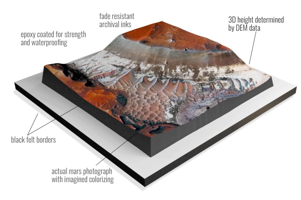
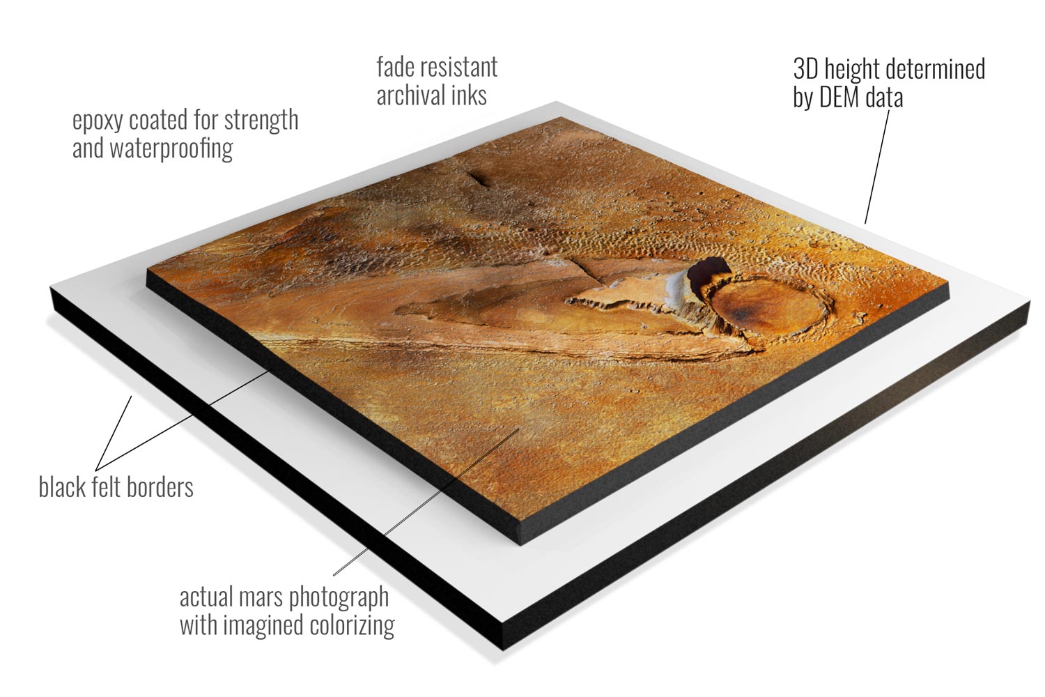
- 4 sizes up to 30″x30″
- Epoxy Coated for Strength and Waterproofing
- Tactile Raised-Relief 3D accuracy using DEM Data
- Black Felt Borders
The aim of the Mariner 9 was to map a large portion of Mars and to study the Martian surface and atmosphere. In nearly a year of orbiting, Mariner 9 was able to capture and send 7,329 images (and roughly 54 billion bits of data) back to Earth. The highly awaited pictures gave researchers an up-close look at the Red Planet for the first time.
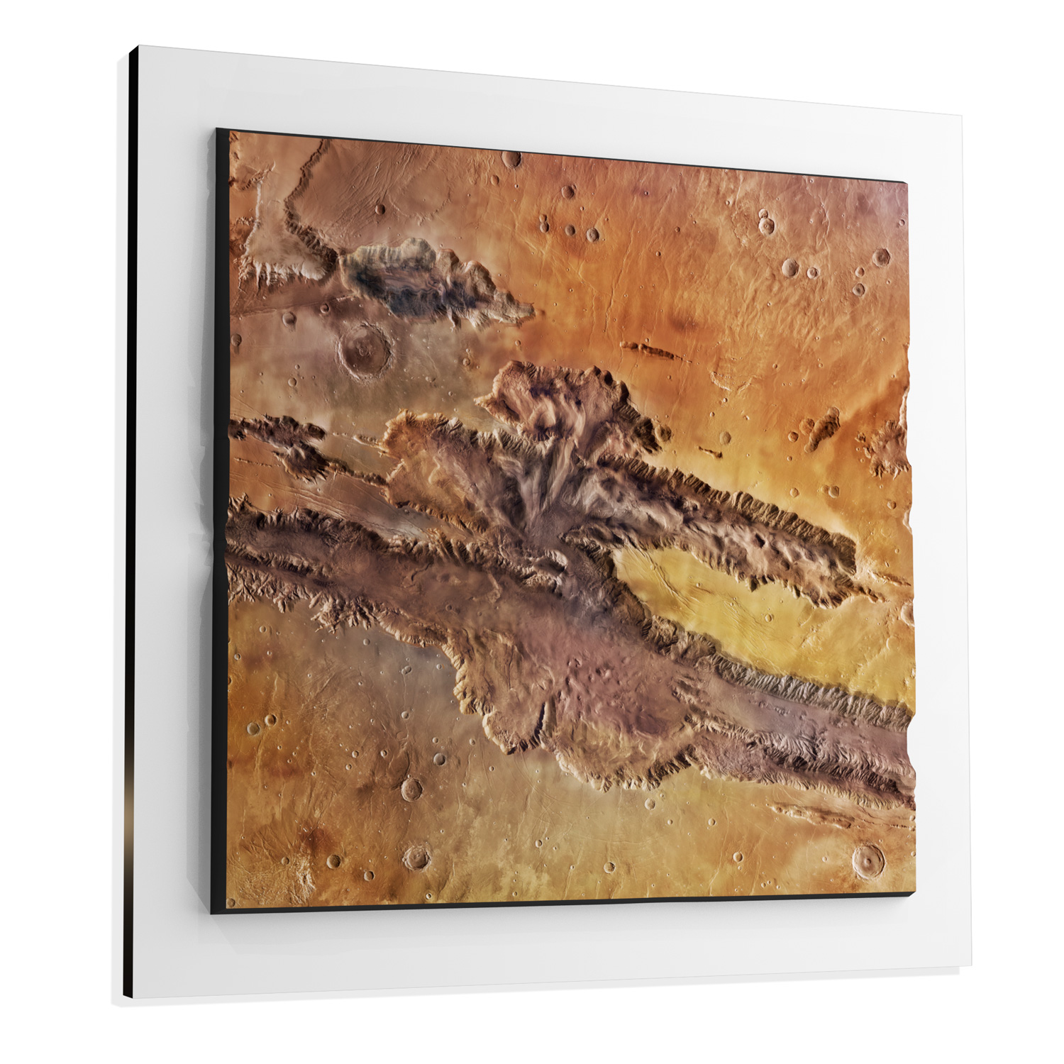
These images show land features such as Martian volcanoes, polar caps, two moons, and one of the most extensive canyon systems in our solar system, Valles Marineris (aptly named for Mariner 9). We chose to highlight the stunning beauty of Valles Marineris for the first installment of our one-of-a-kind Marscapes.
WhiteClouds’ Marscapes are incredibly realistic reproductions of the Martian terrain based on pictures and topography data gathered from NASA and many other scientific resources.
Mars has a multitude of terrain interests. Canyons, dunes, craters, massive volcanoes, polar ice-caps, mountains, plains and many more mysterious oddities give way to a truly out-of-this-world menagerie of Marscapes options.
Gallery of Selected Marscapes
Features & Benefits of 3D Marscapes
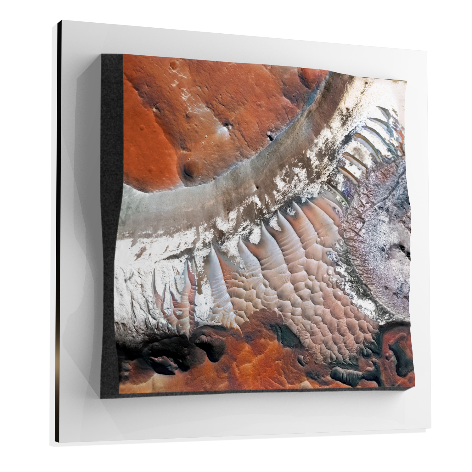
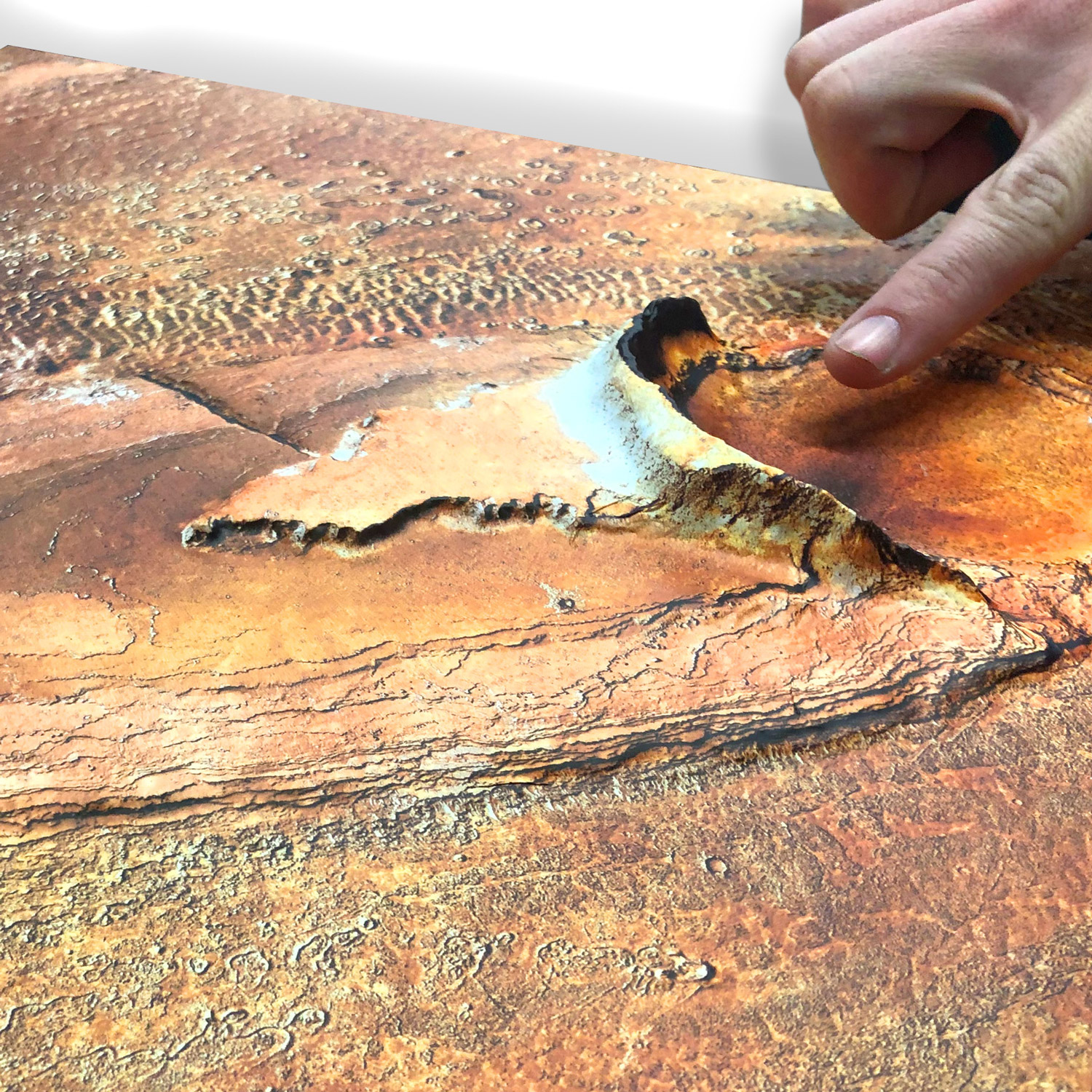
- Marscapes are raised surface terrain models of the Martian landscape.
- These 3D terrain models are NOT simply flat 2D prints of images. Daylight and shadows changing over time reveal the depth of the 3rd and 4th dimensions.
- Accuracy: Marscapes are a combination of high-resolution imagery and digital terrain models obtained directly from NASA. Raised-relief 3D Height Determined by DEM data.
- Our Educational edition map style of Valles Marineris overlays informational text such as points of interest, scale marks, and latitude and longitude lines.
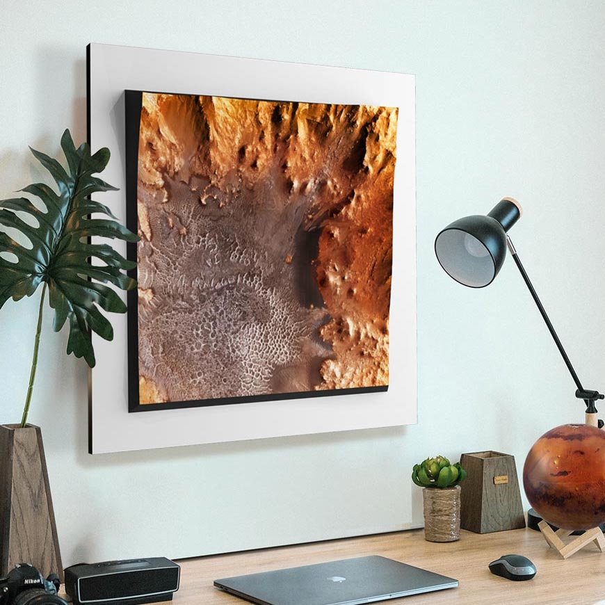
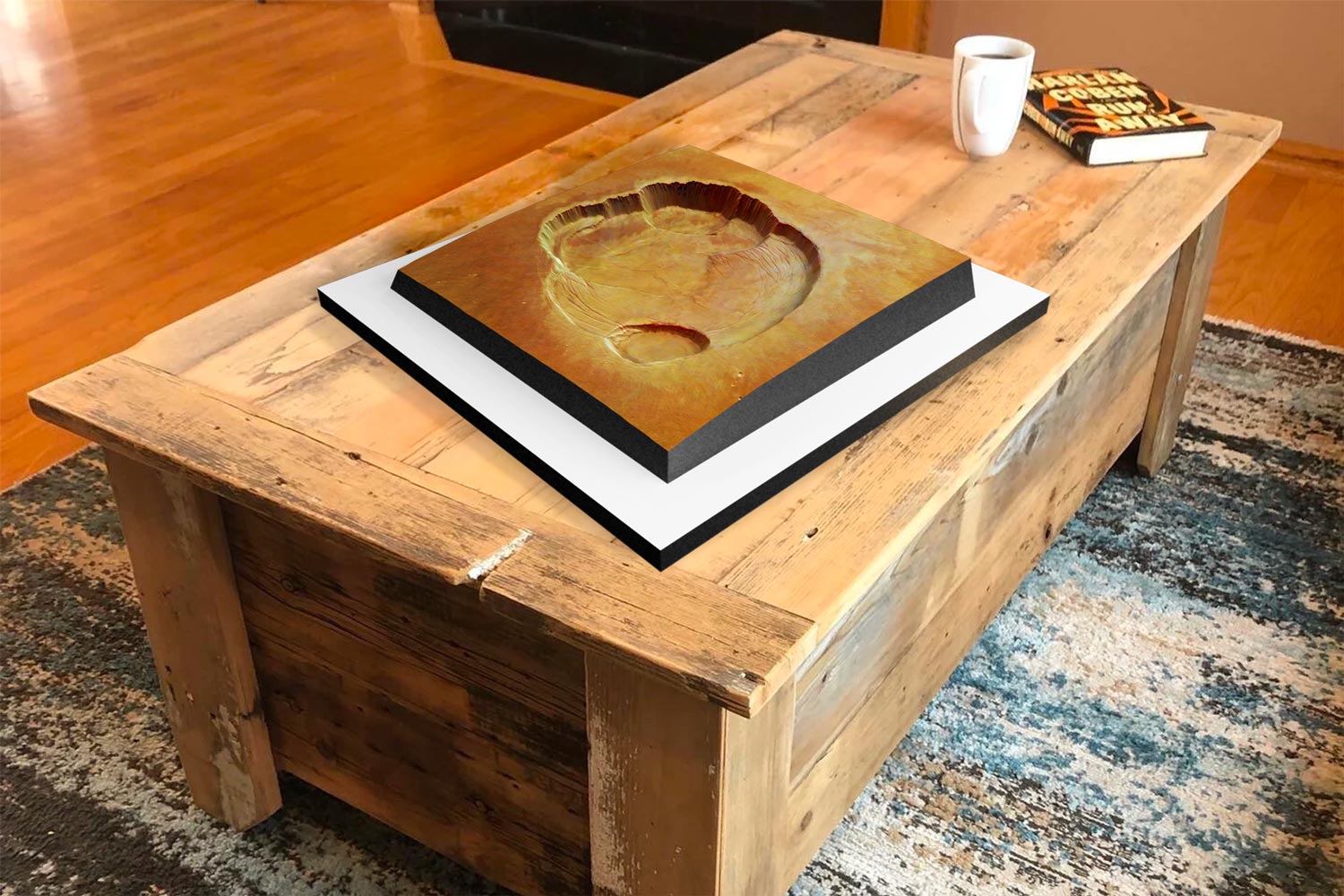
- Excitement: Bring the Mar’s landscape into your home or office as a unique conversation starter and to show off your love and knowledge of the planet.
- Options! With four sizes up to 30″x30″ to choose from and many Marscape locations to collect; the possible mix and match combinations are plentiful.
-
Fade Resistant Archival Inks
-
Epoxy Coated for Strength and Waterproofing
-
Ready to Hang with Pre-Installed Hardware (optional)
-
Black Felt Borders
Marscapes Topographical Features
We chose epic locations on Mars to be the foundation of our Marscape series. These gorgeous sites may be some of the first choices for future tourists and hold spectacularly mysterious oddities representative of the best views of this fascinating Martian world.

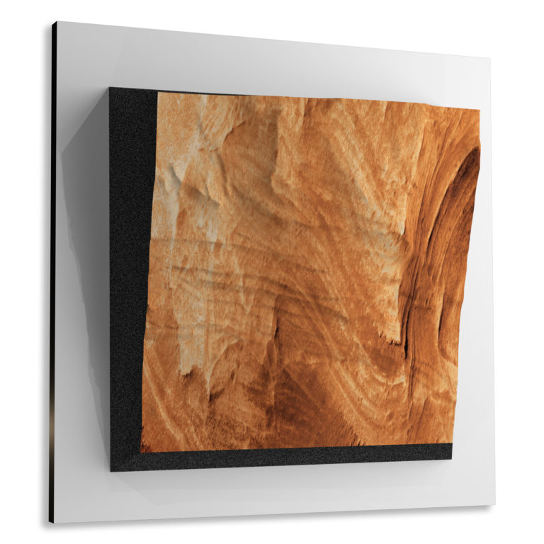
Valles Marineris, Mars is a massive canyon system that is three times deeper than the Grand Canyon. We also have an Educational style that includes longitude and latitude lines, important feature labels and contour lines.
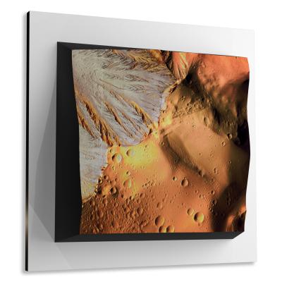
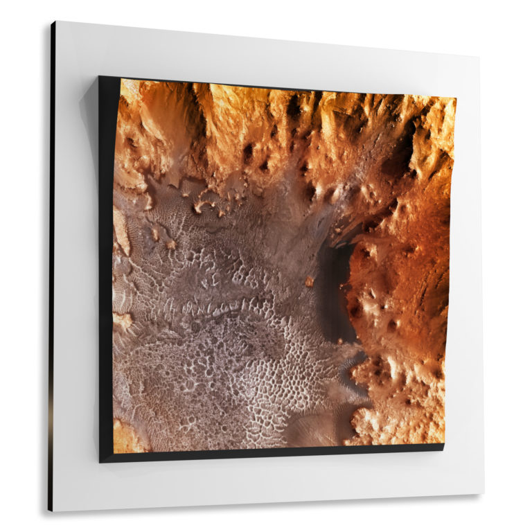
Athabasca Valles, Mars is riddled with (what some call) ring-mound landforms. These terrain forms are characterized by small cones and rings on the floor of the valley.

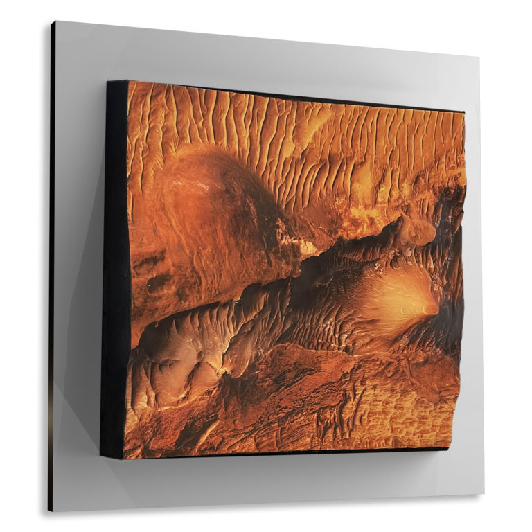
Noctis Labyrinthus, Mars is on the western end of Valles Marineris with deeply walled maze-like valleys.
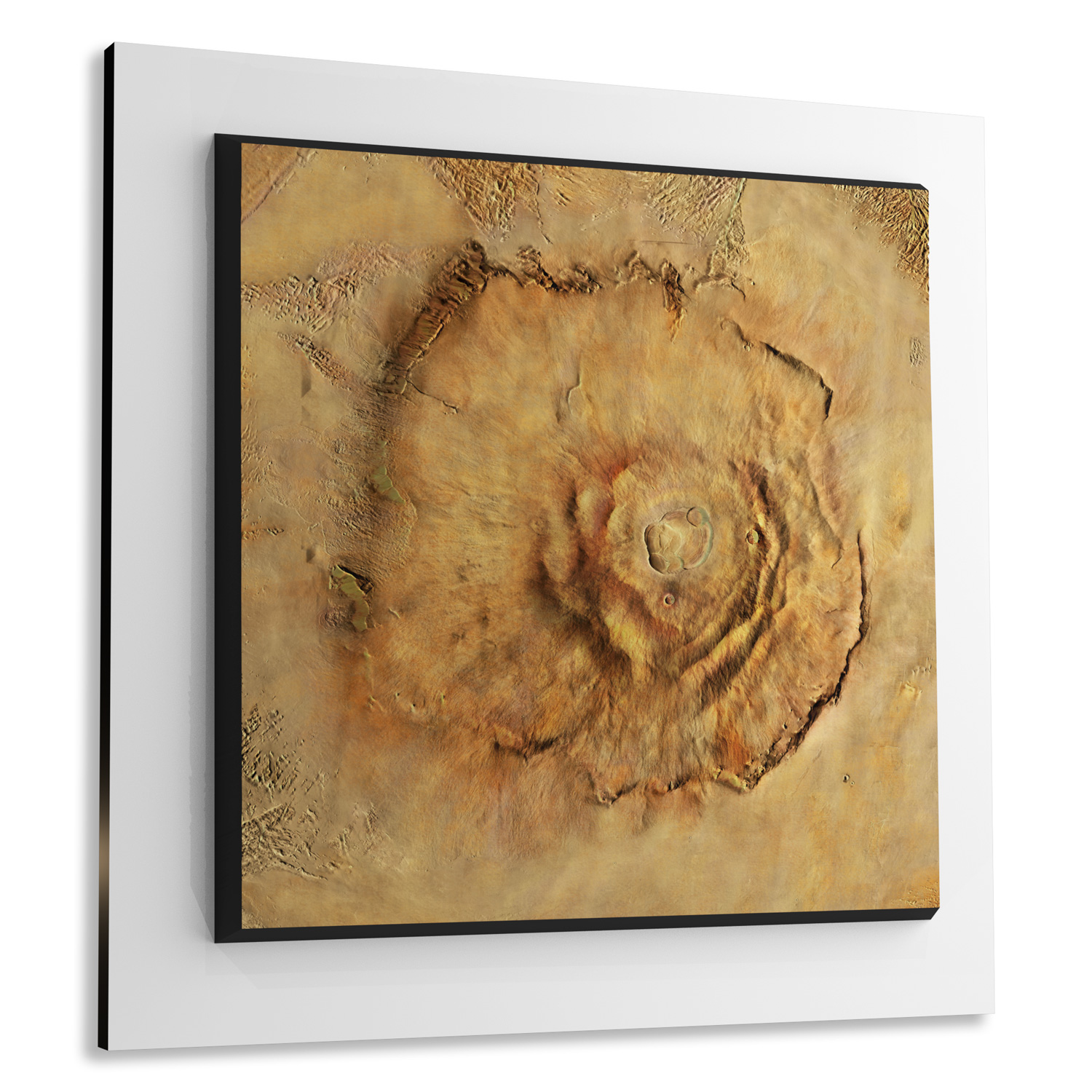
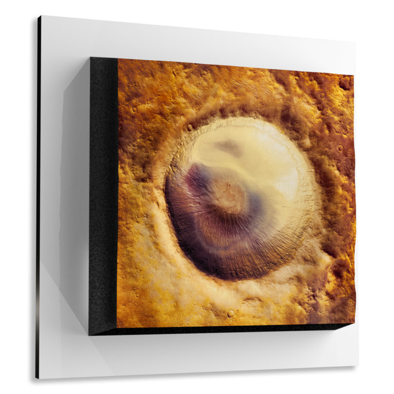
Olympus Mons, Mars is a gigantic shield volcano and is two-and-a-half times greater than Mount Everest. We have 3 unique views within Olympus Mons. The Caldera, the Basal Scarp, and an Aerial View.
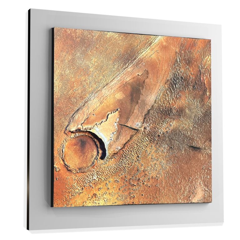
Garni Crater, Mars contains elegant dunes and NASA has discovered evidence of liquid water within it.
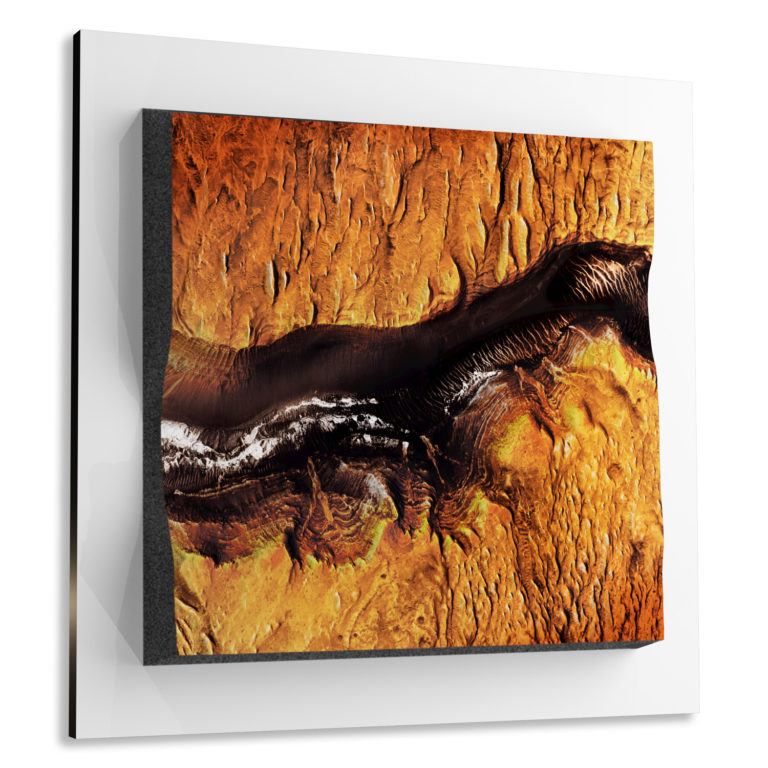
Candor Chasma, Mars takes up a large portion of Valles Marineris with channel terrain features that suggest a history of flowing water.
Elorza Crater, Mars is located northeast of Valles Marineris with a nearly 25-mile diameter.
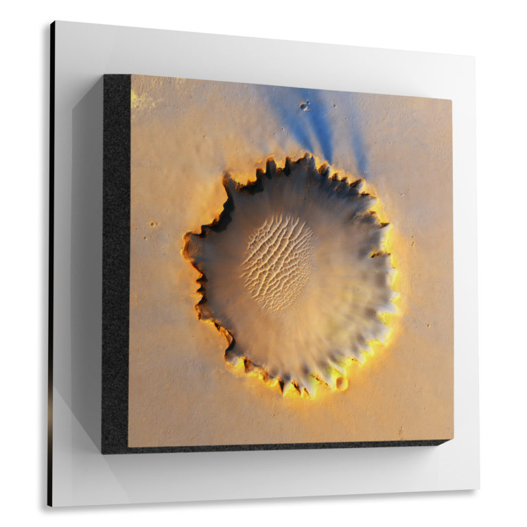
Victoria Crater, Mars was explored in 2006 by NASA’s Opportunity rover. The rover spent 180 sols inside of the crater collecting high-resolution imagery and topography data. Opportunity is distinguishable in the HiRISE image of Victoria crater.
Ius Chasma, Mars is the southern through of Valles Marineris and researchers have found evidence for precipitation here.
Gale Crater, Mars was the landing site of NASA’s Curiosity rover in 2012. This impact crater contains clay and sulfate materials, indicating past water, which may have been a habitat for microbes.
Technology and Materials
Our process includes some traditional techniques, some next-generation 3D printing methods, and a lot of experimentation with different materials and mediums. To create one Marscape topography, it flows through many different expert hands from 3D modelers, digital artists, 3D printers, finishers, quality control, and so on.
Common Questions
- How are the Marscapes made?
Our materials are gallery quality. 3D raised relief models are built with high quality, UV-resistant, environmentally-friendly, fade-resistant, latex archival inks. Our archival inks prevent fading to preserve as much fine detail as possible over time.Built to last with a rugged composite core of 3D printed plastic and a double coated 2-part epoxy hardener. This core is mounted to a 5/8″ engineered wood composite of Medium Density Fiberboard (MDF) that is wrapped in vinyl for easy cleaning. The model is extremely strong and very accurate. Finishing of the model is done with a special sealer providing a weatherproof, stain-resistant matt-finish. A flocking is applied to all edges to give a high-end museum quality finish.
- How long does it take to fabricate a 3D marscape raised relief map?
Each map is carefully crafted by hand and usually takes 7 – 10 days. - How much will I be charged for shipping? Shipping is FREE in the continental United States and a 25% surcharge is added for outside the continental U.S. Orders are shipped from our facility in Ogden, Utah.
- What if my Marscape is damaged in shipping? Even though WhiteClouds takes great care in preparing items for shipment, occasionally there is damage during shipping. If you receive your order and it is damaged or broken, we will gladly replace your items.
Do you have a question we didn‘t answer? Don’t hesitate to contact us at 1-385-206-8700 or [email protected].
Custom Mars Topographies
Over the course of the past eight years, the team at WhiteClouds have refined techniques to create one-of-a-kind custom topography models of various locations on Earth. Our skilled artisans have determined the best materials and fabrication technologies to create high-quality, affordable terrain models. It is not outside of our wheel-house to go beyond the constraints of our ready-made Marscapes to build-to-suit for our customers.
Get a Free 3D Cost Estimate for a Custom Topographical Model
History of Mars Imagery
Though observation of Mars, from Earth, can be traced back as far as the second millennium BCE in ancient Egypt; the first up-close image of Mars was not taken until 1976. Over the past 50 years many rovers and orbiters have furthered up-close exploration of Mars. Some of the more recent exploratory technologies and resources include:
- Themis — The Thermal Emission Imaging System is an instrument on the Mars Odyssey. It combines a 5-wavelength visual imaging and a 9-wavelength infrared imaging system.
- MRO — NASA’s Mars Reconnaissance Orbiter.
- MOLA — The Mars Orbiter Laser Altimeter was on the Mars Global Surveyor spacecraft, which transmitted altimetry data from the Mars orbit from September 1997 to June 2001.
- DTM — Digital Terrain Models are computer manipulatable topographic data files containing the elevation data of the terrain in a digital format.
- HiRISE — High Resolution Imaging Science Experiment is a camera on the Mars Reconnaissance Orbiter. In orbit since 2006, this camera was built under the direction of the University of Arizona’s Lunar and Planetary Laboratory.
- CTX — The Context Camera is on the Mars Reconnaissance Orbiter and it gives a wide contextual view of the terrain around smaller rock and mineral targets as they are imaged by other onboard cameras.
- MOC — The Mars Orbiter Camera and Mars Observer Camera were scientific instruments on board the Mars Observer and Mars Global Surveyor spacecraft.
- HRSC — The High-Resolution Stereo Camera is a push-broom scanning instrument onboard the European Mars Express Mission.