Earth’s unique geography creates stunning abstract art when viewed from space. Diverse landforms, vibrant colors, and intricate patterns form a visual tapestry that transcends traditional notions of art. From winding rivers to jagged mountains, the beauty of Earth’s surface is a captivating palette of hues and shapes. The interplay of light, shadow, and weather patterns adds to the dynamic nature of this cosmic artwork, showcasing the harmonious interconnections between geology, climate, and life. Discover 20 incredible images of our earth taken by the Earth Resources Observation and Science (EROS) Center.
1. Vatnajokull Glacier Ice Cap, 1999
Like icy tendrils, valley glaciers extend from the massive Vatnajokull Glacier, creating a striking display of blue hues within Iceland’s Skaftafell National Park. Situated on the southern fringes of Vatnajokull, Europe’s largest ice cap, this park offers a glimpse into the majestic beauty of glacial formations and their mesmerizing shades of blue in sharp contrast to red.
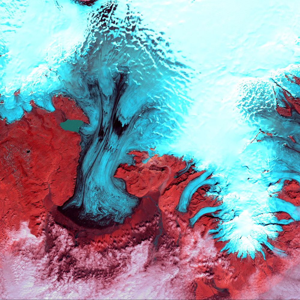
The significance of Vatnajokull Glacier extends far beyond its sheer size and awe-inspiring beauty. As Europe’s largest ice cap, this magnificent glacier plays a crucial role in the local and global environment. Vatnajokull acts as a natural reservoir, storing vast amounts of freshwater that gradually release into rivers, sustaining ecosystems and providing a vital water source for communities. Its meltwater feeds numerous rivers, contributing to the fertility of surrounding lands and supporting a diverse range of flora and fauna. Moreover, Vatnajokull’s icy expanse helps regulate the climate by reflecting sunlight back into the atmosphere, thereby mitigating the impacts of global warming. This glacier serves as a poignant reminder of the interconnectedness between Earth’s ice formations, weather patterns, and the overall health of our planet. Preserving and understanding Vatnajokull Glacier is of paramount importance in safeguarding our environment and ensuring the sustainability of our ecosystems.
2. Cloud Lightning Utah / Arizona, 2014
In a mesmerizing display reminiscent of lightning streaking across a foreboding sky, a dry expanse of rocky buttes reveals itself in the southern regions of Utah and northeastern Arizona. Unbeknownst to the casual observer, river channels gracefully meander northward from Arizona, converging into the mighty San Juan River.
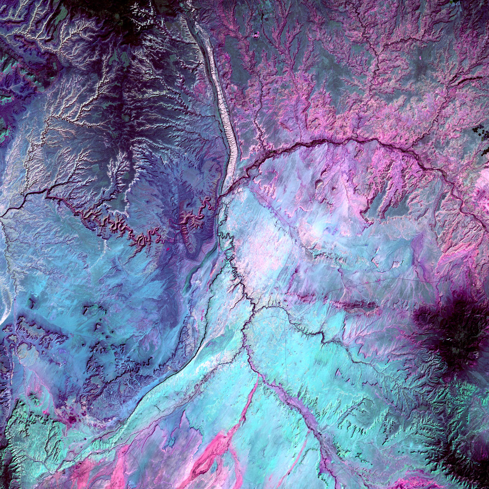
Dominating the upper portion of the image is the remarkable geological feature known as Comb Ridge, characterized by its jagged and folded monocline—an impressive formation resulting from Earth’s crustal movements. This captivating scene serves as a testament to the remarkable landscapes shaped by nature’s forces and invites us to marvel at the intricate wonders hidden within our planet.
3. Outburst in Iceland, 2017
A striking interplay of red and black hues disrupts the icy expanse of southern Iceland’s glacial landscape. Amidst the pristine white surroundings, gray-black filaments emerge, marking the remnants of past glacial melting outbursts known as jökulhlaups. These sudden and intense flooding events cascade down the expansive outwash plain of Skeiðarársandur, renowned as one of the world’s largest of its kind.
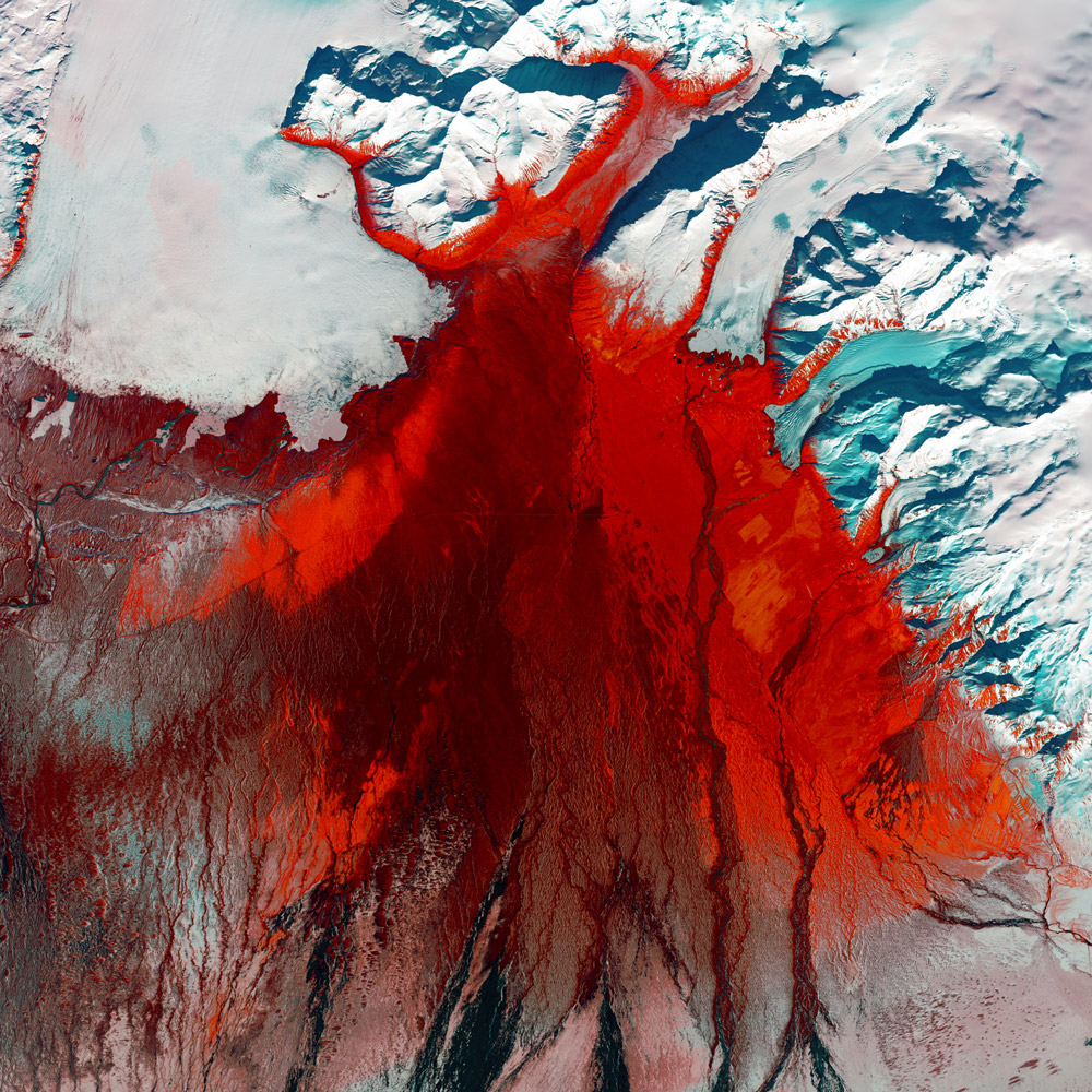
From the upper left corner of the image, the Skeiðarárjökull Glacier extends its icy reach. The plain itself, mostly devoid of vegetation, reveals sporadic bursts of red, indicating the presence of low moss, birch shrubs, and other resilient grass species that manage to thrive in this harsh environment. This captivating scene encapsulates the ever-changing dynamics of glacial landscapes and the tenacious resilience of life in even the most challenging conditions.
4. Bleak Midwinter in Minnesota, 2016
As the winter solstice approaches, a pristine blanket of snow envelops the landscape in southwestern Minnesota, transforming it into a serene monochromatic tableau. Although it may appear as a stark black and white image, it is, in fact, an authentic representation of the natural colors present. Within this wintry scene, the Minnesota River gracefully meanders from the upper left to the lower right, weaving its way through the snowy terrain. This captivating sight captures the essence of the season and the serene beauty that winter bestows upon the land.

The Minnesota River is of significant importance as a vital tributary of the Mississippi River, contributing to the ecological balance of the region. It supports diverse plant and animal species, serving as a habitat and migratory corridor. Additionally, the river has played a central role in the history of human settlement, providing sustenance, transportation, and economic opportunities. However, it also faces environmental challenges, making conservation and sustainable management essential. Understanding the significance of the Minnesota River highlights the interdependence between nature, human communities, and the preservation of our natural resources.
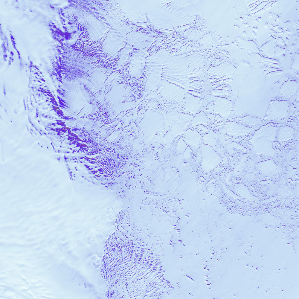
5. Robinson Glacier in Antarctica, 2000
Intricate lines and formations etched upon Antarctica’s Robinson Glacier provide a glimpse into the gradual yet inexorable motions of this colossal ice river. The patterns of lines delineate the presence of icefalls, where the glacier descends over rocky terrain, and crevasses, immense fractures resulting from variations in the glacier’s speed. Flowing towards the continent’s coast, Robinson Glacier converges with vast expanses of sea ice, locked in a frigid embrace by the Southern Ocean. This captivating scene unveils the mesmerizing dynamics of glacial movements and the compelling intersection between Antarctic landmasses and the icy realms of the Southern Ocean.
Robinson Glacier serves as a natural laboratory for scientific research. Its intricate lines, shapes, and crevasses provide insights into glacial processes, ice deformation, and the impact of climate change on polar environments. Scientists can study the glacier to enhance their understanding of ice dynamics, ice sheet stability, and the interplay between glacial systems and the surrounding ocean.
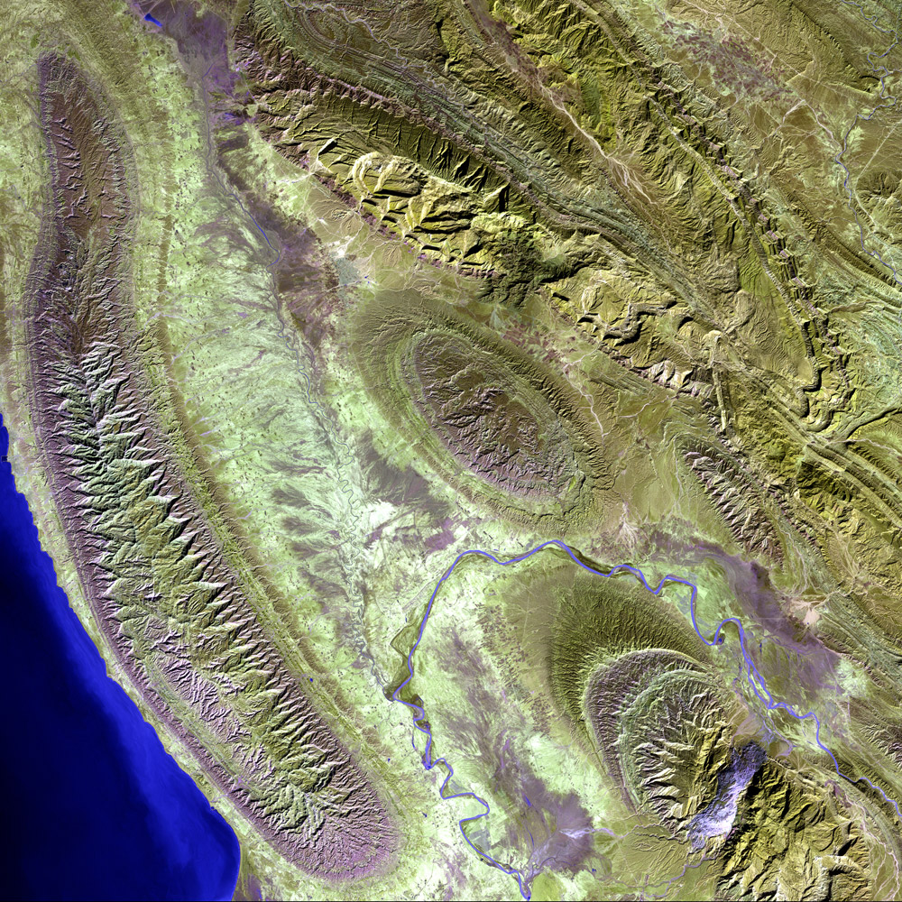
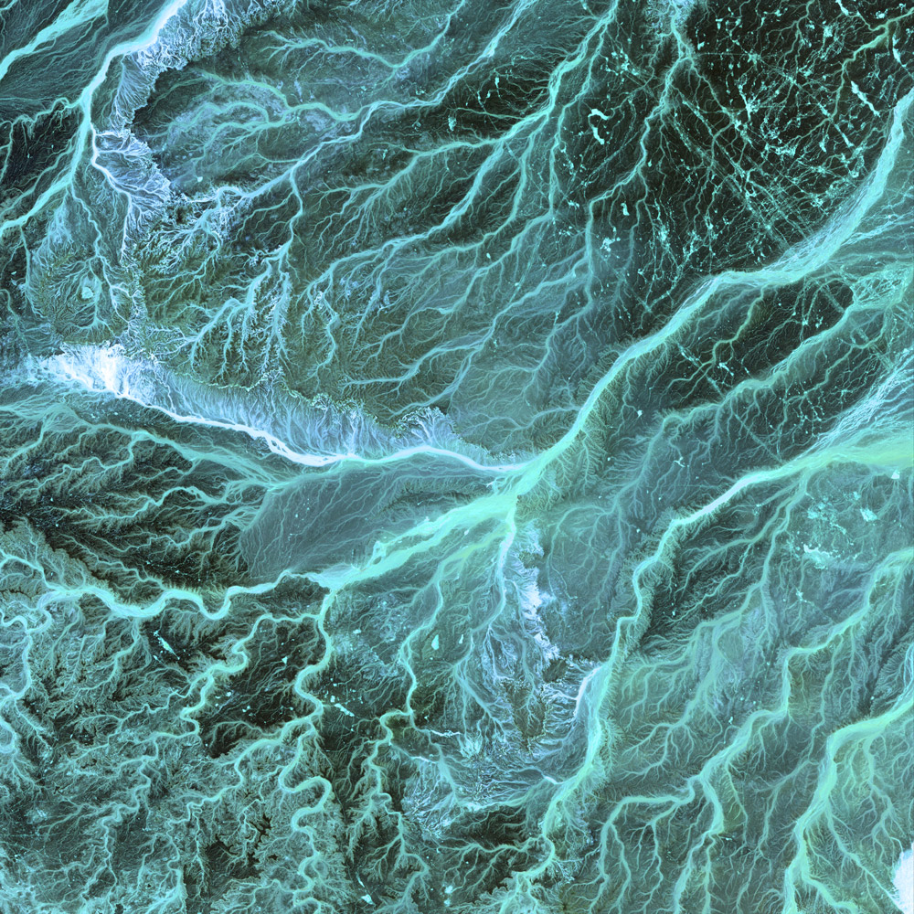
6. Konari Iran, 2000
Nestled amidst the majestic peaks of the Zagros Mountains in western Iran, the Mand River gracefully winds its way, its glistening waters carving a path of natural beauty through the rugged terrain. Alongside the river, the quaint town of Konari exudes a sense of tranquility, perfectly harmonizing with the surrounding landscape. This picturesque setting showcases the seamless blending of nature and human settlements, where the timeless flow of the Mand River serves as a lifeline for the local community, providing sustenance, irrigation, and a source of inspiration for those fortunate enough to call this enchanting region home.
7. Von Karman Vortices Blowing Across the Pacific Ocean, 2002
When prevailing winds from the east encounter the rugged expanse of Alaska’s Aleutian Islands, a mesmerizing phenomenon unfolds, giving rise to spiraling eddies known as Von Karman vortices. These captivating vortices, depicted in the image, manifest as a result of air flowing over and around the obstacles in its path. As the prevailing winds sweep across the vast northern Pacific Ocean, the Aleutian Islands stand as natural barriers, disrupting the smooth flow of air and setting the stage for the formation of these swirling patterns.
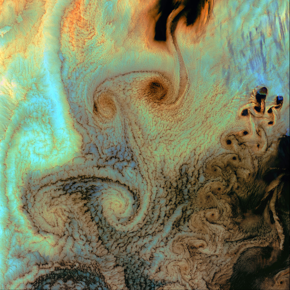
The Von Karman vortices, with their distinct spiral shapes, showcase the intricate dance between the atmosphere and the physical features of the landscape. This remarkable display not only captivates the eye but also serves as a reminder of the dynamic interplay between air currents and natural topography, offering a glimpse into the invisible forces that shape our world.
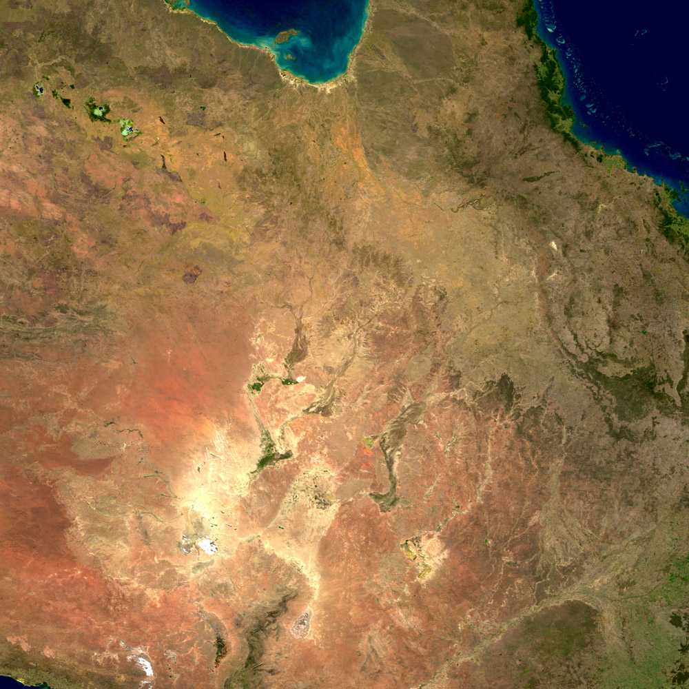
8. Australia, 2018
Among the continents, Australia stands as the smallest and flattest, its landscape shaped predominantly by erosion processes. Numerous rivers traverse the vast expanse, meandering through the continent’s harsh and arid interior, ultimately culminating in salt lakes that remain parched for a significant portion of the year. However, Australia’s coastal regions present a contrasting picture, renowned for their remarkable biodiversity. From the awe-inspiring wonders of the Great Barrier Reef in the northeast to the captivating ecosystems of Shark Bay in the west, Australia’s coastlines teem with a rich tapestry of life. These coastal areas serve as thriving havens, brimming with diverse marine species, vibrant coral reefs, and unique ecosystems that contribute to the global significance of Australia’s natural heritage.
Australia’s deserts possess a unique and captivating allure that sets them apart from deserts found in other parts of the world. These vast arid landscapes showcase a remarkable array of distinctive features and adaptations. With their expansive dune fields, such as the Simpson and Great Victoria deserts, Australia’s deserts boast some of the largest and most mesmerizing sand deserts on the planet. The rugged beauty of ancient rock formations, like the iconic Uluru (Ayers Rock) and Kata Tjuta (The Olgas), add a sense of mystique to these barren terrains. These deserts are also home to remarkable plant and animal life that have adapted to survive in extreme conditions, including resilient desert shrubs, spinifex grasses, and iconic fauna like kangaroos, wallabies, and various reptiles. Additionally, Australia’s deserts hold cultural significance for Aboriginal communities, as they have been inhabited and cherished for tens of thousands of years, contributing to the rich tapestry of Indigenous heritage. The vastness, unique geological formations, diverse flora and fauna, and cultural heritage make Australia’s deserts an extraordinary and treasured part of the country’s natural landscape.
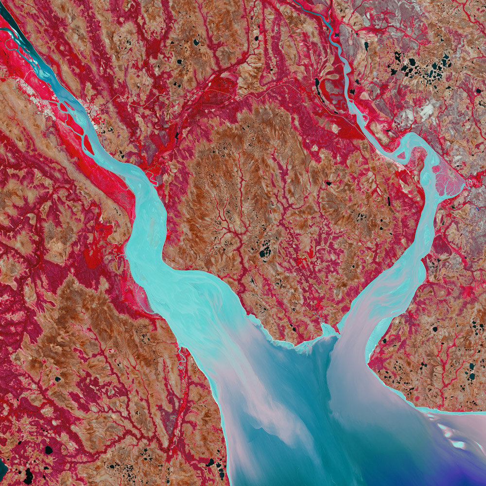
9. Mezen Mixing in Russia, 2014
In the northern reaches of Russia, a captivating convergence occurs where the freshwater flow of the Mezen River merges with the vast expanse of the Arctic Ocean’s saltwater. This meeting of contrasting waters gives rise to a unique estuary characterized by its funnel-shaped form. Within this dynamic estuary, a powerful tidal current ebbs and flows, ceaselessly stirring the waters and preventing the accumulation of sediment that typically forms deltas. Instead, the interplay of currents causes a mesmerizing dance of water turbidity, vividly captured in this colorful composition. As the image unfolds, the intensifying brightness signifies a corresponding increase in the turbidity of the water, hinting at the intermingling of sediments and marine particles. This mesmerizing display serves as a reminder of the intricate interactions between freshwater and saltwater ecosystems, highlighting the harmonious yet ever-changing nature of our planet’s interconnected waterways.
The Mezen Mixing in Russia holds notable significance due to its unique hydrological dynamics and ecological implications. As the freshwater of the Mezen River meets the saltwater of the Arctic Ocean, this convergence creates a distinct estuary characterized by a funnel-shaped form and a powerful tidal current. Unlike typical river deltas, the Mezen Mixing prevents the buildup of sediment and instead fosters a constant mixing of waters. This phenomenon plays a crucial role in maintaining water quality, nutrient distribution, and the ecological balance of the region. It influences the distribution of marine organisms, impacts sediment transport, and contributes to the intricate web of life in the estuarine ecosystem. The study of Mezen Mixing provides insights into the interactions between freshwater and saltwater systems, helping us understand the dynamics of estuaries and their significance in coastal ecosystems.
10. Desolation Canyon in Utah, 2000
Journeying through the rugged landscapes of Utah, the mighty Green River charts a southward course, gracefully traversing the expansive Tavaputs Plateau that crowns the scene. As it carves its path, the river encounters the breathtaking marvel of Desolation Canyon, which dramatically cleaves through the Roan and Book Cliff formations—two towering escarpments that resemble majestic, staircase-like structures. Rivalling the depths of the renowned Grand Canyon, Desolation Canyon proudly stands as one of the largest wilderness areas in the American West, encompassing vast stretches of unspoiled and untamed terrain. Within its boundaries, this pristine wilderness remains largely unprotected, inviting adventurers and nature enthusiasts to immerse themselves in its awe-inspiring beauty and experience the profound solitude that defines the essence of the American West.
Desolation Canyon is renowned for its stunning geology, characterized by towering cliffs, intricate rock formations, and the imposing Roan and Book Cliff escarpments. Moreover, the canyon holds historical and cultural significance, with evidence of human habitation dating back thousands of years, including Native American rock art sites. Its untouched wilderness offers a sanctuary for diverse wildlife, while also serving as a valuable outdoor recreational resource and a testament to the untamed natural beauty that defines the American West.
11. Fractured in Canada, 2016
In the far reaches of northern Canada, the Arctic Ocean’s cracked ice shatters like fragmented glass, creating a mesmerizing spectacle. To the right, lies the uninhabited expanse of Eglinton Island, while the upper left reveals elongated projections from Prince Patrick Island reaching downward. This captivating image showcases the rugged and untouched beauty of these remote Arctic lands, reminding us of the extraordinary and ever-changing nature of the icy northern regions.
These remote and uninhabited island offers a unique and pristine ecosystem that serves as a natural laboratory for studying Arctic flora, fauna, and geological processes. It provides a valuable site for monitoring the impacts of climate change on the Arctic environment, including melting sea ice, changing wildlife habitats, and shifting ecological dynamics. The island’s cultural significance lies in its connection to Indigenous communities who have historically inhabited the region, with traces of their presence evident in archaeological sites and cultural heritage. Prince Patrick Island serves as a reminder of the fragile yet resilient nature of Arctic ecosystems and the need for continued efforts to understand, protect, and preserve this vital part of Canada’s natural and cultural heritage.
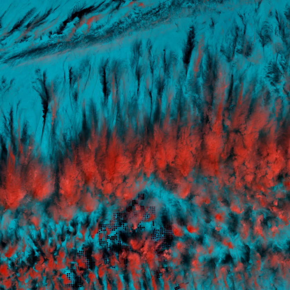
12. Eerie Cloud Shadows in Egypt, 2014
In the southern reaches of Egypt, mysterious cloud patterns weave ethereal shadows across the landscape. Rendered in infrared, these clouds take on a mesmerizing red hue, while the desert terrain below shrouds itself in a hazy blue. This captivating interplay of colors and textures adds a surreal and otherworldly quality to the scene, evoking a sense of enchantment and wonder. The unique perspective provided by the infrared rendition unveils a hidden dimension of the natural world, offering a fresh and captivating lens through which to explore the diverse and ever-evolving landscapes of our planet.
When observed from space, the Earth unveils a mesmerizing array of cloud formations that showcase the dynamic nature of our atmosphere. Delicate wisps of cirrus clouds stretch across vast expanses, resembling delicate brushstrokes against the blue canvas of the sky. Towering cumulonimbus clouds, with their anvil-shaped tops, signify powerful storms brewing below. Stratocumulus clouds gather in layers, resembling a textured blanket over the landscape. Puffy cumulus clouds, resembling cotton balls, dot the sky, adding a touch of whimsy to the scenery. These diverse cloud formations, each with its own unique characteristics, paint a captivating picture of the ever-changing and enchanting nature of our planet’s atmospheric canvas when viewed from the vantage point of space.
13. Jordan, 2001
Across the arid expanse of southeastern Jordan, a captivating sight unfolds as meandering wadis intertwine, giving rise to intricate and dense networks. These wadis, characterized by their dry nature for most of the year, transform into vibrant streambeds following seasonal downpours, breathing life into the barren terrain. The term “wadi,” derived from Arabic, aptly describes these gulley-like formations, which navigate their way through the stark landscape, carving their paths with intermittent watercourses. This interplay between the wadis and the arid surroundings not only adds visual intrigue but also highlights the delicate balance between water and land in this region, where the rejuvenating power of occasional rains sustains both the ecosystem and the communities that rely on it.
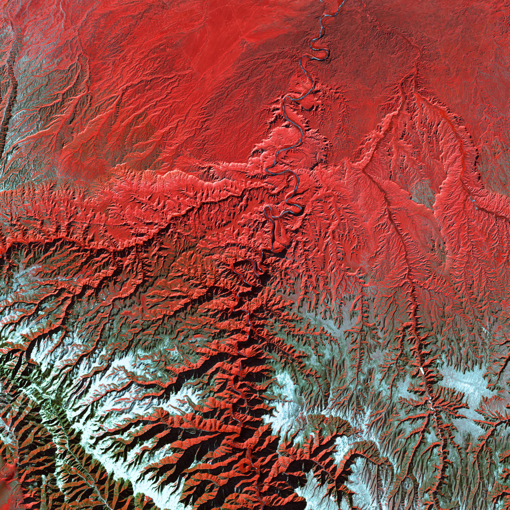
14. Himalayas, 1999
The majestic Eastern Himalaya Mountains dominate the landscape with their towering, snow-capped peaks and intricate ridges, forming a captivating patchwork of white and red hues amidst the southwestern Chinese region. These peaks, reaching great heights, create a striking contrast against the surrounding valleys and rivers. Comprising three parallel mountain ranges, the Himalayas stretch impressively for over 2,900 kilometers. Their awe-inspiring presence not only adds to the visual grandeur of the area but also plays a crucial role in shaping the climate, biodiversity, and cultural heritage of the region.
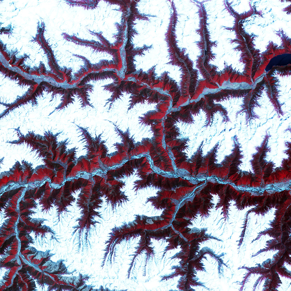
Stretching across multiple countries including India, Nepal, Bhutan, China, and Pakistan, the Himalayas are home to the world’s highest peak, Mount Everest, standing at a staggering height of 8,848 meters (29,029 feet). This mountain range boasts an astonishing collection of over 50 peaks that surpass 7,200 meters (23,600 feet) in elevation. The Himalayas also play a vital role in shaping regional weather patterns, acting as a natural barrier against the cold, dry winds of the Tibetan Plateau and influencing the monsoon rains that sustain the fertile lands below.
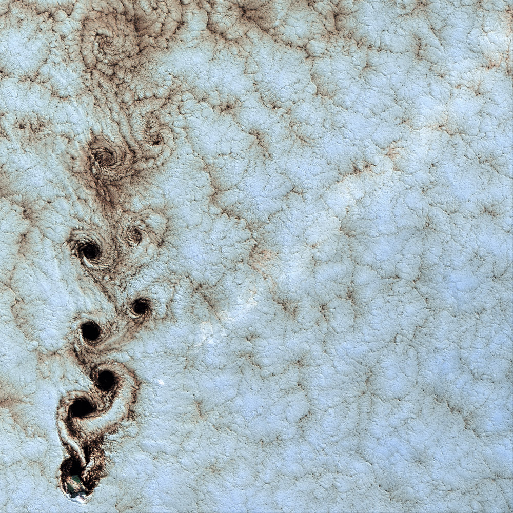
15. Karman Vortices over the Pacific Ocean, 1999
The mesmerizing spectacle of swirling clouds that grace the skies above Alexander Selkirk Island in the southern Pacific Ocean is attributed to a meteorological marvel known as the Karman vortex. Rising dramatically from the surrounding waters, this island boasts a towering peak that reaches almost a mile (1.6 km) above sea level. As wind-driven clouds encounter the island’s imposing presence, they gracefully maneuver around it, giving birth to these expansive, spinning eddies. These Karman vortices serve as a testament to the intricate dance between atmospheric forces and natural topography, showcasing the dynamic and awe-inspiring nature of our planet’s weather phenomena.
Alexander Selkirk Island holds significant importance as a remote and pristine natural sanctuary within the archipelago of the Juan Fernández Islands in the southern Pacific Ocean. The island is named after the Scottish sailor Alexander Selkirk, who was marooned there for over four years in the early 18th century and served as the inspiration for the literary character Robinson Crusoe. Its unique isolation has contributed to the preservation of its rich biodiversity, making it a haven for endemic and unique plant and animal species. The island’s rugged and diverse landscapes, including lush forests, steep cliffs, and pristine beaches, attract researchers, conservationists, and nature enthusiasts seeking to study and protect its remarkable ecosystems. Additionally, Alexander Selkirk Island is recognized as a UNESCO World Biosphere Reserve, highlighting its global significance in terms of conservation and sustainable development. Its cultural and historical legacy, coupled with its ecological significance, make Alexander Selkirk Island a place of great importance and fascination.
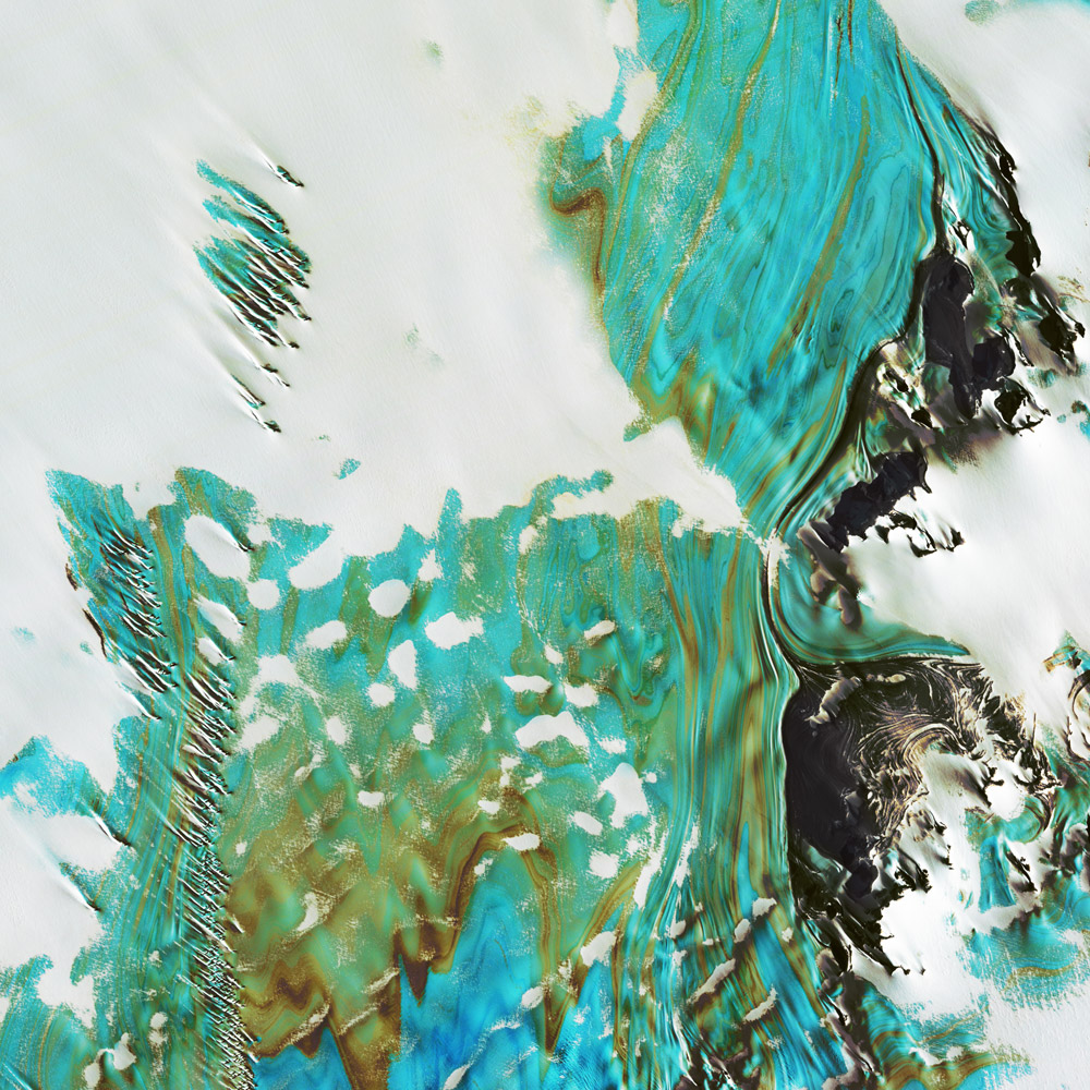
16. Blue Ice in the Yamato Mountains, 2018
In the vicinity of the Queen Fabiola Mountains, known as the Yamato Mountains, a striking illustration of blue ice can be found in Antarctica. This phenomenon occurs when relentless winds sweep across glaciers, stripping away the snow cover and revealing the pristine ice beneath. As layers of partially compacted snow from previous seasons undergo pressure, air bubbles trapped within are expelled, giving rise to the distinctive blue hue. The absorption of red and yellow light wavelengths by the ice, coupled with the uniform scattering of deeply penetrating light at blue wavelengths by the enclosed air bubbles, creates the captivating spectacle of blue ice. This natural phenomenon serves as a testament to the intricate interplay of atmospheric forces, geological processes, and optical properties that contribute to the breathtaking beauty found within the frozen landscapes of Antarctica.
Located in East Antarctica, these mountains serve as a prominent landmark within the vast and icy continent. They have been a focal point for various research expeditions and studies conducted by scientists from around the world. The Yamato Mountains provide valuable insights into the geological history of Antarctica, including its ancient ice sheets and climate changes over time. Additionally, these mountains house important ice cores, which offer crucial information about past climates and atmospheric conditions. The region’s remoteness and extreme conditions make it an ideal location for studying the pristine environment and unraveling the secrets of Earth’s history.
17. Ganges River Delta, 1999
As the mighty Ganges River reaches its final destination and merges with the Bay of Bengal, it gives birth to a sprawling delta of great significance. This vast expanse is characterized by the presence of the Sunderbans, a captivating swamp forest that blankets the majority of the delta.
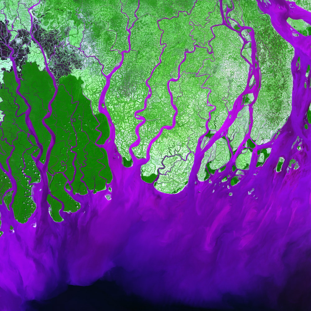
Within this unique ecosystem resides the majestic Royal Bengal Tiger, a symbol of both power and vulnerability. The Sunderbans serves as a crucial habitat for these magnificent creatures, providing them with a sanctuary amidst the intricate network of mangrove forests, winding waterways, and shifting tidal patterns. Beyond its role as a haven for the iconic Bengal Tiger, the Ganges Delta and its associated Sunderbans stand as a testament to the interplay between the river’s life-giving waters, the ever-changing coastal landscape, and the preservation of precious wildlife in one of the world’s most biodiverse regions.
18. Empty Quarter Near Saudi Arabia, 2003
As sunlight filters through the atmosphere, ethereal white clouds create delicate pinpricks of brightness that contrast with the ebony shadows they cast upon the vast expanse of the Rub’ al Khali, also known as the Empty Quarter. Situated along the border between Saudi Arabia and Yemen, this awe-inspiring desert landscape showcases the unmistakable lines of wind-sculpted sand that are characteristic of colossal sand deserts, often referred to as sand seas.
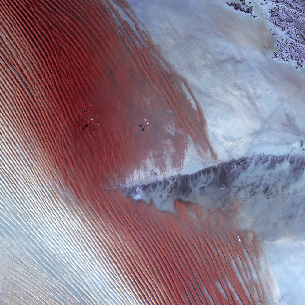
The Rub’ al Khali, encompassing an immense area, stands as the world’s largest desert of this kind. However, a prominent highland ridge disrupts the fluidity of the sand’s contours, creating an interruption in the mesmerizing patterns. Nestled within this distinct landscape, the Saudi Arabian town of Sharurah finds itself at the center of this interruption, a testament to human settlement amidst the formidable beauty of the desert’s shifting sands.
19. The Dhofar Difference off the Arabian Sea, 2000
While vast stretches of Oman are characterized by arid desert landscapes, the Dhofar region along the Arabian Sea coast presents a striking contrast in climate. This coastal area experiences a remarkable phenomenon known as the khareef, where monsoon rains arrive during the summer months. These drenching rains predominantly blanket the mountainous ridge that acts as a natural barrier, separating the lush and fertile coastal regions from the arid interior. As the rains pour down, they replenish the streams, waterfalls, and springs nestled within the mountains, ensuring a plentiful water supply that sustains the fertile lowlands throughout the rest of the year. This unique climatic pattern contributes to the ecological richness and agricultural productivity of the coastal areas, providing a remarkable oasis amidst the otherwise arid landscapes of Oman.
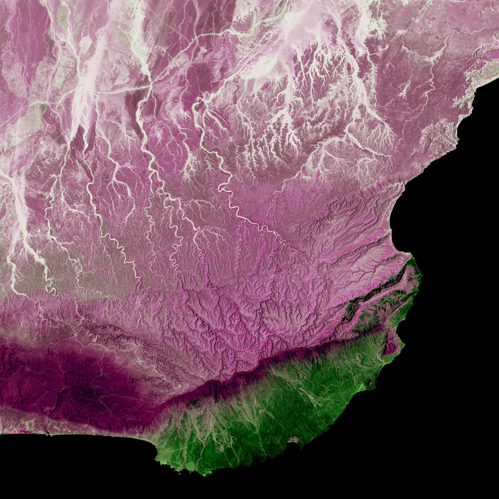
The fertile lowlands of Dhofar become a sanctuary for diverse flora and fauna, supporting agricultural activities and providing grazing grounds for livestock. Additionally, the khareef attracts tourists and nature enthusiasts who are drawn to the region’s stunning natural beauty, including cascading waterfalls, verdant hillsides, and picturesque coastal scenery. The Dhofar region’s significance lies in its role as a unique ecological enclave within the arid Arabian Peninsula, offering a remarkable contrast and contributing to Oman’s rich cultural, agricultural, and tourism heritage.
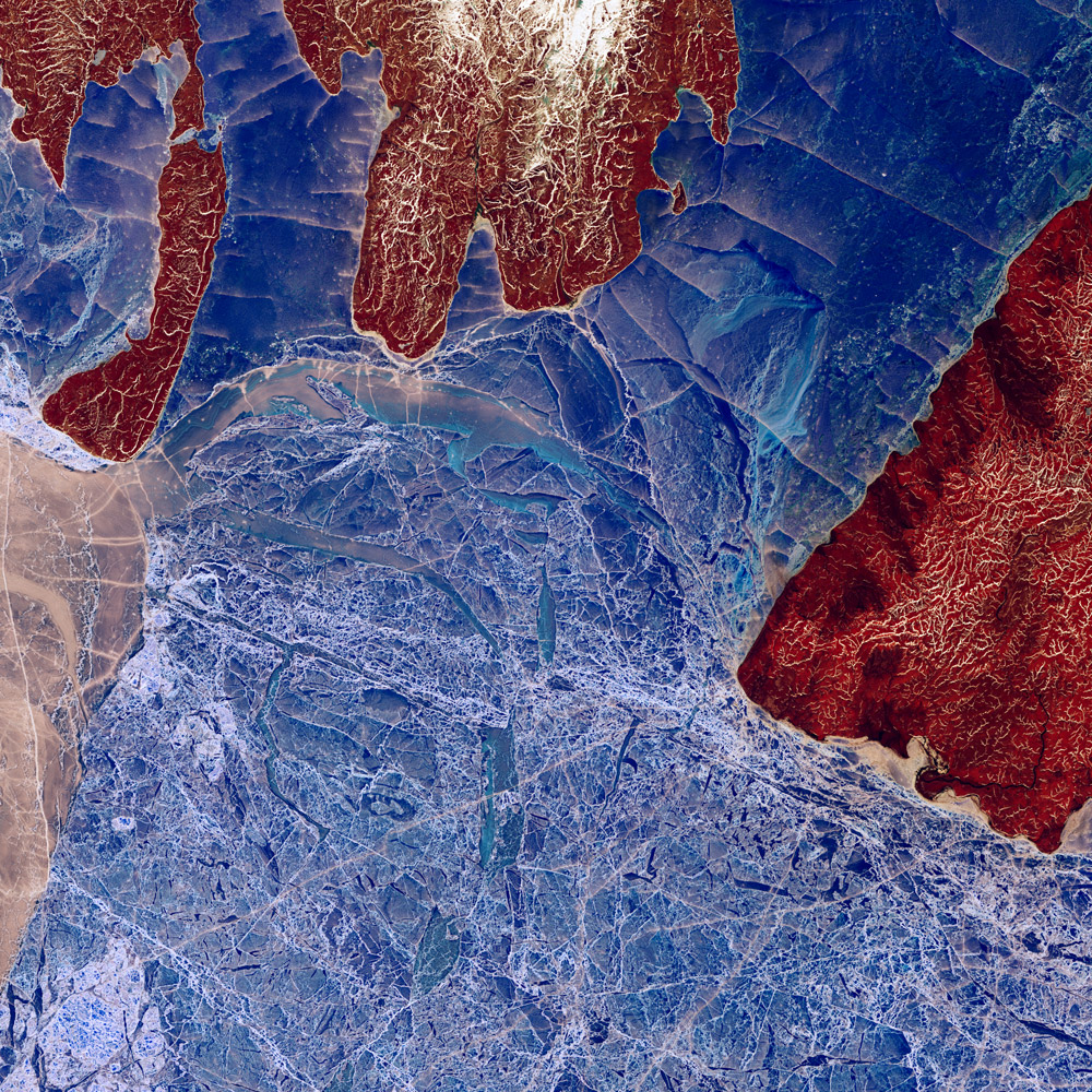
20. Desert Ribbons in Africa, 2019
In the rugged terrain of northwestern Africa, a remarkable display of tectonic forces unfolds. Morocco’s vast desert landscape reveals a captivating spectacle of intricately folded rock formations. These mesmerizing ribbons, meandering across the desert expanse, bear witness to the enduring collision of tectonic plates over time. The prominent feature cutting through the landscape is Jbel Ouarkziz, a majestic ridge that gracefully ascends 200-300 meters above the surrounding valley floors. Its uninterrupted presence stands as a testament to the immense geological forces that have shaped the region, leaving behind a visual testament to the dynamic nature of Earth’s tectonic activity.
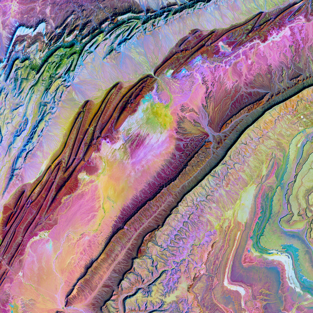
Its formation through rock folding and uplift highlights the complex tectonic history of the area. Additionally, Jbel Ouarkziz serves as a natural landmark and navigational reference point for local communities and travelers. It may also have cultural and historical significance, playing a role in local folklore and traditions. As a visually captivating feature in the desert landscape, Jbel Ouarkziz showcases the natural wonders and the geological heritage of the region, attracting the interest of geologists, adventurers, and nature enthusiasts alike.
These mesmerizing images serve as a reminder of the planet’s artistic allure, showcasing the intricate brushstrokes of nature and inspiring a sense of wonder and appreciation for Earth’s boundless creativity. The aerial perspective offers a fresh lens through which to appreciate the captivating beauty and harmonious interplay of land, water, and atmosphere. If you’ve liked any of these images and would like to order them as canvas prints or would like to see over 100 more of these Earth as Art images, visit our online store.