- All
- 3D Printing
- Architecture
- Character Models
- Characters
- Entertainment
- Foam
- Health Care
- Ideas-Topo
- Letters
- Listicle
- Logo
- Maps
- Mars
- Props
- Replicas
- Selfie
- Signage
- Sports
- Statues
- Thrones
- Top-10
- Trade Show
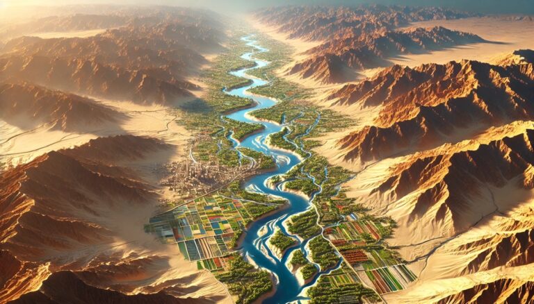
Big Horn River Watershed Map
Discover the Big Horn River Watershed Map, a gateway to the West’s iconic landscapes. Unveil its vibrant ecosystems, dynamic hydrology, and human connections brought to ...

Alabama Topo Map
Discover Alabama’s breathtaking landscapes through detailed topographic maps that reveal the Appalachian peaks, fertile valleys, and Gulf Coast plains. Whether you’re hiking rugged trails, exploring ...
Amazon-Orinoco Transition Watershed Map
Discover the Amazon-Orinoco Transition Watershed, where two mighty rivers meet. Learn how 3D mapping technologies track water flow, support conservation, and guide sustainable resource management. ...

Mississippi Topo Map
Discover Mississippi’s diverse landscapes with topographic maps revealing the fertile Delta, rolling Pine Belt hills, and dynamic Gulf Coast. From the rugged northeastern uplands to ...
Ob-Irtysh Watershed Map
Dive into the Ob-Irtysh River Watershed, a vast and vital water system in Siberia and Central Asia. Discover its rich ecosystems, seasonal dynamics, and how ...
Japura River Watershed Map
Discover the Japurá River Watershed, a vital part of the Amazon Basin. Explore its dynamic geography, rich ecosystems, and how cutting-edge 3D mapping technology is ...

Sierra Nevada Watershed Map
Discover the Sierra Nevada River Watershed Map, revealing the dynamic flow of water, diverse ecosystems, and human influence. With advanced 3D mapping technology, explore how ...

Wyoming Topo Map
Discover Wyoming’s breathtaking terrain with topographic maps revealing the Tetons’ jagged peaks, Yellowstone’s geothermal wonders, and the serene Wind River Range. From rolling High Plains ...

Canada Topo Map
Discover Canada’s breathtaking geography with topo maps that reveal the Rockies’ peaks, vast prairies, and Arctic tundra. Learn how these maps are crafted in 2D ...

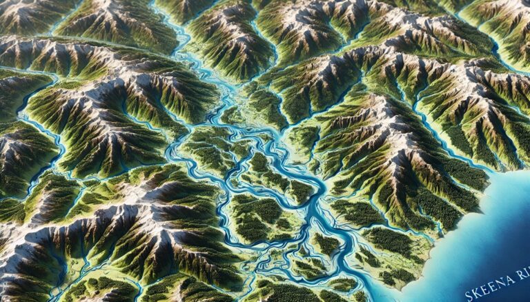
Skeena River Watershed Map
Discover the Skeena River Watershed Map, a gateway to British Columbia’s wild northwest. Unveil its vibrant ecosystems, rich Indigenous heritage, and dynamic hydrology. Experience how ...

Madeira River Watershed Map
Discover the Madeira River Watershed, a crucial Amazonian water system. Explore its dynamic geography, rich biodiversity, and how cutting-edge 3D mapping technology is helping manage ...

Saint Kitts and Nevis Watershed Maps
Saint Kitts and Nevis’ watersheds, such as the Great Salt Pond and Nevis River Basins, are vital for agriculture and ecosystems. Learn how modern technologies ...

Little Colorado River Watershed Map
Discover the Little Colorado River Watershed Map, revealing the river’s dynamic flow, diverse ecosystems, and human influence. With advanced 3D mapping technology, explore how the ...
Yemen Watershed Maps
Yemen’s watersheds, including the Tihama and Wadi Hadramawt Basins, are vital for agriculture and ecosystems. Discover how 3D mapping, GIS, and remote sensing help manage ...

Minnesota Topo Map
Discover Minnesota’s stunning geography with topographic maps revealing rugged northern wilderness, rolling prairies, and vast waterways. From the cliffs of the North Shore to the ...

South Dakota Topo Map
Discover South Dakota’s diverse landscapes with topographic maps revealing the rugged Black Hills, iconic Badlands, and rolling Great Plains. From the mighty Missouri River to ...

Green River Watershed Map
Discover the Green River Watershed, a vital Western U.S. resource sustaining ecosystems, agriculture, and communities. Explore its intricate waterways, rich biodiversity, and cultural heritage. Learn ...
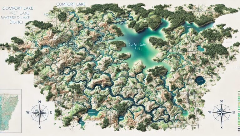
Comfort Lake Forest Lake Watershed District Map
Discover the Comfort Lake Forest Lake Watershed District, a vital Minnesota resource sustaining ecosystems, recreation, and communities. Explore its intricate lakes, streams, and wetlands while ...

Lake Eyre Basin Watershed Map
Discover the Lake Eyre Basin Watershed, a vital and unique landscape in Australia. Explore its diverse geography, seasonal hydrology, and how advanced 3D mapping technology ...

Idaho Watershed Maps
Explore Idaho’s unique watersheds, from rugged mountains to fertile valleys, and discover how 3D mapping technology is revolutionizing water management. Learn how these advanced maps ...

Upper Delaware River Watershed Map
Discover the Upper Delaware River Watershed Map, revealing the river’s dynamic flow, diverse ecosystems, and human influence. With advanced 3D mapping technology, explore how the ...

Tapajós River Watershed Map
Discover the Tapajós River Watershed, a vital Amazonian water system rich in biodiversity. Explore its dynamic hydrology, the critical ecosystems it supports, and how cutting-edge ...

Orange River Watershed Map
Explore the Kobuk River Watershed, a vital waterway in Alaska's Arctic. Learn how 3D mapping technology enhances water management, flood prediction, and conservation. Discover its ...
Lake Turkana Basin Watershed Map
Explore the Lake Turkana Basin Watershed, a vital water system in East Africa. Discover its diverse geography, unique ecosystems, and how advanced 3D mapping technology ...

South Carolina Topo Map
Discover South Carolina’s diverse geography with topographic maps revealing the Blue Ridge Mountains, rolling Piedmont, and serene Lowcountry. From rugged peaks to coastal wetlands, 2D ...
Wisconsin Topo Map
Discover Wisconsin’s breathtaking landscapes with topographic maps showcasing the rugged Driftless Area, serene Northwoods, and glacial wonders of Kettle Moraine. From rolling hills to vast ...

Nevada Topo Map
Discover Nevada's breathtaking terrain with topographic maps that unveil towering peaks, vast deserts, and expansive basins. From the Sierra Nevada's rugged beauty to the flat ...

North Platte River Watershed Map
Explore the North Platte River Watershed Map, revealing the river’s dynamic flow, diverse ecosystems, and human influence. With cutting-edge 3D mapping technology, gain insights into ...