
Navigating the Peach State: A Comprehensive Exploration of the Topographic Map of Georgia
Nestled in the southeastern United States, Georgia is a state of undeniable beauty, rich history, and diverse landscapes. From the rolling hills of the north to the coastal plains in the south, Georgia’s topography is a confirmation to the natural wonders that can be found within its borders. In this extensive exploration, we will embark on a journey through the topographic map of Georgia, unraveling its geographical features, and diving into the stories that lie beneath the surface.
Understanding Topographic Maps
Before we dive into the topography of Georgia, it’s essential to grasp the basics of topographic maps. These specialized maps provide a detailed representation of the Earth’s surface, offering crucial information about elevation, terrain, and geographical features. The distinctive contour lines on topographic maps serve as our guide through the intricate landscapes of Georgia, revealing the rise and fall of the land.
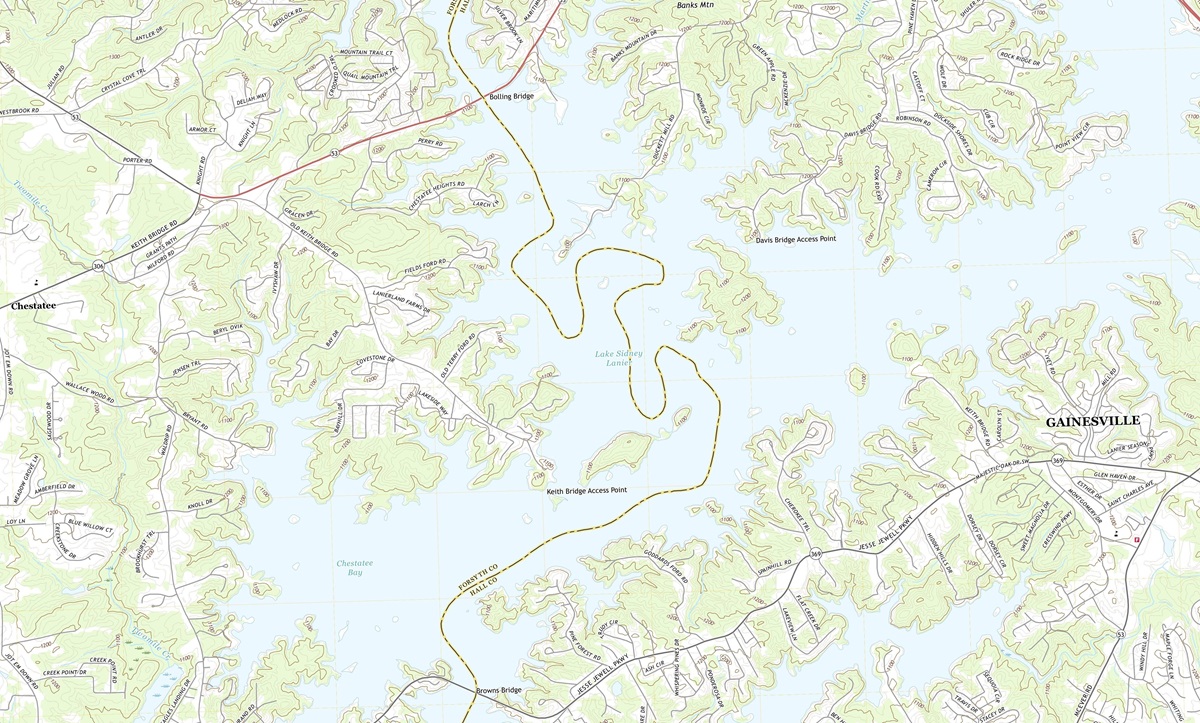 Topographic Map of Chestatee, Georgia 1:24,000 quad, 2020, USGS
Contour Lines: The Language of Topography
Imagine looking at a topographic map of Georgia for the first time. You’ll notice a myriad of lines that appear to snake and wind their way across the paper. These are contour lines, and they are the key to understanding the state’s topography.
Contour lines represent elevation, and every contour line signifies a specific height above sea level. Lines that are close together indicate steep terrain, while widely spaced lines suggest gentle slopes. By reading the contour lines, you can visualize the rise and fall of the land, allowing you to plan your journey through Georgia with precision.
 3D Topographic Map
Elevation and Relief
As we explore the topographic map of Georgia, we’ll frequently encounter two essential concepts: elevation and relief.
Elevation refers to the height of a point above sea level. It’s the numerical value assigned to each contour line on the map, providing a clear indication of how high or low a particular location is. Understanding elevation is crucial for understanding the physical characteristics of Georgia’s various regions.
Relief, on the other hand, refers to the differences in elevation within a specific area. When you see steep cliffs, deep valleys, or towering peaks on a topographic map, you’re witnessing the relief of the land. In Georgia, relief plays a significant role in shaping the state’s topography, creating the stunning landscapes that define its character.
The Northern Highlands
The Blue Ridge Mountains: Our journey through the topographic map of Georgia begins in the northernmost region, where the Blue Ridge Mountains reign supreme. This majestic mountain range, part of the larger Appalachian Mountains, stretches across the northeastern corner of the state.
The Blue Ridge Mountains are characterized by their rugged terrain, dotted with peaks and valleys. As we examine the topographic map, the contour lines reveal the steep ascents and descents that define this region’s topography. At the heart of the Blue Ridge Mountains stands Brasstown Bald, Georgia’s highest point, proudly marked with a prominent contour line.
The Chattahoochee National Forest: Nestled within the embrace of the Blue Ridge Mountains is the Chattahoochee National Forest, a vast expanse of pristine wilderness. The topographic map paints a vivid picture of this area’s lush valleys and winding rivers, all nestled amidst the rolling terrain. With contour lines tracing the curves of the land, hikers, and outdoor enthusiasts can plan their adventures, seeking out hidden waterfalls and secluded camping spots.
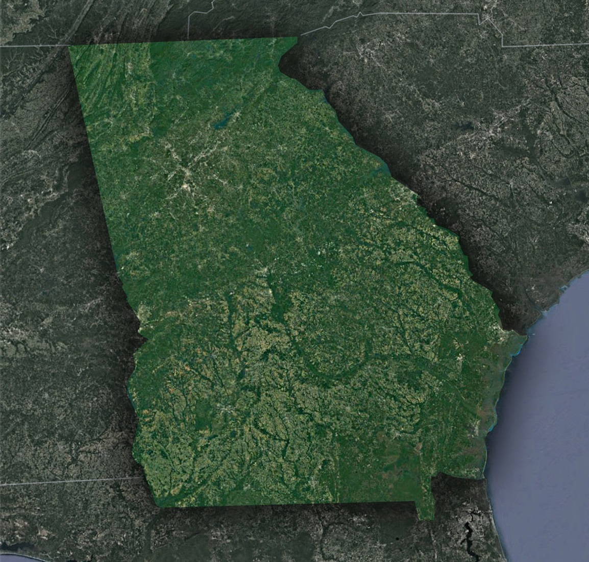 Satellite Map of Georgia
The Piedmont Plateau
Rolling Hills and Gentle Slopes: Moving southward, the topographic map leads us into the Piedmont Plateau, a region defined by rolling hills and gently sloping terrain. This area serves as a transition between the rugged Blue Ridge Mountains and the flat Coastal Plains to the south.
The contour lines in the Piedmont reveal a more gradual change in elevation compared to the mountainous north. These hills are a testament to the geological forces that shaped Georgia over millions of years, leaving behind a landscape that is both visually stunning and agriculturally fertile.
The Fall Line: One of the most intriguing features of the Piedmont is the Fall Line, a geological boundary that separates the harder, crystalline rocks of the Piedmont from the softer, sedimentary rocks of the Coastal Plains. The Fall Line is not a straight line but rather a series of rapids, waterfalls, and shoals that are clearly visible on the topographic map.
Historically, the Fall Line played a pivotal role in the state’s development, serving as a natural barrier to navigation and trade. Understanding the topography of this region is essential to appreciating its significance in Georgia’s history.
The Coastal Plains
Vast Lowlands and Coastal Marshes: As we continue our journey southward, the topographic map reveals the expansive Coastal Plains that dominate southern Georgia. These lowlands are characterized by their flat terrain and numerous rivers, which are clearly depicted by the contour lines.
The Okefenokee Swamp, one of the largest freshwater wetlands in North America, stands out prominently on the map. With its intricate network of waterways and islands, the topography of the swamp is a testament to the ever-changing dynamics of water and land.
Barrier Islands: Off the coast of Georgia, the topographic map unveils a string of barrier islands that protect the mainland from the Atlantic Ocean. These islands are characterized by their sandy shores, sand dunes, and marshy interiors.
Understanding the elevation and contour lines of these islands is crucial for coastal development and conservation efforts. The topographic map helps scientists and urban planners make informed decisions about protecting these fragile ecosystems while accommodating the needs of communities along the coast.
The Geographical Story of Georgia
The Influence of Waterways: Throughout our journey, it becomes clear that water plays a central role in shaping Georgia’s topography. Rivers, lakes, and swamps are all prominently featured on the map, revealing the intricate hydrology that defines the state.
The Savannah River, for example, serves as the natural border between Georgia and South Carolina. Its contour lines showcase the dramatic shifts in elevation along its course, reflecting the challenges faced by early settlers as they navigated this waterway.
The Legacy of Geological Forces: Beneath the surface of Georgia’s topographic map lies a complex geological history. The Appalachian Mountains, formed millions of years ago, continue to influence the state’s topography today. The Piedmont Plateau, with its mixture of rock types, tells the story of tectonic forces and erosion that have sculpted the land.
As we conclude our exploration of the topographic map of Georgia, we leave with a profound appreciation for the state’s diverse and captivating landscapes. From the soaring heights of the Blue Ridge Mountains to the tranquil waters of the Okefenokee Swamp, Georgia’s topography is a reflection of its rich natural heritage.
Understanding the topographic map of Georgia is not only a matter of navigation; it is a gateway to appreciating the geological history, ecological diversity, and cultural significance of the Peach State. Whether you are an avid hiker, a history enthusiast, or simply someone with a passion for exploring the world, Georgia’s topography invites you to embark on a journey of discovery and wonder.
Check out WhiteClouds’ 3D Topographic Maps for more information on a topographic map of Georgia. 2D Canvas Print Satellite Maps of Georgia are also available.

Contact us today to learn more about our 3D services and how we can help you achieve your goals.