A Gateway into the Landscape
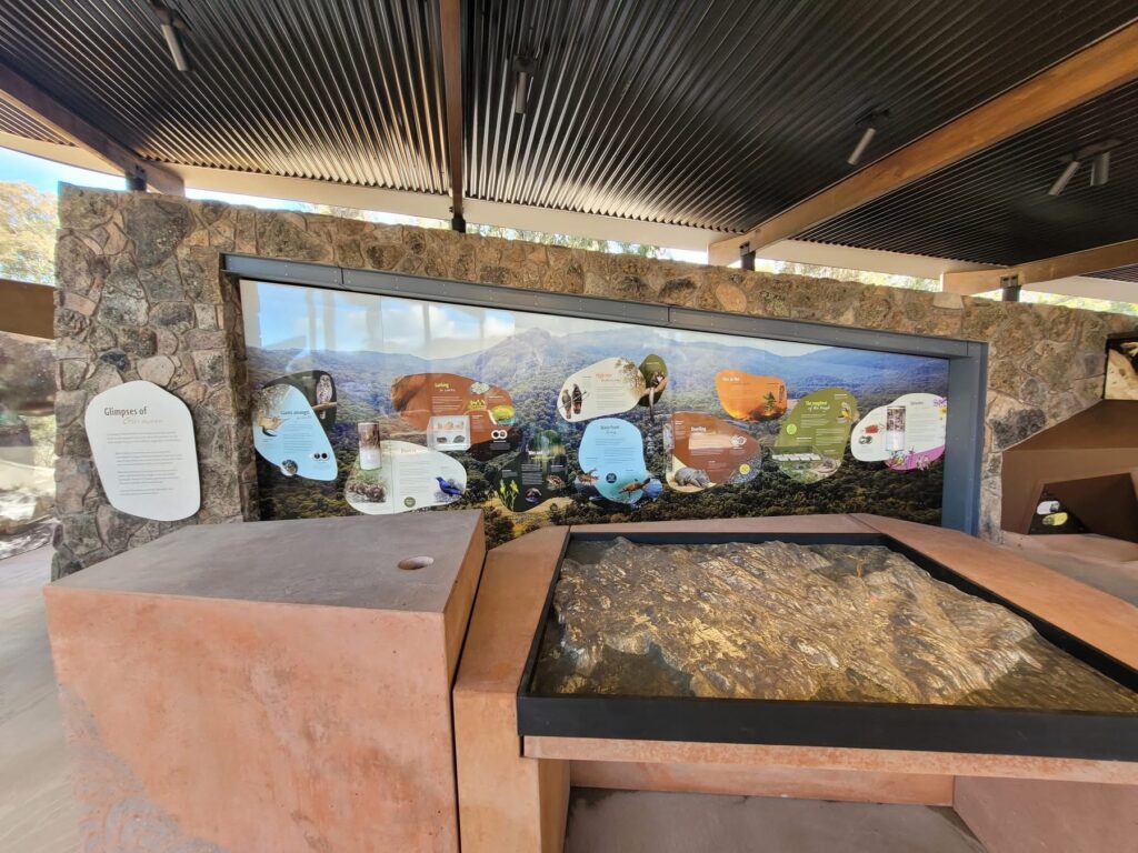
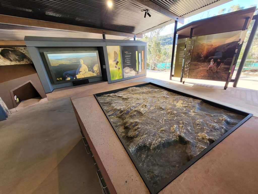
For travelers, adventurers, and nature lovers alike, there are few things more exciting than stepping into a national park knowing you’ll uncover its hidden ridges, deep valleys, and scenic trails. But what if you could explore those landscapes before your first step on the trail? At Girraween National Park in Queensland, Australia, visitors can now do exactly that through a one-of-a-kind immersive topographical map. Mounted into a table at the Visitor Information Centre, this custom 3D relief map brings the dramatic terrain of Girraween to life, setting a new standard for how we experience outdoor destinations.
Measuring 1560mm by 1213mm with a height of 107mm, the map is an impressive centerpiece that immediately draws attention. It’s not just a map—it’s an invitation, an interactive experience where visitors can run their fingers along the peaks, visualize their hikes, and gain a sense of the terrain’s scale. Finished in a sleek high-gloss resin, the map becomes more than a tool—it’s a work of art, shimmering under the protective covering while promising accurate topographic detail.
The Art of Topography in Three Dimensions
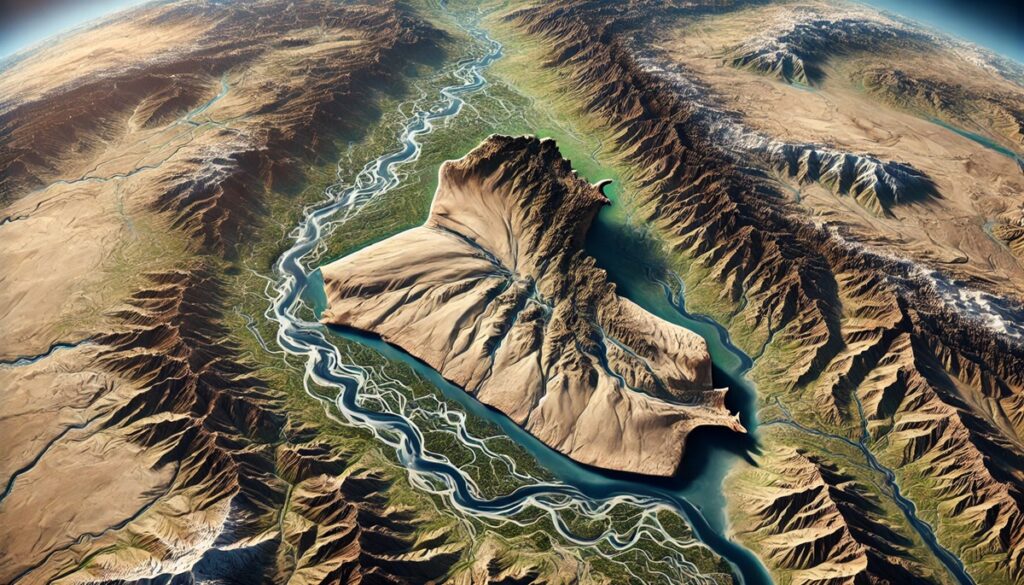
Traditional maps are flat, requiring imagination and interpretation to translate contour lines into real-world elevation. A raised relief topographical map, however, eliminates that gap. By sculpting the landscape into physical form, visitors can see and feel the contours of Girraween—the dramatic granite outcrops, the rolling valleys, the subtle dips and steep climbs that make this park both challenging and breathtaking.
This tactile approach transforms the way people connect with geography. Instead of puzzling over abstract representations, they experience an intuitive understanding of the land. Whether you’re a casual visitor, a family with children eager to learn, or a seasoned hiker preparing for an adventure, the immersive topo map provides clarity and excitement. It bridges the space between visualization and reality, grounding exploration in a tangible, sensory experience.
Girraween National Park: A Land of Granite and Wonder
To truly appreciate the impact of this map, one must understand the character of Girraween National Park itself. Situated on the Queensland-New South Wales border, Girraween is famed for its massive granite boulders, striking rock formations, and wildflower displays that paint the landscape with vibrant seasonal color. Peaks like The Pyramid and Castle Rock define the horizon, while hidden valleys and creeks weave through the park’s rugged terrain.
It’s a place of contrasts—hard granite softened by wildflowers, sheer cliffs complemented by lush gullies, and expansive views framed by the intimate quiet of bushland trails. For many visitors, the challenge lies in navigating this unique terrain. The immersive topo map becomes the perfect orientation tool, enabling hikers to identify landmarks, gauge distances, and prepare for elevation changes before venturing out.
Design Meets Durability
Creating a topographical map for a national park visitor centre is no small feat. It must be both visually stunning and built to last. The Girraween map has been designed with these priorities in mind. While it will be displayed outdoors, it sits beneath a full cover, allowing the designers to avoid the harsher treatments required for full exposure maps while still ensuring resilience.
The high-gloss resin finish is not only protective but enhances the aesthetic, making the contours glisten and drawing attention to the rich details of the landscape. Visitors are encouraged to engage with the map directly, running their hands across its smooth surface to trace the trails, peaks, and valleys. The choice of resin also ensures that cleaning and maintenance are simple, keeping the map pristine for years of interaction.
This marriage of artistry and engineering demonstrates the thoughtfulness behind the design. It’s more than functional—it’s durable, intuitive, and beautiful, a map built to be explored as much as the park itself.
Immersion Through Scale and Detail
Scale is one of the most powerful features of this project. At nearly a meter and a half in width, the map is large enough to showcase details that might be lost in smaller models. Visitors can see not only the park’s iconic granite outcrops but also subtle changes in elevation that influence trail difficulty and water flow. Every ridge, slope, and valley has been carefully sculpted to mirror reality, giving users a sense of immersion even before they step foot on the trails.
The depth of 107mm might seem modest at first glance, but in the world of raised relief mapping, this vertical exaggeration allows the human eye to perceive terrain more clearly. The result is a model that doesn’t just depict the land but animates it, highlighting the natural drama of Girraween’s geology. For young explorers or those less familiar with topographic interpretation, this physicality turns complexity into comprehension.
A Visitor Experience Reimagined
Maps have always been essential tools in national parks, but the Girraween immersive topo map elevates their role from informative to transformative. Instead of standing before a flat board or flipping through pamphlets, visitors now engage in an active discovery process. The experience is tactile, visual, and emotional.
For families, the map becomes an educational tool—children can trace their upcoming hikes, parents can explain landforms, and everyone can share in the anticipation. For international tourists, it’s a chance to grasp the park’s essence without language barriers, since the terrain itself speaks universally. Even for experienced adventurers, the ability to preview routes and identify landmarks ensures safer and more rewarding journeys.
By offering this immersive introduction, the Visitor Information Centre enhances its role as more than a stop for directions. It becomes the first chapter of the adventure, setting the tone for everything that follows.
Technology Behind the Craft
Creating a 3D topographical map of this scale requires a blend of traditional craftsmanship and cutting-edge technology. Digital elevation models and high-resolution topographic data form the foundation, ensuring accuracy in scale and representation. These digital blueprints are then transformed into physical relief through precision manufacturing techniques that capture even the smallest features of the landscape.
The artistry enters with finishing touches. Resin coating, hand-detailed adjustments, and thoughtful design choices turn the raw form into a polished, engaging display. It’s a fusion of data science, engineering, and fine art, culminating in a map that is not only precise but captivating.
In an era where digital maps dominate, the tactile reality of this project feels refreshing. It demonstrates how technology and craftsmanship can collaborate to make geography not just informative but inspiring.
The Future of Immersive Mapping
The Queensland Immersive Topo Map at Girraween sets a precedent for how natural spaces can be interpreted and shared with the public. As parks and cultural sites search for ways to engage visitors more deeply, projects like this highlight the potential of immersive mapping. They bring together education, art, and accessibility, inviting audiences of all ages and backgrounds to connect with the land.
Beyond Girraween, the applications are vast. Imagine interactive maps of entire coastlines, heritage trails, or archaeological sites—all crafted with the same blend of accuracy and immersion. By blending tactile design with durability and artistry, these maps can reshape how we explore, understand, and preserve the landscapes that matter most.
For Girraween National Park, this project is more than a tool. It’s a legacy piece—an installation that will inspire generations of visitors to look closer, venture further, and appreciate the intricate beauty of the Queensland wilderness.
An Invitation to Explore
At its heart, the Queensland Immersive Topo Map is about connection—between people and the land, between curiosity and discovery. It turns orientation into anticipation, preparation into excitement. By standing at the Visitor Information Centre and tracing the granite ridges of The Pyramid or the winding trails through the valleys, visitors are no longer outsiders to the landscape. They become part of it before they even begin. Exploring Girraween just got even more immersive. The raised relief map offers not only guidance but inspiration—a chance to see the park’s grandeur in miniature, to feel its contours in your hands, and to step into the wild with a new depth of understanding. For Queensland, for Girraween, and for every visitor who runs their hand along its glossy ridges, this map represents the future of exploration: tangible, beautiful, and unforgettable.
Contact us today to learn more about our 3D services and how we can help you achieve your goals.