
Utah’s Geological Masterpiece: An Epic Journey Through the 3D Topographic Map
Utah, the Beehive State, is a realm of geological marvels, where towering canyons, expansive deserts, and majestic mountains converge to form a landscape unlike any other. In this comprehensive exploration, we embark on an immersive journey through the 3D topographic map of Utah, peeling back the layers of its geographical wonders and unveiling the captivating stories etched into its diverse terrain.
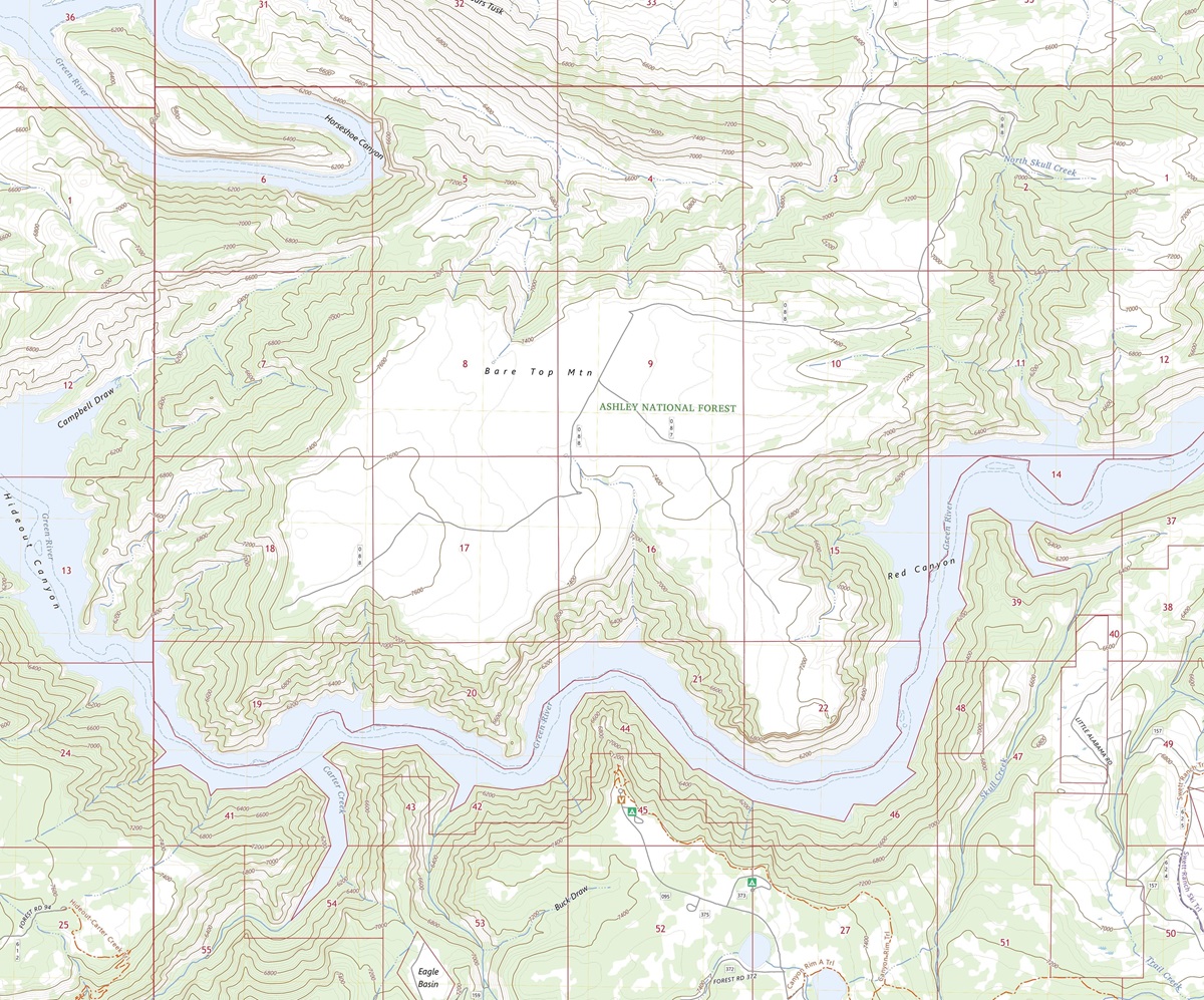 3D Topographic Map of Utah-Flaming Gorge, 1:24,000 quad, 2023, USGS
The World of 3D Topographic Maps
Before we delve into the heart of Utah’s stunning landscapes, it’s essential to grasp the essence of 3D topographic maps. These advanced cartographic tools provide an immersive representation of the Earth’s surface, revealing elevation, terrain, and natural features with unparalleled precision. Unlike traditional maps, 3D maps bring Utah’s landscapes to life, offering a unique perspective that allows us to explore the state’s geography in a whole new dimension.
Elevation: The Vertical Dimension
One of the most remarkable features of 3D topographic maps is their ability to depict elevation in exquisite detail. In Utah, where elevation ranges from the depths of the Great Salt Lake to the towering summits of the Uinta Mountains, this dimension is paramount in understanding the state’s unique topography. From the lowest basins to the loftiest peaks, 3D maps vividly illustrate the vertical aspect of Utah’s terrain.
Terrain Visualization: A New Perspective
3D topographic maps offer an immersive experience by bringing Utah’s terrain to life. Every canyon, plateau, and river is presented with stunning detail, allowing us to appreciate the intricacies of the state’s geography. This unique perspective enables us to uncover hidden features, understand the impact of geological forces, and grasp the interconnectedness of Utah’s landscapes in ways that traditional maps simply cannot convey.
 3D Topographic Map of Park City, Utah
The Mighty Rockies
Majestic Peaks and Alpine Escapes
Our journey through Utah’s 3D topographic map begins with the awe-inspiring Rocky Mountains, a region known for its majestic peaks, alpine wilderness, and pristine lakes. This mountainous terrain is depicted in remarkable detail, showcasing the gradual elevation changes, rolling hills, and the rugged beauty that characterizes this region’s topography.
Elevation gradients reveal the towering summits of Kings Peak, Utah’s highest point, and the intricate network of trails and lakes that make this region a haven for outdoor enthusiasts. This immersive experience provides a deeper understanding of the geological forces that have shaped the Rockies.
Uinta-Wasatch-Cache National Forest: A Wilderness Wonderland
The 3D topographic map vividly portrays the Uinta-Wasatch-Cache National Forest, where adventurers and nature lovers can virtually hike along pristine trails, fish in crystal-clear lakes, and bask in the serenity of the alpine wilderness. This immersive visualization offers a unique perspective on the forest’s diverse ecosystems, rugged terrain, and the scenic beauty that awaits those who explore its natural wonders.
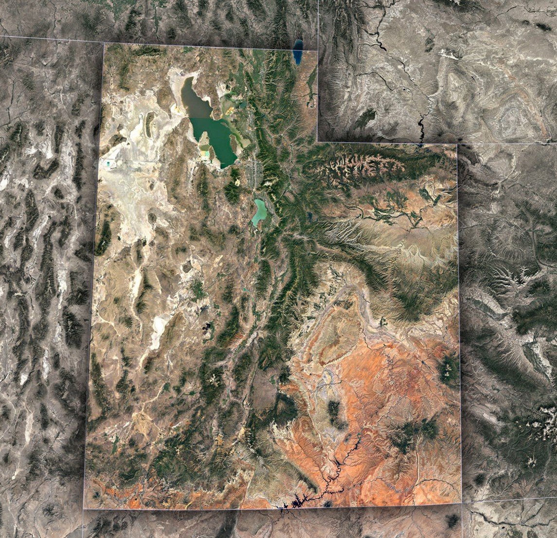 Satellite Map of Utah
Check out WhiteClouds’ 3D Topographic Maps for more information on a topographic map of Utah. 2D Canvas Print Satellite Maps of Utah are also available.

Contact us today to learn more about our 3D services and how we can help you achieve your goals.