
A Visual Guide to Understanding the World Through Large-Scale Maps for Learning, Design, and Everyday Exploration
There’s something timeless about a wall map. It quietly transforms a blank surface into a gateway to the world, turning geography into something you can see, trace, and explore with your eyes. Whether it hangs in a classroom, an office, a home, or a creative studio, a wall map is more than decoration. It’s a tool, a story, and an invitation to think bigger than the space you’re in. But what exactly is a wall map? At its simplest, a wall map is a large-format map designed to be displayed vertically on a wall. Unlike folded road maps or handheld atlases, wall maps are meant to be seen from a distance, shared among viewers, and integrated into a room’s visual identity. They are built for clarity, scale, and presence. Yet beneath that simple definition lies a fascinating blend of design, geography, education, and even psychology.
A Map That Lives in Your Space
A wall map is defined as much by where it lives as by what it shows. It is not tucked into a drawer or stored in a glove compartment. It is meant to be visible, accessible, and constantly part of your environment. That constant presence changes how you interact with it.
When a map is on the wall, it becomes part of your daily life. You glance at it while walking past. You use it to answer spontaneous questions. You point to it during conversations. Over time, it shapes your mental picture of the world. You start to remember locations, distances, and relationships between places simply because you’ve seen them repeatedly.
This is why wall maps have been staples in classrooms, offices, and libraries for generations. They support passive learning. You don’t have to sit down and study them to gain value. Just by being there, they begin to teach.
The Size and Scale of Wall Maps
One of the defining features of a wall map is its size. Unlike smaller maps, which are limited by portability, wall maps can expand to fill a significant portion of a wall. This allows for a higher level of detail and readability.
A typical wall map might range from a couple of feet wide to several feet across. Some are designed to fit neatly above a desk or couch, while others stretch across entire walls in offices, classrooms, or conference rooms. Large-scale wall maps can show entire continents or the whole world with enough clarity that countries, cities, rivers, and terrain features remain legible from several feet away.
Scale is critical here. A wall map is carefully designed so that its level of detail matches its size. If a map is too small for its level of detail, it becomes cluttered. If it’s too large without enough detail, it feels empty. The best wall maps strike a balance, offering just enough information to be useful while remaining visually clean.
This balance is what makes a wall map both functional and beautiful. It is not just a blown-up version of a smaller map. It is designed specifically for its format.
Types of Wall Maps
Wall maps come in many forms, each designed with a particular purpose in mind. Some focus on geography, showing countries, borders, and major cities. Others highlight physical features like mountains, rivers, and oceans. There are political maps, topographic maps, road maps, thematic maps, and even artistic interpretations.
A political wall map emphasizes human-made boundaries and administrative regions. It’s ideal for understanding countries, states, and cities. A physical map, on the other hand, focuses on natural features such as elevation, terrain, and bodies of water, often using color gradients and shading to show relief.
There are also specialized wall maps designed for specific uses. Educational maps may include additional labels, diagrams, or contextual information. Business maps might highlight regions, markets, or logistics routes. Travel maps can focus on destinations and landmarks. Decorative maps may prioritize aesthetics, using vintage styles, muted tones, or minimalist designs. Despite their differences, all wall maps share a common goal: to present spatial information in a way that is easy to see, understand, and engage with.
Wall Maps as Educational Tools
Few tools are as effective for visual learning as a wall map. In classrooms, they provide a shared reference point for teachers and students. Instead of imagining where a place is, students can see it instantly. This makes abstract concepts more concrete.
Wall maps also support different types of learners. Visual learners benefit from seeing information laid out clearly. Kinesthetic learners may interact with the map by pointing, tracing routes, or marking locations. Even auditory learners can benefit when discussions are anchored to a visual reference.
Beyond formal education, wall maps encourage curiosity. A student might notice a country they’ve never heard of or a river that runs through multiple regions. That curiosity can lead to questions, research, and deeper understanding.
In this way, a wall map is not just a static object. It is a starting point for exploration.
The Design Behind a Great Wall Map
Creating a wall map is both a scientific and artistic process. Cartographers must decide what information to include, how to represent it, and how to organize it in a way that is both accurate and visually appealing.
- Color plays a major role. Different hues can distinguish countries, highlight terrain, or indicate elevation.
- Typography is equally important.
- Labels must be readable from a distance without overwhelming the map.
- Symbols, lines, and shading all contribute to clarity.
The layout must also consider how the map will be viewed. Unlike a handheld map, which can be rotated or examined up close, a wall map is typically seen from a fixed orientation and varying distances. This means the design must work both from across the room and up close. A well-designed wall map feels intuitive. You can quickly find what you’re looking for without confusion. At the same time, it invites closer inspection, rewarding viewers with more detail the longer they look.
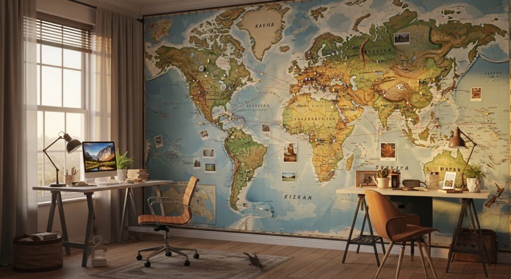
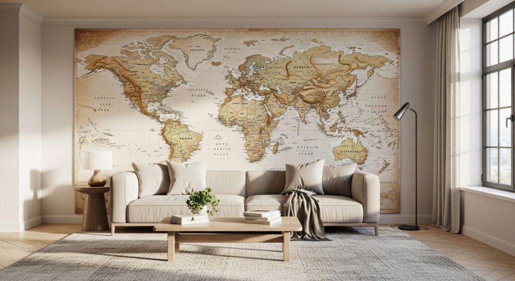
Wall Maps as Decorative Statements
In recent years, wall maps have become increasingly popular as decorative elements. They add character, depth, and meaning to a space. A large world map can serve as a focal point in a living room. A vintage-style map can bring warmth and nostalgia to an office. A minimalist map can complement a modern interior.
What makes wall maps unique as décor is that they combine beauty with purpose. They are not just visual elements. They carry information, stories, and connections. They reflect interests, experiences, and aspirations.
For travelers, a wall map might represent places visited and places yet to explore. For businesses, it might symbolize global reach or strategic focus. For families, it can become a shared reference point for learning and conversation.
In all these cases, the wall map becomes part of the identity of the space.
Materials and Formats
Wall maps are produced in a variety of materials, each with its own advantages. Paper maps are the most traditional and often the most detailed. They can be framed, mounted, or laminated for durability.
Laminated wall maps are popular in classrooms and offices because they can be written on with dry-erase markers. This makes them interactive and adaptable. You can highlight routes, mark locations, or update information as needed.
Canvas maps offer a more textured, artistic look. They are often used in home décor and can resemble paintings. Vinyl and fabric maps are also common, especially for large installations or temporary displays.
Some wall maps are mounted on boards or come with rails for easy hanging. Others are designed as peel-and-stick decals, allowing for easy application and removal. The choice of material often depends on how the map will be used and the style of the space.
The Role of Technology
Even in a digital age, wall maps remain relevant. In fact, they complement digital tools rather than compete with them. While digital maps offer interactivity and real-time updates, wall maps provide a stable, always-visible reference.
There is something powerful about seeing the entire world at once, without zooming or scrolling. A wall map offers a big-picture perspective that can be harder to achieve on a screen. At the same time, modern printing technology has improved the quality of wall maps dramatically. High-resolution printing, precise color control, and durable materials allow for maps that are both beautiful and long-lasting.
Some wall maps even integrate with digital tools. For example, you might use a wall map alongside an app or device to plan routes, track progress, or visualize data. This combination of physical and digital creates a richer experience.
Choosing the Right Wall Map
Selecting a wall map involves more than picking a design you like. It requires thinking about purpose, space, and audience.
Consider where the map will be placed. A large wall in a conference room can handle a wide, detailed map. A smaller wall in a home office might benefit from a more compact design. Lighting, viewing distance, and surrounding décor all play a role.
Think about what you want the map to do. Is it primarily decorative, educational, or functional? Do you need detailed city labels, or a broader overview? Will people interact with it, or simply view it?
Also consider style. A bright, colorful political map might be perfect for a classroom, while a muted, vintage-style map might suit a living room or study. The right map should feel like it belongs in the space.
Why Wall Maps Still Matter
In a world filled with screens, wall maps offer something different. They slow things down. They encourage you to step back and take in the bigger picture. They provide a constant, reliable reference that doesn’t depend on batteries or connectivity.
More importantly, they create connections. They connect people to places, ideas, and each other. They spark conversations, inspire curiosity, and support learning in a way that feels natural and engaging.
A wall map is not just about geography. It is about perspective. It reminds us that the world is vast, interconnected, and full of stories waiting to be discovered.
The Lasting Appeal of a Wall Map
So, what is a wall map? It is a large-format map designed for display, built to inform, inspire, and engage. It is a blend of art and science, combining accurate geographic data with thoughtful design. It is a tool for education, a piece of décor, and a window into the world. From classrooms to living rooms, from offices to studios, wall maps continue to hold their place. They evolve in style and material, but their core purpose remains the same: to make the world visible. In the end, a wall map does something simple yet powerful. It takes the vast complexity of the world and places it within reach. All you have to do is look up.


