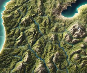
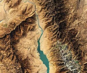
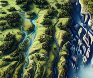
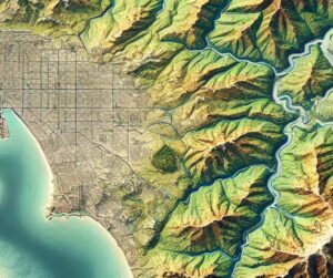
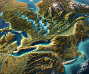
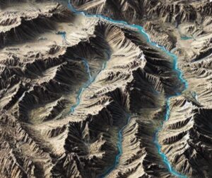
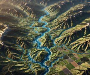
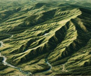
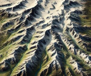
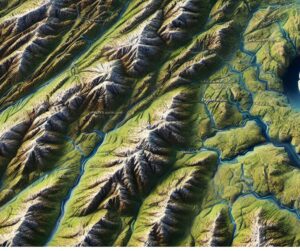
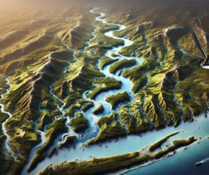
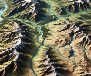
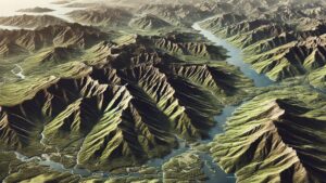
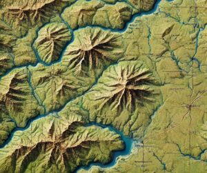
Author: Jerry Ropelato

Peru Topo Map

Peru Topo Map

Discover Peru’s breathtaking landscapes through topo maps that unveil the Andes’ peaks, the Amazon’s vast rivers, and coastal deserts. Explore how these maps are crafted in stunning 2D and 3D formats, blending precision with artistry. Perfect for adventurers, scientists, and history lovers, Peru’s topo maps offer a window into the country’s natural beauty and rich cultural heritage.

Read More »
Michigan Topo Map

Michigan Topo Map

Discover Michigan’s stunning geography with topographic maps showcasing the rugged Upper Peninsula, rolling Lower Peninsula hills, and expansive Great Lakes shores. From the towering dunes of Sleeping Bear to the remote Isle Royale, 2D and 3D maps bring the Great Lakes State’s landscapes to life, offering adventurers and conservationists a deeper connection to its natural beauty and rich geography.

Read More »
California Topo Map

California Topo Map

Discover California’s diverse landscapes through detailed topographic maps, revealing the towering Sierra Nevada, rugged coastline, and vast deserts. Whether exploring the cliffs of Yosemite, navigating Death Valley, or studying the Central Valley’s subtle contours, 2D and 3D topo maps bring the Golden State’s dynamic terrain to life, offering a new way to experience its natural beauty and geographical wonders.

Read More »
Rhoda Island Topo Map

Rhode Island Topo Map

Discover Rhode Island’s captivating geography with topographic maps showcasing Narragansett Bay, rugged coastal cliffs, and rolling inland hills. From Block Island’s dramatic bluffs to tranquil river valleys, 2D and 3D maps bring the Ocean State’s landscapes to life, offering adventurers and conservationists a deeper connection to its stunning terrain and natural beauty.

Read More »
San Diego Topo Map

San Diego Topo Map

Discover San Diego’s breathtaking landscapes with topo maps that reveal its coastal cliffs, rolling hills, and urban landmarks. Learn how 2D and 3D maps are expertly crafted to capture the city’s dynamic terrain, blending technology with artistry. Perfect for adventurers, planners, and conservationists, these maps unlock the beauty and complexity of America’s Finest City in unparalleled detail.

Read More »
St. Lawrence River Watershed Map

St. Lawrence River Watershed Map

Discover the St. Lawrence River Watershed, a vital system linking the Great Lakes to the Atlantic. Explore its diverse ecosystems, rich cultural history, and economic importance. Learn how stunning 3D maps bring its waterways to life while addressing challenges like climate change and pollution. Uncover the critical role this watershed plays in sustaining life and trade across North America.

Read More »
Ukraine Topo Map

Ukraine Topo Map

Dive into the world of Ukraine’s topo maps, where cutting-edge technology meets artistic precision. From the soaring Carpathians to the vast Dnieper, these maps unveil the country’s breathtaking landscapes in stunning detail. Explore how 2D and 3D maps are crafted, their uses in adventure, conservation, and history, and the vital role they play in showcasing Ukraine’s diverse geography.

Read More »
Yakima River Watershed Map

Yakima River Watershed Map

Discover the Yakima River Watershed, a vital Pacific Northwest resource sustaining ecosystems, agriculture, and communities. Explore its intricate waterways, rich biodiversity, and cultural significance. Learn how stunning 3D maps bring its geography to life, addressing challenges like climate change and habitat loss while preserving its natural beauty and resources for future generations.

Read More »
Massachusetts Topo Map

Massachusetts Topo Map

Discover Massachusetts’ stunning landscapes with topographic maps that showcase the rugged Berkshires, rolling Connecticut River Valley, and iconic Cape Cod coastline. From Boston’s urban topography to tranquil river systems, 2D and 3D maps bring the Bay State’s diverse terrain to life, offering adventurers and conservationists a deeper connection to its natural beauty and rich geography.

Read More »
Pennsylvania Topo Map

Pennsylvania Topo Map

Discover Pennsylvania’s stunning geography with topographic maps revealing the rugged Appalachians, fertile Piedmont, and serene Lake Erie shores. From dramatic gorges to vibrant river valleys, 2D and 3D maps bring the Keystone State to life, offering adventurers and conservationists a deeper connection to its diverse landscapes and natural beauty.

Read More »
Alaska Topo Map

Alaska Topo Map

Discover Alaska’s majestic landscapes through detailed topographic maps that unveil towering peaks, sprawling glaciers, vast tundra, and rugged coastlines. Whether navigating Denali’s heights, exploring icy rivers, or mapping the Arctic tundra, 2D and 3D topo maps bring Alaska’s vast wilderness to life, offering a unique and immersive way to experience the beauty and complexity of America’s Last Frontier.

Read More »
Maryland Topo Map

Maryland Topo Map

Discover Maryland’s diverse landscapes with topographic maps showcasing rugged Appalachian peaks, rolling Piedmont hills, and the intricate Chesapeake Bay. From sandy Atlantic shores to fertile river valleys, 2D and 3D maps bring the Old Line State’s terrain to life, offering adventurers and conservationists a deeper connection to its natural beauty and unique geography.

Read More »
Connecticut River Watershed Map

Connecticut River Watershed Map

Discover the Connecticut River Watershed, New England’s largest, sustaining ecosystems, agriculture, and communities. Explore its intricate waterways, rich biodiversity, and cultural significance. Learn how stunning 3D maps bring its geography to life, addressing challenges like climate change and habitat loss while preserving its natural beauty and resources for future generations.

Read More »
Oregon Topo Map

Oregon Topo Map

Discover Oregon’s diverse geography with topographic maps showcasing the towering Cascades, scenic coast, fertile valleys, and rugged high desert. From the Columbia River Gorge to Crater Lake, 2D and 3D maps bring the Beaver State’s landscapes to life, offering adventurers and conservationists a deeper connection to its breathtaking terrain and natural wonders.

Read More »
Aridondak Mountains Raised Relief Map 2

Adirondack Mountains Raised Relief Map

Experience the Adirondacks like never before with raised relief maps that bring the region’s peaks, valleys, and lakes to life. Perfect for adventurers, educators, and nature lovers, these 3D masterpieces offer a tactile exploration of New York’s rugged wilderness. Discover the artistry and precision behind their creation and celebrate the timeless beauty of one of America’s most iconic natural landscapes.

Read More »
Oklahoma Topo Map

Oklahoma Topo Map

Discover Oklahoma’s dynamic landscapes with topographic maps showcasing the sweeping Great Plains, rugged Wichita Mountains, and lush Cross Timbers. From rolling prairies to fertile river valleys, 2D and 3D maps bring the Sooner State to life, offering adventurers and conservationists a deeper connection to its natural beauty and diverse geography.

Read More »

Get a Free Quote