Watersheds in the United States
Watersheds in the United States
We build 2D and 3D Watershed Maps
Table of Contents
Watersheds
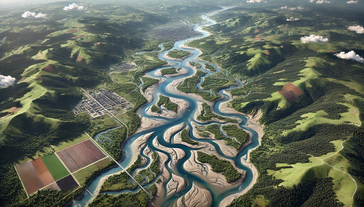
Watersheds are the lifelines of the United States, shaping the landscape and sustaining ecosystems, communities, and industries. From the mighty Mississippi River Basin, draining nearly half the country, to the serene rivers of Hawaii’s volcanic islands, these interconnected systems are crucial for managing water resources, supporting biodiversity, and providing recreation and economic opportunities. Exploring the watersheds of the U.S. reveals not only the natural beauty of its rivers, lakes, and wetlands but also the intricate balance required to preserve them for future generations. Below are the major watersheds in the United States.
Mississippi River Basin (Central U.S.)
Mississippi River Watershed
The Mississippi River Watershed is the largest in the United States, covering over 1.2 million square miles across 31 states and two Canadian provinces. It drains about 40% of the continental U.S., making it a vital waterway for agriculture, transportation, and ecosystems. The river’s vast network supports wetlands, forests, and diverse wildlife while also serving as a critical artery for shipping and commerce, especially along the Gulf Coast.
Missouri River Watershed
The Missouri River Watershed spans more than 500,000 square miles and is the largest tributary of the Mississippi River. Stretching from Montana to Missouri, it traverses the Great Plains, supplying irrigation water for agriculture and habitats for wildlife. Known as the “Big Muddy,” the river has historical significance as a route for westward expansion and today supports hydroelectric power and recreation.
Arkansas River Watershed
The Arkansas River Watershed covers over 170,000 square miles, flowing from the Rocky Mountains in Colorado through Kansas, Oklahoma, and Arkansas. It plays a crucial role in regional agriculture, supplying irrigation for vast croplands. The watershed is also rich in recreational opportunities, with areas like the Arkansas Headwaters Recreation Area offering world-class whitewater rafting.
Red River of the South Watershed
The Red River Watershed spans nearly 93,000 square miles across Texas, Oklahoma, Arkansas, and Louisiana. Known for its distinctive reddish color due to sediment, the Red River supports agriculture, drinking water supplies, and wetlands. It also has cultural significance, marking historical boundaries and serving as an essential resource for Native American tribes and settlers.
Illinois River Watershed
The Illinois River Watershed, primarily located in Illinois, covers over 28,000 square miles. As a tributary of the Mississippi River, it serves as a critical conduit for transportation and commerce. The watershed is also a haven for wildlife, with the Illinois River Valley hosting significant wetland habitats that attract migratory birds and other species.
Ohio River Watershed
The Ohio River Watershed encompasses over 200,000 square miles, stretching from Pennsylvania to Illinois. The Ohio River is a major tributary of the Mississippi and serves as a vital water source for over 25 million people. It supports industry, agriculture, and recreation while connecting cities like Pittsburgh, Cincinnati, and Louisville via its extensive waterway system.
Tennessee River Watershed
The Tennessee River Watershed spans over 40,000 square miles across Tennessee and six neighboring states. Managed extensively by the Tennessee Valley Authority (TVA), it is a critical source of hydroelectric power, flood control, and recreation. The watershed is also essential for biodiversity, supporting numerous aquatic species and habitats.
Cumberland River Watershed
The Cumberland River Watershed covers approximately 18,000 square miles across Tennessee and Kentucky. The river winds through stunning landscapes, including the Cumberland Falls and Lake Cumberland, which provide recreational opportunities. The watershed also supplies water for drinking, agriculture, and energy production through dams and reservoirs.
Platte River Watershed
The Platte River Watershed spans approximately 90,000 square miles, primarily in Nebraska and Colorado. The river is known for its shallow, braided channels and critical role in supporting migratory bird populations, such as Sandhill Cranes. It also supplies water for irrigation in the arid plains and sustains diverse ecosystems along its banks.
Atchafalaya River Watershed
The Atchafalaya River Watershed is a vital offshoot of the Mississippi River, covering about 14,000 square miles in Louisiana. It includes the Atchafalaya Basin, the largest swamp in the United States. This unique watershed is a biodiversity hotspot, providing habitats for alligators, birds, and fish while acting as a crucial flood control system for the Mississippi River.
Yazoo River Watershed
The Yazoo River Watershed, located in Mississippi, spans roughly 13,000 square miles. Known for its fertile soils, the watershed is integral to agriculture in the Mississippi Delta, often referred to as the birthplace of the blues. The region also faces challenges from flooding, making the watershed a focal point for water management and conservation efforts.
The Mississippi River Basin is a monumental network of watersheds that sustains life, commerce, and ecosystems across vast swaths of North America. From the sprawling plains of the Missouri River to the fertile soils of the Yazoo River, each watershed within the basin plays a unique role in shaping the natural and human landscapes it traverses. Together, these interconnected systems form the backbone of U.S. agriculture, transportation, and biodiversity. As climate change, pollution, and water management challenges arise, the health and sustainability of these watersheds become increasingly critical. Protecting and preserving the Mississippi River Basin is essential to ensure its continued support for millions of people, wildlife, and communities for generations to come.
Great Lakes Basin (Northern U.S.)
Lake Superior Watershed
The Lake Superior Watershed encompasses the largest and deepest of the Great Lakes, spanning parts of Minnesota, Wisconsin, Michigan, and Ontario, Canada. Covering over 200,000 square miles, it contains some of the most pristine freshwater ecosystems in the world. The watershed supports diverse fish populations, including trout and salmon, and is vital for regional drinking water, forestry, and tourism.
Lake Michigan Watershed
The Lake Michigan Watershed is unique as the only Great Lake entirely within the United States, covering parts of Illinois, Indiana, Wisconsin, and Michigan. It supports critical industries like shipping, manufacturing, and agriculture while offering vast recreational opportunities. Major cities like Chicago and Milwaukee depend on this watershed for drinking water, transportation, and commerce.
Lake Huron Watershed
The Lake Huron Watershed spans parts of Michigan and Ontario, covering over 134,000 square miles. It includes key features like Georgian Bay and the Thunder Bay National Marine Sanctuary. The watershed supports commercial and recreational fishing, shipping routes, and pristine beaches, while also serving as a crucial habitat for fish and bird species.
Lake Erie Watershed
The Lake Erie Watershed, the shallowest of the Great Lakes, covers parts of Michigan, Ohio, Pennsylvania, New York, and Ontario. Its fertile waters are ideal for agriculture, making it one of the most intensively farmed watersheds in the region. However, the watershed faces challenges like nutrient runoff and harmful algal blooms, prompting conservation efforts to protect water quality.
Lake Ontario Watershed
The Lake Ontario Watershed is the easternmost in the Great Lakes Basin, covering parts of New York and Ontario. It serves as the outlet for the Great Lakes, flowing into the St. Lawrence River. The watershed supports agriculture, hydropower, and major urban centers like Rochester and Toronto. Its waters are home to diverse fish species, including salmon and trout, making it a hub for recreational fishing.
Niagara River Watershed
The Niagara River Watershed connects Lake Erie to Lake Ontario and includes the iconic Niagara Falls. Spanning parts of New York and Ontario, it supports hydropower generation, supplying energy to millions of people. The river and its surrounding watershed are also key tourist destinations and provide habitats for a variety of aquatic and bird species.
St. Marys River Watershed
The St. Marys River Watershed serves as the sole outlet for Lake Superior, connecting it to Lake Huron. Straddling the U.S.-Canada border in Michigan and Ontario, it is a critical shipping route for the Great Lakes, home to the Soo Locks, one of the world’s busiest canal systems. The watershed supports fisheries, recreation, and important habitats for native species.
The Great Lakes Basin is a cornerstone of North America’s freshwater system, providing drinking water for over 40 million people, supporting industries, and preserving biodiversity. However, it faces challenges like invasive species, pollution, and climate change. Efforts to protect and restore these watersheds are essential to sustain their ecological and economic importance for future generations.
Atlantic Seaboard Basin (Eastern U.S.)
Connecticut River Watershed
The Connecticut River Watershed spans approximately 11,250 square miles across New Hampshire, Vermont, Massachusetts, and Connecticut. It is the largest river system in New England and supports agriculture, fisheries, and hydropower. The river’s clean waters and vibrant ecosystems have earned it recognition as a National Blueway, highlighting its ecological and recreational importance.
Hudson River Watershed
The Hudson River Watershed covers 13,400 square miles in eastern New York and parts of New Jersey, Massachusetts, and Vermont. Known for its cultural and historical significance, it was central to the American Revolution and the Hudson River School of art. Today, the watershed supports drinking water supplies, recreation, and habitats for diverse wildlife.
Delaware River Watershed
The Delaware River Watershed spans 13,539 square miles across New York, New Jersey, Pennsylvania, Delaware, and Maryland. It is the source of drinking water for over 15 million people, including New York City and Philadelphia. The watershed supports vibrant ecosystems, such as the Delaware Water Gap and tidal marshes, while also playing a key role in commerce and recreation.
Potomac River Watershed
The Potomac River Watershed covers 14,670 square miles across Maryland, Virginia, West Virginia, Pennsylvania, and Washington, D.C. Known as the “Nation’s River,” it provides drinking water to the capital and surrounding areas. The watershed features stunning landscapes like the Great Falls and offers a rich history tied to early American settlements.
Susquehanna River Watershed
The Susquehanna River Watershed is the largest on the East Coast, covering 27,500 square miles across Pennsylvania, New York, and Maryland. It is a vital contributor to the Chesapeake Bay, supplying nearly half its freshwater. The watershed supports agriculture, recreation, and energy production, including hydroelectric power at the Conowingo Dam.
James River Watershed
The James River Watershed spans 10,432 square miles in Virginia, making it the largest watershed entirely within the state. The river is historically significant, as it was central to the Jamestown settlement. Today, the watershed supports drinking water, agriculture, and recreation while being home to diverse ecosystems and wildlife.
Rappahannock River Watershed
The Rappahannock River Watershed covers 2,848 square miles in Virginia. Known for its scenic beauty and historical importance, the river flows through the Chesapeake Bay region. The watershed supports recreational activities like fishing and kayaking, while its wetlands and forests provide critical habitats for wildlife.
Roanoke River Watershed
The Roanoke River Watershed spans approximately 9,580 square miles across Virginia and North Carolina. Known for its rich biodiversity, the watershed supports critical ecosystems, including the Roanoke River floodplain, which is a haven for bird species. It also serves as a resource for agriculture, hydropower, and recreation.
Savannah River Watershed
The Savannah River Watershed covers 10,577 square miles across Georgia and South Carolina. This watershed is vital for drinking water, energy production, and industry. Its diverse ecosystems include wetlands and estuaries, which support fisheries, bird habitats, and recreational opportunities along its scenic banks.
Altamaha River Watershed
The Altamaha River Watershed spans over 14,000 square miles in Georgia, making it one of the largest river systems in the Southeast. Known as the “Little Amazon,” the watershed is a biodiversity hotspot, with extensive wetlands and forests. It supports agriculture, timber industries, and a variety of recreational activities.
Pee Dee River Watershed
The Pee Dee River Watershed covers 10,755 square miles across North and South Carolina. Known for its rich cultural history and lush ecosystems, it supports agriculture, fishing, and recreation. The watershed is also home to the Pee Dee National Wildlife Refuge, which provides a critical habitat for migratory birds.
Santee River Watershed
The Santee River Watershed spans approximately 16,000 square miles in South Carolina. Its network of rivers and lakes supports hydroelectric power, agriculture, and recreation. The watershed is also a key contributor to the freshwater inflow into the Atlantic Ocean, influencing coastal ecosystems.
Cape Fear River Watershed
The Cape Fear River Watershed covers 9,149 square miles, making it the largest watershed entirely within North Carolina. It supports drinking water for cities like Wilmington, as well as agriculture and industry. The watershed’s wetlands and estuaries are critical for fish and bird species, while its rivers provide recreational opportunities.
St. Johns River Watershed
The St. Johns River Watershed covers 9,390 square miles in northeastern Florida, making it the longest river in the state. Known for its slow flow and vast floodplains, the watershed supports agriculture, recreation, and urban water needs. It is home to diverse wildlife, including manatees, and is integral to Florida’s natural heritage.
The watersheds of the Atlantic Seaboard are a lifeline for ecosystems, communities, and industries along the eastern United States. These rivers and their tributaries connect people to nature, offering recreation, water resources, and vital habitats. As urbanization and climate change place pressure on these watersheds, conservation and sustainable management become more important than ever to ensure their health for future generations.
Gulf of Mexico Basin (Southeastern U.S.)
Mobile River Watershed
The Mobile River Watershed is one of the largest in the Southeastern United States, covering 44,000 square miles across Alabama, Mississippi, Georgia, and Tennessee. It flows into Mobile Bay, which is a critical estuary for Gulf fisheries. The watershed supports diverse ecosystems, including extensive wetlands, and provides water for agriculture, industry, and recreation. It’s also home to species like the Alabama red-bellied turtle, highlighting its ecological importance.
Alabama River Watershed
The Alabama River Watershed spans approximately 22,800 square miles and is a key tributary of the Mobile River. The river flows entirely within Alabama, linking agricultural areas, industrial centers, and forested lands. Its reservoirs, including Lake Martin and Jordan Lake, offer recreational opportunities like fishing and boating while also providing hydroelectric power and flood control.
Apalachicola River Watershed
The Apalachicola River Watershed covers 19,500 square miles across Georgia, Alabama, and Florida. It culminates in the Apalachicola Bay, a vital estuary for shellfish and marine species. The watershed is renowned for its biodiversity, including unique freshwater and coastal habitats. It also plays a critical role in water supply and agricultural irrigation, though it faces challenges from interstate water disputes.
Suwannee River Watershed
The Suwannee River Watershed spans 10,000 square miles across Georgia and Florida. Known for its clear springs and scenic beauty, the river flows through diverse ecosystems, including wetlands, forests, and estuaries, before reaching the Gulf of Mexico. The watershed is crucial for aquifer recharge, supporting Florida’s unique karst landscapes, and offers recreational opportunities like kayaking and fishing.
Pascagoula River Watershed
The Pascagoula River Watershed covers 9,400 square miles across Mississippi and Alabama. The Pascagoula River is one of the last unimpeded major rivers in the contiguous United States, making it a natural treasure. Its floodplains and wetlands are essential for wildlife habitats, including migratory birds and fish species. The watershed also provides water for local communities and industries while maintaining its ecological integrity.
Choctawhatchee River Watershed
The Choctawhatchee River Watershed spans approximately 4,600 square miles across Alabama and Florida. The river flows into Choctawhatchee Bay, a critical estuary for marine life. The watershed is known for its pristine sand-bottomed streams, forests, and wetlands that support diverse plant and animal species. It also serves as a vital water resource for agriculture, drinking water, and recreation in the region.
The Gulf of Mexico Basin’s watersheds are lifelines for the Southeastern United States, linking inland ecosystems to the Gulf’s rich coastal environments. These watersheds provide critical services, from supporting biodiversity to supplying water for communities, agriculture, and industry. However, they face pressures from urbanization, pollution, and climate change. Protecting these watersheds ensures the health of the Gulf region’s ecosystems and the communities that rely on them for generations to come.
Pacific Coast Basin (Western U.S.)
Columbia River Watershed
The Columbia River Watershed spans over 258,000 square miles across seven U.S. states and British Columbia, Canada, making it one of the largest in North America. The Columbia River is renowned for its hydroelectric power, with a network of dams providing energy to millions. The watershed also supports rich fisheries, including salmon, and diverse ecosystems ranging from alpine forests to arid plateaus.
Snake River Watershed
The Snake River Watershed covers 108,000 square miles, primarily in Idaho, but also in Oregon, Washington, Wyoming, and Utah . As the Columbia River’s largest tributary, the Snake River is vital for agriculture, providing irrigation to the arid plains. The watershed also features iconic landscapes like Hells Canyon and supports recreational activities such as fishing, rafting, and hiking.
Yakima River Watershed
The Yakima River Watershed spans 6,155 square miles in central Washington. Known for its agricultural productivity, the Yakima Valley is a leading producer of apples, hops, and wine grapes. The watershed also supports vital salmon habitats, with restoration projects focused on improving fish passage and water quality.
Sacramento River Watershed
The Sacramento River Watershed covers approximately 27,500 square miles in Northern California, making it the state’s largest watershed. It supplies water to California’s Central Valley, a global agricultural powerhouse, and is a critical source for urban water needs. The watershed includes diverse habitats, from mountain streams to wetlands, supporting species like Chinook salmon and migratory birds.
San Joaquin River Watershed
The San Joaquin River Watershed encompasses 15,880 square miles in California’s Central Valley. It is a vital lifeline for agriculture, providing irrigation for one of the most productive farming regions in the world. The watershed also features wetlands critical for waterfowl along the Pacific Flyway, although it faces challenges from water scarcity and habitat degradation.
Klamath River Watershed
The Klamath River Watershed spans 15,000 square miles across southern Oregon and northern California. Known for its cultural and ecological significance, the river has been central to Native American tribes for centuries. The watershed supports salmon runs, diverse wetlands, and efforts to balance water needs between agriculture, wildlife, and hydropower.
Rogue River Watershed
The Rogue River Watershed covers 5,156 square miles in southwestern Oregon. Famous for its stunning scenery and whitewater rapids, the Rogue River is a recreational gem. The watershed supports salmon and steelhead populations, with conservation efforts focused on restoring riparian habitats and maintaining water quality.
Willamette River Watershed
The Willamette River Watershed spans 11,478 square miles, primarily in western Oregon. It is home to over 70% of the state’s population, including the cities of Portland and Eugene. The watershed supports agriculture, forestry, and industry while maintaining critical habitats for fish, birds, and other wildlife. Restoration projects are ongoing to address urbanization impacts.
Trinity River Watershed
The Trinity River Watershed covers 2,965 square miles in Northern California. As a major tributary of the Klamath River, the Trinity is essential for salmon and steelhead fisheries. The watershed features rugged landscapes, pristine forests, and reservoirs that provide hydroelectric power and recreation, while also supporting wildlife habitats.
Salinas River Watershed
The Salinas River Watershed spans 4,160 square miles in central California, flowing through the agricultural heart of the state. Known as the “Salad Bowl of the World,” the Salinas Valley produces a significant portion of the nation’s fruits and vegetables. The watershed also supports unique riparian ecosystems and is vital for groundwater recharge in the region.
Russian River Watershed
The Russian River Watershed covers 1,485 square miles in Northern California. Known for its wine country and scenic beauty, the watershed supports agriculture, tourism, and recreation. The Russian River provides critical habitats for steelhead and coho salmon, with ongoing restoration efforts aimed at improving water quality and fish passage.
The Pacific Coast Basin’s watersheds are integral to the Western U.S., providing water for agriculture, hydropower, and urban development while supporting rich ecosystems and recreational opportunities. Despite their importance, these watersheds face challenges from drought, pollution, and habitat loss. Sustainable management and conservation are crucial to ensuring the health and resilience of these vital water systems for future generations.
Colorado River Basin (Southwestern U.S.)
Upper Colorado River Watershed
The Upper Colorado River Watershed spans over 100,000 square miles, covering parts of Colorado, Utah, Wyoming, and New Mexico. This watershed is the primary source of water for the Colorado River, fed by snowmelt from the Rocky Mountains. It supplies water to agricultural lands, urban centers, and ecosystems while also supporting recreational activities like rafting in the iconic Colorado River canyons.
Lower Colorado River Watershed
The Lower Colorado River Watershed covers parts of Arizona, California, Nevada, and Mexico. As a lifeline for arid regions, it supports agriculture in the Imperial and Coachella Valleys and provides water for cities like Las Vegas, Phoenix, and Los Angeles. This watershed also sustains desert ecosystems, including the Colorado River Delta, although water scarcity poses significant challenges.
Gila River Watershed
The Gila River Watershed spans 60,000 square miles across New Mexico and Arizona, making it the largest tributary watershed of the Colorado River. The Gila River supports agriculture, wildlife, and recreation in the Southwest. Key features include the Gila National Forest and Wilderness, which preserve unique habitats, although portions of the river have been heavily altered for irrigation and urban use.
Green River Watershed
The Green River Watershed covers 45,000 square miles across Wyoming, Colorado, and Utah. As the largest tributary of the Colorado River, the Green River flows through striking landscapes like Dinosaur National Monument and Canyonlands National Park. It is critical for water storage, as the Flaming Gorge Reservoir supplies water for agriculture, hydropower, and recreation.
San Juan River Watershed
The San Juan River Watershed spans 24,000 square miles across Colorado, New Mexico, Utah, and Arizona. It is vital for agriculture, drinking water, and energy production, with key infrastructure like the Navajo Dam and Reservoir. The watershed is culturally significant for the Navajo Nation and supports diverse ecosystems in the arid Southwest.
Virgin River Watershed
The Virgin River Watershed covers 12,000 square miles in Utah, Arizona, and Nevada. The Virgin River is a key tributary to the Colorado River and flows through Zion National Park, offering stunning landscapes and habitats for endemic species. The watershed supports agriculture, urban water needs, and recreational tourism, although drought and population growth strain its resources.
The Colorado River Basin is one of the most vital and heavily utilized watersheds in the United States. It sustains millions of people, vast agricultural lands, and unique ecosystems in some of the country’s most arid regions. However, increasing demand, drought, and climate change present significant challenges. Effective management and conservation are essential to preserving the basin’s critical resources for future generations.
Arctic and Sub-Arctic Basins (Northern Alaska)
Yukon River Watershed
The Yukon River Watershed is the largest in Alaska and the third largest in North America, covering approximately 330,000 square miles across Alaska, the Yukon Territory, and British Columbia. The river flows over 1,980 miles, supporting Indigenous communities, subsistence fishing, and diverse wildlife such as salmon, moose, and caribou. Its vast network of rivers and streams is essential for sustaining ecosystems in the Arctic and Sub-Arctic regions.
Colville River Watershed
The Colville River Watershed spans about 20,000 square miles in northern Alaska, flowing into the Beaufort Sea. It is critical for Arctic wildlife, serving as a major breeding ground for migratory birds and a habitat for caribou herds. The watershed also plays an essential role in Alaska’s oil development, with much of the state’s energy infrastructure located nearby. Its remote and pristine landscapes are a hallmark of Arctic ecosystems.
Kuskokwim River Watershed
The Kuskokwim River Watershed covers around 50,000 square miles in southwestern Alaska, making it the second-largest watershed in the state. The Kuskokwim River, stretching over 700 miles, supports subsistence fishing for salmon and other species, which are vital to the livelihoods of Indigenous communities. The watershed also includes wetlands and tundra, providing critical habitats for waterfowl and other Arctic wildlife.
Kobuk River Watershed
The Kobuk River Watershed encompasses roughly 12,300 square miles in northwestern Alaska, flowing from the Brooks Range to the Kotzebue Sound. Known for its pristine wilderness, the Kobuk River supports diverse Arctic ecosystems and is a vital resource for subsistence hunting and fishing. Kobuk Valley National Park, located within the watershed, is famous for its sand dunes and caribou migrations.
Noatak River Watershed
The Noatak River Watershed spans approximately 12,800 square miles in northern Alaska. The Noatak River, one of the longest free-flowing rivers in the United States, originates in the Brooks Range and flows into the Chukchi Sea. The watershed is a pristine wilderness, largely protected within the Noatak National Preserve, and supports Arctic ecosystems, including grizzly bears, wolves, and migratory birds.
The Arctic and Sub-Arctic Basins in Alaska are among the most remote and untouched watersheds in the United States. These watersheds are crucial for sustaining Indigenous communities, Arctic wildlife, and global biodiversity. However, they face increasing threats from climate change, including permafrost thaw, changing ecosystems, and pressures from resource development. Protecting these unique and fragile watersheds is vital for maintaining their ecological and cultural significance.
Interior Basins (Closed Basins)
Great Basin Watershed
The Great Basin Watershed covers over 200,000 square miles across Nevada, Utah, Oregon, California, and Idaho. It is the largest closed basin in North America, meaning its waters do not flow to the ocean. Instead, precipitation either evaporates, is absorbed by the ground, or collects in salt flats and playas. The watershed is home to unique ecosystems, including sagebrush steppes, desert landscapes, and saline lakes such as Great Salt Lake.
Humboldt River Watershed
The Humboldt River Watershed spans approximately 16,000 square miles, making it the largest river system in Nevada. Flowing entirely within the Great Basin, the Humboldt River is a vital water source for agriculture and mining in the region. Its waters terminate in the Humboldt Sink, a dry lakebed, emphasizing the closed nature of the basin. The watershed supports limited but critical wetlands for migratory birds and other wildlife.
Bear River Watershed
The Bear River Watershed covers about 7,500 square miles across Utah, Idaho, and Wyoming. It is the largest tributary to the Great Salt Lake, which it feeds with freshwater. The river supports agriculture and drinking water supplies, while the Bear River Migratory Bird Refuge is a key stopover for millions of waterfowl along the Pacific Flyway. The watershed’s balance is delicate, with water demands often competing with environmental preservation.
Sevier River Watershed
The Sevier River Watershed spans roughly 11,500 square miles in central Utah. The Sevier River winds through arid valleys, supporting agriculture and small communities before terminating in Sevier Lake, a dry salt flat. The watershed is vital for irrigating crops and livestock but faces challenges from water scarcity and variable precipitation in the desert environment.
Death Valley Watershed
The Death Valley Watershed spans about 15,000 square miles across California and Nevada, including the lowest point in North America at Badwater Basin. This extreme environment is characterized by salt flats, sand dunes, and rugged mountains. The watershed experiences little rainfall, and its rivers and streams typically evaporate or seep underground. Despite its harshness, Death Valley supports unique wildlife and plants adapted to the desert.
Owens River Watershed
The Owens River Watershed spans approximately 3,600 square miles in eastern California. The Owens River historically flowed into Owens Lake, but much of its water is now diverted to supply Los Angeles via the Los Angeles Aqueduct. The watershed includes stunning landscapes like the Eastern Sierra Nevada and provides habitats for fish and migratory birds. Efforts to restore portions of Owens Lake have been ongoing to mitigate ecological impacts.
The Interior Basins, defined by their closed hydrology, are some of the most distinctive watersheds in the United States. They embody the balance between arid ecosystems and human use, supporting agriculture, wildlife, and industry in challenging environments. These watersheds face ongoing pressures from water scarcity, climate change, and competing demands, highlighting the need for sustainable water management and conservation efforts to preserve their unique landscapes and ecosystems.
Hawaiian and Island Watersheds
Hanalei River Watershed (Hawaii)
The Hanalei River Watershed is located on the north shore of Kauai, covering approximately 24 square miles. The Hanalei River flows through lush valleys and taro fields before emptying into Hanalei Bay. This watershed supports traditional taro farming, which has been a cornerstone of Hawaiian culture for centuries. It is also a critical habitat for endangered native species like the Hawaiian coot and the Hawaiian stilt. The Hanalei National Wildlife Refuge within the watershed preserves its rich biodiversity and scenic beauty, attracting ecotourism and conservation efforts.
Alakoko Watershed (Hawaii)
The Alakoko Watershed, also on Kauai, is most notable for the Alakoko Fishpond, an ancient Hawaiian aquaculture system constructed over 600 years ago. The watershed encompasses streams and wetlands that sustain native fish, birds, and plants. The fishpond, sometimes called the “Menehune Fishpond,” is a cultural and historical treasure, showcasing early Hawaiian ingenuity in sustainable resource management. Efforts are underway to restore the watershed and fishpond to preserve their ecological and cultural significance.
Wailuku River Watershed (Hawaii)
The Wailuku River Watershed, located on the Big Island of Hawaii, spans approximately 290 square miles and includes the island’s longest river, the Wailuku River. Known for its stunning waterfalls, including Rainbow Falls and Boiling Pots, the watershed is a vital freshwater source for Hilo and the surrounding areas. It also supports native forests and endemic species while serving as an important cultural site for Native Hawaiians. The watershed faces challenges from invasive species and urban development, prompting conservation initiatives to maintain its natural and cultural heritage.
The Hawaiian and island watersheds are unique ecosystems shaped by volcanic landscapes, abundant rainfall, and cultural history. These watersheds sustain traditional agricultural practices, provide vital freshwater resources, and preserve habitats for rare and endemic species. As they face threats from invasive species, climate change, and human activity, the importance of protecting these watersheds grows. Through restoration and stewardship, Hawaii’s watersheds can continue to support its people, wildlife, and natural beauty for generations to come.
Conclusion
The watersheds of the United States are as diverse as its landscapes, flowing through mountains, plains, forests, and deserts to create a vast network of interconnected ecosystems. They provide essential resources, foster cultural heritage, and support thriving communities. However, watersheds face increasing challenges from climate change, pollution, and urbanization. Protecting these vital systems requires collective efforts to manage water sustainably, restore habitats, and ensure that future generations can benefit from the remarkable natural and cultural treasures they offer. By understanding and valuing these watersheds, we take a critical step toward safeguarding their resilience and beauty.