Topography
A topographical map details the land surface features of a particular area. There are four main types of land characteristics shown on a topography map. Landforms on a topographical map are features such as mountains, valleys, ridges, peaks, and saddles. The watercourses shown are areas like rivers, streams, lakes, swamps, and reservoirs. Vegetation displayed on a topographical map is often that of parks, farmland, plains, and orchards. Humanmade features such as buildings, roads, trails, boundaries, and railway lines can also be shown on a topographical map.
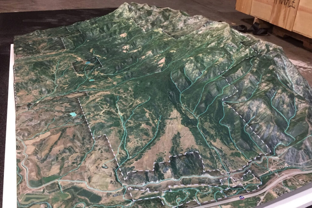
Topographical maps are traditionally delineated as two-dimensional planes and can now be made into three-dimensional maps thanks to modern technology. The data collected from the older two-dimensional maps along with photogrammetry and 3D printing technology allow for the creation of highly-accurate three-dimensional representations of land surfaces.
A three-dimensional topography map is easier to read than a two-dimensional topographical map. The 2D topography maps show elevations as lines on a sheet of paper, whereas a 3D topography map shows the elevations with raised dimension. Novice cartologists can plan mountain trail routes by visually following the path and seeing the route interaction with terrain elevations.
To learn more about 3D printed topography, take a look at our topography page.
To learn more about the latest in 3D Printing, check out our 3D printing.